
Broadstone Inkwell
201 The Promenade N,
Long Beach, CA 90802
$2,595 - $7,030
Studio - 3 Beds


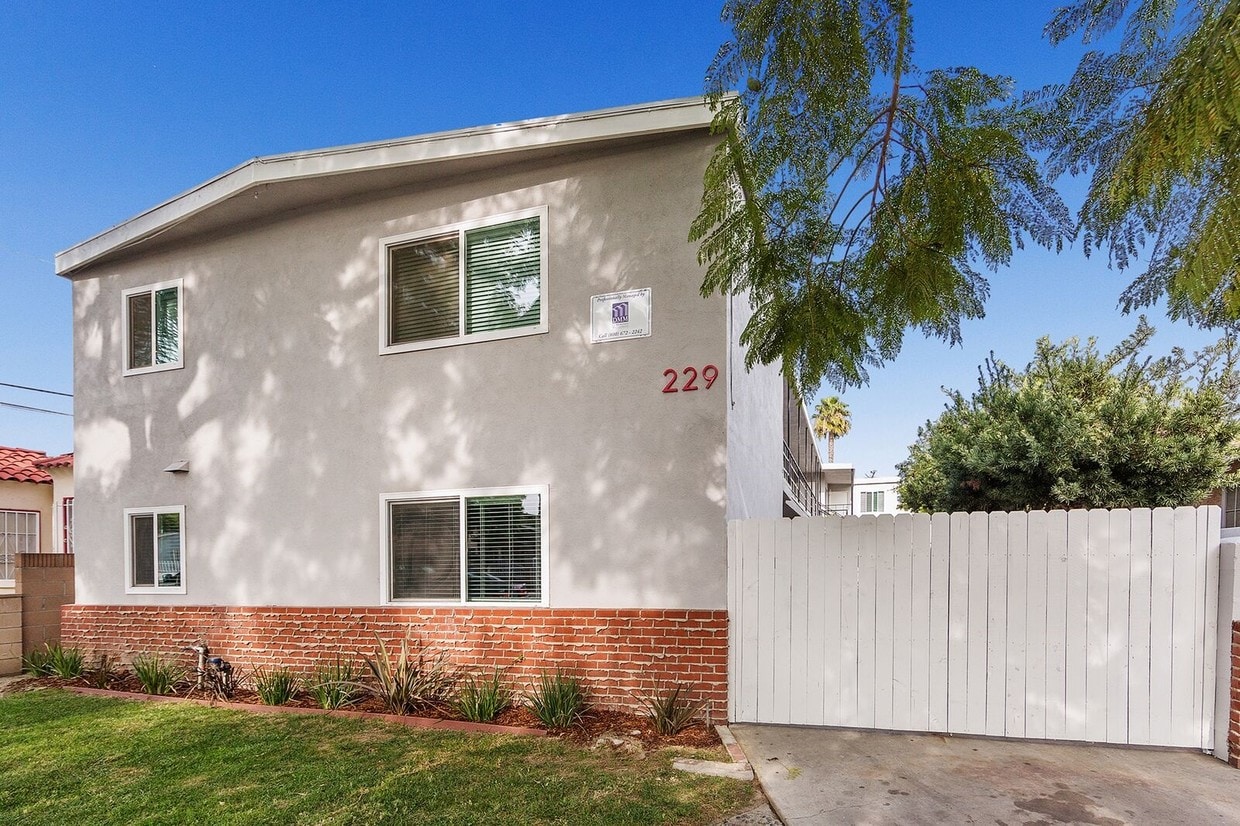
Discover your new home at 229 E 57th St in Long Beach, CA. This property is situated in the Bixby Knolls area of Long Beach. Let the knowledgeable leasing staff show you everything this community has in store. Start living the good life at 229 E 57th St. Contact us or stop in to see available floor plans.
229 E 57Th St is an apartment community located in Los Angeles County and the 90805 ZIP Code. This area is served by the Long Beach Unified attendance zone.
Nestled in northern Long Beach, Bixby Knolls is a family-friendly neighborhood brimming with character. Atlantic Avenue serves as the main commercial thoroughfare, touting an array of independently owned restaurants, specialty shops, and boutiques in rows of historic storefronts. Bixby Knolls exudes a distinct sense of community spirit, with strong support of local businesses and special events such as First Fridays, Bixby Saturday Nights, and Concerts in the Park(ing Lot), among many others.
Rentals in Bixby Knolls include a wide variety of apartments, condos, townhomes, and houses tucked along tree-lined avenues. Residents enjoy convenience to Long Beach Airport as well as golfing destinations like the Virginia Country Club, Lakewood Golf Course, and Skylinks at Long Beach. Commuting from Bixby Knolls is a breeze with access to Interstates 405 and 710.
Learn more about living in Bixby KnollsCompare neighborhood and city base rent averages by bedroom.
| Bixby Knolls | Long Beach, CA | |
|---|---|---|
| Studio | $1,464 | $1,473 |
| 1 Bedroom | $1,521 | $1,809 |
| 2 Bedrooms | $1,945 | $2,311 |
| 3 Bedrooms | $2,235 | $2,566 |
| Colleges & Universities | Distance | ||
|---|---|---|---|
| Colleges & Universities | Distance | ||
| Drive: | 7 min | 2.6 mi | |
| Drive: | 11 min | 5.3 mi | |
| Drive: | 12 min | 5.7 mi | |
| Drive: | 13 min | 5.7 mi |


Transportation options available in Long Beach include Del Amo Station, located 2.2 miles from 229 E 57th St. 229 E 57th St is near Long Beach (Daugherty Field), located 4.7 miles or 10 minutes away, and Los Angeles International, located 19.3 miles or 27 minutes away.
| Transit / Subway | Distance | ||
|---|---|---|---|
| Transit / Subway | Distance | ||
|
|
Drive: | 6 min | 2.2 mi |
|
|
Drive: | 9 min | 3.5 mi |
|
|
Drive: | 9 min | 3.6 mi |
|
|
Drive: | 9 min | 3.9 mi |
|
|
Drive: | 8 min | 4.2 mi |
| Commuter Rail | Distance | ||
|---|---|---|---|
| Commuter Rail | Distance | ||
|
|
Drive: | 18 min | 11.5 mi |
|
|
Drive: | 19 min | 11.7 mi |
|
|
Drive: | 21 min | 13.0 mi |
|
|
Drive: | 22 min | 15.1 mi |
|
|
Drive: | 25 min | 17.5 mi |
| Airports | Distance | ||
|---|---|---|---|
| Airports | Distance | ||
|
Long Beach (Daugherty Field)
|
Drive: | 10 min | 4.7 mi |
|
Los Angeles International
|
Drive: | 27 min | 19.3 mi |
Time and distance from 229 E 57th St.
| Shopping Centers | Distance | ||
|---|---|---|---|
| Shopping Centers | Distance | ||
| Walk: | 9 min | 0.5 mi | |
| Walk: | 11 min | 0.6 mi | |
| Walk: | 13 min | 0.7 mi |
| Parks and Recreation | Distance | ||
|---|---|---|---|
| Parks and Recreation | Distance | ||
|
Compton Creek Natural Park at George Washington Elementary
|
Drive: | 11 min | 5.6 mi |
|
Banning Residence Museum
|
Drive: | 15 min | 8.5 mi |
|
El Dorado Nature Center
|
Drive: | 16 min | 8.8 mi |
|
Watts Towers-Rodia State Park
|
Drive: | 15 min | 9.2 mi |
|
Earl Burns Miller Japanese Garden
|
Drive: | 16 min | 10.5 mi |
| Hospitals | Distance | ||
|---|---|---|---|
| Hospitals | Distance | ||
| Drive: | 5 min | 2.5 mi | |
| Drive: | 10 min | 4.0 mi | |
| Drive: | 10 min | 4.0 mi |
| Military Bases | Distance | ||
|---|---|---|---|
| Military Bases | Distance | ||
| Drive: | 23 min | 13.0 mi | |
| Drive: | 25 min | 14.6 mi |
What Are Walk Score®, Transit Score®, and Bike Score® Ratings?
Walk Score® measures the walkability of any address. Transit Score® measures access to public transit. Bike Score® measures the bikeability of any address.
What is a Sound Score Rating?
A Sound Score Rating aggregates noise caused by vehicle traffic, airplane traffic and local sources
229 E 57th St
Long Beach, CA 90805


 - Violet on Virgil")


