-
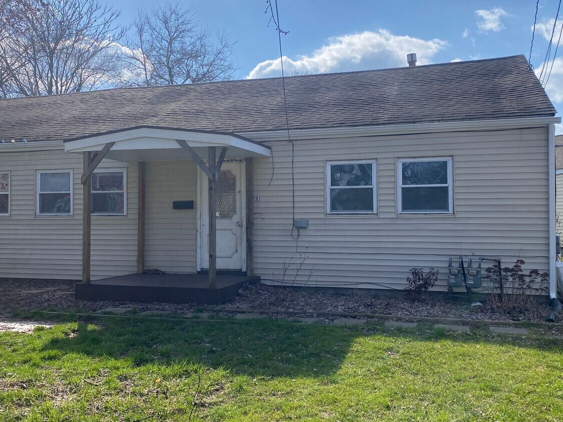
229-231 N Seneca Street

-

-
$650
/ Month
229-231 N Seneca St Unit 231 N Seneca Street
Rittman, OH 44270
Favorites
229-231 N Seneca St Unit 231 N Seneca Street

Favorites
Check Back Soon for Upcoming Availability
| Beds | Baths | Average SF |
|---|---|---|
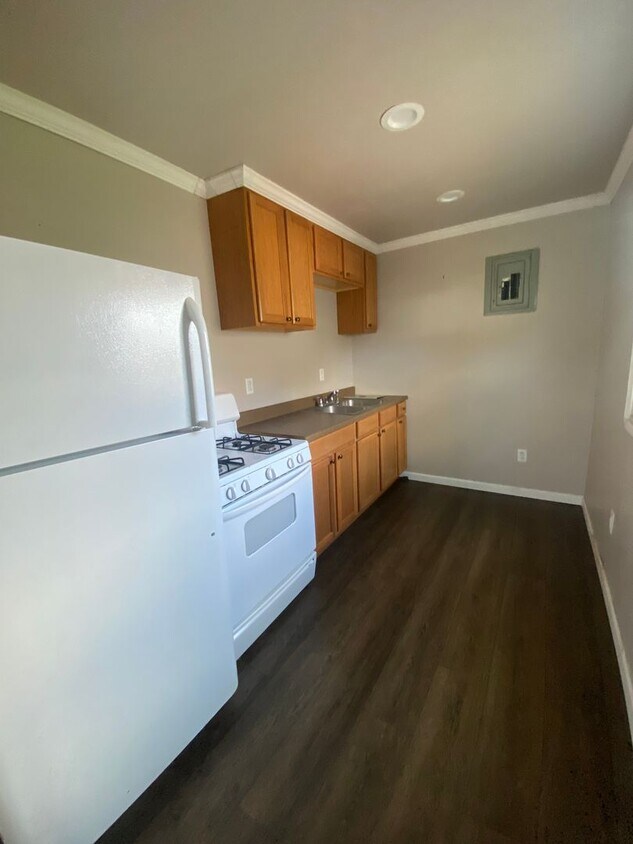
| 2 Bedrooms 2 Bedrooms 2 Br | 1 Bath 1 Bath 1 Ba | 792 SF |
About This Property
If you're moving to Rittman, OH, this great property could be your new place. This well-maintained apartment unit for rent is located in Rittman, OH at 229-231 N Seneca St, where you'll have convenient access to a variety of attractions. Stop your search and get moving. Contact us to schedule a tour.
229-231 N Seneca St is an apartment community located in Wayne County and the 44270 ZIP Code.
229-231 N Seneca St,
Rittman,
OH
44270
Education
| Colleges & Universities | Distance | ||
|---|---|---|---|
| Colleges & Universities | Distance | ||
| Drive: | 28 min | 18.3 mi | |
| Drive: | 31 min | 20.3 mi | |
| Drive: | 33 min | 22.9 mi | |
| Drive: | 41 min | 31.7 mi |
229-231 N Seneca St Unit 231 N Seneca Street is within 28 minutes or 18.3 miles from The College of Wooster. It is also near University of Akron and Cuyahoga C.C., Brunswick.
Walkability Near 229-231 N Seneca St Rittman, OH 44270
Getting Around
 What do Walkability, Transit, Drivability, and Bikeability mean?
Walkability measures the walking distance to day-to-day needs.
Transit measures access to public transportation.
Drivability measures congestion, parking availability, and access to major roads.
Bikeability measures the suitability for cycling.
How It Works
What do Walkability, Transit, Drivability, and Bikeability mean?
Walkability measures the walking distance to day-to-day needs.
Transit measures access to public transportation.
Drivability measures congestion, parking availability, and access to major roads.
Bikeability measures the suitability for cycling.
How It Works
Fairly Walkable
Walkability
40
/ 100
Very Drivable
Drivability
80
/ 100
Somewhat Bikeable
Bikeability
30
/ 100
Scores provided by
-
Soundscore™
-
/ 100
Traffic
-Airport
-Businesses
-Scores provided by
HowLoud What is a Sound Score Rating? A Sound Score Rating aggregates noise caused by vehicle traffic, airplane traffic and local sources. How It WorksYou May Also Like
Similar Rentals Nearby
-
-
-
-
-
-
-
-
-
2 Beds$1,599+3 Beds$2,099Total Monthly Price24 Month LeaseTotal Monthly Price NewPrices include all required monthly fees.Specials
Fitness Center Pool In Unit Washer & Dryer Walk-In Closets Clubhouse Balcony Stainless Steel Appliances
-


What Are Walk Score®, Transit Score®, and Bike Score® Ratings?
Walk Score® measures the walkability of any address. Transit Score® measures access to public transit. Bike Score® measures the bikeability of any address.
What is a Sound Score Rating?
A Sound Score Rating aggregates noise caused by vehicle traffic, airplane traffic and local sources.
229-231 N Seneca St
Rittman, OH 44270