

$1,495
Total Monthly Price
226 N West St
Buffalo Gap, TX 79508
2 Weeks Ago
|
Edit
Favorites
226 N West St

Favorites
Check Back Soon for Upcoming Availability
| Beds | Baths | Average SF |
|---|---|---|
| 2 Bedrooms 2 Bedrooms 2 Br | 1 Bath 1 Bath 1 Ba | 1,200 SF |
Fees and Policies
The fees listed below are community-provided and may exclude utilities or add-ons. All payments are made directly to the property and are non-refundable unless otherwise specified.
- Dogs Allowed
-
Fees not specified
-
Weight limit--
-
Pet Limit--
- Parking
-
Covered--
About This Property
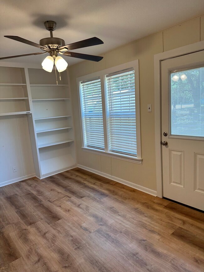
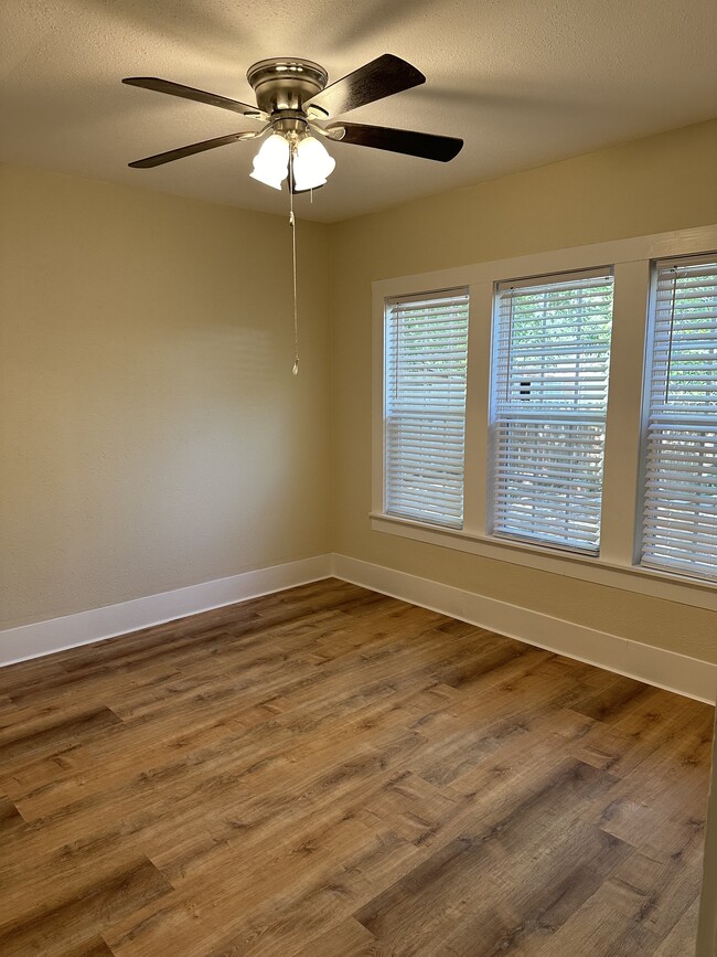
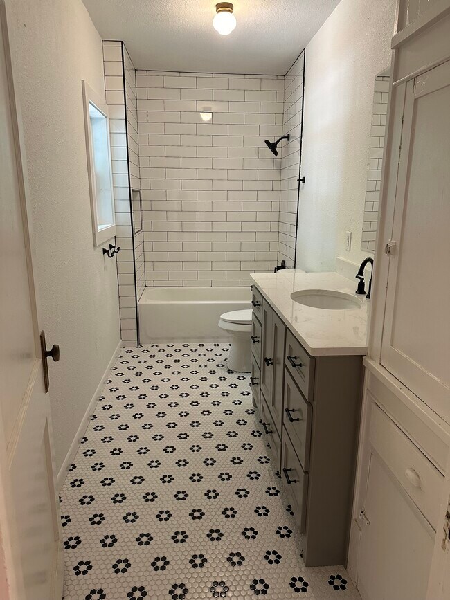
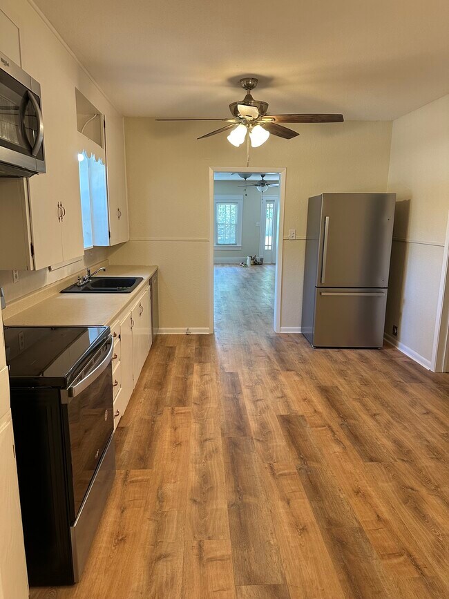
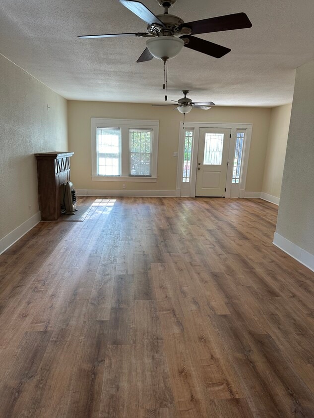
Quaint 2 BDR/ 1 BA remodeled 1940s house on corner lot, with bonus room that could be office, guest room or playroom. Two-car carport. Storage shed. New HVAC system, floors, doors, paint, windows, doors, roof and more. Great front and back porches. Fenced yard. Dogs accepted under 50 lbs. Utilities are not included.
226 N West St is a house located in Taylor County and the 79508 ZIP Code.
House Features
Washer/Dryer Hookup
High Speed Internet Access
Tub/Shower
Office
- High Speed Internet Access
- Washer/Dryer Hookup
- Heating
- Ceiling Fans
- Storage Space
- Tub/Shower
- Office
- Guest Apartment
- Yard
226 N West St,
Buffalo Gap,
TX
79508
Amenities
- High Speed Internet Access
- Washer/Dryer Hookup
- Heating
- Ceiling Fans
- Storage Space
- Tub/Shower
- Office
- Guest Apartment
- Yard
Education
| Colleges & Universities | Distance | ||
|---|---|---|---|
| Colleges & Universities | Distance | ||
| Drive: | 21 min | 11.4 mi | |
| Drive: | 28 min | 15.1 mi | |
| Drive: | 30 min | 16.3 mi |
226 N West St is within 21 minutes or 11.4 miles from McMurry University. It is also near Hardin-Simmons University and Abilene Christian University.
Walkability Near 226 N West St Buffalo Gap, TX 79508
Getting Around
 What do Walkability, Transit, Drivability, and Bikeability mean?
Walkability measures the walking distance to day-to-day needs.
Transit measures access to public transportation.
Drivability measures congestion, parking availability, and access to major roads.
Bikeability measures the suitability for cycling.
How It Works
What do Walkability, Transit, Drivability, and Bikeability mean?
Walkability measures the walking distance to day-to-day needs.
Transit measures access to public transportation.
Drivability measures congestion, parking availability, and access to major roads.
Bikeability measures the suitability for cycling.
How It Works
Not Walkable
Walkability
10
/ 100
Exceptionally Drivable
Drivability
90
/ 100
Somewhat Bikeable
Bikeability
30
/ 100
Scores provided by
-
Soundscore™
-
/ 100
Traffic
-Airport
-Businesses
-Scores provided by
HowLoud What is a Sound Score Rating? A Sound Score Rating aggregates noise caused by vehicle traffic, airplane traffic and local sources. How It WorksYou May Also Like
Similar Rentals Nearby
-
-
-

-
 3 Beds, 2 Baths, 1,216 sq ft$2,399Total Monthly PriceTotal Monthly Price NewPrices include all required monthly fees.438 Benjamin Ln
 -
 3 Beds, 2 Baths, 1,337 sq ft$2,750Total Monthly PriceTotal Monthly Price NewPrices include all required monthly fees.435 Colorado St
 -
 3 Beds, 2 Baths, 1,337 sq ft$2,750Total Monthly PriceTotal Monthly Price NewPrices include all required monthly fees.511 Colorado St
 -
 3 Beds, 2 Baths, 1,337 sq ft$2,750Total Monthly PriceTotal Monthly Price NewPrices include all required monthly fees.519 Colorado St
 -
 3 Beds, 2 Baths, 1,337 sq ft$2,750Total Monthly PriceTotal Monthly Price NewPrices include all required monthly fees.527 Colorado St
 -
 3 Beds, 2 Baths, 1,337 sq ft$2,750Total Monthly PriceTotal Monthly Price NewPrices include all required monthly fees.4225 Ranger St
 -
 3 Beds, 2 Baths, 1,337 sq ft$2,750Total Monthly PriceTotal Monthly Price NewPrices include all required monthly fees.4217 Ranger St
What Are Walk Score®, Transit Score®, and Bike Score® Ratings?
Walk Score® measures the walkability of any address. Transit Score® measures access to public transit. Bike Score® measures the bikeability of any address.
What is a Sound Score Rating?
A Sound Score Rating aggregates noise caused by vehicle traffic, airplane traffic and local sources.
226 N West St
Buffalo Gap, TX 79508