

$4,700
/ Month
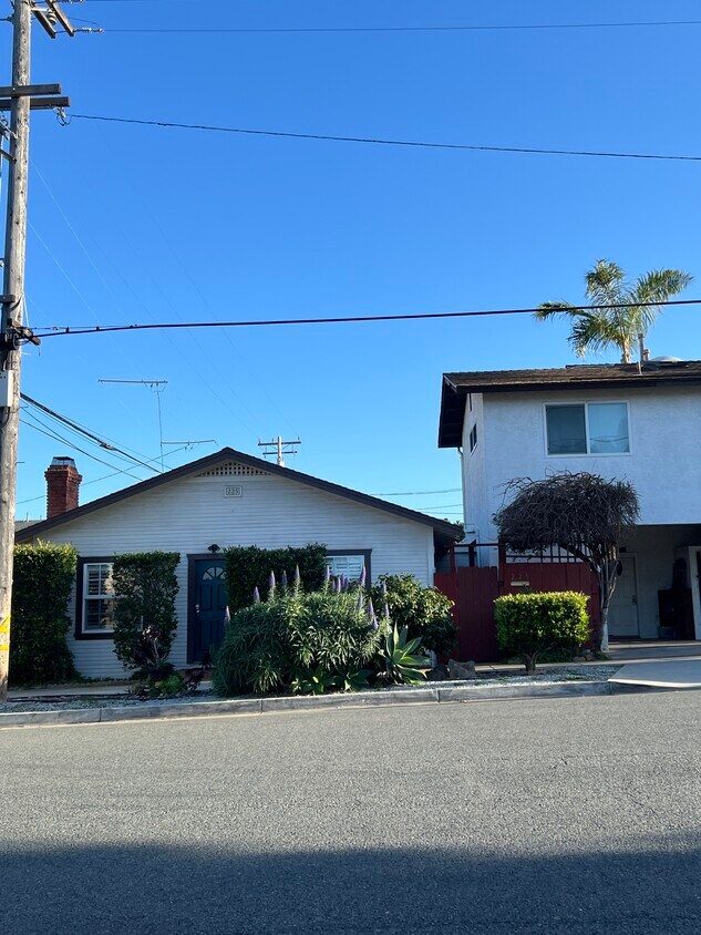
225 W H St
Encinitas, CA 92024
2 Weeks Ago
|
Edit
Favorites
225 W H St

Favorites
Check Back Soon for Upcoming Availability
| Beds | Baths | Average SF |
|---|---|---|
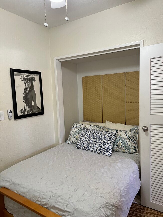
| 2 Bedrooms 2 Bedrooms 2 Br | 2 Baths 2 Baths 2 Ba | 850 SF |
Fees and Policies
The fees below are based on community-supplied data and may exclude additional fees and utilities.
- Parking
-
Covered--
Details
Property Information
-
Furnished Units Available
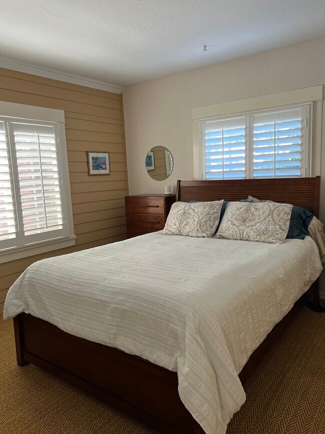
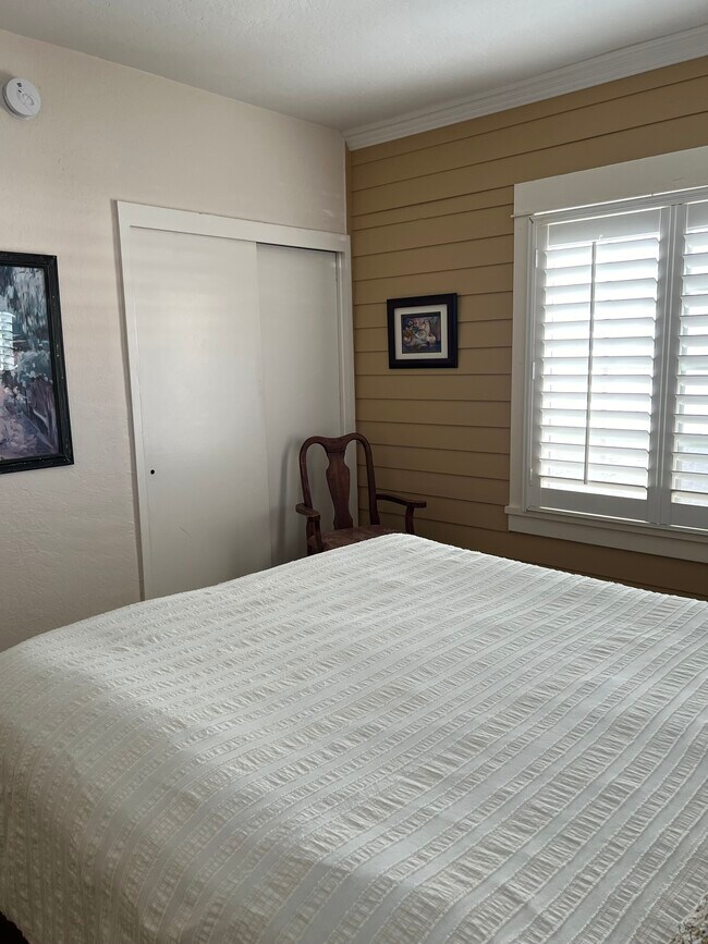
About This Property
Completely furnished with all utilities, WiFi, water and sanitation included. Walk to train station, restaurants, local attractions and beaches. Park on the property.
225 W H St is a house located in San Diego County and the 92024 ZIP Code.
House Features
Washer/Dryer
High Speed Internet Access
Wi-Fi
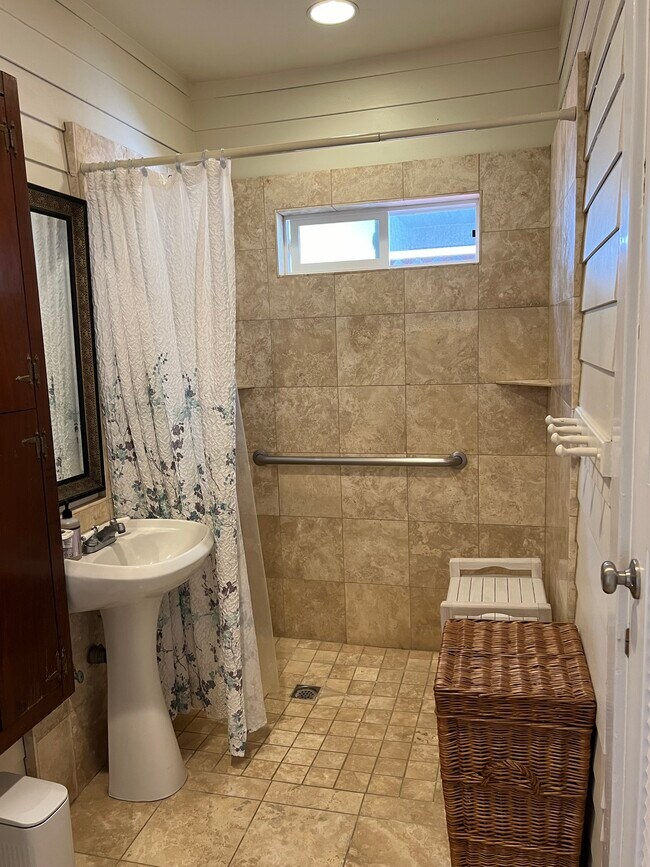
Tub/Shower
- High Speed Internet Access
- Wi-Fi
- Washer/Dryer
- Heating
- Ceiling Fans
- Cable Ready
- Tub/Shower
- Furnished
- Furnished Units Available
Location
Get Directions
Encinitas spans 19 square miles along Southern California's coastline, offering a perfect mix of beach town atmosphere and coastal living. From beachfront properties to inland residential communities, the area provides diverse housing options. Current rental trends show one-bedroom apartments averaging $2,536, while two-bedroom units typically command $2,988. The historic downtown district along Coast Highway 101 features independent shops, restaurants, and the restored La Paloma Theatre, while neighborhoods like Cardiff-by-the-Sea and Leucadia maintain their individual character with tree-lined streets and local art scenes.
The city is renowned for its outdoor recreation, particularly at Swami's Beach, one of California's premier surfing destinations featured in The Beach Boys' "Surfin' U.S.A." The San Diego Botanic Garden showcases the region's diverse plant life, while Moonlight Beach hosts community events including the annual Switchfoot Bro-Am surf competition.
Learn more about living in Encinitas
Amenities
- High Speed Internet Access
- Wi-Fi
- Washer/Dryer
- Heating
- Ceiling Fans
- Cable Ready
- Tub/Shower
- Furnished
- Furnished Units Available
Education
| Colleges & Universities | Distance | ||
|---|---|---|---|
| Colleges & Universities | Distance | ||
| Drive: | 8 min | 4.8 mi | |
| Drive: | 25 min | 13.0 mi | |
| Drive: | 26 min | 13.2 mi | |
| Drive: | 22 min | 14.8 mi |
225 W H St is within 8 minutes or 4.8 miles from MiraCosta College, San Elijo. It is also near Palomar College and CSU San Marcos.
Transportation options available in Encinitas include Palomar College, located 12.5 miles from 225 W H St. 225 W H St is near San Diego International, located 25.0 miles or 33 minutes away.
| Transit / Subway | Distance | ||
|---|---|---|---|
| Transit / Subway | Distance | ||
|
|
Drive: | 23 min | 12.5 mi |
| Commuter Rail | Distance | ||
|---|---|---|---|
| Commuter Rail | Distance | ||
|
|
Walk: | 10 min | 0.6 mi |
|
|
Drive: | 8 min | 3.9 mi |
|
|
Drive: | 11 min | 6.2 mi |
|
|
Drive: | 17 min | 10.6 mi |
|
|
Drive: | 16 min | 12.1 mi |
| Airports | Distance | ||
|---|---|---|---|
| Airports | Distance | ||
|
San Diego International
|
Drive: | 33 min | 25.0 mi |
Time and distance from 225 W H St.
| Shopping Centers | Distance | ||
|---|---|---|---|
| Shopping Centers | Distance | ||
| Walk: | 4 min | 0.2 mi | |
| Walk: | 7 min | 0.4 mi | |
| Walk: | 11 min | 0.6 mi |
225 W H St has 3 shopping centers within 0.6 mile, which is about a 11-minute walk. The miles and minutes will be for the farthest away property.
| Parks and Recreation | Distance | ||
|---|---|---|---|
| Parks and Recreation | Distance | ||
|
Moonlight State Beach
|
Walk: | 10 min | 0.6 mi |
|
San Elijo State Beach
|
Drive: | 3 min | 1.5 mi |
|
San Diego Botanic Garden
|
Drive: | 6 min | 1.9 mi |
|
Leucadia State Beach
|
Drive: | 5 min | 2.1 mi |
|
San Elijo Lagoon Ecological Reserve and Nature Center
|
Drive: | 6 min | 2.6 mi |
225 W H St has 5 parks within 2.6 miles, including Moonlight State Beach, San Elijo State Beach, and San Diego Botanic Garden.
| Hospitals | Distance | ||
|---|---|---|---|
| Hospitals | Distance | ||
| Drive: | 4 min | 1.4 mi | |
| Drive: | 21 min | 14.5 mi |
225 W H St is 1.4 miles from Scripps Memorial Hospital - Encinitas, and is convenient to other hospitals, including Tri - City Medical Center.
| Military Bases | Distance | ||
|---|---|---|---|
| Military Bases | Distance | ||
| Drive: | 35 min | 23.4 mi |
225 W H St is 23.4 miles and a 35 minute drive from USMC Air Station Miramar.
You May Also Like
Similar Rentals Nearby


What Are Walk Score®, Transit Score®, and Bike Score® Ratings?
Walk Score® measures the walkability of any address. Transit Score® measures access to public transit. Bike Score® measures the bikeability of any address.
What is a Sound Score Rating?
A Sound Score Rating aggregates noise caused by vehicle traffic, airplane traffic and local sources
225 W H St
Encinitas, CA 92024