$3,800
/ Month
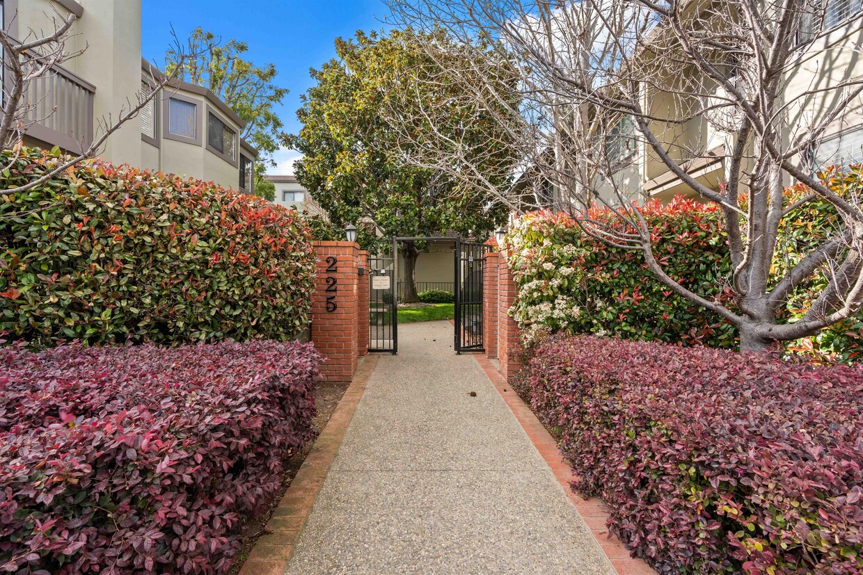
225 E Santa Inez Ave
San Mateo, CA 94401
Favorites
225 E Santa Inez Ave

Favorites
Check Back Soon for Upcoming Availability
| Beds | Baths | Average SF |
|---|---|---|
| 2 Bedrooms 2 Bedrooms 2 Br | 2.5 Baths 2.5 Baths 2.5 Ba | 1,400 SF |
About This Property
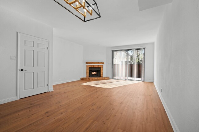
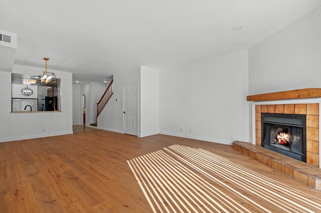
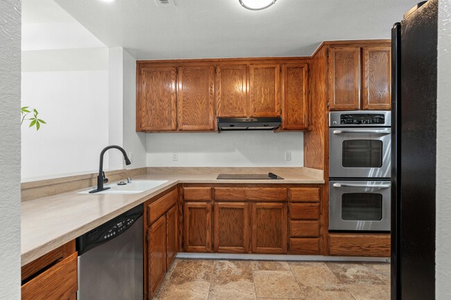
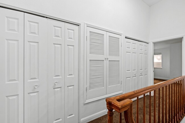
Welcome home! Check out our recently renovated two-bedroom, two-and-a-half-bathroom townhome. Modern updates throughout, from light fixtures to flooring and carpet, and fresh paint. Enjoy the convenience of two ensuite bathrooms, a balcony, patio, two assigned and gated parking spots, plus an in-unit washer/dryer. Located just minutes from Downtown San Mateo in a controlled-access building. Don't miss out – schedule a showing today! 0.4 miles from San Mateo Caltrain Station 0.6 miles from Downtown San Mateo 1.0 mile from Central Park Professionally Managed by Goodwin Real Estate Inc. CA DRE #02191218
225 E Santa Inez Ave is a townhome located in San Mateo County and the 94401 ZIP Code. This area is served by the San Mateo-Foster City School District attendance zone.
Townhome Features
- Storage Space
225 E Santa Inez Ave,
San Mateo,
CA
94401
True to its name, North Central is a large neighborhood that offers residents easy access to the best of San Mateo and the Bay Area. This trendy neighborhood has a variety of rental options available including mid-rise apartments, luxury condos, and Mediterranean-style houses and townhomes. North Central is located directly north of Downtown San Mateo and the neighborhood’s southern border is part of the downtown area as well. Access to Highway 82, Route 101, and a rail station allows easy travel north into San Francisco and south towards San Jose.
Although North Central has its own amenities, residents enjoy living within walking distance of downtown’s restaurants, grocers, and retailers. North Central is also directly east of Downtown Burlingame, providing residents with even more options for shopping, dining, and entertainment.
Learn more about living in North CentralBelow are rent ranges for similar nearby apartments
Amenities
- Storage Space
Education
| Colleges & Universities | Distance | ||
|---|---|---|---|
| Colleges & Universities | Distance | ||
| Drive: | 8 min | 4.3 mi | |
| Drive: | 18 min | 10.3 mi | |
| Drive: | 20 min | 13.0 mi | |
| Drive: | 20 min | 13.8 mi |
225 E Santa Inez Ave is within 8 minutes or 4.3 miles from College of San Mateo. It is also near Skyline College and Menlo College.
Schools


Public Elementary School
Grades K-5
Nearby
Public Elementary School
Grades K-5
340 Students
Attendance Zone
Public Middle School
Grades 6-8
903 Students
Attendance Zone
Public High School
Grades 9-12
1,557 Students
Attendance Zone
Private Elementary School
Grades PK-5
10 Students
Nearby
Private Elementary, Middle & High School
Grades K-12
91 Students
Nearby
Private Elementary School
Grades 1-6
18 Students
Nearby
School data provided by
 The GreatSchools Rating helps parents compare schools within a state based on a variety of school quality indicators and provides a helpful picture of how effectively each school serves all of its students. Ratings are on a scale of 1 (below average) to 10 (above average) and can include test scores, college readiness, academic progress, advanced courses, equity, discipline and attendance data. We also advise parents to visit schools, consider other information on school performance and programs, and consider family needs as part of the school selection process.
View GreatSchools Rating Methodology
Data provided by GreatSchools.org © 2026. All rights reserved.
View GreatSchools Rating Methodology
Data provided by GreatSchools.org © 2026. All rights reserved.
Transportation options available in San Mateo include Millbrae (Caltrain Transfer Platform), located 4.1 miles from 225 E Santa Inez Ave. 225 E Santa Inez Ave is near San Francisco International, located 5.7 miles or 11 minutes away, and Metro Oakland International, located 27.0 miles or 35 minutes away.
| Transit / Subway | Distance | ||
|---|---|---|---|
| Transit / Subway | Distance | ||
|
|
Drive: | 7 min | 4.1 mi |
| Drive: | 10 min | 5.3 mi | |
| Drive: | 10 min | 5.5 mi | |
|
|
Drive: | 11 min | 5.7 mi |
|
|
Drive: | 12 min | 5.7 mi |
| Commuter Rail | Distance | ||
|---|---|---|---|
| Commuter Rail | Distance | ||
| Walk: | 10 min | 0.6 mi | |
| Drive: | 2 min | 1.1 mi | |
| Drive: | 5 min | 2.1 mi | |
| Drive: | 4 min | 2.2 mi | |
| Drive: | 4 min | 2.3 mi |
| Airports | Distance | ||
|---|---|---|---|
| Airports | Distance | ||
|
San Francisco International
|
Drive: | 11 min | 5.7 mi |
|
Metro Oakland International
|
Drive: | 35 min | 27.0 mi |
Walkability Near 225 E Santa Inez Ave San Mateo, CA 94401
Getting Around
 What do Walkability, Transit, Drivability, and Bikeability mean?
Walkability measures the walking distance to day-to-day needs.
Transit measures access to public transportation.
Drivability measures congestion, parking availability, and access to major roads.
Bikeability measures the suitability for cycling.
How It Works
What do Walkability, Transit, Drivability, and Bikeability mean?
Walkability measures the walking distance to day-to-day needs.
Transit measures access to public transportation.
Drivability measures congestion, parking availability, and access to major roads.
Bikeability measures the suitability for cycling.
How It Works
Moderately Walkable
Walkability
70
/ 100
Some Public Transit
Transit
50
/ 100
Very Drivable
Drivability
80
/ 100
Moderately Bikeable
Bikeability
60
/ 100
Scores provided by
-
Soundscore™
-
/ 100
Traffic
-Airport
-Businesses
-Scores provided by
HowLoud What is a Sound Score Rating? A Sound Score Rating aggregates noise caused by vehicle traffic, airplane traffic and local sources. How It WorksTime and distance from 225 E Santa Inez Ave.
| Shopping Centers | Distance | ||
|---|---|---|---|
| Shopping Centers | Distance | ||
| Walk: | 15 min | 0.8 mi | |
| Walk: | 15 min | 0.8 mi | |
| Walk: | 16 min | 0.9 mi |
225 E Santa Inez Ave has 3 shopping centers within 0.9 mile, which is about a 16-minute walk. The miles and minutes will be for the farthest away property.
| Parks and Recreation | Distance | ||
|---|---|---|---|
| Parks and Recreation | Distance | ||
|
Japanese Tea Garden (San Mateo)
|
Walk: | 17 min | 0.9 mi |
|
San Mateo Arboretum
|
Drive: | 3 min | 1.3 mi |
|
Coyote Point Recreational Area
|
Drive: | 6 min | 2.0 mi |
|
CuriOdyssey
|
Drive: | 6 min | 2.0 mi |
|
Shoreline Parks
|
Drive: | 5 min | 2.3 mi |
225 E Santa Inez Ave has 5 parks within 2.3 miles, including Japanese Tea Garden (San Mateo), San Mateo Arboretum, and Shoreline Parks.
| Hospitals | Distance | ||
|---|---|---|---|
| Hospitals | Distance | ||
| Drive: | 6 min | 3.6 mi | |
| Drive: | 9 min | 5.3 mi | |
| Drive: | 15 min | 9.9 mi |
225 E Santa Inez Ave has 3 hospitals within 9.9 miles, the nearest is Peninsula Medical Center which is 3.6 miles away and a 6 minute drive.
| Military Bases | Distance | ||
|---|---|---|---|
| Military Bases | Distance | ||
| Drive: | 41 min | 26.2 mi | |
| Drive: | 46 min | 34.4 mi | |
| Drive: | 47 min | 34.6 mi |
225 E Santa Inez Ave has 3 military bases within 34.6 miles, the nearest is Oakland Army Base which is 26.2 miles away and a 41 minute drive.
You May Also Like
Similar Rentals Nearby
-
-
2 Beds$4,734+3 Beds$4,834+4 Beds$4,914+Total Monthly PriceTotal Monthly Price NewPrices include base rent and required monthly fees of $22. Variable costs based on usage may apply.Base Rent:2 Beds$4,711+3 Beds$4,811+4 Beds$4,891+Specials
-
-
-
-
-
-
-
-


")


What Are Walk Score®, Transit Score®, and Bike Score® Ratings?
Walk Score® measures the walkability of any address. Transit Score® measures access to public transit. Bike Score® measures the bikeability of any address.
What is a Sound Score Rating?
A Sound Score Rating aggregates noise caused by vehicle traffic, airplane traffic and local sources.

225 E Santa Inez Ave
San Mateo, CA 94401