
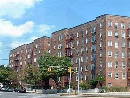
193-47 Salerno Ave
193-47 Salerno Ave,
Queens, NY 11423
$4,695 Total Monthly Price
3 Beds 12 Month Lease

Come home to 22410 Jamaica Ave in Queens Village, NY. This community is located in the 11428 area of Queens Village. Compare 1 to 2 bedroom apartments then schedule a visit to see them in person. The professional leasing staff is available to help you find your new home. Contact us today to schedule a tour and find your new home at 22410 Jamaica Ave.
22410 Jamaica Ave is an apartment community located in Queens County and the 11428 ZIP Code. This area is served by the New York City Geographic District #29 attendance zone.
Queens Village sits at the eastern edge of New York City's Queens borough, where the energy of the city softens into something quieter and more grounded. Stretching across roughly four square miles, this mostly residential area carries a distinct small-town rhythm that's easy to overlook from the outside. Commercial activity runs along Jamaica Avenue and Hillside Avenue, offering a practical mix of local shops and everyday services without the chaos of denser city corridors. Nearby Cunningham Park and Alley Pond Park give residents easy access to green space, while the Long Island Rail Road station makes commuting into Manhattan straightforward. Historically, the area is home to part of the Long Island Motor Parkway, built by William Kissam Vanderbilt in the early 1900s and once the site of the famed Vanderbilt Cup races.
Learn more about living in Queens VillageCompare neighborhood and city base rent averages by bedroom.
| Southeast Queens | Queens Village, NY | |
|---|---|---|
| Studio | $1,690 | $1,432 |
| 1 Bedroom | $2,110 | $1,527 |
| 2 Bedrooms | $2,679 | $1,934 |
| 3 Bedrooms | $3,298 | $2,175 |
| Colleges & Universities | Distance | ||
|---|---|---|---|
| Colleges & Universities | Distance | ||
| Drive: | 7 min | 3.5 mi | |
| Drive: | 8 min | 4.3 mi | |
| Drive: | 9 min | 4.5 mi | |
| Drive: | 11 min | 5.1 mi |


Transportation options available in Queens Village include Jamaica-179 Street, located 3.5 miles from 22410 Jamaica Ave. 22410 Jamaica Ave is near John F Kennedy International, located 9.4 miles or 15 minutes away, and LaGuardia, located 10.9 miles or 18 minutes away.
| Transit / Subway | Distance | ||
|---|---|---|---|
| Transit / Subway | Distance | ||
|
|
Drive: | 6 min | 3.5 mi |
|
|
Drive: | 7 min | 4.0 mi |
|
|
Drive: | 9 min | 4.2 mi |
|
|
Drive: | 8 min | 4.3 mi |
|
|
Drive: | 9 min | 4.7 mi |
| Commuter Rail | Distance | ||
|---|---|---|---|
| Commuter Rail | Distance | ||
|
|
Walk: | 10 min | 0.5 mi |
|
|
Drive: | 3 min | 1.6 mi |
|
|
Drive: | 5 min | 1.9 mi |
|
|
Drive: | 4 min | 2.2 mi |
|
|
Drive: | 5 min | 2.3 mi |
| Airports | Distance | ||
|---|---|---|---|
| Airports | Distance | ||
|
John F Kennedy International
|
Drive: | 15 min | 9.4 mi |
|
LaGuardia
|
Drive: | 18 min | 10.9 mi |
Scores provided by
Traffic
-Airport
-Businesses
-Scores provided by
HowLoud What is a Sound Score Rating? A Sound Score Rating aggregates noise caused by vehicle traffic, airplane traffic and local sources. How It WorksTime and distance from 22410 Jamaica Ave.
| Shopping Centers | Distance | ||
|---|---|---|---|
| Shopping Centers | Distance | ||
| Walk: | 2 min | 0.1 mi | |
| Walk: | 20 min | 1.0 mi |
| Parks and Recreation | Distance | ||
|---|---|---|---|
| Parks and Recreation | Distance | ||
|
Queens County Farm Museum
|
Drive: | 5 min | 2.3 mi |
|
Cunningham Park
|
Drive: | 6 min | 3.4 mi |
|
Alley Pond Park
|
Drive: | 6 min | 3.5 mi |
|
Detective Keith L. Williams Park
|
Drive: | 8 min | 3.9 mi |
|
Alley Pond Environmental Center
|
Drive: | 6 min | 4.0 mi |
| Hospitals | Distance | ||
|---|---|---|---|
| Hospitals | Distance | ||
| Drive: | 3 min | 1.9 mi | |
| Drive: | 8 min | 4.7 mi | |
| Drive: | 10 min | 5.3 mi |
| Military Bases | Distance | ||
|---|---|---|---|
| Military Bases | Distance | ||
| Drive: | 11 min | 6.8 mi | |
| Drive: | 29 min | 18.1 mi | |
| Drive: | 37 min | 19.6 mi |
What Are Walk Score®, Transit Score®, and Bike Score® Ratings?
Walk Score® measures the walkability of any address. Transit Score® measures access to public transit. Bike Score® measures the bikeability of any address.
What is a Sound Score Rating?
A Sound Score Rating aggregates noise caused by vehicle traffic, airplane traffic and local sources.

22410 Jamaica Ave
Queens Village, NY 11428


