2230 Homestead Ct
2230 Homestead Ct,
Los Altos,
CA
94024
2 Weeks Ago
Favorites
2230 Homestead Ct

Favorites
Check Back Soon for Upcoming Availability
Fees and Policies
The fees below are based on community-supplied data and may exclude additional fees and utilities.
- Cats Allowed
-
Fees not specified
-
Weight limit--
-
Pet Limit--
- Parking
-
Surface Lot--
Details
Lease Options
-
6 Month
About 2230 Homestead Ct Los Altos, CA 94024
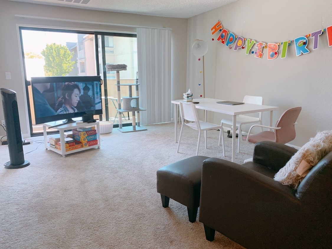
Cupertino / Los Altos 94024 2b1.5b APARTMENT IS LOOKING FOR A ROOMMATE. Lease length is feasible. For 6-month lease, the rent is $1350/month. Deposit is $1350. The apartment includes: Rent includes $70 utility (Wi-Fi, water, sewage, electricity, and 1x parking spot) Basic furniture included (queen size mattress & bed frame) AC & heater are available Super spacious wardrobe with mirrors New carpets in the bedrooms & living room. Elevator in building. Laundry room with washer & dryer in the building. Neighborhood & Transportation The location is super convenient. 2 minutes drive to highway 85/280, foothill expressway. 8 minutes drive to Apple Headquarters, De Anza College, Foothill College. 15 minutes drive to Google, Amazon, Tesla and other major companies. 3 minutes walk to Trader Joes, UPS Post Office, Starbucks, SUBWAY. 5 minutes drive to the nearest gym. 10-15 minutes drive to various restaurants, supermarkets, etc. Security on site 24/7. A super adorable cat (her name is longlong) is currently in the apartment. A couple lives in the master bedroom right now. Lease Details: All Included
2230 Homestead Ct is an apartment community located in Santa Clara County and the 94024 ZIP Code.
Apartment Features
- Wi-Fi
- Carpet
- Laundry Facilities
- Elevator
Location
Get Directions
Located in the renowned Silicon Valley, Stevens Creek Park is a picturesque namesake neighborhood. Stevens Creek County Park is the heart of the community, connecting several green spaces and natural areas. A haven for equestrians, hikers, and bikers, residents here enjoy scenic views of vineyards, hills, and mountainous terrain at this park. The park is also home to the Picchetti Winery, one of the many wineries in the area.
Along with wine tasting, Picchetti is an excellent destination for picnicking and hiking. Of course, the area attracts techies (Steve Job’s iconic garage is just a few blocks from the neighborhood), but families love the area as well. Suburban Stevens Creek Park is safe and has access to some of the nation’s highest performing schools. Whether you’re a tech lover on the prowl for the next big innovation, a nature enthusiast, or a parent, Stevens Creek Park offers everything a renter could ever need in Silicon Valley.
Learn more about living in Stevens Creek ParkBelow are rent ranges for similar nearby apartments
Amenities
- Wi-Fi
- Carpet
- Laundry Facilities
- Elevator
Education
| Colleges & Universities | Distance | ||
|---|---|---|---|
| Colleges & Universities | Distance | ||
| Drive: | 7 min | 2.8 mi | |
| Drive: | 8 min | 4.9 mi | |
| Drive: | 14 min | 7.8 mi | |
| Drive: | 13 min | 8.1 mi |
2230 Homestead Ct is within 7 minutes or 2.8 miles from De Anza College. It is also near Foothill Coll., Los Altos and Foothill College, Middlefield.
Transportation options available in Los Altos include Whisman Station, located 5.2 miles from 2230 Homestead Ct. 2230 Homestead Ct is near Norman Y Mineta San Jose International, located 12.5 miles or 19 minutes away, and San Francisco International, located 30.0 miles or 38 minutes away.
| Transit / Subway | Distance | ||
|---|---|---|---|
| Transit / Subway | Distance | ||
|
|
Drive: | 9 min | 5.2 mi |
| Drive: | 8 min | 5.2 mi | |
|
|
Drive: | 8 min | 5.2 mi |
|
|
Drive: | 9 min | 5.5 mi |
|
|
Drive: | 11 min | 6.8 mi |
| Commuter Rail | Distance | ||
|---|---|---|---|
| Commuter Rail | Distance | ||
| Drive: | 8 min | 5.0 mi | |
| Drive: | 8 min | 5.0 mi | |
| Drive: | 11 min | 5.3 mi | |
| Drive: | 12 min | 6.3 mi | |
| Drive: | 14 min | 7.0 mi |
| Airports | Distance | ||
|---|---|---|---|
| Airports | Distance | ||
|
Norman Y Mineta San Jose International
|
Drive: | 19 min | 12.5 mi |
|
San Francisco International
|
Drive: | 38 min | 30.0 mi |
Time and distance from 2230 Homestead Ct.
| Shopping Centers | Distance | ||
|---|---|---|---|
| Shopping Centers | Distance | ||
| Walk: | 1 min | 0.1 mi | |
| Drive: | 4 min | 1.5 mi | |
| Drive: | 4 min | 1.6 mi |
2230 Homestead Ct has 3 shopping centers within 1.6 miles, which is about a 4-minute walk. The miles and minutes will be for the farthest away property.
| Parks and Recreation | Distance | ||
|---|---|---|---|
| Parks and Recreation | Distance | ||
|
Deer Hollow Farm
|
Drive: | 6 min | 2.0 mi |
|
Rancho San Antonio County Park
|
Drive: | 6 min | 2.1 mi |
|
McClellan Ranch Park
|
Drive: | 6 min | 2.4 mi |
|
Fujitsu Planetarium
|
Drive: | 7 min | 2.8 mi |
|
Fremont Older Open Space Preserve
|
Drive: | 13 min | 4.7 mi |
2230 Homestead Ct has 5 parks within 4.7 miles, including Deer Hollow Farm, Rancho San Antonio County Park, and McClellan Ranch Park.
| Hospitals | Distance | ||
|---|---|---|---|
| Hospitals | Distance | ||
| Drive: | 7 min | 2.7 mi | |
| Drive: | 8 min | 3.7 mi | |
| Drive: | 9 min | 4.1 mi |
2230 Homestead Ct has 3 hospitals within 4.1 miles, the nearest is El Camino Hospital which is 2.7 miles away and a 7 minute drive.
| Military Bases | Distance | ||
|---|---|---|---|
| Military Bases | Distance | ||
| Drive: | 13 min | 6.9 mi |
2230 Homestead Ct is 6.9 miles and a 13 minute drive from Ames Research Center.
You May Also Like
Similar Rentals Nearby


What Are Walk Score®, Transit Score®, and Bike Score® Ratings?
Walk Score® measures the walkability of any address. Transit Score® measures access to public transit. Bike Score® measures the bikeability of any address.
What is a Sound Score Rating?
A Sound Score Rating aggregates noise caused by vehicle traffic, airplane traffic and local sources