
Kinect at Southport
2301 Jefferson Blvd,
Sacramento, CA 95691
$1,550 - $3,044
Studio - 3 Beds
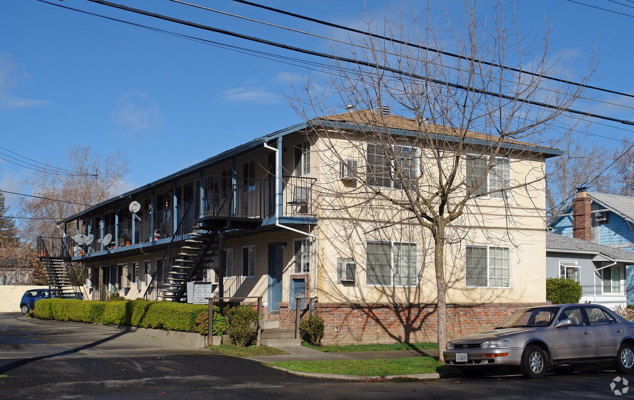
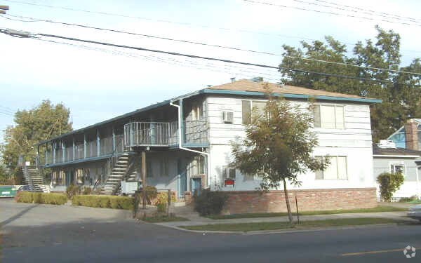
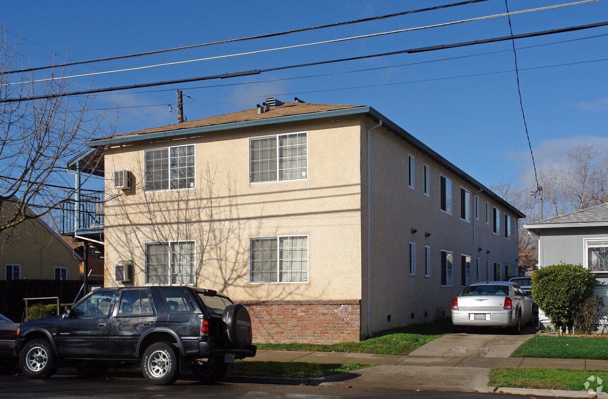

Find a new home at 2230 34th St. The 95817 location in Sacramento is an ideal place to live. From amenities to location, the professional leasing team is available to assist you in finding your perfect floorplan. Be sure to check out the current floorplan options. Stop by the leasing office to ask about the current floorplan availability.
2230 34th St is an apartment community located in Sacramento County and the 95817 ZIP Code. This area is served by the Sacramento City Unified School District attendance zone.
Neighboring Med Center, North Oak Park is an excellent option for renters looking for excellent access to some of the best things Sacramento has to offer at a fraction of the cost. Compared to other Sacramento neighborhoods, North Oak Park has a variety of affordable to more upscale rental options available. Although it’s common for residents to travel to the heart of the city for shopping, dining, and entertainment, the neighborhood has a good number of amenities. Along Broadway you’ll find art galleries, intimate entertainment venues, eclectic cafes, boutiques, a brewery, and more. Residents enjoy a breath of fresh air and abundant amenities including a themed play area, a community pool, and an annual farmers market at McClatchy Park. This diverse neighborhood is walkable and it's common to see neighbors riding their bikes to work in Midtown or Downtown, which are both only three miles away.
Learn more about living in North Oak ParkCompare neighborhood and city base rent averages by bedroom.
| North Oak Park | Sacramento, CA | |
|---|---|---|
| Studio | $1,863 | $1,495 |
| 1 Bedroom | $1,431 | $1,576 |
| 2 Bedrooms | $2,367 | $1,875 |
| 3 Bedrooms | $1,986 | $2,423 |
| Colleges & Universities | Distance | ||
|---|---|---|---|
| Colleges & Universities | Distance | ||
| Drive: | 5 min | 2.2 mi | |
| Drive: | 8 min | 4.1 mi | |
| Drive: | 15 min | 9.3 mi | |
| Drive: | 17 min | 10.8 mi |


Transportation options available in Sacramento include 39Th Street, located 0.9 mile from 2230 34th St. 2230 34th St is near Sacramento International, located 14.1 miles or 22 minutes away.
| Transit / Subway | Distance | ||
|---|---|---|---|
| Transit / Subway | Distance | ||
|
|
Walk: | 16 min | 0.9 mi |
|
|
Drive: | 3 min | 1.3 mi |
|
|
Drive: | 3 min | 1.3 mi |
|
|
Drive: | 3 min | 1.5 mi |
|
|
Drive: | 4 min | 1.9 mi |
| Commuter Rail | Distance | ||
|---|---|---|---|
| Commuter Rail | Distance | ||
| Drive: | 7 min | 3.3 mi | |
| Drive: | 21 min | 16.6 mi | |
|
|
Drive: | 26 min | 19.5 mi |
|
|
Drive: | 27 min | 21.6 mi |
|
|
Drive: | 42 min | 33.4 mi |
| Airports | Distance | ||
|---|---|---|---|
| Airports | Distance | ||
|
Sacramento International
|
Drive: | 22 min | 14.1 mi |
Scores provided by
Traffic
-Airport
-Businesses
-Scores provided by
HowLoud What is a Sound Score Rating? A Sound Score Rating aggregates noise caused by vehicle traffic, airplane traffic and local sources. How It WorksTime and distance from 2230 34th St.
| Shopping Centers | Distance | ||
|---|---|---|---|
| Shopping Centers | Distance | ||
| Walk: | 7 min | 0.4 mi | |
| Walk: | 20 min | 1.1 mi | |
| Drive: | 3 min | 1.4 mi |
| Parks and Recreation | Distance | ||
|---|---|---|---|
| Parks and Recreation | Distance | ||
|
Sutter's Fort State Historical Monument
|
Drive: | 3 min | 1.3 mi |
|
California Native Plant Demonstration Garden
|
Drive: | 6 min | 2.2 mi |
|
California State Capitol Museum
|
Drive: | 4 min | 2.2 mi |
|
Leland Stanford Mansion State Historic Park
|
Drive: | 4 min | 2.3 mi |
|
Governor's Mansion State Historic Park
|
Drive: | 5 min | 2.5 mi |
| Hospitals | Distance | ||
|---|---|---|---|
| Hospitals | Distance | ||
| Walk: | 15 min | 0.8 mi | |
| Walk: | 16 min | 0.9 mi | |
| Walk: | 21 min | 1.1 mi |
| Military Bases | Distance | ||
|---|---|---|---|
| Military Bases | Distance | ||
| Drive: | 24 min | 11.8 mi | |
| Drive: | 55 min | 42.5 mi | |
| Drive: | 71 min | 50.8 mi |
What Are Walk Score®, Transit Score®, and Bike Score® Ratings?
Walk Score® measures the walkability of any address. Transit Score® measures access to public transit. Bike Score® measures the bikeability of any address.
What is a Sound Score Rating?
A Sound Score Rating aggregates noise caused by vehicle traffic, airplane traffic and local sources.

2230 34th St
Sacramento, CA 95817


