
Seaview Apartments
520-550 Seaview Ave,
Staten Island, NY 10305
$3,075
2 Beds
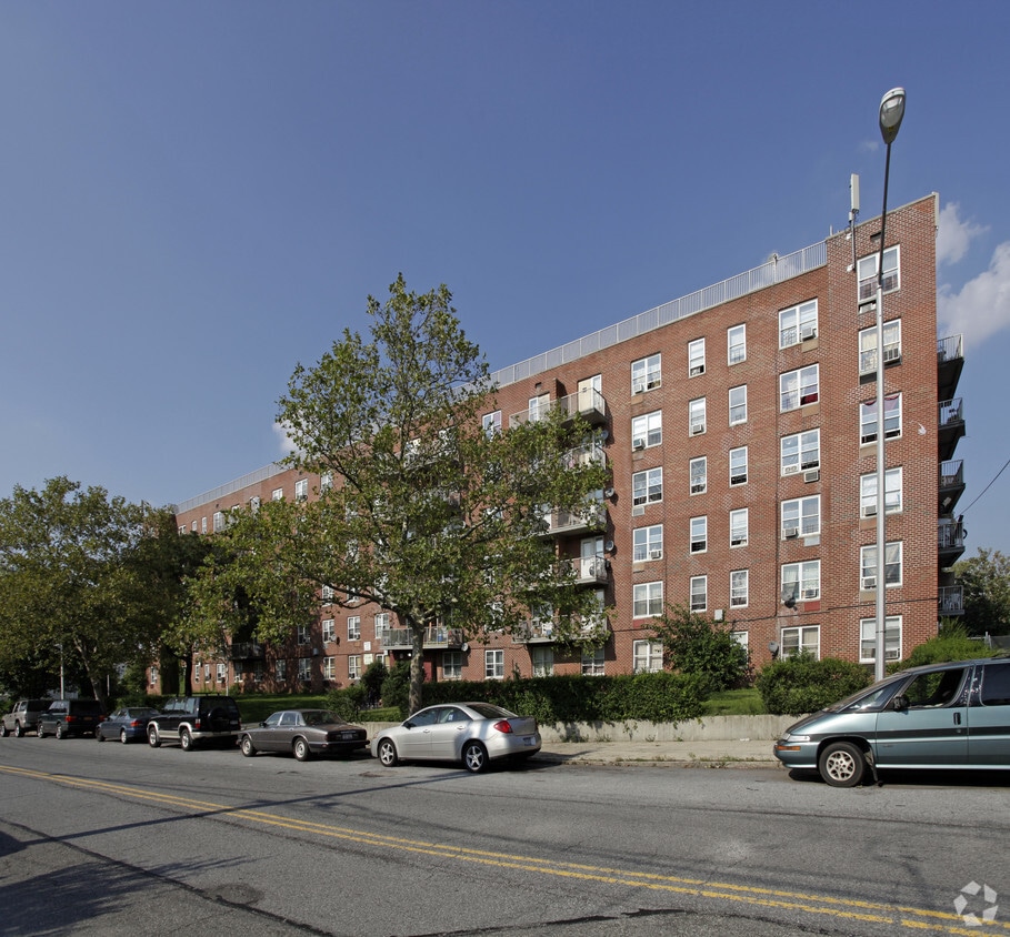
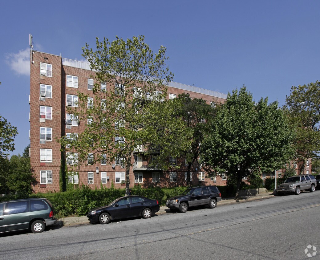

Experience your new home at 220 Osgood Ave. The location in Staten Island's 10304 area is an ideal place to move. From availability to location, the leasing staff is ready to help you in finding your perfect home. Come by to check out the current floorplan options. Contact us or drop by to schedule a tour and make your move to 220 Osgood Ave.
220 Osgood Ave is an apartment community located in Richmond County and the 10304 ZIP Code. This area is served by the New York City Geographic District #31 attendance zone.
Staten Island occupies a singular position as New York City's southernmost borough, physically separate from the rest of the city yet firmly connected to it through the iconic, round-the-clock Staten Island Ferry. As the least densely populated of the five boroughs, it carries a noticeably quieter, more residential character than Manhattan or Brooklyn, covering roughly 59 square miles with a population near 490,000. The College of Staten Island anchors the borough's educational presence, while Snug Harbor Cultural Center and Botanical Garden reflects a deep commitment to the arts and green space. During the American Revolution, Staten Island served as a primary staging ground for British forces and remained under British control longer than any other part of what would become the United States.
Neighborhoods vary considerably across the island. St. George on the North Shore functions as the civic and cultural hub, while Tottenville anchors the quieter South Shore.
Learn more about living in Staten Island| Colleges & Universities | Distance | ||
|---|---|---|---|
| Colleges & Universities | Distance | ||
| Drive: | 5 min | 1.3 mi | |
| Drive: | 12 min | 5.1 mi | |
| Drive: | 22 min | 10.2 mi | |
| Drive: | 25 min | 13.5 mi |


Transportation options available in Staten Island include Bay Ridge-95 Street, located 5.1 miles from 220 Osgood Ave. 220 Osgood Ave is near Newark Liberty International, located 16.1 miles or 26 minutes away, and LaGuardia, located 21.5 miles or 37 minutes away.
| Transit / Subway | Distance | ||
|---|---|---|---|
| Transit / Subway | Distance | ||
|
|
Drive: | 10 min | 5.1 mi |
|
|
Drive: | 10 min | 5.4 mi |
|
|
Drive: | 11 min | 5.8 mi |
|
|
Drive: | 12 min | 6.2 mi |
|
|
Drive: | 13 min | 6.8 mi |
| Commuter Rail | Distance | ||
|---|---|---|---|
| Commuter Rail | Distance | ||
|
|
Walk: | 15 min | 0.8 mi |
|
|
Drive: | 3 min | 1.2 mi |
|
|
Drive: | 4 min | 1.2 mi |
|
|
Drive: | 4 min | 1.8 mi |
|
|
Drive: | 6 min | 2.0 mi |
| Airports | Distance | ||
|---|---|---|---|
| Airports | Distance | ||
|
Newark Liberty International
|
Drive: | 26 min | 16.1 mi |
|
LaGuardia
|
Drive: | 37 min | 21.5 mi |
Scores provided by
Traffic
-Airport
-Businesses
-Scores provided by
HowLoud What is a Sound Score Rating? A Sound Score Rating aggregates noise caused by vehicle traffic, airplane traffic and local sources. How It WorksTime and distance from 220 Osgood Ave.
| Shopping Centers | Distance | ||
|---|---|---|---|
| Shopping Centers | Distance | ||
| Walk: | 8 min | 0.4 mi | |
| Drive: | 4 min | 1.1 mi | |
| Drive: | 4 min | 1.6 mi |
| Parks and Recreation | Distance | ||
|---|---|---|---|
| Parks and Recreation | Distance | ||
|
Alice Austen Park
|
Drive: | 4 min | 1.5 mi |
|
Silver Lake Park
|
Drive: | 6 min | 1.9 mi |
|
Gateway NRA - Staten Island Unit -Fort Wadsworth
|
Drive: | 6 min | 2.0 mi |
|
Clove Lakes Park
|
Drive: | 6 min | 2.2 mi |
|
Mahoney Playground
|
Drive: | 7 min | 2.4 mi |
| Hospitals | Distance | ||
|---|---|---|---|
| Hospitals | Distance | ||
| Drive: | 7 min | 2.9 mi | |
| Drive: | 9 min | 3.0 mi | |
| Drive: | 8 min | 3.4 mi |
| Military Bases | Distance | ||
|---|---|---|---|
| Military Bases | Distance | ||
| Drive: | 5 min | 1.5 mi | |
| Drive: | 11 min | 5.5 mi | |
| Drive: | 20 min | 11.0 mi |
What Are Walk Score®, Transit Score®, and Bike Score® Ratings?
Walk Score® measures the walkability of any address. Transit Score® measures access to public transit. Bike Score® measures the bikeability of any address.
What is a Sound Score Rating?
A Sound Score Rating aggregates noise caused by vehicle traffic, airplane traffic and local sources.


