
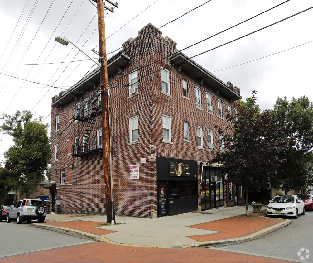
228 Park Ave
228 Park Ave,
East Rutherford, NJ 07073
$3,500 - $3,800
1 Bed

Welcome to 180 Orchard St, East Rutherford #1, a charming 2-bedroom, 1-bathroom apartment located in the vibrant East Rutherford, NJ. This apartment offers a convenient lifestyle with its close proximity to public transportation and a variety of retail and dining options. The dine-in kitchen provides a cozy space for home-cooked meals, while the private parking and private entrance add an extra layer of convenience and security. Additionally, the common commercial laundry machines make laundry day a breeze. Experience the perfect blend of comfort and convenience at 180 Orchard St, East Rutherford #1.
216 Park Ave is an apartment community located in Bergen County and the 07073 ZIP Code. This area is served by the East Rutherford School District attendance zone.
Laundry Facilities
Controlled Access
24 Hour Access
Maintenance on site
Dishwasher
High Speed Internet Access
Hardwood Floors
Walk-In Closets
Nestled between the Passaic and Hackensack rivers in Bergen County, East Rutherford is known for housing the Meadowlands Sports Complex, a three-venue complex where guests can see the Giants, Jets, concerts, and horse racing. Located about seven miles west of Midtown Manhattan, East Rutherford affords residents access to metropolitan luxuries and suburban tranquility.
A slew of excellent restaurants serving international cuisine are strewn throughout East Rutherford. Residents have easy access to nearby parks, including the popular Riverside County Park, Richard W. DeKorte Park, and Laurel Hill Park, where outdoor recreation abounds. The Secaucus Outlets are just minutes from East Rutherford as well. Commuting and traveling to New York City and Hoboken from East Rutherford is simple with access to I-95 and NJ Transit train stations.
Learn more about living in East Rutherford| Colleges & Universities | Distance | ||
|---|---|---|---|
| Colleges & Universities | Distance | ||
| Drive: | 4 min | 1.1 mi | |
| Drive: | 5 min | 2.4 mi | |
| Drive: | 5 min | 2.7 mi | |
| Drive: | 9 min | 3.9 mi |


Transportation options available in East Rutherford include Tonnelle Avenue, located 6.7 miles from 216 Park Ave. 216 Park Ave is near Newark Liberty International, located 12.5 miles or 16 minutes away, and LaGuardia, located 21.7 miles or 34 minutes away.
| Transit / Subway | Distance | ||
|---|---|---|---|
| Transit / Subway | Distance | ||
|
|
Drive: | 9 min | 6.7 mi |
|
|
Drive: | 11 min | 7.5 mi |
|
|
Drive: | 14 min | 8.6 mi |
|
|
Drive: | 15 min | 9.0 mi |
|
|
Drive: | 15 min | 9.0 mi |
| Commuter Rail | Distance | ||
|---|---|---|---|
| Commuter Rail | Distance | ||
|
|
Walk: | 3 min | 0.2 mi |
|
|
Drive: | 3 min | 2.0 mi |
|
|
Drive: | 4 min | 2.4 mi |
|
|
Drive: | 6 min | 2.7 mi |
|
|
Drive: | 6 min | 3.5 mi |
| Airports | Distance | ||
|---|---|---|---|
| Airports | Distance | ||
|
Newark Liberty International
|
Drive: | 16 min | 12.5 mi |
|
LaGuardia
|
Drive: | 34 min | 21.7 mi |
Scores provided by
Traffic
-Airport
-Businesses
-Scores provided by
HowLoud What is a Sound Score Rating? A Sound Score Rating aggregates noise caused by vehicle traffic, airplane traffic and local sources. How It WorksTime and distance from 216 Park Ave.
| Shopping Centers | Distance | ||
|---|---|---|---|
| Shopping Centers | Distance | ||
| Walk: | 8 min | 0.5 mi | |
| Walk: | 18 min | 0.9 mi | |
| Drive: | 6 min | 3.5 mi |
| Parks and Recreation | Distance | ||
|---|---|---|---|
| Parks and Recreation | Distance | ||
|
Meadowlands Environment Center
|
Drive: | 12 min | 4.5 mi |
|
McDowell Observatory
|
Drive: | 12 min | 4.5 mi |
|
Richard W. DeKorte Park
|
Drive: | 14 min | 6.4 mi |
|
Kearny Marsh
|
Drive: | 12 min | 6.4 mi |
|
Laurel Hill Park
|
Drive: | 13 min | 7.1 mi |
| Hospitals | Distance | ||
|---|---|---|---|
| Hospitals | Distance | ||
| Drive: | 6 min | 3.5 mi | |
| Drive: | 6 min | 4.4 mi | |
| Drive: | 7 min | 5.2 mi |
| Military Bases | Distance | ||
|---|---|---|---|
| Military Bases | Distance | ||
| Drive: | 25 min | 14.8 mi | |
| Drive: | 24 min | 17.0 mi | |
| Drive: | 39 min | 26.5 mi |
What Are Walk Score®, Transit Score®, and Bike Score® Ratings?
Walk Score® measures the walkability of any address. Transit Score® measures access to public transit. Bike Score® measures the bikeability of any address.
What is a Sound Score Rating?
A Sound Score Rating aggregates noise caused by vehicle traffic, airplane traffic and local sources.
216 Park Ave
East Rutherford, NJ 07073


