
$900
/ Month
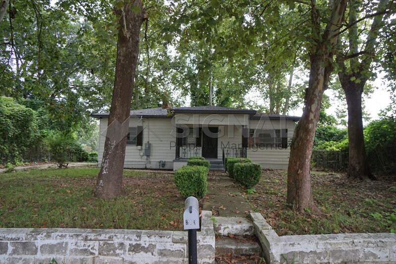
215 8th St NE
Graysville, AL 35073
Favorites
215 8th St NE

Favorites
Check Back Soon for Upcoming Availability
| Beds | Baths | Average SF |
|---|---|---|
| 3 Bedrooms 3 Bedrooms 3 Br | 2 Baths 2 Baths 2 Ba | 1,232 SF |
About This Property
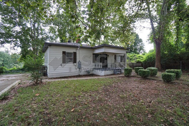
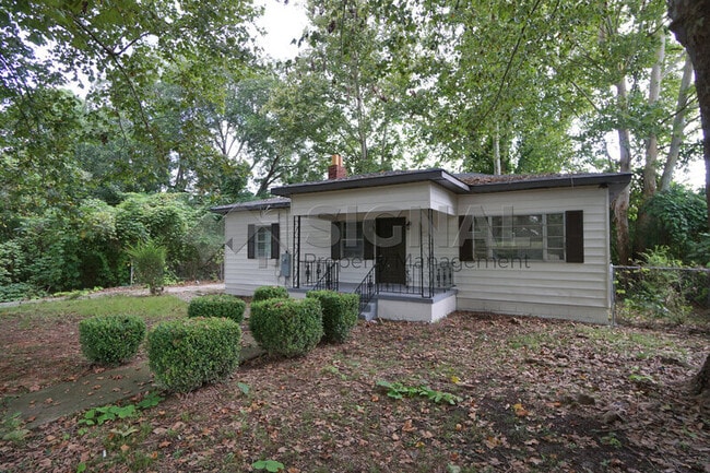
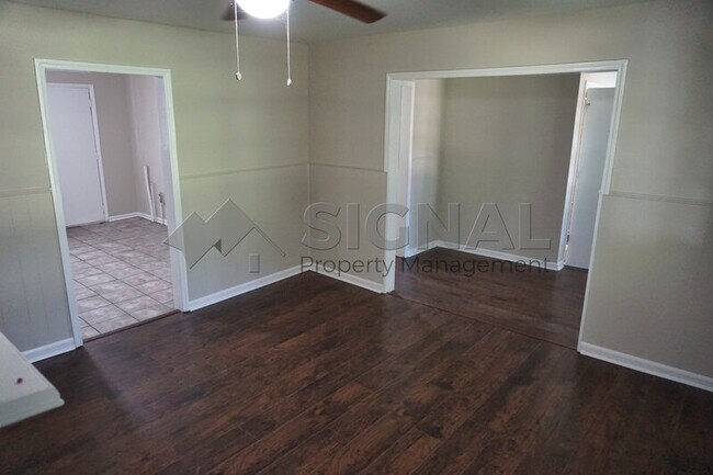
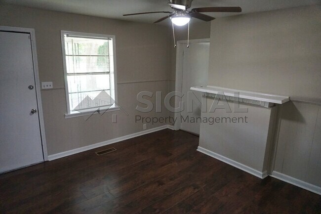
Not available on Section 8. Come see this beautiful all-electric home today! Located on a large lot with plenty of natural lighting. The living area and all 3 bedrooms with nice hardwood floors throughout. Eat-in kitchen with granite countertops. Driveway at the side of the home for off-street parking. Schedule a showing before it's gone!
215 8th St Ne is a house located in Jefferson County and the 35073 ZIP Code. This area is served by the Jefferson County School District attendance zone.
215 8th St NE,
Graysville,
AL
35073
Education
| Colleges & Universities | Distance | ||
|---|---|---|---|
| Colleges & Universities | Distance | ||
| Drive: | 28 min | 13.8 mi | |
| Drive: | 22 min | 15.6 mi | |
| Drive: | 22 min | 15.9 mi | |
| Drive: | 26 min | 19.1 mi |
215 8th St NE is within 22 minutes or 15.6 miles from Birmingham Southern College. It is also near Miles College and Univ. of Ala. at Birmingham.
Schools


Public Elementary School
Grades PK-5
588 Students
Nearby
Public Elementary School
Grades K-5
187 Students
Nearby
Public Middle School
Grades 6-8
728 Students
Nearby
Public High School
Grades 9-12
915 Students
Nearby
Private Elementary School
Grades PK-5
75 Students
Nearby
Private Elementary, Middle & High School
Grades K-12
Nearby
School data provided by
 The GreatSchools Rating helps parents compare schools within a state based on a variety of school quality indicators and provides a helpful picture of how effectively each school serves all of its students. Ratings are on a scale of 1 (below average) to 10 (above average) and can include test scores, college readiness, academic progress, advanced courses, equity, discipline and attendance data. We also advise parents to visit schools, consider other information on school performance and programs, and consider family needs as part of the school selection process.
View GreatSchools Rating Methodology
Data provided by GreatSchools.org © 2026. All rights reserved.
View GreatSchools Rating Methodology
Data provided by GreatSchools.org © 2026. All rights reserved.
Walkability Near 215 8th St NE Graysville, AL 35073
Getting Around
 What do Walkability, Transit, Drivability, and Bikeability mean?
Walkability measures the walking distance to day-to-day needs.
Transit measures access to public transportation.
Drivability measures congestion, parking availability, and access to major roads.
Bikeability measures the suitability for cycling.
How It Works
What do Walkability, Transit, Drivability, and Bikeability mean?
Walkability measures the walking distance to day-to-day needs.
Transit measures access to public transportation.
Drivability measures congestion, parking availability, and access to major roads.
Bikeability measures the suitability for cycling.
How It Works
Somewhat Walkable
Walkability
20
/ 100
Exceptionally Drivable
Drivability
100
/ 100
Somewhat Bikeable
Bikeability
20
/ 100
Scores provided by
-
Soundscore™
-
/ 100
Traffic
-Airport
-Businesses
-Scores provided by
HowLoud What is a Sound Score Rating? A Sound Score Rating aggregates noise caused by vehicle traffic, airplane traffic and local sources. How It WorksYou May Also Like
Similar Rentals Nearby


What Are Walk Score®, Transit Score®, and Bike Score® Ratings?
Walk Score® measures the walkability of any address. Transit Score® measures access to public transit. Bike Score® measures the bikeability of any address.
What is a Sound Score Rating?
A Sound Score Rating aggregates noise caused by vehicle traffic, airplane traffic and local sources.
215 8th St NE
Graysville, AL 35073