

$795
Total Monthly Price
2133 Pierpont Ave
Charleston, SC 29414
2 Weeks Ago
|
Edit
Favorites
-
Bedrooms
1
-
Bathrooms
1
-
Square Feet
600 sq ft
Highlight
- Smoke Free
2133 Pierpont Ave

Favorites
2 Available Units
C
$795
Total Monthly Price
1 bed,
1 bath,
600 sq ft
12 Month Lease, $795 deposit,
Available Now
Apartment C
$795
Total Monthly Price
1 bed,
1 bath,
600 sq ft
12 Month Lease, $795 deposit,
Available Now
* Price shown is base rent. Excludes user-selected optional fees and variable or usage-based fees and required charges due at or prior to move-in or at move-out.
Price, availability, fees, and any applicable rent special are subject to change without notice.
* Square footage definitions vary. Displayed square footage is approximate.
About 2133 Pierpont Ave Charleston, SC 29414
12 Month Lease,
$795 deposit
Cute! Quaint! Senior Living (Singles age 55 and older) Must see! This newly remodeled unit is tucked away in a quiet private neighborhood in West Ashley. Safe, one level apartment.
2133 Pierpont Ave is an apartment community located in Charleston County and the 29414 ZIP Code.
* Price shown is total price based on community-supplied monthly required fees. Excludes user-selected optional fees and variable or usage-based fees and required charges due at or prior to move-in or at move-out. Price, availability, fees, and any applicable rent special are subject to change without notice.
* Square footage definitions vary. Displayed square footage is approximate.
Apartment Features
- Washer/Dryer
- Air Conditioning
- Smoke Free
Fees and Policies
The fees listed below are community-provided and may exclude utilities or add-ons. All payments are made directly to the property and are non-refundable unless otherwise specified.
- Parking
-
Surface Lot--
Details
Utilities Included
-
Water
-
Trash Removal
-
Sewer
Property Information
-
8 units
Contact
- Listed by Danielle Mantek
Location
Get Directions
West Ashley sits within the city of Charleston and is west of the Ashley River, hence its name, and is the birthplace of Hootie & the Blowfish’s frontman, Darius Rucker. Lined with mossy oaks, the Ashley and Stono Rivers border West Ashley, creating the breathtaking scenery for which Charleston is known. West Ashley residents enjoy close proximity to the area's only indoor mall, the Citadel Mall, and a large number of big-box stores.
Situated seven miles due west of Downtown Charleston, residents can plan on a 15- to 30-minute drive, depending on traffic, to take in all downtown has to offer. Nearby Interstate 526, which feeds directly into Charleston’s Interstate Highway 26, gives residents a fast and easy route in and out of area. Mid- to late-1900s ranch-style homes characterize the housing in outer West Ashley, but neighborhoods built in the 2000s also sprinkle the area.
Learn more about living in West Ashley
Education
| Colleges & Universities | Distance | ||
|---|---|---|---|
| Colleges & Universities | Distance | ||
| Drive: | 12 min | 5.7 mi | |
| Drive: | 16 min | 7.4 mi | |
| Drive: | 19 min | 8.6 mi | |
| Drive: | 19 min | 8.7 mi |
2133 Pierpont Ave is within 12 minutes or 5.7 miles from Southern Wesleyan, Charleston. It is also near Medical Univ. of S.C. and The Citadel.
Getting Around
 What do Walkability, Transit, Drivability, and Bikeability mean?
Walkability measures the walking distance to day-to-day needs.
Transit measures access to public transportation.
Drivability measures congestion, parking availability, and access to major roads.
Bikeability measures the suitability for cycling.
How It Works
What do Walkability, Transit, Drivability, and Bikeability mean?
Walkability measures the walking distance to day-to-day needs.
Transit measures access to public transportation.
Drivability measures congestion, parking availability, and access to major roads.
Bikeability measures the suitability for cycling.
How It Works
Somewhat Walkable
Walkability
30
/ 100
Minimal Public Transit
Transit
0
/ 100
Exceptionally Drivable
Drivability
100
/ 100
Somewhat Bikeable
Bikeability
30
/ 100
Scores provided by
-
Soundscore™
-
/ 100
Traffic
-Airport
-Businesses
-Scores provided by
HowLoud What is a Sound Score Rating? A Sound Score Rating aggregates noise caused by vehicle traffic, airplane traffic and local sources. How It Works
Amenities
- Washer/Dryer
- Air Conditioning
- Smoke Free
2133 Pierpont Ave Photos
-
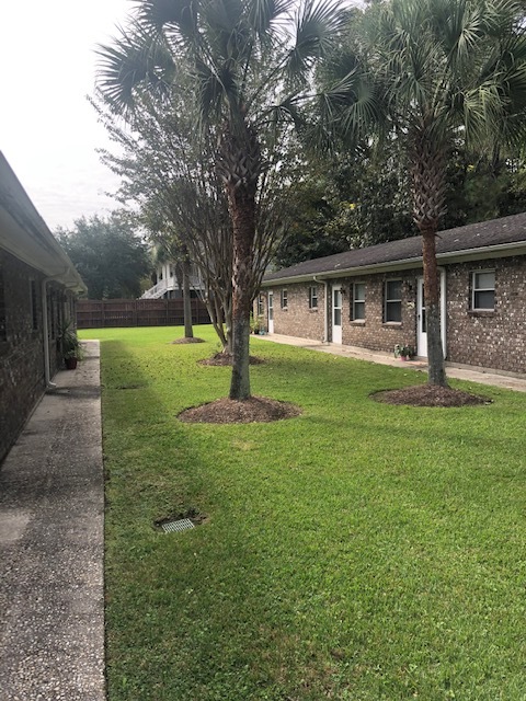
Outdoor Courtyard (entrance)
-
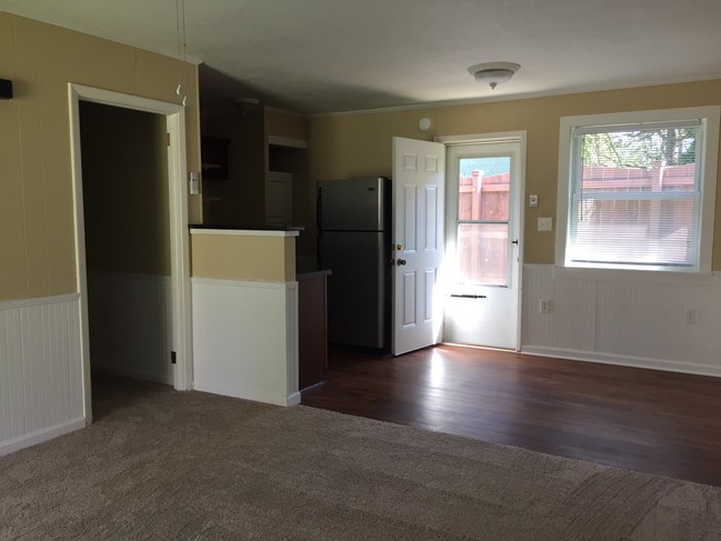
Main Living Area
-
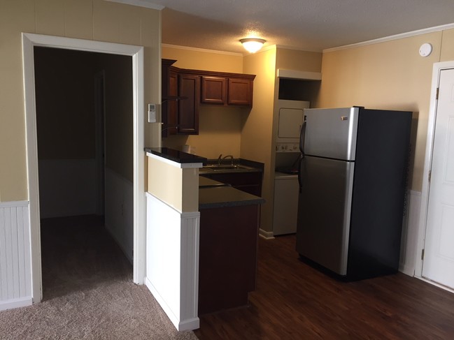
Kitchen
-
Dining Space
-
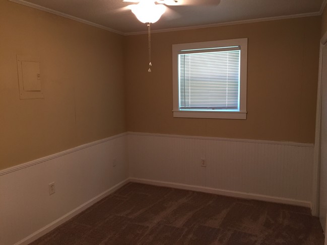
Bedroom
-
Closet view in Bedroom
-
Bathroom - off bedroom
-
Outside Front Door.. End Unit
-
Dining/BackDoor
What Are Walk Score®, Transit Score®, and Bike Score® Ratings?
Walk Score® measures the walkability of any address. Transit Score® measures access to public transit. Bike Score® measures the bikeability of any address.
What is a Sound Score Rating?
A Sound Score Rating aggregates noise caused by vehicle traffic, airplane traffic and local sources.
2133 Pierpont Ave
Charleston, SC 29414