

$502
/ Month
2125 S Breezewood Rd
Breezewood, PA 15533
2 Weeks Ago
|
Edit
Favorites
2125 S Breezewood Rd

Favorites
Check Back Soon for Upcoming Availability
| Beds | Baths | Average SF |
|---|---|---|
| 2 Bedrooms 2 Bedrooms 2 Br | 2 Baths 2 Baths 2 Ba | — |
About This Property
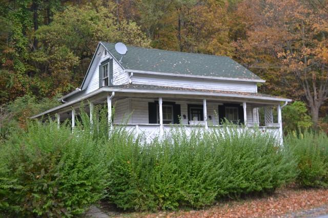
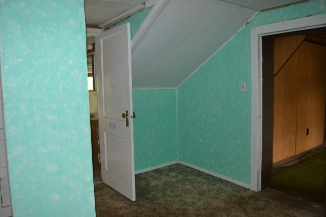
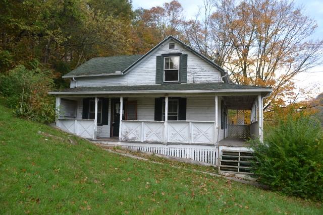
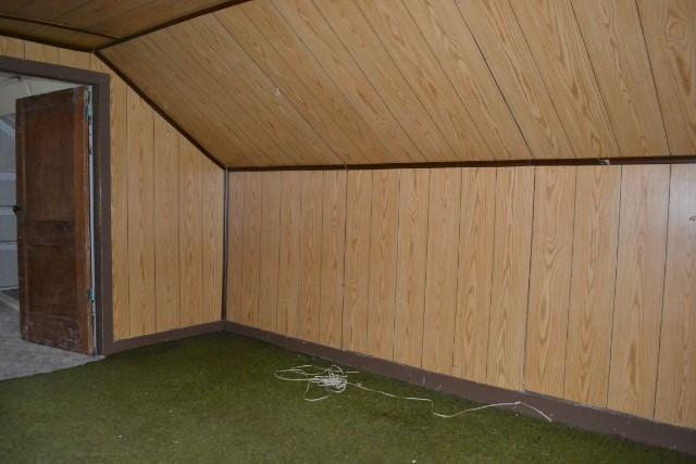
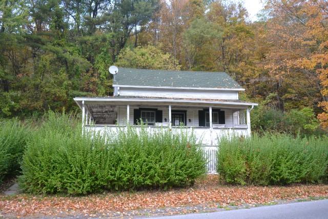
Before inquiring about this property, please understand that this home may require major repairs and work before it is move in ready! This home is also NOT FOR RENT. Only serious inquiries please! This 2 bedroom, 2 bathroom home is located in Breezewood, PA. The overall condition of the home is fair, will need several repairs and updates to the kitchen and bathrooms. Great project for a contractor!
2125 S Breezewood Rd is a house located in Bedford County and the 15533 ZIP Code. This area is served by the Everett Area School District attendance zone.
2125 S Breezewood Rd,
Breezewood,
PA
15533
Education
| Colleges & Universities | Distance | ||
|---|---|---|---|
| Colleges & Universities | Distance | ||
| Drive: | 72 min | 57.7 mi |
2125 S Breezewood Rd is within 72 minutes or 57.7 miles from Allegany College of Maryland.
Schools


Public Elementary School
Grades PK-5
213 Students
Nearby
Public Elementary School
Grades K-5
77 Students
Nearby
Public Middle School
Grades 6-8
293 Students
Nearby
Public High School
Grades 9-12
360 Students
Attendance Zone
Private Elementary, Middle & High School
Grades PK-12
49 Students
Nearby
Private Middle & High School
Grades 6-12
Nearby
School data provided by
 The GreatSchools Rating helps parents compare schools within a state based on a variety of school quality indicators and provides a helpful picture of how effectively each school serves all of its students. Ratings are on a scale of 1 (below average) to 10 (above average) and can include test scores, college readiness, academic progress, advanced courses, equity, discipline and attendance data. We also advise parents to visit schools, consider other information on school performance and programs, and consider family needs as part of the school selection process.
View GreatSchools Rating Methodology
Data provided by GreatSchools.org © 2026. All rights reserved.
View GreatSchools Rating Methodology
Data provided by GreatSchools.org © 2026. All rights reserved.
Walkability Near 2125 S Breezewood Rd Breezewood, PA 15533
Getting Around
 What do Walkability, Transit, Drivability, and Bikeability mean?
Walkability measures the walking distance to day-to-day needs.
Transit measures access to public transportation.
Drivability measures congestion, parking availability, and access to major roads.
Bikeability measures the suitability for cycling.
How It Works
What do Walkability, Transit, Drivability, and Bikeability mean?
Walkability measures the walking distance to day-to-day needs.
Transit measures access to public transportation.
Drivability measures congestion, parking availability, and access to major roads.
Bikeability measures the suitability for cycling.
How It Works
Not Walkable
Walkability
10
/ 100
Exceptionally Drivable
Drivability
100
/ 100
Somewhat Bikeable
Bikeability
20
/ 100
Scores provided by
-
Soundscore™
-
/ 100
Traffic
-Airport
-Businesses
-Scores provided by
HowLoud What is a Sound Score Rating? A Sound Score Rating aggregates noise caused by vehicle traffic, airplane traffic and local sources. How It WorksSimilar Rentals Nearby

What Are Walk Score®, Transit Score®, and Bike Score® Ratings?
Walk Score® measures the walkability of any address. Transit Score® measures access to public transit. Bike Score® measures the bikeability of any address.
What is a Sound Score Rating?
A Sound Score Rating aggregates noise caused by vehicle traffic, airplane traffic and local sources.
2125 S Breezewood Rd
Breezewood, PA 15533