

$3,200
Total Monthly Price
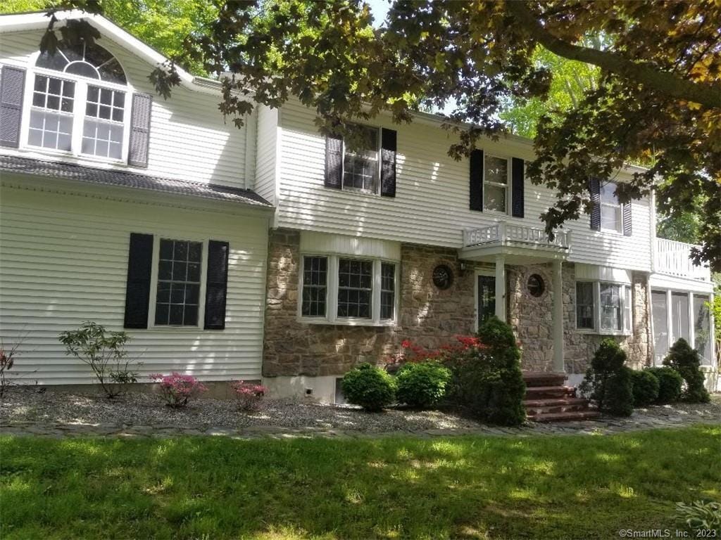
212 E Rutland Rd
Milford, CT 06461
Favorites
203-430-0690
-
Bedrooms
4
-
Bathrooms
1.5
-
Square Feet
2,465 sq ft
-
Available
Not Available
Highlights
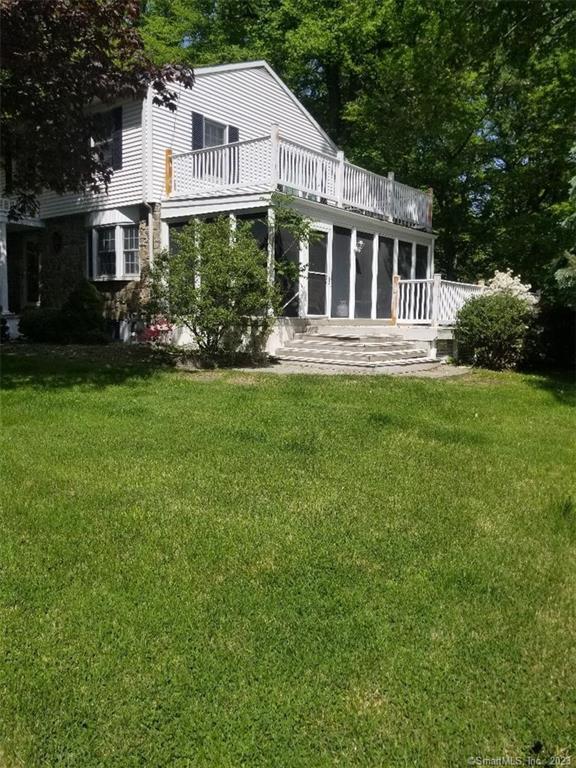
- Colonial Architecture
- Deck
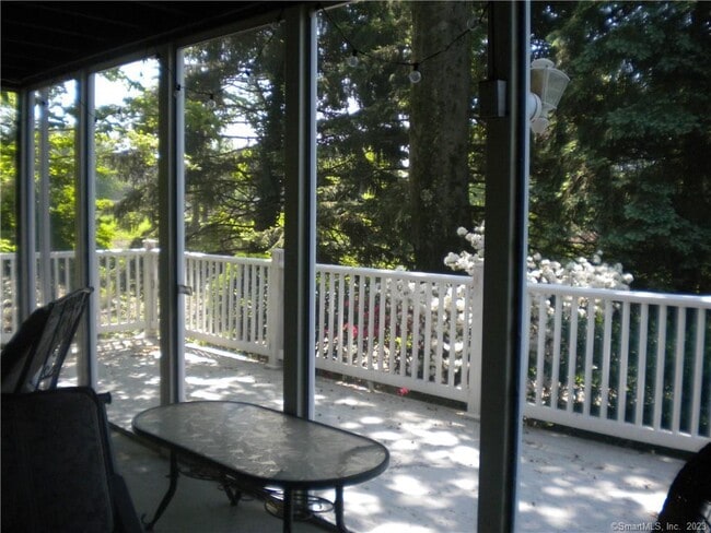
- Enclosed Patio or Porch
- Laundry Room
- Property is near golf course and shops
- Hot Water Circulator
212 E Rutland Rd

Favorites
About This Home
Not Available
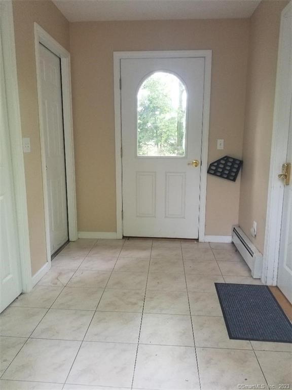
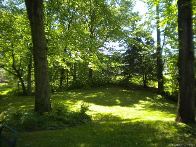
Call for Availability - Spacious New England Colonial on tranquil, lightly wooded lot makes you feel like you're in the country while being close to everything! With over 2400 sq. ft, this 4 BR, 1.5 Bath home is well-maintained, updated and has plenty of room as well as everything you need to entertain your friends: large patio, 3-season porch overlooking your rolling lawn; open & airy living room; chef's kitchen w/large breakfast bar and adjacent, full dining room; laundry room and large pantry with extra refrigeration. And that's just the first floor! Upstairs, enjoy your 4 spacious bedrooms with hardwood floors, private balcony and access to a large storage room. Parking is 1 spot in driveway and 1 spot in two-car garage shared with the downstairs tenant. Conveniently located near parks, shopping, restaurants, the Milford Pkwy and I-95. NOTE: Driveway and Garage are shared with basement tenant, who has separate entrance. Good credit a must, background check, references, 1st month's rent, 2 months security required. MLS# 24183018
212 E Rutland Rd is a house located in New Haven County and the 06461 ZIP Code. This area is served by the Milford School District attendance zone.
* Price shown is total price based on community-supplied monthly required fees. Excludes user-selected optional fees and variable or usage-based fees and required charges due at or prior to move-in or at move-out. Price, availability, fees, and any applicable rent special are subject to change without notice.
* Square footage definitions vary. Displayed square footage is approximate.
Home Details
Year Built
Built in 1963
Bedrooms and Bathrooms
1.5 Bathrooms
4 Bedrooms
Home Design
Colonial Architecture
Aluminum Siding
Interior Spaces
Ceiling Fan
2,465 Sq Ft Home
Kitchen
Electric Range
Microwave
Dishwasher
Laundry
Laundry Room
Laundry on main level
Electric Dryer
Washer
Listing and Financial Details
Assessor Parcel Number 1215844
Location
Property is near golf course and shops
Lot Details
37,462 Sq Ft Lot
Property is zoned R30
Outdoor Features
Deck
Enclosed Patio or Porch
Parking
Parking Deck
1 Car Garage
Utilities
Hot Water Circulator
Hot Water Heating System
Heating System Uses Natural Gas
Community Details
Pet Policy
No Pets Allowed
Contact
- Listed by Catherine Vincelette | Ditchkus Real Estate
- Phone Number
- Contact
-
Source
 Smart MLS
The data relating to real estate for sale on this website appears in part through the SMARTMLS Internet Data Exchange program, a voluntary cooperative exchange of property listing data between licensed real estate brokerage firms, and is provided by SMARTMLS through a licensing agreement. Listing information is from various brokers who participate in the SMARTMLS IDX program and not all listings may be visible on the site. The property information being provided on or through the website is for the personal, non-commercial use of consumers and such information may not be used for any purpose other than to identify prospective properties consumers may be interested in purchasing. Some properties which appear for sale on the website may no longer be available because they are for instance, under contract, sold or are no longer being offered for sale. Property information displayed is deemed reliable but is not guaranteed. Copyright 2026 SmartMLS, Inc.
Location
Get Directions
Bordered by the Housatonic River on its western edge, the neighborhood of Parkway/Wheelers Farm Road sits roughly 12 miles west of New Haven and 70 miles northeast of Manhattan. This largely rural area features single-family homes with apartment buildings in the more densely populated southern area close to I-95.
For shopping needs, Connecticut Post Mall features more than 150 stores and eateries, and the retail strips along Bridgeport Avenue and Boston Post Road provide alternative venues. Local restaurants include Mi Casita Restaurant and Bakery, where patrons gather for hearty Columbian dishes. For comfort food, diners recommend Bar 3 Thirty Three in the northern part of town.
Nestled close to the river and the coast, the area offers plenty in the way of outdoor activities. The Charles E. Wheeler Wildlife Area features interesting birdwatching opportunities for experienced canoeists, and Silver Sands State Park provides a boardwalk and beach fun.
Learn more about living in Parkway/Wheelers Farm Road
Education
| Colleges & Universities | Distance | ||
|---|---|---|---|
| Colleges & Universities | Distance | ||
| Drive: | 11 min | 5.7 mi | |
| Drive: | 14 min | 8.4 mi | |
| Drive: | 14 min | 9.6 mi | |
| Drive: | 18 min | 11.3 mi |
212 E Rutland Rd is within 11 minutes or 5.7 miles from Yale University, West Campus. It is also near University of New Haven and University of Bridgeport.
Schools


Public Elementary School
Grades PK-5
329 Students
Nearby
Public Elementary School
Grades K-5
315 Students
Attendance Zone
Public Middle School
Grades 6-8
403 Students
Attendance Zone
Public High School
Grades 9-12
815 Students
Attendance Zone
Private Elementary, Middle & High School
Grades K-12
60 Students
Nearby
School data provided by
 The GreatSchools Rating helps parents compare schools within a state based on a variety of school quality indicators and provides a helpful picture of how effectively each school serves all of its students. Ratings are on a scale of 1 (below average) to 10 (above average) and can include test scores, college readiness, academic progress, advanced courses, equity, discipline and attendance data. We also advise parents to visit schools, consider other information on school performance and programs, and consider family needs as part of the school selection process.
View GreatSchools Rating Methodology
Data provided by GreatSchools.org © 2026. All rights reserved.
View GreatSchools Rating Methodology
Data provided by GreatSchools.org © 2026. All rights reserved.
Getting Around
 What do Walkability, Transit, Drivability, and Bikeability mean?
Walkability measures the walking distance to day-to-day needs.
Transit measures access to public transportation.
Drivability measures congestion, parking availability, and access to major roads.
Bikeability measures the suitability for cycling.
How It Works
What do Walkability, Transit, Drivability, and Bikeability mean?
Walkability measures the walking distance to day-to-day needs.
Transit measures access to public transportation.
Drivability measures congestion, parking availability, and access to major roads.
Bikeability measures the suitability for cycling.
How It Works
Fairly Walkable
Walkability
40
/ 100
Limited Public Transit
Transit
30
/ 100
Exceptionally Drivable
Drivability
100
/ 100
Fairly Bikeable
Bikeability
40
/ 100
Scores provided by
Active
Soundscore™
76
/ 100
Traffic
ActiveAirport
CalmBusinesses
CalmScores provided by
HowLoud What is a Sound Score Rating? A Sound Score Rating aggregates noise caused by vehicle traffic, airplane traffic and local sources. How It WorksYou May Also Like
Similar Rentals Nearby
-
-

-

-

-

-
 4 Beds, 2 Baths, 1,450 sq ft$4,200Total Monthly PriceTotal Monthly Price NewPrices include all required monthly fees.11 Colony St
 -
 4 Beds, 2 Baths, 2,004 sq ft$2,850Total Monthly PriceTotal Monthly Price NewPrices include all required monthly fees.39 Pardee Pl
 -
 4 Beds, 2 Baths, 2,000 sq ft$2,950Total Monthly PriceTotal Monthly Price NewPrices include all required monthly fees.49 Hubinger St
 -
 4 Beds, 2 Baths, 3,045 sq ft$2,600Total Monthly PriceTotal Monthly Price NewPrices include all required monthly fees.106 Butler St
 -
 4 Beds, 4 Baths, 5,224 sq ft$10,000Total Monthly PriceTotal Monthly Price NewPrices include all required monthly fees.14 Magellan Ln
What Are Walk Score®, Transit Score®, and Bike Score® Ratings?
Walk Score® measures the walkability of any address. Transit Score® measures access to public transit. Bike Score® measures the bikeability of any address.
What is a Sound Score Rating?
A Sound Score Rating aggregates noise caused by vehicle traffic, airplane traffic and local sources.
212 E Rutland Rd
Milford, CT 06461