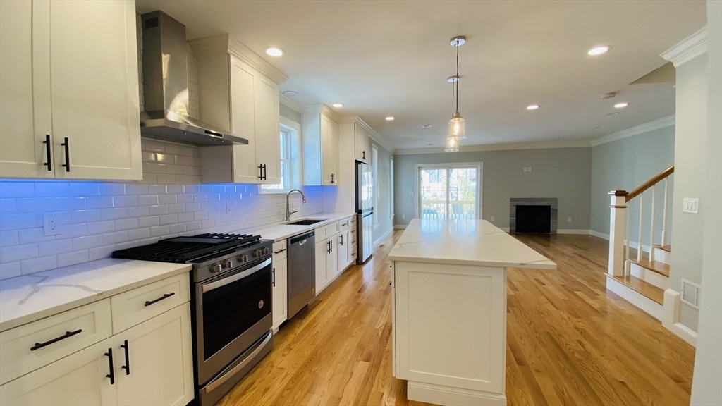
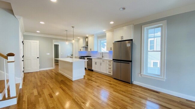
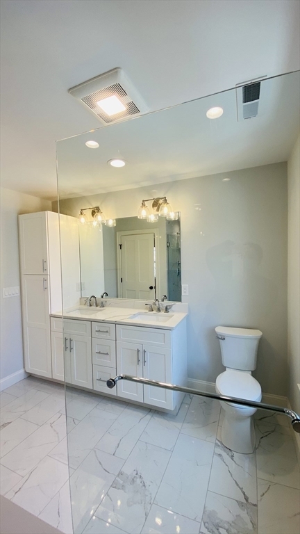
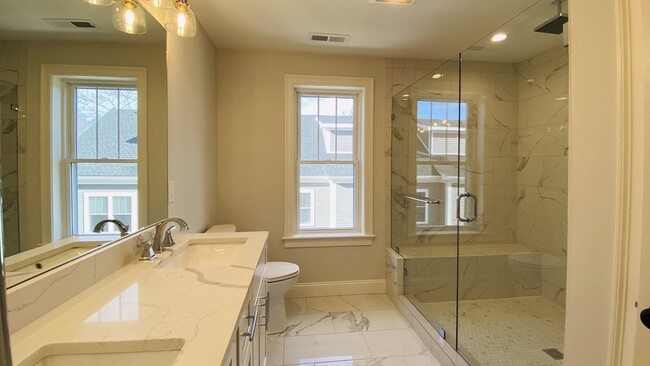
4 Beds, 1 Bath, 1,300 sq ft
211 West St
Needham, MA 02494
-
Bedrooms
4
-
Bathrooms
3.5
-
Square Feet
3,064 sq ft
-
Available
Available Now
Highlights
- Property is near public transit
- 1 Fireplace
- Cooling Available
- Shops
- 1 Car Garage
- Heating System Uses Natural Gas
About This Home
2021 brand new construction,attached single family,high end appliances,Quartz Counter tops,contemporary kitchen cabinets,spacious bedrooms withfinished basement and attic. Master Suite has over sized shower,double vanity sinks and walk-in closet. A lot of storage space and private outdoorspace.Conveniently located at a nice neighborhood with walking distance to commuter rails,public schools,shopping center and restaurants. Easy access tothe highway 95. MLS# 73369424
211 West St is a townhome located in Norfolk County and the 02494 ZIP Code. This area is served by the Needham attendance zone.
Home Details
Year Built
Bedrooms and Bathrooms
Home Design
Interior Spaces
Laundry
Listing and Financial Details
Location
Lot Details
Parking
Utilities
Community Details
Amenities
Overview
Pet Policy
Contact
- Listed by Shasha Chang | Peace of Mind Realty
- Phone Number
-
Source
MLS Property Information Network
Just west of Boston and East of Worcester sits Metro West, a region that houses a group of towns and cities with significant historical backgrounds. A total of 19 municipalities make up the core of this community, but other municipalities are considered to be a part of the Interstate 495/Metro West Corridor.
Learn more about living in Metro West| Colleges & Universities | Distance | ||
|---|---|---|---|
| Colleges & Universities | Distance | ||
| Drive: | 6 min | 2.5 mi | |
| Drive: | 11 min | 4.3 mi | |
| Drive: | 11 min | 5.8 mi | |
| Drive: | 14 min | 7.2 mi |
The GreatSchools Rating helps parents compare schools within a state based on a variety of school quality indicators and provides a helpful picture of how effectively each school serves all of its students. Ratings are on a scale of 1 (below average) to 10 (above average) and can include test scores, college readiness, academic progress, advanced courses, equity, discipline and attendance data. We also advise parents to visit schools, consider other information on school performance and programs, and consider family needs as part of the school selection process.
View GreatSchools Rating Methodology
Data provided by GreatSchools.org © 2025. All rights reserved.
Transportation options available in Needham include Newton Highlands Station, located 2.9 miles from 211 West St. 211 West St is near General Edward Lawrence Logan International, located 16.1 miles or 29 minutes away, and Worcester Regional, located 42.6 miles or 61 minutes away.
| Transit / Subway | Distance | ||
|---|---|---|---|
| Transit / Subway | Distance | ||
|
|
Drive: | 5 min | 2.9 mi |
|
|
Drive: | 7 min | 3.1 mi |
|
|
Drive: | 7 min | 3.3 mi |
|
|
Drive: | 8 min | 4.5 mi |
|
|
Drive: | 9 min | 4.8 mi |
| Commuter Rail | Distance | ||
|---|---|---|---|
| Commuter Rail | Distance | ||
|
|
Walk: | 3 min | 0.2 mi |
|
|
Drive: | 2 min | 1.2 mi |
|
|
Drive: | 3 min | 1.7 mi |
|
|
Drive: | 5 min | 2.5 mi |
|
|
Drive: | 6 min | 2.8 mi |
| Airports | Distance | ||
|---|---|---|---|
| Airports | Distance | ||
|
General Edward Lawrence Logan International
|
Drive: | 29 min | 16.1 mi |
|
Worcester Regional
|
Drive: | 61 min | 42.6 mi |
Time and distance from 211 West St.
| Shopping Centers | Distance | ||
|---|---|---|---|
| Shopping Centers | Distance | ||
| Drive: | 2 min | 1.1 mi | |
| Drive: | 2 min | 1.3 mi | |
| Drive: | 3 min | 1.5 mi |
| Parks and Recreation | Distance | ||
|---|---|---|---|
| Parks and Recreation | Distance | ||
|
Cutler Park Reservation
|
Drive: | 3 min | 1.7 mi |
|
Hemlock Gorge Reservation
|
Drive: | 4 min | 2.1 mi |
|
Whitin Observatory
|
Drive: | 9 min | 3.7 mi |
|
Horticultural Society at Elm Bank
|
Drive: | 12 min | 5.1 mi |
|
Elm Bank Reservation
|
Drive: | 14 min | 5.5 mi |
| Hospitals | Distance | ||
|---|---|---|---|
| Hospitals | Distance | ||
| Drive: | 2 min | 1.3 mi | |
| Drive: | 7 min | 4.3 mi | |
| Drive: | 10 min | 5.5 mi |
| Military Bases | Distance | ||
|---|---|---|---|
| Military Bases | Distance | ||
| Drive: | 14 min | 6.9 mi | |
| Drive: | 24 min | 14.3 mi |
You May Also Like
Similar Rentals Nearby
-
Total Monthly Price New$3,100Total Monthly PricePrices include all required monthly fees.13 Month LeaseTownhome for Rent
-
Total Monthly Price New$6,700Total Monthly PricePrices include all required monthly fees.12 Month LeaseTownhome for Rent
4 Beds, 4.5 Baths, 1,675 sq ft
-
-
-
-
-
-
-
-
What Are Walk Score®, Transit Score®, and Bike Score® Ratings?
Walk Score® measures the walkability of any address. Transit Score® measures access to public transit. Bike Score® measures the bikeability of any address.
What is a Sound Score Rating?
A Sound Score Rating aggregates noise caused by vehicle traffic, airplane traffic and local sources