
$650
/ Month
20808 Highway 28
Dixon, MO 65459
2 Weeks Ago
|
Edit
Favorites
20808 Highway 28

Favorites
Check Back Soon for Upcoming Availability
| Beds | Baths | Average SF |
|---|---|---|
| 3 Bedrooms 3 Bedrooms 3 Br | 2 Baths 2 Baths 2 Ba | — |
About This Property
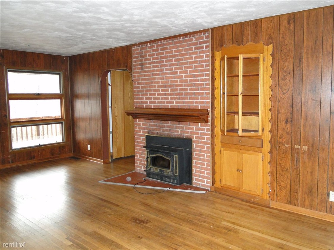
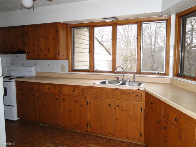
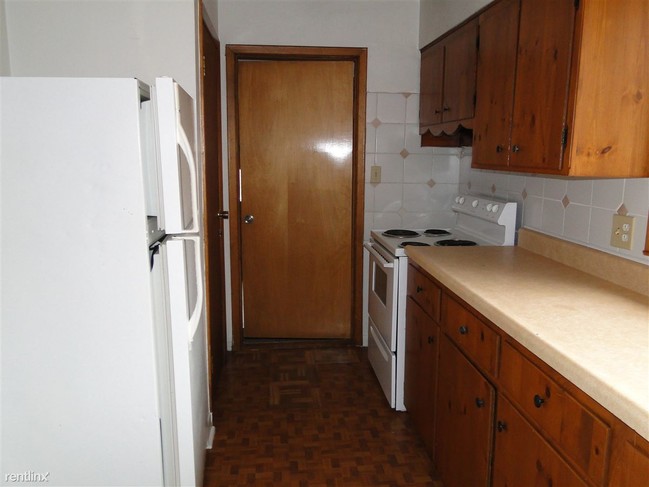
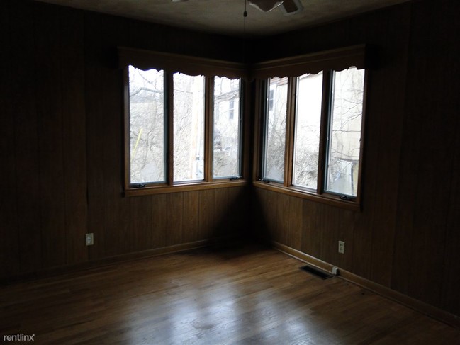
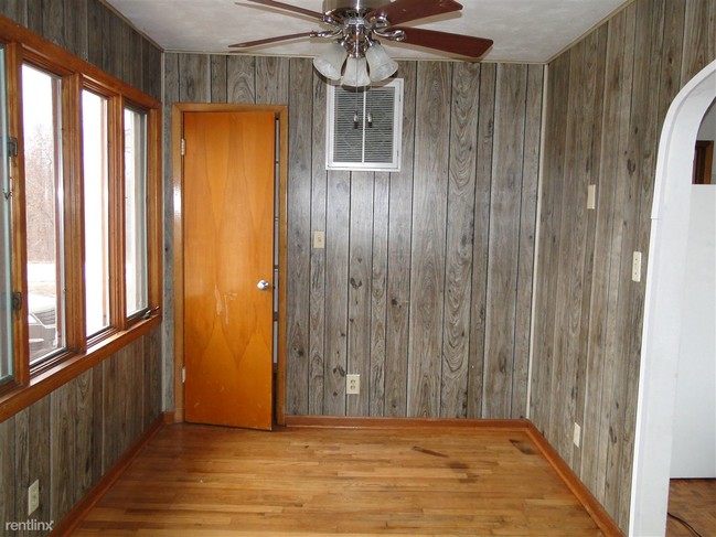
(573) 336-3535 - 3 Bedroom, 2 Bath Ranch Style home with a 2 Car Garage. Newly refinished hardwood flooring throughout. Built in Bookcases. Walk in Closets. Custom Shelving. This is a very nice, older home that is priced right compared to others with this space. Small Pet Friendly. Accepts Section 8. (RLNE1202037) Other Amenities - Unfurnished, Parking- 2 Car Garage, Smoke Free. Appliances - Air Conditioning, Refrigerator, Range, Oven, Washer & Dryer Hookup. Lease lengths - Other- Negotiable. Details regarding this property's Utilities - Resident Pays Electricity, Resident Pays Gas, Resident Pays Water, Resident Pays Trash Pick-up. Pet policies - Small Dogs Allowed, Cats Allowed.
20808 Highway 28 is a house located in Pulaski County and the 65459 ZIP Code. This area is served by the Dixon R-I School District attendance zone.
House Features
- Air Conditioning
20808 Highway 28,
Dixon,
MO
65459
Amenities
- Air Conditioning
Education
| Colleges & Universities | Distance | ||
|---|---|---|---|
| Colleges & Universities | Distance | ||
| Drive: | 29 min | 24.5 mi |
20808 Highway 28 is within 29 minutes or 24.5 miles from Missouri Univ. of Sci. &Tech..
Schools


Public Elementary School
Grades PK-5
Attendance Zone
Public Middle School
Grades 6-8
Attendance Zone
Public High School
Grades 9-12
Attendance Zone
Private Elementary, Middle & High School
Grades PK-12
Nearby
School data provided by
 The GreatSchools Rating helps parents compare schools within a state based on a variety of school quality indicators and provides a helpful picture of how effectively each school serves all of its students. Ratings are on a scale of 1 (below average) to 10 (above average) and can include test scores, college readiness, academic progress, advanced courses, equity, discipline and attendance data. We also advise parents to visit schools, consider other information on school performance and programs, and consider family needs as part of the school selection process.
View GreatSchools Rating Methodology
Data provided by GreatSchools.org © 2026. All rights reserved.
View GreatSchools Rating Methodology
Data provided by GreatSchools.org © 2026. All rights reserved.
Walkability Near 20808 Highway 28 Dixon, MO 65459
Getting Around
 What do Walkability, Transit, Drivability, and Bikeability mean?
Walkability measures the walking distance to day-to-day needs.
Transit measures access to public transportation.
Drivability measures congestion, parking availability, and access to major roads.
Bikeability measures the suitability for cycling.
How It Works
What do Walkability, Transit, Drivability, and Bikeability mean?
Walkability measures the walking distance to day-to-day needs.
Transit measures access to public transportation.
Drivability measures congestion, parking availability, and access to major roads.
Bikeability measures the suitability for cycling.
How It Works
Not Walkable
Walkability
10
/ 100
Exceptionally Drivable
Drivability
100
/ 100
Somewhat Bikeable
Bikeability
20
/ 100
Scores provided by
-
Soundscore™
-
/ 100
Traffic
-Airport
-Businesses
-Scores provided by
HowLoud What is a Sound Score Rating? A Sound Score Rating aggregates noise caused by vehicle traffic, airplane traffic and local sources. How It WorksYou May Also Like
Similar Rentals Nearby


What Are Walk Score®, Transit Score®, and Bike Score® Ratings?
Walk Score® measures the walkability of any address. Transit Score® measures access to public transit. Bike Score® measures the bikeability of any address.
What is a Sound Score Rating?
A Sound Score Rating aggregates noise caused by vehicle traffic, airplane traffic and local sources.

20808 Highway 28
Dixon, MO 65459