
The Equestrian At Pelham Parkway
1680 Pelham Pkwy S,
Bronx, NY 10461
$1,850 - $2,900
Studio - 2 Beds
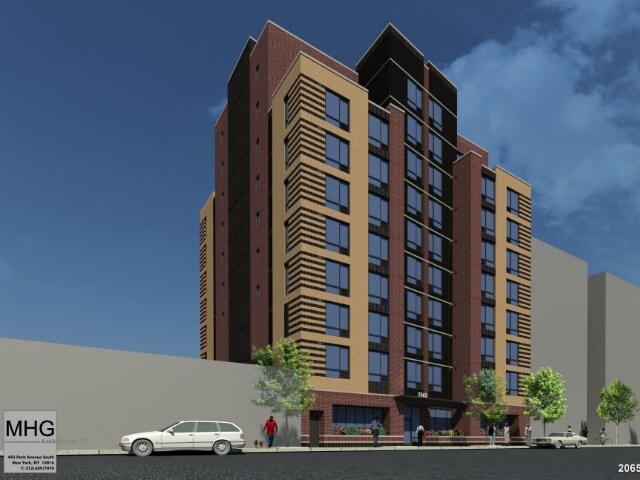
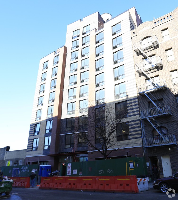
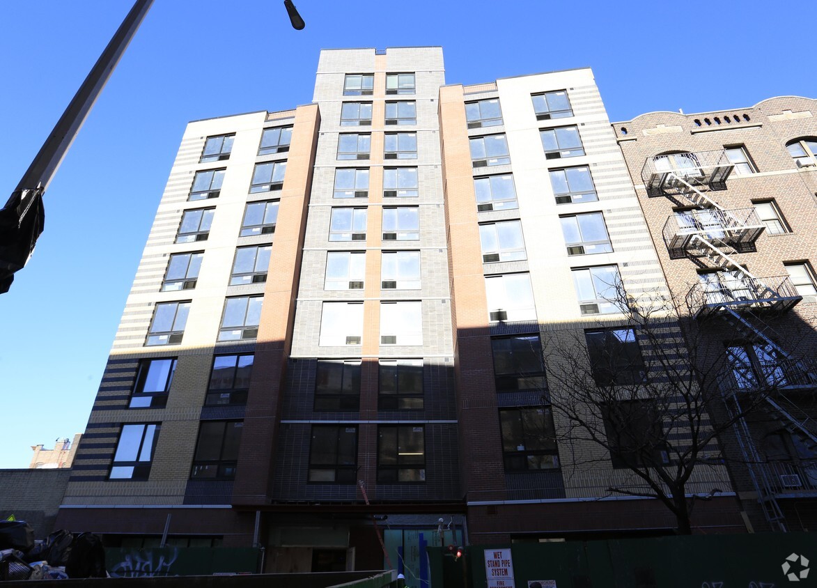
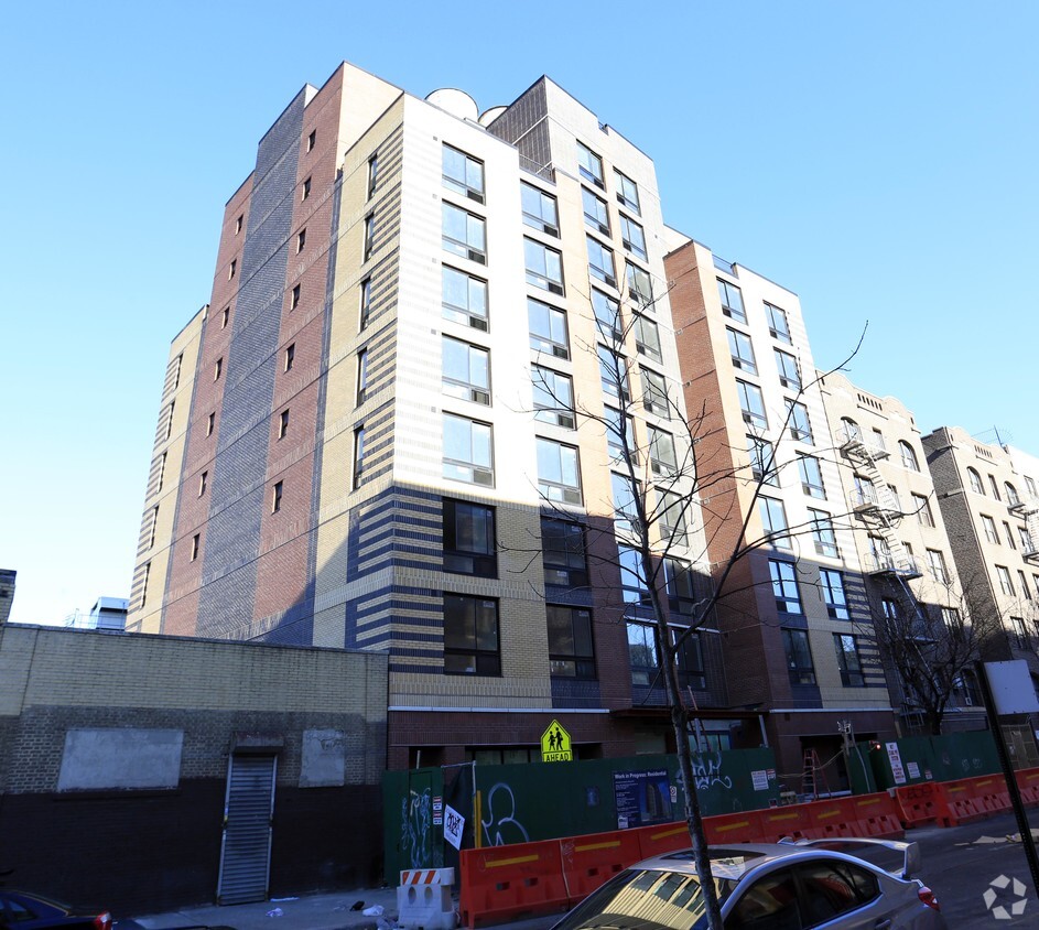
Discover your new place at 2065 Walton Ave in Bronx. Situated in Bronx's 10453 area, living at this community gives you a number of nearby points of interest. Here at this community, the leasing team is excited to help you find the perfect floorplan. Come for a visit to check out the apartment floorplan options. It's all waiting for you at 2065 Walton Ave. Contact or drop by the leasing office to find out the availability today.
2065 Walton Ave is an apartment community located in Bronx County and the 10453 ZIP Code. This area is served by the New York City Geographic District #10 attendance zone.
Air Conditioning
Refrigerator
Heating
Oven
Fordham Heights hosts a thriving and energetic section of the city dominated by five- and six-story apartment buildings, with nearby parks and green spaces creating a welcome reprieve from city life. The neighborhood is about a block from the Bronx Zoo, and Fordham University is located off the northeast corner of the neighborhood, along East Fordham Road.
With Manhattan only eight miles to the southwest, a commute to the city takes just a few minutes. Plenty of city amenities are located right in the heart of downtown; Fordham Road hosts a large marketplace with foot traffic rivaling Manhattan's thoroughfares. Rapid growth fueled by local industry and community spirit makes the area a premier destination filled with retail space, natural beauty, and neighborhood energy.
Learn more about living in Fordham HeightsCompare neighborhood and city base rent averages by bedroom.
| Fordham Heights | Bronx, NY | |
|---|---|---|
| Studio | $1,354 | $1,613 |
| 1 Bedroom | $1,411 | $1,636 |
| 2 Bedrooms | $1,578 | $2,098 |
| 3 Bedrooms | $1,847 | $2,358 |
| Colleges & Universities | Distance | ||
|---|---|---|---|
| Colleges & Universities | Distance | ||
| Walk: | 13 min | 0.7 mi | |
| Walk: | 15 min | 0.8 mi | |
| Drive: | 5 min | 1.9 mi | |
| Drive: | 5 min | 1.9 mi |


Transportation options available in Bronx include Burnside Avenue, located 0.1 mile from 2065 Walton Ave. 2065 Walton Ave is near LaGuardia, located 9.8 miles or 19 minutes away, and John F Kennedy International, located 20.2 miles or 29 minutes away.
| Transit / Subway | Distance | ||
|---|---|---|---|
| Transit / Subway | Distance | ||
|
|
Walk: | 2 min | 0.1 mi |
|
|
Walk: | 6 min | 0.3 mi |
|
|
Walk: | 7 min | 0.4 mi |
|
|
Walk: | 8 min | 0.4 mi |
|
|
Walk: | 10 min | 0.5 mi |
| Commuter Rail | Distance | ||
|---|---|---|---|
| Commuter Rail | Distance | ||
|
|
Walk: | 13 min | 0.7 mi |
|
|
Drive: | 3 min | 1.2 mi |
|
|
Drive: | 4 min | 1.4 mi |
|
|
Drive: | 3 min | 1.5 mi |
|
|
Drive: | 6 min | 2.7 mi |
| Airports | Distance | ||
|---|---|---|---|
| Airports | Distance | ||
|
LaGuardia
|
Drive: | 19 min | 9.8 mi |
|
John F Kennedy International
|
Drive: | 29 min | 20.2 mi |
Scores provided by
Traffic
ActiveAirport
CalmBusinesses
BusyScores provided by
HowLoud What is a Sound Score Rating? A Sound Score Rating aggregates noise caused by vehicle traffic, airplane traffic and local sources. How It WorksTime and distance from 2065 Walton Ave.
| Shopping Centers | Distance | ||
|---|---|---|---|
| Shopping Centers | Distance | ||
| Walk: | 2 min | 0.0 mi | |
| Drive: | 2 min | 1.1 mi | |
| Drive: | 3 min | 1.3 mi |
| Parks and Recreation | Distance | ||
|---|---|---|---|
| Parks and Recreation | Distance | ||
|
St. James Park
|
Drive: | 2 min | 1.2 mi |
|
Roberto Clemente State Park
|
Drive: | 4 min | 1.3 mi |
|
Claremont Park
|
Drive: | 4 min | 1.3 mi |
|
Poe Park
|
Drive: | 3 min | 1.4 mi |
|
Sherman Creek and Swindler Cove
|
Drive: | 11 min | 4.7 mi |
| Hospitals | Distance | ||
|---|---|---|---|
| Hospitals | Distance | ||
| Drive: | 4 min | 1.4 mi | |
| Drive: | 5 min | 2.2 mi | |
| Drive: | 6 min | 2.9 mi |
| Military Bases | Distance | ||
|---|---|---|---|
| Military Bases | Distance | ||
| Drive: | 19 min | 10.6 mi | |
| Drive: | 31 min | 14.5 mi | |
| Drive: | 34 min | 22.7 mi |
What Are Walk Score®, Transit Score®, and Bike Score® Ratings?
Walk Score® measures the walkability of any address. Transit Score® measures access to public transit. Bike Score® measures the bikeability of any address.
What is a Sound Score Rating?
A Sound Score Rating aggregates noise caused by vehicle traffic, airplane traffic and local sources.


