$1,600
/ Month
2050 Lucas Ln
Voorhees Township, NJ 08043
2 Weeks Ago
Favorites
2050 Lucas Ln

Favorites
Check Back Soon for Upcoming Availability
| Beds | Baths | Average SF |
|---|---|---|
| 1 Bedroom 1 Bedroom 1 Br | 1 Bath 1 Bath 1 Ba | 654 SF |
About This Property
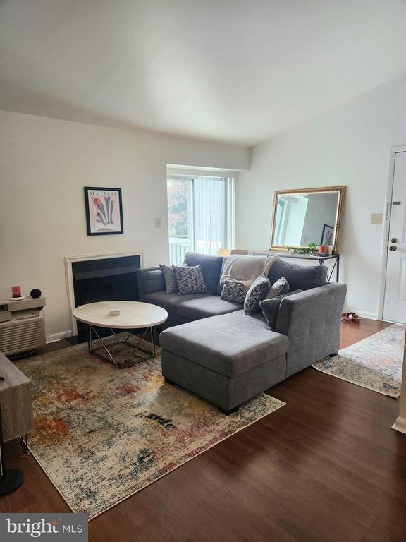
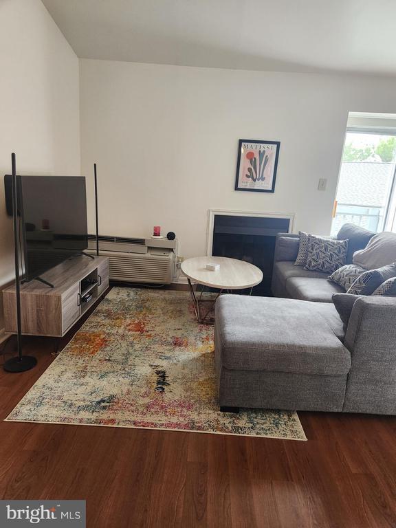
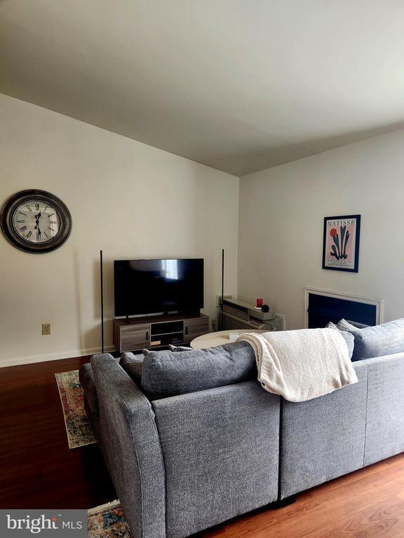
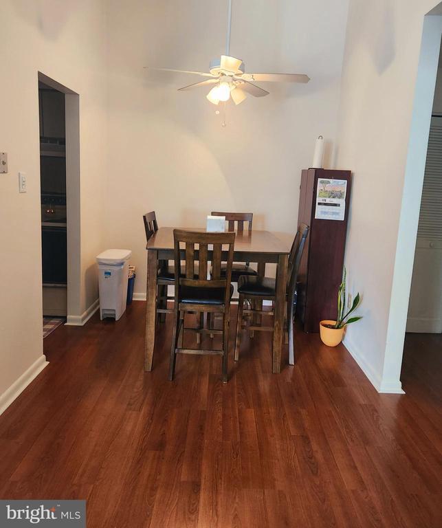
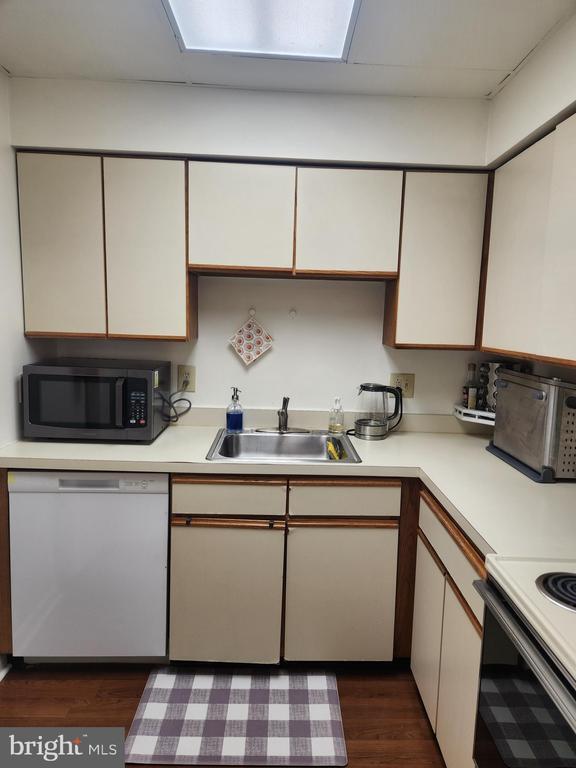
Welcome to 2050 Lucas Ln! This cute well maintained upper floor home offers cathedral ceiling in the living room and dining room, wood burning fireplace, fully equipped kitchen, washer/dryer, a large closet in bedroom. The home is located next to so much, The Voorhees Town center, Restaurants, shopping and it's also conveniently located close to the Lindenwold and Ashland high-speed line, routes 295, White Horse Pike and Atlantic City rail line. Available 7/1/24
2050 Lucas Ln is an apartment community located in Camden County and the 08043 ZIP Code.
Features
- Fireplace
Location
Get Directions
Amenities
- Fireplace
Education
| Colleges & Universities | Distance | ||
|---|---|---|---|
| Colleges & Universities | Distance | ||
| Drive: | 12 min | 5.8 mi | |
| Drive: | 20 min | 11.5 mi | |
| Drive: | 18 min | 12.6 mi | |
| Drive: | 19 min | 12.9 mi |
2050 Lucas Ln is within 12 minutes or 5.8 miles from Camden Co. Coll., Blackwood. It is also near Gloucester County College and Camden Co. Coll., Camden City.
Transportation options available in Voorhees Township include Ashland, located 1.5 miles from 2050 Lucas Ln. 2050 Lucas Ln is near Philadelphia International, located 18.8 miles or 31 minutes away, and Trenton Mercer, located 40.8 miles or 57 minutes away.
| Transit / Subway | Distance | ||
|---|---|---|---|
| Transit / Subway | Distance | ||
|
|
Drive: | 4 min | 1.5 mi |
|
|
Drive: | 4 min | 1.7 mi |
|
|
Drive: | 7 min | 2.5 mi |
|
|
Drive: | 9 min | 5.6 mi |
|
|
Drive: | 11 min | 6.1 mi |
| Commuter Rail | Distance | ||
|---|---|---|---|
| Commuter Rail | Distance | ||
|
|
Drive: | 4 min | 1.6 mi |
|
|
Drive: | 15 min | 7.9 mi |
|
|
Drive: | 13 min | 8.8 mi |
| Drive: | 22 min | 11.6 mi | |
|
|
Drive: | 23 min | 14.9 mi |
| Airports | Distance | ||
|---|---|---|---|
| Airports | Distance | ||
|
Philadelphia International
|
Drive: | 31 min | 18.8 mi |
|
Trenton Mercer
|
Drive: | 57 min | 40.8 mi |
Time and distance from 2050 Lucas Ln.
| Shopping Centers | Distance | ||
|---|---|---|---|
| Shopping Centers | Distance | ||
| Walk: | 7 min | 0.4 mi | |
| Walk: | 13 min | 0.7 mi | |
| Walk: | 14 min | 0.7 mi |
2050 Lucas Ln has 3 shopping centers within 0.7 mile, which is about a 14-minute walk. The miles and minutes will be for the farthest away property.
| Parks and Recreation | Distance | ||
|---|---|---|---|
| Parks and Recreation | Distance | ||
|
Downs Farms Trails
|
Drive: | 4 min | 1.8 mi |
|
Kresson Nature Trails
|
Drive: | 9 min | 4.0 mi |
|
Croft Farm Nature Trail
|
Drive: | 9 min | 4.8 mi |
|
Garden State Discovery Museum
|
Drive: | 12 min | 5.8 mi |
|
Barclay Farmstead Nature Trail
|
Drive: | 13 min | 7.3 mi |
2050 Lucas Ln has 5 parks within 7.3 miles, including Downs Farms Trails, Kresson Nature Trails, and Croft Farm Nature Trail.
| Hospitals | Distance | ||
|---|---|---|---|
| Hospitals | Distance | ||
| Drive: | 3 min | 1.7 mi | |
| Drive: | 12 min | 5.8 mi | |
| Drive: | 14 min | 6.7 mi |
2050 Lucas Ln has 3 hospitals within 6.7 miles, the nearest is Jefferson Stratford Hospital which is 1.7 miles away and a 3 minute drive.
| Military Bases | Distance | ||
|---|---|---|---|
| Military Bases | Distance | ||
| Drive: | 22 min | 13.9 mi |
2050 Lucas Ln is 13.9 miles and a 22 minute drive from Philadelphia Naval Busi Center.
You May Also Like
Similar Rentals Nearby


What Are Walk Score®, Transit Score®, and Bike Score® Ratings?
Walk Score® measures the walkability of any address. Transit Score® measures access to public transit. Bike Score® measures the bikeability of any address.
What is a Sound Score Rating?
A Sound Score Rating aggregates noise caused by vehicle traffic, airplane traffic and local sources

2050 Lucas Ln
Voorhees Township, NJ 08043