
$1,899 / Month
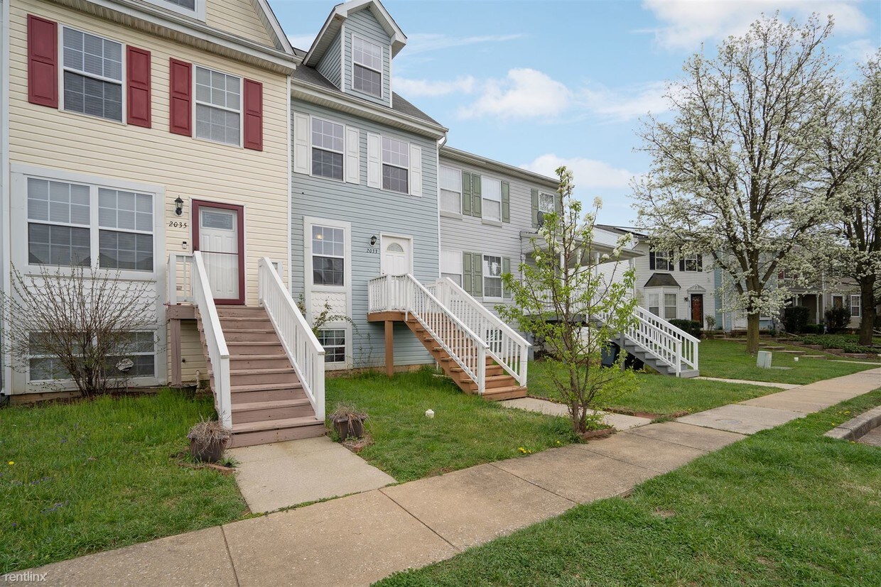
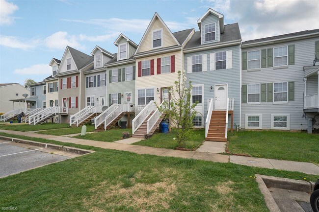
2033 Riding Crop Way
Woodlawn, MD 21244
2 Weeks Ago
Favorites
2033 Riding Crop Way

Favorites
Check Back Soon for Upcoming Availability
| Beds | Baths | Average SF |
|---|---|---|
| 3 Bedrooms 3 Bedrooms 3 Br | 2 Baths 2 Baths 2 Ba | 1,200 SF |
Fees and Policies
The fees below are based on community-supplied data and may exclude additional fees and utilities.
- Dogs Allowed
-
Fees not specified
- Cats Allowed
-
Fees not specified
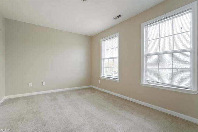
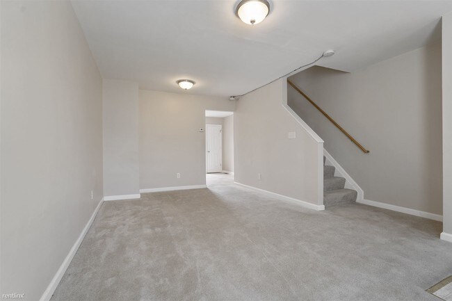
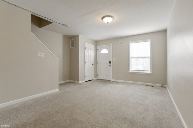
About This Property
(855) 516-7623 - Coming Soon! This home is currently occupied and will be available very soon! Please contact us for additional information, or let us know if you would like to consider some of our other homes available for immediate viewing. Thank you for respecting the privacy of our current resident by not disturbing them. (RLNE6845964) Other Amenities: Other (3rd floor loft w/ full bathroom). Appliances: Refrigerator, Range, Oven. Lease lengths: Other (Minimum 12 months). Pet policies: Small Dogs Allowed (Breed restrictions may apply), Cats Allowed.
2033 Riding Crop Way is a house located in Baltimore County and the 21244 ZIP Code. This area is served by the Baltimore County Public Schools attendance zone.
Unique Features
- Small Dogs Allowed - Breed restrictions may apply, Lease Lengths - Minimum 12 months, Oven, Amenitie
Location
Get Directions
Located about five miles west of Baltimore, Woodlawn is a quiet suburb on the cusp of the vibrant Inner Harbor. Woodlawn offers residents a wide variety of shopping opportunities, with numerous shopping centers and plazas in town as well as Security Square Mall. Woodlawn is also just minutes away from Westview Mall.
Recreational opportunities abound in Woodlawn, with convenient access to Patapsco Valley State Park and the Patapsco River in addition to multiple golf courses like Forest Park Golf Course and the Woodlands Golf Course.
Woodlawn sits at the intersection of Interstates 70 and 695, providing easy access for commuters and travelers alike. Baltimore Washington International Thurgood Marshall Airport is just a short drive away from Woodlawn as well.
Learn more about living in Woodlawn
Amenities
- Small Dogs Allowed - Breed restrictions may apply, Lease Lengths - Minimum 12 months, Oven, Amenitie
Education
| Colleges & Universities | Distance | ||
|---|---|---|---|
| Colleges & Universities | Distance | ||
| Drive: | 17 min | 7.6 mi | |
| Drive: | 22 min | 7.8 mi | |
| Drive: | 19 min | 8.1 mi | |
| Drive: | 23 min | 12.3 mi |
2033 Riding Crop Way is within 17 minutes or 7.6 miles from CCBC Cantonsville. It is also near UMBC and Coppin State University.
Schools


Public Elementary School
Grades PK-5
490 Students
Attendance Zone
Public Middle School
Grades 6-8
626 Students
Attendance Zone
Public High School
Grades 9-12
1,815 Students
Attendance Zone
Private Elementary, Middle & High School
Grades PK-12
83 Students
Nearby
Private Elementary, Middle & High School
Grades K-12
140 Students
Nearby
School data provided by
 The GreatSchools Rating helps parents compare schools within a state based on a variety of school quality indicators and provides a helpful picture of how effectively each school serves all of its students. Ratings are on a scale of 1 (below average) to 10 (above average) and can include test scores, college readiness, academic progress, advanced courses, equity, discipline and attendance data. We also advise parents to visit schools, consider other information on school performance and programs, and consider family needs as part of the school selection process.
View GreatSchools Rating Methodology
Data provided by GreatSchools.org © 2025. All rights reserved.
View GreatSchools Rating Methodology
Data provided by GreatSchools.org © 2025. All rights reserved.
Transportation options available in Woodlawn include Old Court Station (Metro) Sb, located 6.8 miles from 2033 Riding Crop Way. 2033 Riding Crop Way is near Baltimore/Washington International Thurgood Marshall, located 13.5 miles or 25 minutes away, and Ronald Reagan Washington Ntl, located 40.1 miles or 65 minutes away.
| Transit / Subway | Distance | ||
|---|---|---|---|
| Transit / Subway | Distance | ||
| Drive: | 17 min | 6.8 mi | |
| Drive: | 16 min | 6.9 mi | |
| Drive: | 21 min | 7.9 mi | |
| Drive: | 18 min | 8.0 mi | |
| Drive: | 19 min | 8.8 mi |
| Commuter Rail | Distance | ||
|---|---|---|---|
| Commuter Rail | Distance | ||
| Drive: | 17 min | 9.0 mi | |
| Drive: | 17 min | 9.0 mi | |
|
|
Drive: | 17 min | 9.0 mi |
|
|
Drive: | 21 min | 9.2 mi |
| Drive: | 20 min | 10.8 mi |
| Airports | Distance | ||
|---|---|---|---|
| Airports | Distance | ||
|
Baltimore/Washington International Thurgood Marshall
|
Drive: | 25 min | 13.5 mi |
|
Ronald Reagan Washington Ntl
|
Drive: | 65 min | 40.1 mi |
Time and distance from 2033 Riding Crop Way.
| Shopping Centers | Distance | ||
|---|---|---|---|
| Shopping Centers | Distance | ||
| Drive: | 5 min | 1.7 mi | |
| Drive: | 5 min | 1.9 mi | |
| Drive: | 6 min | 2.1 mi |
2033 Riding Crop Way has 3 shopping centers within 2.1 miles, which is about a 6-minute drive. The miles and minutes will be for the farthest away property.
| Parks and Recreation | Distance | ||
|---|---|---|---|
| Parks and Recreation | Distance | ||
|
Carrie Murray Nature Center
|
Drive: | 14 min | 5.2 mi |
|
Gwynns Falls - Leakin Park
|
Drive: | 14 min | 5.3 mi |
|
Benjamin Banneker Historical Park and Museum
|
Drive: | 15 min | 5.7 mi |
|
Gwynns Falls Trail
|
Drive: | 16 min | 6.1 mi |
|
Banneker Planetarium
|
Drive: | 17 min | 7.5 mi |
2033 Riding Crop Way has 5 parks within 7.5 miles, including Carrie Murray Nature Center, Benjamin Banneker Historical Park and Museum, and Gwynns Falls - Leakin Park.
| Hospitals | Distance | ||
|---|---|---|---|
| Hospitals | Distance | ||
| Drive: | 11 min | 4.3 mi | |
| Drive: | 13 min | 5.9 mi | |
| Drive: | 15 min | 6.1 mi |
2033 Riding Crop Way has 3 hospitals within 6.1 miles, the nearest is University of Maryland Rehabilitation & Orthopaedic Institute which is 4.3 miles away and a 11 minute drive.
| Military Bases | Distance | ||
|---|---|---|---|
| Military Bases | Distance | ||
| Drive: | 38 min | 21.9 mi |
2033 Riding Crop Way is 21.9 miles and a 38 minute drive from Fort George Meade.
You May Also Like
Similar Rentals Nearby


What Are Walk Score®, Transit Score®, and Bike Score® Ratings?
Walk Score® measures the walkability of any address. Transit Score® measures access to public transit. Bike Score® measures the bikeability of any address.
What is a Sound Score Rating?
A Sound Score Rating aggregates noise caused by vehicle traffic, airplane traffic and local sources

2033 Riding Crop Way
Woodlawn, MD 21244