
$2,799
/ Month
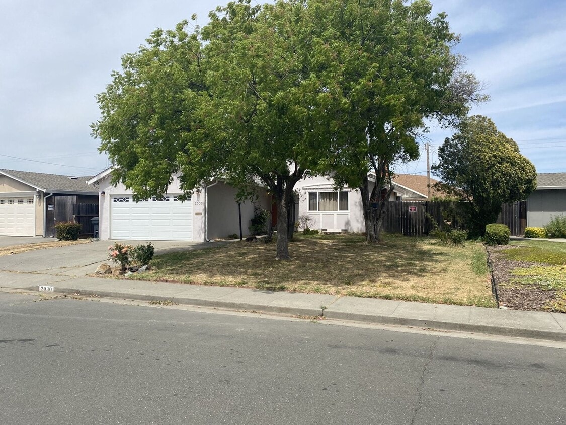
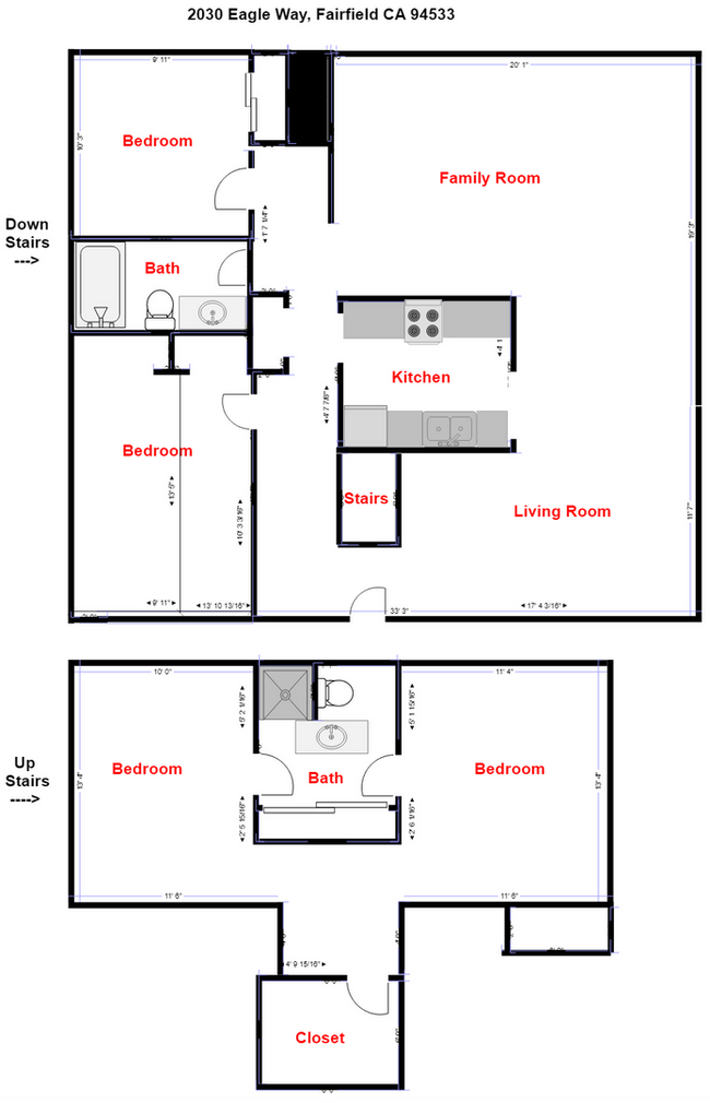
2030 Eagle Way
Fairfield, CA 94533
Favorites
-
Bedrooms
4
-
Bathrooms
2
-
Square Feet
1,584 sq ft
2030 Eagle Way

Favorites
About This Home
$2,799 deposit
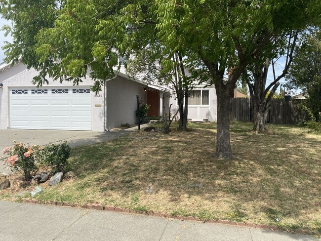
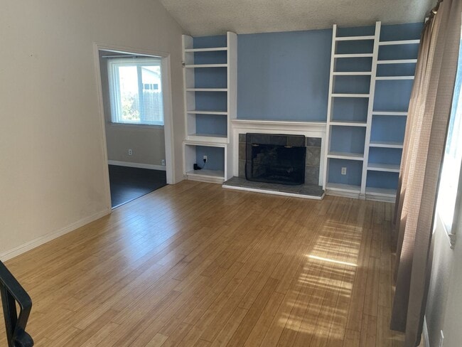
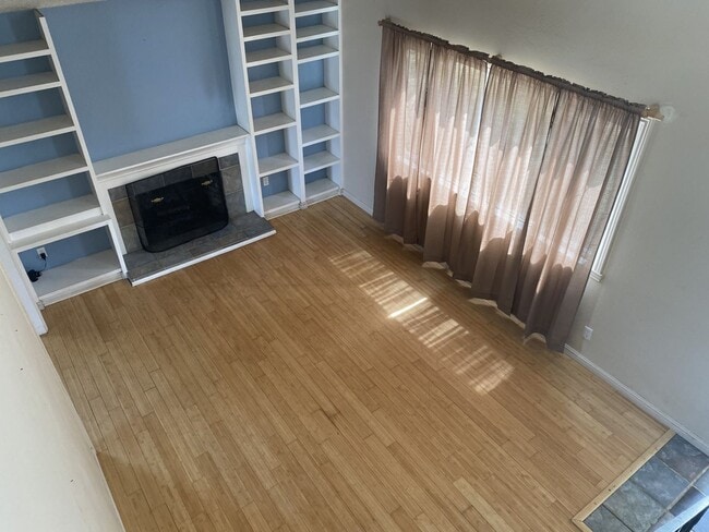
Charming home with a sought-after floor plan! Genuine character expressed throughout every inch of this home. Living room with fireplace, open kitchen, family room/dining room combo. Four privately filled bedrooms, two full bathrooms. Mature trees that provide shade, and a large private rear yard. Summer months will be so much more pleasant with the central air conditioning! Close to schools, parks, shopping, and Travis AFB. Available Now! (Pet Friendly - Case by case basis – Additional pet rent applies – per pet) Our office participates in the Pet Screening service. ALL APPLICANTS MUST COMPLETE A PET SCREENING PROFILE EVEN IF THERE ARE NO PETS IN THE HOME. Please use the link provided here to set up your account: More Information: DRE #01197438
Unique Features
- None
2030 Eagle Way is a house located in Solano County and the 94533 ZIP Code. This area is served by the Fairfield-Suisun Unified School District attendance zone.
* Price shown is base rent. Excludes user-selected optional fees and variable or usage-based fees and required charges due at or prior to move-in or at move-out. Price, availability, fees, and any applicable rent special are subject to change without notice.
* Square footage definitions vary. Displayed square footage is approximate.
House Features
- Dishwasher
Contact
- Listed by Utopia Management Inc. | Utopia Management Inc.
Location
Get Directions
Fairfield sits at the center of Solano County as its county seat, planted squarely along Interstate 80 between Sacramento and San Francisco—making it a practical home base for people who work in either direction. Founded in 1856 by clipper ship captain Robert H. Waterman, who named it after his Connecticut hometown, the city has grown into a place with real economic range. Travis Air Force Base anchors a significant portion of the local economy, while the Jelly Belly Candy Company and Anheuser-Busch brewery add to a workforce that also draws from healthcare, retail, and commercial sectors. Solano Community College serves students throughout the region and adds an educational presence to the community.
Neighborhoods shift noticeably from one part of the city to another. Downtown and the West Texas Street corridor offer walkable blocks with local shops and a more urban rhythm, while Cordelia and Green Valley lean toward hillside settings with open space nearby.
Learn more about living in Fairfield
Amenities
- Dishwasher
- None
Education
| Colleges & Universities | Distance | ||
|---|---|---|---|
| Colleges & Universities | Distance | ||
| Drive: | 16 min | 9.3 mi | |
| Drive: | 26 min | 19.4 mi | |
| Drive: | 31 min | 22.8 mi | |
| Drive: | 53 min | 39.6 mi |
2030 Eagle Way is within 16 minutes or 9.3 miles from Solano Community College. It is also near Napa Valley College and Touro University California.
Schools


Public Elementary, Middle & High School
Grades K-12
368 Students
Nearby
Public Elementary School
Grades K-5
464 Students
Attendance Zone
Public Middle School
Grades 6-8
944 Students
Attendance Zone
Public High School
Grades 9-12
1,605 Students
Attendance Zone
Private Elementary School
Grades PK-2
16 Students
Nearby
Private Elementary, Middle & High School
Grades K-12
Nearby
Private Elementary School
Grades K-5
Nearby
Private Elementary School
Grades K-5
Nearby
School data provided by
 The GreatSchools Rating helps parents compare schools within a state based on a variety of school quality indicators and provides a helpful picture of how effectively each school serves all of its students. Ratings are on a scale of 1 (below average) to 10 (above average) and can include test scores, college readiness, academic progress, advanced courses, equity, discipline and attendance data. We also advise parents to visit schools, consider other information on school performance and programs, and consider family needs as part of the school selection process.
View GreatSchools Rating Methodology
Data provided by GreatSchools.org © 2026. All rights reserved.
View GreatSchools Rating Methodology
Data provided by GreatSchools.org © 2026. All rights reserved.
Getting Around
 What do Walkability, Transit, Drivability, and Bikeability mean?
Walkability measures the walking distance to day-to-day needs.
Transit measures access to public transportation.
Drivability measures congestion, parking availability, and access to major roads.
Bikeability measures the suitability for cycling.
How It Works
What do Walkability, Transit, Drivability, and Bikeability mean?
Walkability measures the walking distance to day-to-day needs.
Transit measures access to public transportation.
Drivability measures congestion, parking availability, and access to major roads.
Bikeability measures the suitability for cycling.
How It Works
Fairly Walkable
Walkability
40
/ 100
Minimal Public Transit
Transit
10
/ 100
Exceptionally Drivable
Drivability
90
/ 100
Fairly Bikeable
Bikeability
50
/ 100
Scores provided by
-
Soundscore™
-
/ 100
Traffic
-Airport
-Businesses
-Scores provided by
HowLoud What is a Sound Score Rating? A Sound Score Rating aggregates noise caused by vehicle traffic, airplane traffic and local sources. How It WorksYou May Also Like
Similar Rentals Nearby


What Are Walk Score®, Transit Score®, and Bike Score® Ratings?
Walk Score® measures the walkability of any address. Transit Score® measures access to public transit. Bike Score® measures the bikeability of any address.
What is a Sound Score Rating?
A Sound Score Rating aggregates noise caused by vehicle traffic, airplane traffic and local sources.

2030 Eagle Way
Fairfield, CA 94533