
1650 Riverwoods Dr
1650 Riverwoods Dr,
Melrose Park, IL 60160
$1,995 - $2,175 Total Monthly Price
2 Beds 12 Month Lease

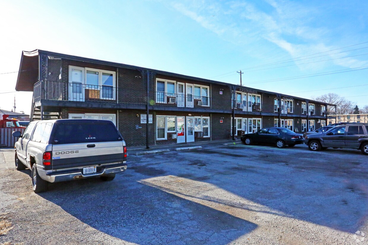
Check out 2027 N Mannheim Rd. Located at 2027 N. Mannheim Rd. in Melrose Park, this community is perfectly situated for work or play. From pricing to features, the leasing staff is excited to help you find your dream apartment. Your new home awaits you at 2027 N Mannheim Rd. Contact us or stop in to schedule a tour.
2027 N Mannheim Rd is an apartment community located in Cook County and the 60164 ZIP Code. This area is served by the Mannheim School District 83 attendance zone.
High Speed Internet Access
Refrigerator
Tub/Shower
Smoke Free
West Cook is a multicultural neighborhood south of O’Hare International Airport. Golfers in the community enjoy its numerous golf greens, including Oak Park Country Club and Edgewood Valley Country Club.
Public transit abounds in West Cook, attracting renters who wish to live outside the cities in which they work. Residents appreciate the shopping opportunities at Fashion Outlets of Chicago and North Riverside Park Mall.
The Brookfield Zoo is a fun-filled attraction in West Cook which houses hundreds of animals. Locals adore the neighborhood’s lush green spaces – many of which are in walking distance of affordable West Cook apartments. Direct access to Interstate 55 and Interstate 294 makes commuting easy, whether you’re traveling into Chicago or a neighboring state.
Learn more about living in West CookCompare neighborhood and city base rent averages by bedroom.
| West Cook | Melrose Park, IL | |
|---|---|---|
| Studio | $902 | $676 |
| 1 Bedroom | $1,120 | $902 |
| 2 Bedrooms | $1,387 | $1,036 |
| 3 Bedrooms | $1,520 | - |
| Colleges & Universities | Distance | ||
|---|---|---|---|
| Colleges & Universities | Distance | ||
| Drive: | 9 min | 3.7 mi | |
| Drive: | 10 min | 4.5 mi | |
| Drive: | 11 min | 5.0 mi | |
| Drive: | 14 min | 5.6 mi |


Transportation options available in Melrose Park include Rosemont Station, located 5.6 miles from 2027 N Mannheim Rd. 2027 N Mannheim Rd is near Chicago O'Hare International, located 6.7 miles or 12 minutes away, and Chicago Midway International, located 14.4 miles or 26 minutes away.
| Transit / Subway | Distance | ||
|---|---|---|---|
| Transit / Subway | Distance | ||
|
|
Drive: | 9 min | 5.6 mi |
|
|
Drive: | 13 min | 5.8 mi |
|
|
Drive: | 13 min | 5.8 mi |
|
|
Drive: | 12 min | 7.2 mi |
|
|
Drive: | 14 min | 7.2 mi |
| Commuter Rail | Distance | ||
|---|---|---|---|
| Commuter Rail | Distance | ||
|
|
Drive: | 5 min | 2.2 mi |
|
|
Drive: | 5 min | 2.4 mi |
|
|
Drive: | 6 min | 2.6 mi |
|
|
Drive: | 6 min | 2.9 mi |
|
|
Drive: | 9 min | 4.0 mi |
| Airports | Distance | ||
|---|---|---|---|
| Airports | Distance | ||
|
Chicago O'Hare International
|
Drive: | 12 min | 6.7 mi |
|
Chicago Midway International
|
Drive: | 26 min | 14.4 mi |
Scores provided by
Traffic
-Airport
-Businesses
-Scores provided by
HowLoud What is a Sound Score Rating? A Sound Score Rating aggregates noise caused by vehicle traffic, airplane traffic and local sources. How It WorksTime and distance from 2027 N Mannheim Rd.
| Shopping Centers | Distance | ||
|---|---|---|---|
| Shopping Centers | Distance | ||
| Walk: | 5 min | 0.3 mi | |
| Walk: | 9 min | 0.5 mi | |
| Walk: | 19 min | 1.0 mi |
| Parks and Recreation | Distance | ||
|---|---|---|---|
| Parks and Recreation | Distance | ||
|
Cernan Earth and Space Center
|
Drive: | 8 min | 4.0 mi |
|
Lizzadro Museum of Lapidary Art
|
Drive: | 10 min | 4.6 mi |
|
Wilder Park Conservatory
|
Drive: | 10 min | 4.6 mi |
|
Tyrell Trailside Museum / Thatcher Woods
|
Drive: | 10 min | 4.7 mi |
|
Schiller Woods
|
Drive: | 11 min | 5.0 mi |
| Hospitals | Distance | ||
|---|---|---|---|
| Hospitals | Distance | ||
| Drive: | 6 min | 3.2 mi | |
| Drive: | 7 min | 3.2 mi | |
| Drive: | 10 min | 4.8 mi |
| Military Bases | Distance | ||
|---|---|---|---|
| Military Bases | Distance | ||
| Drive: | 24 min | 16.0 mi |
What Are Walk Score®, Transit Score®, and Bike Score® Ratings?
Walk Score® measures the walkability of any address. Transit Score® measures access to public transit. Bike Score® measures the bikeability of any address.
What is a Sound Score Rating?
A Sound Score Rating aggregates noise caused by vehicle traffic, airplane traffic and local sources.
2027 N Mannheim Rd
Melrose Park, IL 60164


