
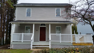
$1,650 / Month
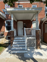
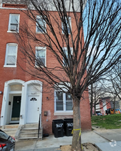
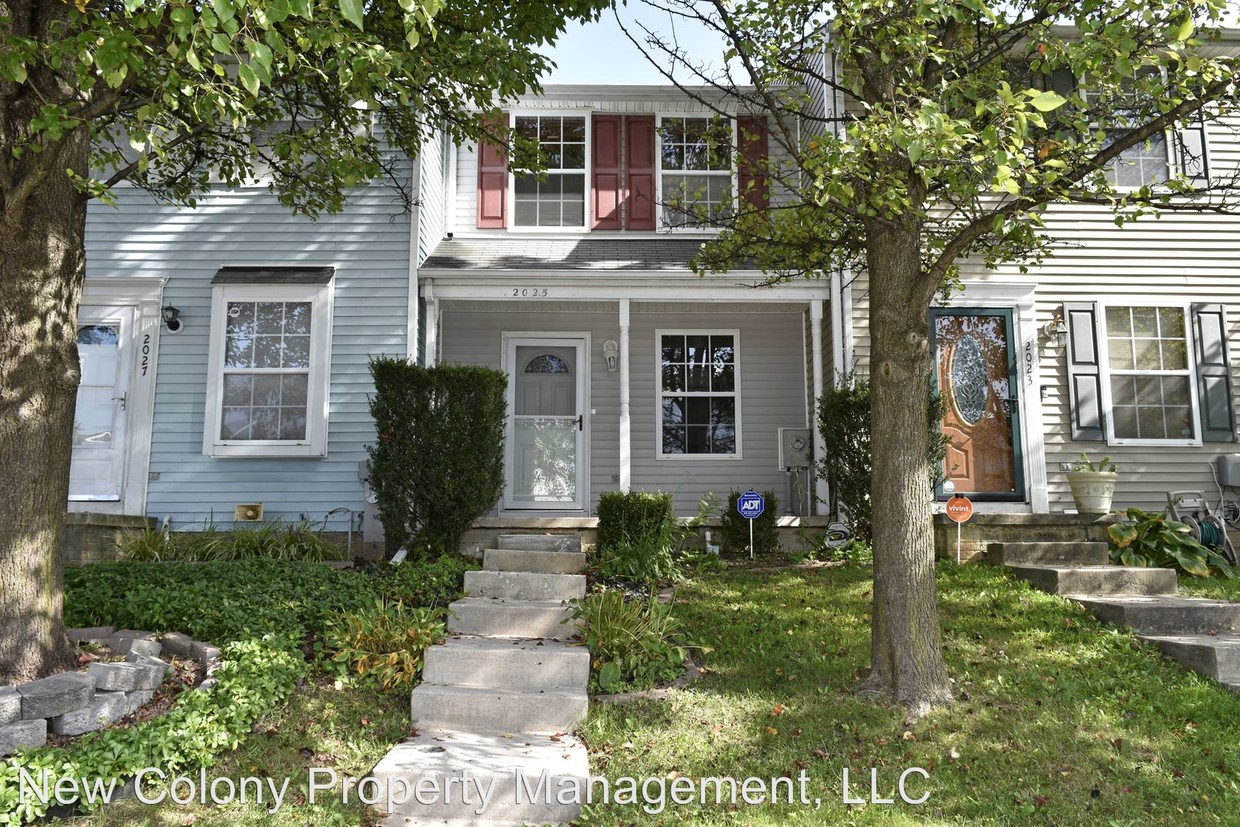
2025 Riding Crop Way
Windsor Mill, MD 21244
2 Weeks Ago
Favorites
2025 Riding Crop Way

Favorites
Check Back Soon for Upcoming Availability
| Beds | Baths | Average SF |
|---|---|---|
| 2 Bedrooms 2 Bedrooms 2 Br | 2 Baths 2 Baths 2 Ba | 870 SF |
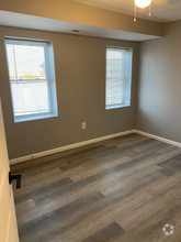
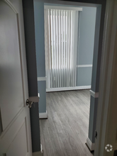
About This Property
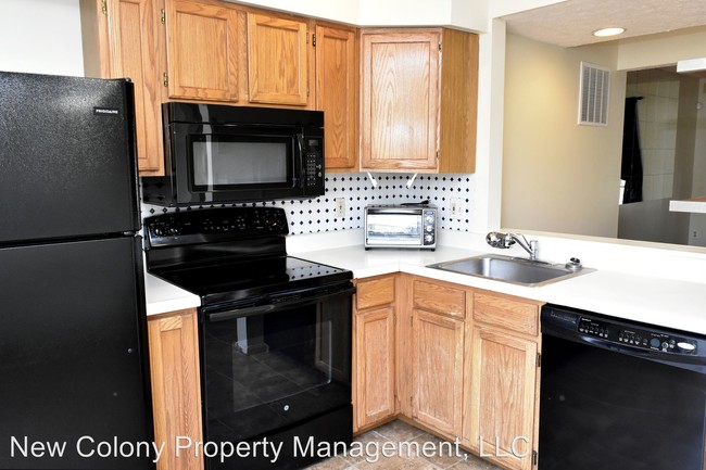
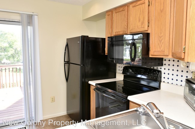
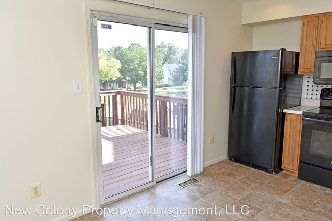
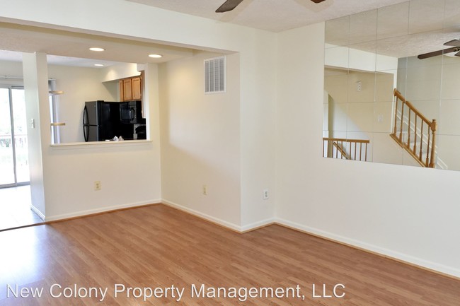
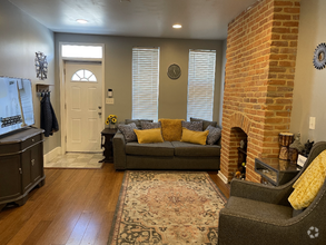
(301) 703-8608 - Windsor Mill, MD - 2 bedroom 2 full bath interior townhouse available now! New carpet, fresh paint, walk-out basement to fenced backyard! (RLNE3581765) Pet policies - Small Dogs Allowed.
2025 Riding Crop Way is a house located in Baltimore County and the 21244 ZIP Code. This area is served by the Baltimore County Public Schools attendance zone.
Location
Get Directions
The large community of Windsor Mill sits on the northeast side of Downtown Baltimore, just west of the Baltimore Beltway (I-695). Windsor Mill is considered part of Milford Mill, another large CDP on the north end of Windsor Mill. Other nearby communities include Rockdale and Woodlawn. This popular area is ideal for commuters -- Downtown Baltimore is just eight miles southeast. Those who prefer car-free commuting can take the MARC train directly into the city.
Windsor Mill provides a charming neighborhood complete with large commercial districts, great shops and restaurants, and golfing fun at the Woodlands Golf Course. Other nearby locations include Villa Nova Park and Patapsco Valley Park, located along the Patapsco River. The University of Maryland-Baltimore County is just seven miles southeast.
Learn more about living in Windsor Mill
Education
| Colleges & Universities | Distance | ||
|---|---|---|---|
| Colleges & Universities | Distance | ||
| Drive: | 17 min | 7.6 mi | |
| Drive: | 22 min | 7.8 mi | |
| Drive: | 19 min | 8.1 mi | |
| Drive: | 23 min | 12.4 mi |
2025 Riding Crop Way is within 17 minutes or 7.6 miles from CCBC Cantonsville. It is also near UMBC and Coppin State University.
Schools


Public Elementary School
Grades PK-5
490 Students
Attendance Zone
Public Middle School
Grades 6-8
626 Students
Attendance Zone
Public High School
Grades 9-12
1,815 Students
Attendance Zone
Private Elementary, Middle & High School
Grades PK-12
83 Students
Nearby
Private Elementary, Middle & High School
Grades K-12
140 Students
Nearby
School data provided by
 The GreatSchools Rating helps parents compare schools within a state based on a variety of school quality indicators and provides a helpful picture of how effectively each school serves all of its students. Ratings are on a scale of 1 (below average) to 10 (above average) and can include test scores, college readiness, academic progress, advanced courses, equity, discipline and attendance data. We also advise parents to visit schools, consider other information on school performance and programs, and consider family needs as part of the school selection process.
View GreatSchools Rating Methodology
View GreatSchools Rating Methodology
Transportation options available in Windsor Mill include Old Court, located 6.8 miles from 2025 Riding Crop Way. 2025 Riding Crop Way is near Baltimore/Washington International Thurgood Marshall, located 13.6 miles or 25 minutes away, and Ronald Reagan Washington Ntl, located 40.1 miles or 65 minutes away.
| Transit / Subway | Distance | ||
|---|---|---|---|
| Transit / Subway | Distance | ||
|
Old Court
|
Drive: | 17 min | 6.8 mi |
| Drive: | 19 min | 7.7 mi | |
| Drive: | 21 min | 7.9 mi | |
| Drive: | 18 min | 8.1 mi | |
| Drive: | 20 min | 8.9 mi |
| Commuter Rail | Distance | ||
|---|---|---|---|
| Commuter Rail | Distance | ||
|
|
Drive: | 17 min | 9.1 mi |
|
|
Drive: | 21 min | 9.2 mi |
|
|
Drive: | 20 min | 10.8 mi |
|
|
Drive: | 28 min | 11.9 mi |
|
|
Drive: | 24 min | 13.2 mi |
| Airports | Distance | ||
|---|---|---|---|
| Airports | Distance | ||
|
Baltimore/Washington International Thurgood Marshall
|
Drive: | 25 min | 13.6 mi |
|
Ronald Reagan Washington Ntl
|
Drive: | 65 min | 40.1 mi |
Time and distance from 2025 Riding Crop Way.
| Shopping Centers | Distance | ||
|---|---|---|---|
| Shopping Centers | Distance | ||
| Drive: | 5 min | 1.7 mi | |
| Drive: | 5 min | 1.9 mi | |
| Drive: | 6 min | 2.1 mi |
2025 Riding Crop Way has 3 shopping centers within 2.1 miles, which is about a 6-minute drive. The miles and minutes will be for the farthest away property.
| Parks and Recreation | Distance | ||
|---|---|---|---|
| Parks and Recreation | Distance | ||
|
Carrie Murray Nature Center
|
Drive: | 14 min | 5.3 mi |
|
Gwynns Falls - Leakin Park
|
Drive: | 14 min | 5.3 mi |
|
Benjamin Banneker Historical Park and Museum
|
Drive: | 15 min | 5.7 mi |
|
Gwynns Falls Trail
|
Drive: | 16 min | 6.1 mi |
|
Banneker Planetarium
|
Drive: | 17 min | 7.6 mi |
2025 Riding Crop Way has 5 parks within 7.6 miles, including Carrie Murray Nature Center, Benjamin Banneker Historical Park and Museum, and Gwynns Falls - Leakin Park.
| Hospitals | Distance | ||
|---|---|---|---|
| Hospitals | Distance | ||
| Drive: | 11 min | 4.3 mi | |
| Drive: | 13 min | 5.9 mi | |
| Drive: | 15 min | 6.1 mi |
2025 Riding Crop Way has 3 hospitals within 6.1 miles, the nearest is University of Maryland Rehabilitation & Orthopaedic Institute which is 4.3 miles away and a 11 minute drive.
| Military Bases | Distance | ||
|---|---|---|---|
| Military Bases | Distance | ||
| Drive: | 38 min | 21.9 mi |
2025 Riding Crop Way is 21.9 miles and a 38 minute drive from Fort George Meade.
You May Also Like
Similar Rentals Nearby
What Are Walk Score®, Transit Score®, and Bike Score® Ratings?
Walk Score® measures the walkability of any address. Transit Score® measures access to public transit. Bike Score® measures the bikeability of any address.
What is a Sound Score Rating?
A Sound Score Rating aggregates noise caused by vehicle traffic, airplane traffic and local sources
2025 Riding Crop Way
Windsor Mill, MD 21244