
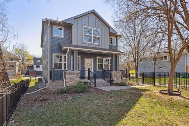

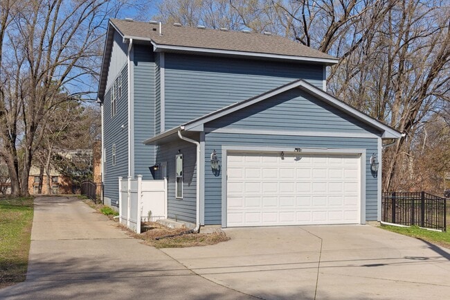
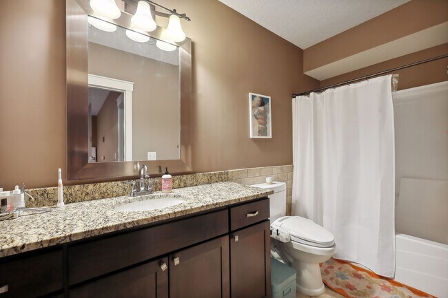
2019 Louisiana Ave S
Minneapolis, MN 55426

Fees and Policies
Details
Property Information
-
Built in 2012
Contact
- Phone Number
- Contact
Located about six miles west of Downtown Minneapolis, Eliot is a suburban neighborhood surrounded by plenty of amenities. Along with several neighborhood parks with ponds, Eliot residents have access to multiple golf courses and natural areas nearby. Spend a day on the green at the Minneapolis Golf Club or explore Westwood Hills Nature Center, a 160-acre park. During the summers, residents cool off at one of the many waterfront parks and lakes like Cedar Lake Point Beach, which has several beaches, lakes, and trails. This convenient locale is located just two miles west of the Shops at West End, a high-end alfresco mall with vibrant restaurants and bars. Along with being a few minutes from downtown, Eliot is only nine miles from the University of Minnesota. Rentals in Eliot primarily include mid-range to upscale apartments and condos, but there are some houses present as well.
Learn more about living in Eliot| Colleges & Universities | Distance | ||
|---|---|---|---|
| Colleges & Universities | Distance | ||
| Drive: | 8 min | 5.0 mi | |
| Drive: | 9 min | 5.5 mi | |
| Drive: | 11 min | 6.3 mi | |
| Drive: | 12 min | 8.3 mi |
Transportation options available in Minneapolis include Target Field Station, located 5.7 miles from 2019 Louisiana Ave S. 2019 Louisiana Ave S is near Minneapolis-St Paul International/Wold-Chamberlain, located 16.3 miles or 26 minutes away.
| Transit / Subway | Distance | ||
|---|---|---|---|
| Transit / Subway | Distance | ||
|
|
Drive: | 9 min | 5.7 mi |
|
|
Drive: | 9 min | 5.8 mi |
| Drive: | 9 min | 5.9 mi | |
|
|
Drive: | 10 min | 6.0 mi |
|
|
Drive: | 10 min | 6.3 mi |
| Commuter Rail | Distance | ||
|---|---|---|---|
| Commuter Rail | Distance | ||
|
|
Drive: | 10 min | 5.9 mi |
|
|
Drive: | 18 min | 11.6 mi |
|
|
Drive: | 23 min | 16.1 mi |
|
|
Drive: | 29 min | 19.1 mi |
|
|
Drive: | 32 min | 20.8 mi |
| Airports | Distance | ||
|---|---|---|---|
| Airports | Distance | ||
|
Minneapolis-St Paul International/Wold-Chamberlain
|
Drive: | 26 min | 16.3 mi |
Scores provided by
Traffic
-Airport
-Businesses
-Scores provided by
HowLoud What is a Sound Score Rating? A Sound Score Rating aggregates noise caused by vehicle traffic, airplane traffic and local sources. How It WorksTime and distance from 2019 Louisiana Ave S.
| Shopping Centers | Distance | ||
|---|---|---|---|
| Shopping Centers | Distance | ||
| Walk: | 6 min | 0.3 mi | |
| Walk: | 6 min | 0.3 mi | |
| Drive: | 3 min | 1.5 mi |
| Parks and Recreation | Distance | ||
|---|---|---|---|
| Parks and Recreation | Distance | ||
|
Westwood Hills Nature Center
|
Drive: | 4 min | 1.5 mi |
|
Quaking Bog
|
Drive: | 8 min | 3.8 mi |
|
Cedar Lake Park
|
Drive: | 9 min | 3.9 mi |
|
Eloise Butler Wildflower Garden and Bird Sanctuary
|
Drive: | 10 min | 4.1 mi |
|
Brownie Lake
|
Drive: | 8 min | 4.3 mi |
| Hospitals | Distance | ||
|---|---|---|---|
| Hospitals | Distance | ||
| Drive: | 6 min | 2.9 mi | |
| Drive: | 11 min | 6.6 mi | |
| Drive: | 13 min | 6.8 mi |
| Military Bases | Distance | ||
|---|---|---|---|
| Military Bases | Distance | ||
| Drive: | 22 min | 13.2 mi |
2019 Louisiana Ave S Photos
What Are Walk Score®, Transit Score®, and Bike Score® Ratings?
Walk Score® measures the walkability of any address. Transit Score® measures access to public transit. Bike Score® measures the bikeability of any address.
What is a Sound Score Rating?
A Sound Score Rating aggregates noise caused by vehicle traffic, airplane traffic and local sources.

2019 Louisiana Ave S
Minneapolis, MN 55426