$5,500
/ Month
2017 Rancho Verde Cir W
Danville, CA 94526
Favorites
925-899-6993
-
Bedrooms
2
-
Bathrooms
2
-
Square Feet
1,436 sq ft
-
Available
Available May 14
Highlights
- Golf Course Community
- Fitness Center
- Clubhouse
- Contemporary Architecture
- Wood Flooring
- Solid Surface Countertops
2017 Rancho Verde Cir W

Favorites
About This Home
Available May 14
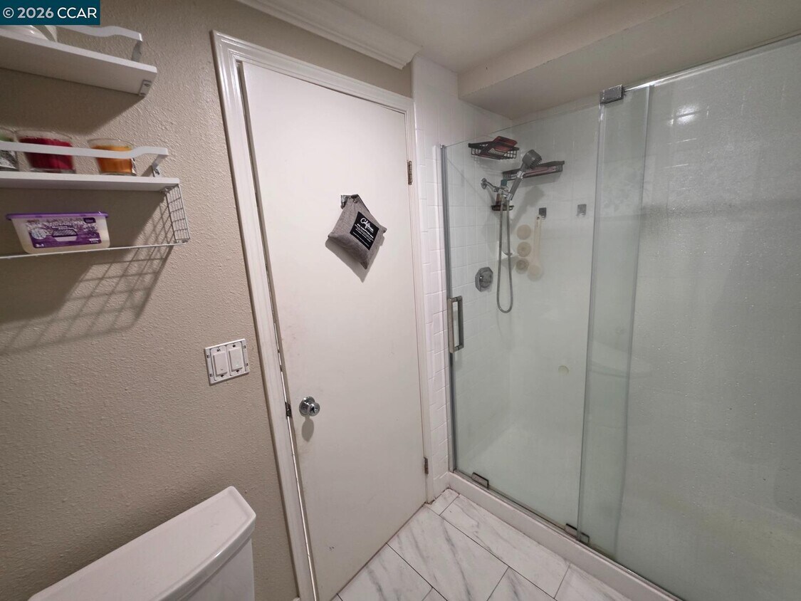
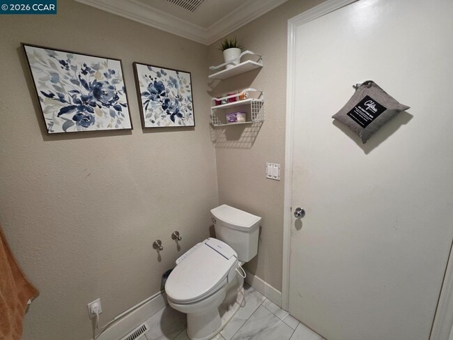
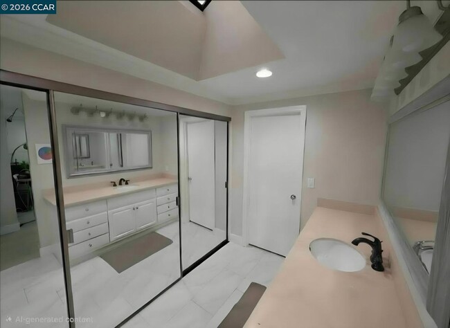
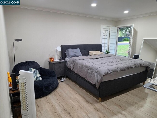
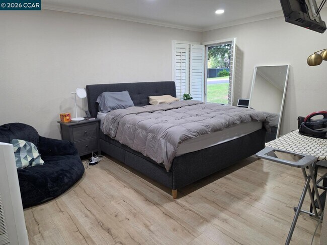
LOCATION • PRIVACY • UPGRADES Beautifully updated end-unit townhome on a premium corner lot bordering a lush greenbelt—no neighbor on one side and just steps from the main entry gate,community amenities (including six pools),and Crow Canyon Country Club. This rare end unit offers exceptional privacy with only one shared wall and serene greenbelt surroundings. The living room features a vaulted ceiling,gas fireplace,abundant natural light,and peaceful golf-course views,opening to a private patio/deck with low-maintenance landscaping. The dining area enjoys bright atrium views. The remodeled kitchen includes Corian countertops,custom cabinetry,generous storage,and a newer dishwasher and microwave,with direct access to the patio for easy indoor-outdoor living. The expanded primary suite boasts a vaulted ceiling and upgraded bath. A separate enclosed office/bonus room—accessed from the hallway,not through a bedroom—includes its own door,window,and skylight,making it ideal for WFH,study,nursery,hobbies,fitness,or a quiet retreat. Additional upgrades include fresh paint,new flooring,LED lighting,new baseboards,solar,central A/C,heat/privacy-tinted windows,and an attached 2-car garage. Conveniently located near Danville’s shops,dining,parks,top-rated schools,and easy freeway access. Tennis and pickleball courts sit directly in front of the driveway,with the main gate just moments away.
2017 Rancho Verde Cir W is a townhome located in Contra Costa County and the 94526 ZIP Code. This area is served by the San Ramon Valley Unified School District attendance zone.
* Price shown is base rent. Excludes user-selected optional fees and variable or usage-based fees and required charges due at or prior to move-in or at move-out. Price, availability, fees, and any applicable rent special are subject to change without notice.
* Square footage definitions vary. Displayed square footage is approximate.
Home Details
Home Type
Townhome
Year Built
Built in 1985
Bedrooms and Bathrooms
2 Full Bathrooms
2 Bedrooms
Eco-Friendly Details
Solar owned by a third party
Flooring
Wood
Concrete
Home Design
Contemporary Architecture
Wood Siding
Composition Shingle Roof
Interior Spaces
Living Room with Fireplace
Window Screens
Gas Fireplace
1-Story Property
Kitchen
Solid Surface Countertops
Breakfast Area or Nook
Electric Cooktop
Breakfast Bar
Microwave
Dishwasher
Laundry
Laundry in Garage
220 Volts In Laundry
Washer and Dryer Hookup
Listing and Financial Details
Assessor Parcel Number 2186910028
Lot Details
3,509 Sq Ft Lot
Parking
2 Car Attached Garage
Garage Door Opener
Utilities
Forced Air Heating and Cooling System
Community Details
Amenities
Clubhouse
Overview
Greenbelt
$458 Monthly HOA Fees
885 Units
Crow Canyon Estates Association, Phone Number (925) 866-8900
Crow Canyon Subdivision
Recreation
Golf Course Community
Fitness Center
Community Pool
Contact
- Listed by Anton Khella | Alliance Bay Realty
- Phone Number
- Contact
-
Source
 Contra Costa Association of REALTORS®
Copyright © 2026 Bay East, CCAR, bridgeMLS. Based on information from Bay East and Contra Costa Association of REALTORS® and bridgeMLS. All data, including all measurements and calculations of area, is obtained from various sources and has not been, and will not be, verified by broker or MLS. All information should be independently reviewed and verified for accuracy. If a floor plan is included, the floor plan is for illustrative purposes only, and the actual dimensions and layout of the home may differ from the floor plan. Buyer is urged to make a detailed inspection of the property, and if any aspect of a floor plan is critical to the buyer's decision to purchase, buyer must conduct their own measurements and inspection. Properties may or may not be listed by the office/agent presenting the information.
Location
Get Directions
Danville is an upscale suburban community located just south of Walnut Creek and about twenty miles east of Oakland. Residents enjoy an ideal location, surrounded by scenic rolling hills and lush greenery while still being within minutes of the Bay Area’s biggest cities. The thriving Downtown district along Hartz Boulevard is packed with terrific restaurants, specialty shops, and bars, as well as unique attractions like the Village Theatre and Art Gallery and the Danville Farmers’ Market. The surrounding landscape offers terrific opportunities to make the most of California’s natural beauty, with Las Trampas Regional Wilderness and the Diablo Foothills just outside of town providing great venues for hiking and camping.
Learn more about living in Danville
Education
| Colleges & Universities | Distance | ||
|---|---|---|---|
| Colleges & Universities | Distance | ||
| Drive: | 12 min | 5.9 mi | |
| Drive: | 28 min | 14.1 mi | |
| Drive: | 24 min | 15.4 mi | |
| Drive: | 29 min | 16.7 mi |
2017 Rancho Verde Cir W is within 12 minutes or 5.9 miles from Diablo Valley Coll, San Ramon. It is also near Saint Marys Coll. of Calif. and Cal State East Bay.
Schools


Public Elementary School
Grades K-5
732 Students
Attendance Zone
Public Elementary School
Grades PK-5
231 Students
Nearby
Public Middle School
Grades 6-8
853 Students
Attendance Zone
Public High School
Grades 9-12
2,036 Students
Attendance Zone
Private Elementary School
Grades PK-5
40 Students
Nearby
Private Elementary & Middle School
Grades PK-8
Nearby
Private Middle & High School
Grades 6-12
536 Students
Nearby
School data provided by
 The GreatSchools Rating helps parents compare schools within a state based on a variety of school quality indicators and provides a helpful picture of how effectively each school serves all of its students. Ratings are on a scale of 1 (below average) to 10 (above average) and can include test scores, college readiness, academic progress, advanced courses, equity, discipline and attendance data. We also advise parents to visit schools, consider other information on school performance and programs, and consider family needs as part of the school selection process.
View GreatSchools Rating Methodology
Data provided by GreatSchools.org © 2026. All rights reserved.
View GreatSchools Rating Methodology
Data provided by GreatSchools.org © 2026. All rights reserved.
Transportation options available in Danville include West Dublin/Pleasanton Station, located 7.6 miles from 2017 Rancho Verde Cir W. 2017 Rancho Verde Cir W is near Metro Oakland International, located 21.1 miles or 34 minutes away, and San Francisco International, located 35.0 miles or 53 minutes away.
| Transit / Subway | Distance | ||
|---|---|---|---|
| Transit / Subway | Distance | ||
|
|
Drive: | 11 min | 7.6 mi |
|
|
Drive: | 13 min | 8.6 mi |
|
|
Drive: | 20 min | 11.2 mi |
| Commuter Rail | Distance | ||
|---|---|---|---|
| Commuter Rail | Distance | ||
| Drive: | 17 min | 12.0 mi | |
|
|
Drive: | 25 min | 12.9 mi |
| Drive: | 25 min | 12.9 mi | |
| Drive: | 25 min | 17.0 mi | |
| Drive: | 28 min | 19.7 mi |
| Airports | Distance | ||
|---|---|---|---|
| Airports | Distance | ||
|
Metro Oakland International
|
Drive: | 34 min | 21.1 mi |
|
San Francisco International
|
Drive: | 53 min | 35.0 mi |
Getting Around
 What do Walkability, Transit, Drivability, and Bikeability mean?
Walkability measures the walking distance to day-to-day needs.
Transit measures access to public transportation.
Drivability measures congestion, parking availability, and access to major roads.
Bikeability measures the suitability for cycling.
How It Works
What do Walkability, Transit, Drivability, and Bikeability mean?
Walkability measures the walking distance to day-to-day needs.
Transit measures access to public transportation.
Drivability measures congestion, parking availability, and access to major roads.
Bikeability measures the suitability for cycling.
How It Works
Fairly Walkable
Walkability
50
/ 100
Minimal Public Transit
Transit
10
/ 100
Exceptionally Drivable
Drivability
90
/ 100
Fairly Bikeable
Bikeability
40
/ 100
Scores provided by
-
Soundscore™
-
/ 100
Traffic
-Airport
-Businesses
-Scores provided by
HowLoud What is a Sound Score Rating? A Sound Score Rating aggregates noise caused by vehicle traffic, airplane traffic and local sources. How It WorksTime and distance from 2017 Rancho Verde Cir W.
| Shopping Centers | Distance | ||
|---|---|---|---|
| Shopping Centers | Distance | ||
| Walk: | 12 min | 0.7 mi | |
| Drive: | 3 min | 1.1 mi | |
| Drive: | 4 min | 1.3 mi |
2017 Rancho Verde Cir W has 3 shopping centers within 1.3 miles, which is about a 4-minute drive. The miles and minutes will be for the farthest away property.
| Parks and Recreation | Distance | ||
|---|---|---|---|
| Parks and Recreation | Distance | ||
|
Bishop Ranch Regional Preserve
|
Drive: | 8 min | 3.8 mi |
|
Little Hills Picnic Ranch (By Reservation)
|
Drive: | 20 min | 6.3 mi |
|
Las Trampas Regional Wilderness
|
Drive: | 21 min | 6.8 mi |
|
Eugene O'Neill National Historic Site
|
Drive: | 15 min | 6.9 mi |
|
Dublin Hills Regional Parks
|
Drive: | 17 min | 7.0 mi |
2017 Rancho Verde Cir W has 5 parks within 7.0 miles, including Bishop Ranch Regional Preserve, Eugene O'Neill National Historic Site, and Little Hills Picnic Ranch (By Reservation).
| Hospitals | Distance | ||
|---|---|---|---|
| Hospitals | Distance | ||
| Walk: | 16 min | 0.9 mi | |
| Drive: | 15 min | 10.5 mi | |
| Drive: | 16 min | 10.9 mi |
2017 Rancho Verde Cir W has 3 hospitals within 10.9 miles, the nearest is San Ramon Regional Medical Center which is 0.9 mile away and a 16 minute walk.
| Military Bases | Distance | ||
|---|---|---|---|
| Military Bases | Distance | ||
| Drive: | 42 min | 23.2 mi | |
| Drive: | 43 min | 29.1 mi | |
| Drive: | 44 min | 30.1 mi |
2017 Rancho Verde Cir W has 3 military bases within 30.1 miles, the nearest is US Naval Station Port Chicago which is 23.2 miles away and a 42 minute drive.
You May Also Like
Similar Rentals Nearby


What Are Walk Score®, Transit Score®, and Bike Score® Ratings?
Walk Score® measures the walkability of any address. Transit Score® measures access to public transit. Bike Score® measures the bikeability of any address.
What is a Sound Score Rating?
A Sound Score Rating aggregates noise caused by vehicle traffic, airplane traffic and local sources.

2017 Rancho Verde Cir W
Danville, CA 94526