$2,000
/ Month
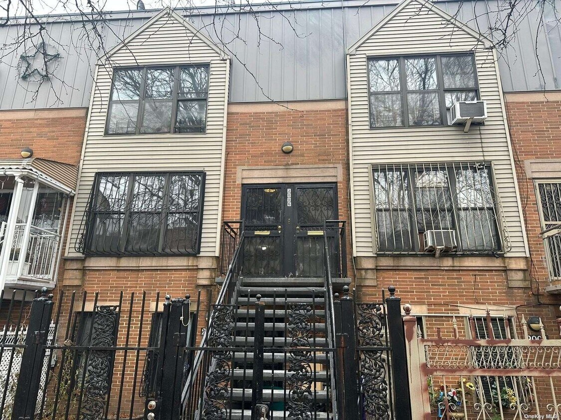
2006 Mapes Ave
The Bronx, NY 10460
Favorites
2006 Mapes Ave

Favorites
Check Back Soon for Upcoming Availability
| Beds | Baths | Average SF |
|---|---|---|
| Studio Studio 0 Br | 1 Bath 1 Bath 1 Ba | 500 SF |
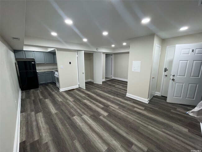
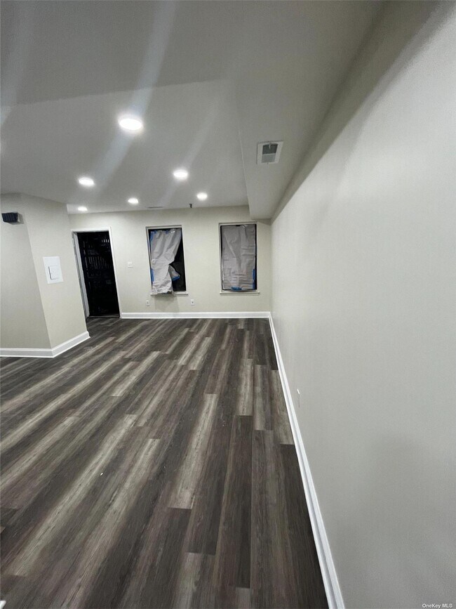
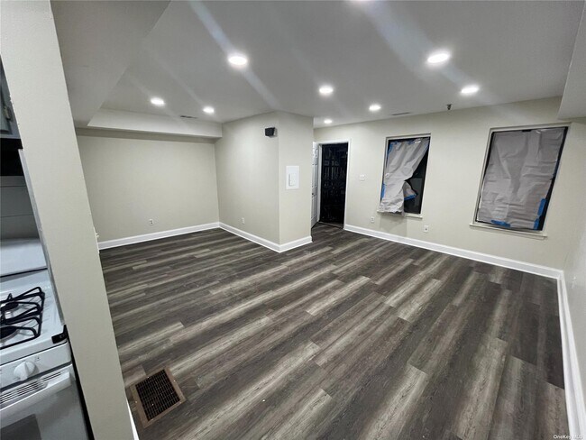
About This Property
A perfect affordable studio close to all. Ideal for someone who is just starting out. Close to hospitals,shops,public transportation and 2 major Colleges Fordham University and Lehman College. Your search for the right home ends here. Tenant pays for ELECTRICITY only!!!! Based on information submitted to the MLS GRID as of [see last changed date above]. All data is obtained from various sources and may not have been verified by broker or MLS GRID. Supplied Open House Information is subject to change without notice. All information should be independently reviewed and verified for accuracy. Properties may or may not be listed by the office/agent presenting the information. Some IDX listings have been excluded from this website. Prices displayed on all Sold listings are the Last Known Listing Price and may not be the actual selling price.
2006 Mapes Ave is an apartment community located in Bronx County and the 10460 ZIP Code.
2006 Mapes Ave,
The Bronx,
NY
10460
Education
| Colleges & Universities | Distance | ||
|---|---|---|---|
| Colleges & Universities | Distance | ||
| Drive: | 5 min | 1.6 mi | |
| Drive: | 6 min | 2.1 mi | |
| Drive: | 6 min | 2.2 mi | |
| Drive: | 7 min | 2.9 mi |
2006 Mapes Ave is within 5 minutes or 1.6 miles from Fordham University, Rose Hill. It is also near Monroe College, Bronx Campus and Bronx Community College.
Transportation options available in The Bronx include West Farms Square-East Tremont Avenue, located 0.5 mile from 2006 Mapes Ave. 2006 Mapes Ave is near LaGuardia, located 9.3 miles or 20 minutes away, and John F Kennedy International, located 18.1 miles or 27 minutes away.
| Transit / Subway | Distance | ||
|---|---|---|---|
| Transit / Subway | Distance | ||
|
|
Walk: | 10 min | 0.5 mi |
|
|
Walk: | 11 min | 0.6 mi |
|
|
Walk: | 16 min | 0.8 mi |
|
|
Drive: | 4 min | 1.2 mi |
|
|
Drive: | 4 min | 1.7 mi |
| Commuter Rail | Distance | ||
|---|---|---|---|
| Commuter Rail | Distance | ||
|
|
Walk: | 15 min | 0.8 mi |
|
|
Drive: | 4 min | 1.7 mi |
|
|
Drive: | 6 min | 1.9 mi |
|
|
Drive: | 8 min | 2.6 mi |
|
|
Drive: | 8 min | 2.8 mi |
| Airports | Distance | ||
|---|---|---|---|
| Airports | Distance | ||
|
LaGuardia
|
Drive: | 20 min | 9.3 mi |
|
John F Kennedy International
|
Drive: | 27 min | 18.1 mi |
Walkability Near 2006 Mapes Ave The Bronx, NY 10460
Getting Around
 What do Walkability, Transit, Drivability, and Bikeability mean?
Walkability measures the walking distance to day-to-day needs.
Transit measures access to public transportation.
Drivability measures congestion, parking availability, and access to major roads.
Bikeability measures the suitability for cycling.
How It Works
What do Walkability, Transit, Drivability, and Bikeability mean?
Walkability measures the walking distance to day-to-day needs.
Transit measures access to public transportation.
Drivability measures congestion, parking availability, and access to major roads.
Bikeability measures the suitability for cycling.
How It Works
Exceptionally Walkable
Walkability
100
/ 100
Exceptional Public Transit
Transit
100
/ 100
Fairly Drivable
Drivability
40
/ 100
Moderately Bikeable
Bikeability
70
/ 100
Scores provided by
-
Soundscore™
-
/ 100
Traffic
-Airport
-Businesses
-Scores provided by
HowLoud What is a Sound Score Rating? A Sound Score Rating aggregates noise caused by vehicle traffic, airplane traffic and local sources. How It WorksTime and distance from 2006 Mapes Ave.
| Shopping Centers | Distance | ||
|---|---|---|---|
| Shopping Centers | Distance | ||
| Walk: | 7 min | 0.4 mi | |
| Walk: | 8 min | 0.4 mi | |
| Walk: | 16 min | 0.8 mi |
2006 Mapes Ave has 3 shopping centers within 0.8 mile, which is about a 16-minute walk. The miles and minutes will be for the farthest away property.
| Parks and Recreation | Distance | ||
|---|---|---|---|
| Parks and Recreation | Distance | ||
|
Bronx Zoo
|
Walk: | 20 min | 1.1 mi |
|
Crotona Park
|
Drive: | 4 min | 1.4 mi |
|
Bronx Park
|
Drive: | 7 min | 1.9 mi |
|
Claremont Park
|
Drive: | 6 min | 2.0 mi |
|
Starlight Park
|
Drive: | 5 min | 2.2 mi |
2006 Mapes Ave has 5 parks within 2.2 miles, including Crotona Park, Bronx Zoo, and Starlight Park.
| Hospitals | Distance | ||
|---|---|---|---|
| Hospitals | Distance | ||
| Drive: | 4 min | 1.3 mi | |
| Drive: | 4 min | 1.8 mi | |
| Drive: | 6 min | 2.7 mi |
2006 Mapes Ave has 3 hospitals within 2.7 miles, the nearest is St. Barnabas Hospital which is 1.3 miles away and a 4 minute drive.
| Military Bases | Distance | ||
|---|---|---|---|
| Military Bases | Distance | ||
| Drive: | 17 min | 8.6 mi | |
| Drive: | 28 min | 14.4 mi | |
| Drive: | 32 min | 16.0 mi |
2006 Mapes Ave has 3 military bases within 16.0 miles, the nearest is Fort Totten US Govt Reservation which is 8.6 miles away and a 17 minute drive.
You May Also Like
Similar Rentals Nearby


What Are Walk Score®, Transit Score®, and Bike Score® Ratings?
Walk Score® measures the walkability of any address. Transit Score® measures access to public transit. Bike Score® measures the bikeability of any address.
What is a Sound Score Rating?
A Sound Score Rating aggregates noise caused by vehicle traffic, airplane traffic and local sources.

2006 Mapes Ave
The Bronx, NY 10460