
$4,200 / Month
20 Dale St
Needham, MA 02494
2 Weeks Ago
Favorites
20 Dale St

Favorites
Check Back Soon for Upcoming Availability
| Beds | Baths | Average SF |
|---|---|---|
| 4 Bedrooms 4 Bedrooms 4 Br | 2.5 Baths 2.5 Baths 2.5 Ba | 2,000 SF |
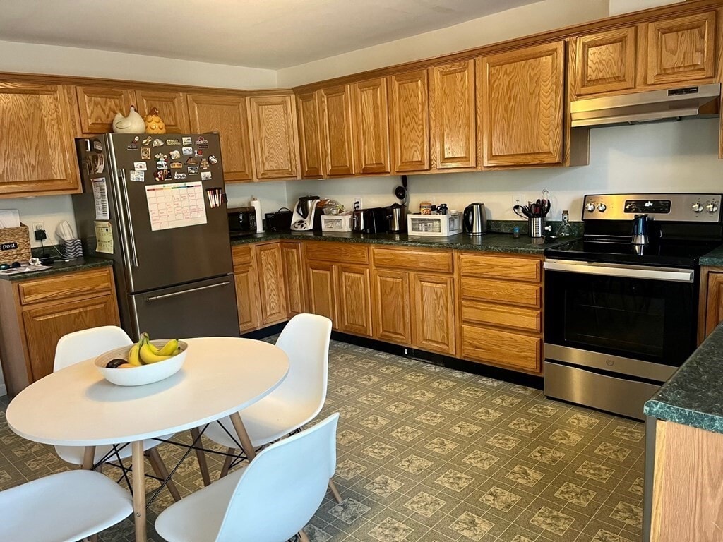
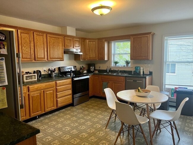
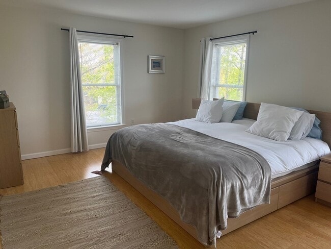
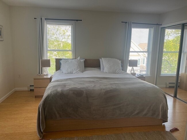
About This Property
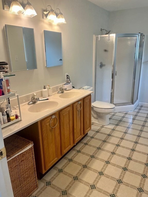
Spacious townhouse in the heart of Needham featuring 4 bedrooms,2.5 bathrooms,newer stainless-steel appliances and a large 2 car garage. Solar panels provide near zero electricity expenses in the summer months. Conveniently located near Needham Center and the commuter rail,Starbucks,Trader Joes,many shops/restaurants and major highways Rt 9 and 95/128. Available July 1st.
20 Dale St is a townhome located in Norfolk County and the 02494 ZIP Code. This area is served by the Needham attendance zone.
Location
Get Directions
Just west of Boston and East of Worcester sits Metro West, a region that houses a group of towns and cities with significant historical backgrounds. A total of 19 municipalities make up the core of this community, but other municipalities are considered to be a part of the Interstate 495/Metro West Corridor.
Learn more about living in Metro WestBelow are rent ranges for similar nearby apartments
| Beds | Average Size | Lowest | Typical | Premium |
|---|---|---|---|---|
| Studio Studio Studio | 510-512 Sq Ft | $1,390 | $2,455 | $7,210 |
| 1 Bed 1 Bed 1 Bed | 896-897 Sq Ft | $1,400 | $2,958 | $8,867 |
| 2 Beds 2 Beds 2 Beds | 1277-1279 Sq Ft | $2,100 | $3,695 | $16,075 |
| 3 Beds 3 Beds 3 Beds | 1542-1547 Sq Ft | $1,000 | $4,912 | $19,833 |
| 4 Beds 4 Beds 4 Beds | 3646 Sq Ft | $1,110 | $6,786 | $18,000 |
Education
| Colleges & Universities | Distance | ||
|---|---|---|---|
| Colleges & Universities | Distance | ||
| Drive: | 6 min | 2.6 mi | |
| Drive: | 11 min | 4.3 mi | |
| Drive: | 11 min | 5.9 mi | |
| Drive: | 14 min | 7.2 mi |
20 Dale St is within 6 minutes or 2.6 miles from Babson College. It is also near Wellesley College and Boston College.
Schools


Public Elementary School
Grades PK-5
699 Students
Nearby
Public Elementary & Middle School
Grades 6
446 Students
Attendance Zone
Public Elementary School
Grades K-5
529 Students
Attendance Zone
Public Middle School
Grades 6-8
657 Students
Nearby
Public Middle School
Grades 7-8
818 Students
Attendance Zone
Public High School
Grades 9-12
1,645 Students
Attendance Zone
Private Elementary School
Grades PK-6
191 Students
Nearby
Private Elementary & Middle School
Grades PK-8
353 Students
Nearby
Private Middle & High School
Grades 7-12
9 Students
Nearby
Private Middle School
Grades 6-8
109 Students
Nearby
Private High School
Grades 9-12
10 Students
Nearby
School data provided by
 The GreatSchools Rating helps parents compare schools within a state based on a variety of school quality indicators and provides a helpful picture of how effectively each school serves all of its students. Ratings are on a scale of 1 (below average) to 10 (above average) and can include test scores, college readiness, academic progress, advanced courses, equity, discipline and attendance data. We also advise parents to visit schools, consider other information on school performance and programs, and consider family needs as part of the school selection process.
View GreatSchools Rating Methodology
Data provided by GreatSchools.org © 2025. All rights reserved.
View GreatSchools Rating Methodology
Data provided by GreatSchools.org © 2025. All rights reserved.
Transportation options available in Needham include Newton Highlands Station, located 2.9 miles from 20 Dale St. 20 Dale St is near General Edward Lawrence Logan International, located 16.1 miles or 29 minutes away, and Worcester Regional, located 42.6 miles or 61 minutes away.
| Transit / Subway | Distance | ||
|---|---|---|---|
| Transit / Subway | Distance | ||
|
|
Drive: | 5 min | 2.9 mi |
|
|
Drive: | 7 min | 3.1 mi |
|
|
Drive: | 7 min | 3.3 mi |
|
|
Drive: | 8 min | 4.6 mi |
|
|
Drive: | 9 min | 4.8 mi |
| Commuter Rail | Distance | ||
|---|---|---|---|
| Commuter Rail | Distance | ||
|
|
Walk: | 4 min | 0.2 mi |
|
|
Drive: | 2 min | 1.2 mi |
|
|
Drive: | 4 min | 1.7 mi |
|
|
Drive: | 5 min | 2.5 mi |
|
|
Drive: | 7 min | 2.9 mi |
| Airports | Distance | ||
|---|---|---|---|
| Airports | Distance | ||
|
General Edward Lawrence Logan International
|
Drive: | 29 min | 16.1 mi |
|
Worcester Regional
|
Drive: | 61 min | 42.6 mi |
Time and distance from 20 Dale St.
| Shopping Centers | Distance | ||
|---|---|---|---|
| Shopping Centers | Distance | ||
| Drive: | 2 min | 1.2 mi | |
| Drive: | 3 min | 1.4 mi | |
| Drive: | 3 min | 1.5 mi |
20 Dale St has 3 shopping centers within 1.5 miles, which is about a 3-minute drive. The miles and minutes will be for the farthest away property.
| Parks and Recreation | Distance | ||
|---|---|---|---|
| Parks and Recreation | Distance | ||
|
Cutler Park Reservation
|
Drive: | 3 min | 1.7 mi |
|
Hemlock Gorge Reservation
|
Drive: | 5 min | 2.1 mi |
|
Whitin Observatory
|
Drive: | 10 min | 3.8 mi |
|
Horticultural Society at Elm Bank
|
Drive: | 12 min | 5.2 mi |
|
Elm Bank Reservation
|
Drive: | 14 min | 5.6 mi |
20 Dale St has 5 parks within 5.6 miles, including Cutler Park Reservation, Hemlock Gorge Reservation, and Whitin Observatory.
| Hospitals | Distance | ||
|---|---|---|---|
| Hospitals | Distance | ||
| Drive: | 2 min | 1.3 mi | |
| Drive: | 7 min | 4.3 mi | |
| Drive: | 11 min | 5.5 mi |
20 Dale St has 3 hospitals within 5.5 miles, the nearest is Beth Israel Deaconess Hospital - Needham which is 1.3 miles away and a 2 minute drive.
| Military Bases | Distance | ||
|---|---|---|---|
| Military Bases | Distance | ||
| Drive: | 15 min | 7.0 mi | |
| Drive: | 24 min | 14.3 mi |
20 Dale St is 7.0 miles from US Military Reservation, and is convenient to other military bases, including Hanscom Air Force Base.
You May Also Like
Similar Rentals Nearby


What Are Walk Score®, Transit Score®, and Bike Score® Ratings?
Walk Score® measures the walkability of any address. Transit Score® measures access to public transit. Bike Score® measures the bikeability of any address.
What is a Sound Score Rating?
A Sound Score Rating aggregates noise caused by vehicle traffic, airplane traffic and local sources

20 Dale St
Needham, MA 02494