
Shoreline Gateway
777 E Ocean Blvd,
Long Beach, CA 90802
$3,397 - $5,381 Total Monthly Price
Studio - 2 Beds
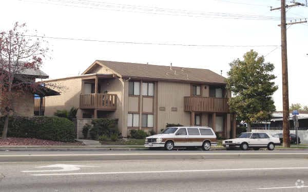

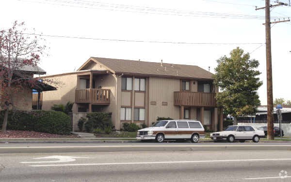
Thanks for visiting 1998 E 52nd St in Long Beach. The location in Long Beach's 90805 area is an ideal place to move. Schedule a time to see the available floorplan options. From location to floorplan options, the community staff will be ready to help you find the perfect floorplan option. Visit 1998 E 52nd St today.
1998 E 52nd St is an apartment community located in Los Angeles County and the 90805 ZIP Code. This area is served by the Long Beach Unified Rop School District attendance zone.
Nestled in northern Long Beach, Bixby Knolls is a family-friendly neighborhood brimming with character. Atlantic Avenue serves as the main commercial thoroughfare, touting an array of independently owned restaurants, specialty shops, and boutiques in rows of historic storefronts. Bixby Knolls exudes a distinct sense of community spirit, with strong support of local businesses and special events such as First Fridays, Bixby Saturday Nights, and Concerts in the Park(ing Lot), among many others.
Rentals in Bixby Knolls include a wide variety of apartments, condos, townhomes, and houses tucked along tree-lined avenues. Residents enjoy convenience to Long Beach Airport as well as golfing destinations like the Virginia Country Club, Lakewood Golf Course, and Skylinks at Long Beach. Commuting from Bixby Knolls is a breeze with access to Interstates 405 and 710.
Learn more about living in Bixby KnollsCompare neighborhood and city base rent averages by bedroom.
| Bixby Knolls | Long Beach, CA | |
|---|---|---|
| Studio | $1,506 | $1,477 |
| 1 Bedroom | $1,587 | $1,828 |
| 2 Bedrooms | $1,980 | $2,339 |
| 3 Bedrooms | $2,229 | $2,644 |
| Colleges & Universities | Distance | ||
|---|---|---|---|
| Colleges & Universities | Distance | ||
| Drive: | 8 min | 3.7 mi | |
| Drive: | 10 min | 4.4 mi | |
| Drive: | 10 min | 4.9 mi | |
| Drive: | 13 min | 6.8 mi |


Transportation options available in Long Beach include Del Amo Station, located 2.9 miles from 1998 E 52nd St. 1998 E 52nd St is near Long Beach (Daugherty Field), located 2.8 miles or 5 minutes away, and Los Angeles International, located 19.7 miles or 29 minutes away.
| Transit / Subway | Distance | ||
|---|---|---|---|
| Transit / Subway | Distance | ||
|
|
Drive: | 6 min | 2.9 mi |
|
|
Drive: | 7 min | 3.3 mi |
|
|
Drive: | 8 min | 3.7 mi |
|
|
Drive: | 11 min | 5.0 mi |
|
|
Drive: | 11 min | 5.8 mi |
| Commuter Rail | Distance | ||
|---|---|---|---|
| Commuter Rail | Distance | ||
|
|
Drive: | 18 min | 10.7 mi |
|
|
Drive: | 21 min | 12.7 mi |
|
|
Drive: | 23 min | 14.1 mi |
|
|
Drive: | 20 min | 14.3 mi |
|
|
Drive: | 24 min | 17.7 mi |
| Airports | Distance | ||
|---|---|---|---|
| Airports | Distance | ||
|
Long Beach (Daugherty Field)
|
Drive: | 5 min | 2.8 mi |
|
Los Angeles International
|
Drive: | 29 min | 19.7 mi |
Scores provided by
Traffic
-Airport
-Businesses
-Scores provided by
HowLoud What is a Sound Score Rating? A Sound Score Rating aggregates noise caused by vehicle traffic, airplane traffic and local sources. How It WorksTime and distance from 1998 E 52nd St.
| Shopping Centers | Distance | ||
|---|---|---|---|
| Shopping Centers | Distance | ||
| Walk: | 6 min | 0.3 mi | |
| Walk: | 8 min | 0.5 mi | |
| Walk: | 9 min | 0.5 mi |
| Parks and Recreation | Distance | ||
|---|---|---|---|
| Parks and Recreation | Distance | ||
|
El Dorado Nature Center
|
Drive: | 12 min | 6.9 mi |
|
Earl Burns Miller Japanese Garden
|
Drive: | 12 min | 7.0 mi |
|
El Dorado East Regional Park
|
Drive: | 14 min | 7.5 mi |
|
Compton Creek Natural Park at George Washington Elementary
|
Drive: | 13 min | 8.0 mi |
|
Colorado Lagoon
|
Drive: | 14 min | 8.1 mi |
| Hospitals | Distance | ||
|---|---|---|---|
| Hospitals | Distance | ||
| Drive: | 3 min | 1.8 mi | |
| Drive: | 8 min | 4.0 mi | |
| Drive: | 8 min | 4.0 mi |
| Military Bases | Distance | ||
|---|---|---|---|
| Military Bases | Distance | ||
| Drive: | 21 min | 12.7 mi | |
| Drive: | 24 min | 13.6 mi | |
| Drive: | 28 min | 15.7 mi |
Pets Allowed Fitness Center Pool In Unit Washer & Dryer Clubhouse Balcony
What Are Walk Score®, Transit Score®, and Bike Score® Ratings?
Walk Score® measures the walkability of any address. Transit Score® measures access to public transit. Bike Score® measures the bikeability of any address.
What is a Sound Score Rating?
A Sound Score Rating aggregates noise caused by vehicle traffic, airplane traffic and local sources.
1998 E 52nd St
Long Beach, CA 90805


