
The Equestrian At Pelham Parkway
1680 Pelham Pkwy S,
Bronx, NY 10461
$1,850 - $2,900
Studio - 2 Beds

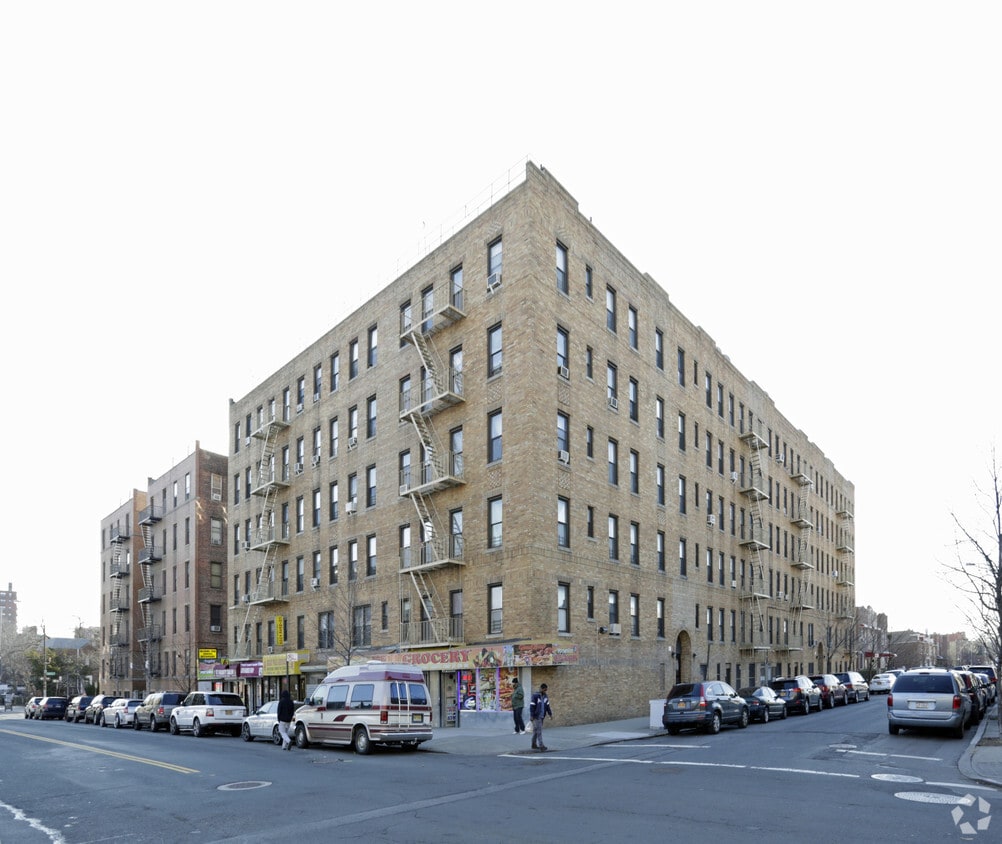
Discover your new home at 1996 Gleason Ave in Bronx. The 1996 Gleason Ave location in Bronx's 10472 Zip code has so much to offer its residents. From availability to location, the team of leasing professionals will be ready to help you find your perfect floorplan option. Be sure to check out the current floorplan options. Life is great at 1996 Gleason Ave. Contact or drop by the leasing office to schedule a tour.
1996 Gleason Ave is an apartment community located in Bronx County and the 10472 ZIP Code. This area is served by the New York City Geographic District # 8 attendance zone.
Unionport, with its tree-lined streets and mix of row houses, provides a suburban feel in the heart of the Bronx. Local amenities include convenient shopping districts along White Plains Road, with a variety of shops and eateries such as the popular Sabrosura restaurant. The neighborhood is also home to Pugsley Creek Park, offering picturesque views and outdoor activities. Housing options range from affordable one-bedroom apartments to larger detached homes, catering to a wide spectrum of renters. Although Unionport is primarily residential, it enjoys proximity to significant employers around the Bronx, making it convenient for those commuting within the borough.
Residents enjoy easy access to major roadways like the Cross Bronx and Bruckner Expressways. Public transit options include the Number 6 subway line, which connects residents to Manhattan within an hour.
Learn more about living in UnionportCompare neighborhood and city base rent averages by bedroom.
| Unionport | Bronx, NY | |
|---|---|---|
| Studio | $1,419 | $1,630 |
| 1 Bedroom | $1,479 | $1,635 |
| 2 Bedrooms | $1,663 | $2,101 |
| 3 Bedrooms | $2,346 | $2,370 |
| Colleges & Universities | Distance | ||
|---|---|---|---|
| Colleges & Universities | Distance | ||
| Drive: | 6 min | 2.3 mi | |
| Drive: | 9 min | 3.9 mi | |
| Drive: | 9 min | 4.2 mi | |
| Drive: | 9 min | 4.9 mi |


Transportation options available in Bronx include Castle Hill Avenue, located 0.6 mile from 1996 Gleason Ave. 1996 Gleason Ave is near LaGuardia, located 8.6 miles or 18 minutes away, and John F Kennedy International, located 16.2 miles or 24 minutes away.
| Transit / Subway | Distance | ||
|---|---|---|---|
| Transit / Subway | Distance | ||
|
|
Walk: | 11 min | 0.6 mi |
|
|
Walk: | 12 min | 0.7 mi |
|
|
Drive: | 3 min | 1.1 mi |
|
|
Drive: | 4 min | 1.1 mi |
|
|
Drive: | 4 min | 1.8 mi |
| Commuter Rail | Distance | ||
|---|---|---|---|
| Commuter Rail | Distance | ||
|
|
Drive: | 6 min | 3.0 mi |
|
|
Drive: | 9 min | 3.9 mi |
|
|
Drive: | 8 min | 4.0 mi |
|
|
Drive: | 8 min | 4.1 mi |
|
|
Drive: | 9 min | 4.3 mi |
| Airports | Distance | ||
|---|---|---|---|
| Airports | Distance | ||
|
LaGuardia
|
Drive: | 18 min | 8.6 mi |
|
John F Kennedy International
|
Drive: | 24 min | 16.2 mi |
Scores provided by
Traffic
-Airport
-Businesses
-Scores provided by
HowLoud What is a Sound Score Rating? A Sound Score Rating aggregates noise caused by vehicle traffic, airplane traffic and local sources. How It WorksTime and distance from 1996 Gleason Ave.
| Shopping Centers | Distance | ||
|---|---|---|---|
| Shopping Centers | Distance | ||
| Walk: | 11 min | 0.6 mi | |
| Walk: | 12 min | 0.6 mi | |
| Walk: | 12 min | 0.7 mi |
| Parks and Recreation | Distance | ||
|---|---|---|---|
| Parks and Recreation | Distance | ||
|
Soundview Park
|
Drive: | 5 min | 1.7 mi |
|
Bronx Zoo
|
Drive: | 6 min | 2.0 mi |
|
Starlight Park
|
Drive: | 5 min | 2.2 mi |
|
Concrete Plant Park
|
Drive: | 6 min | 2.9 mi |
|
Ferry Point Park
|
Drive: | 10 min | 3.3 mi |
| Hospitals | Distance | ||
|---|---|---|---|
| Hospitals | Distance | ||
| Drive: | 5 min | 1.9 mi | |
| Drive: | 8 min | 3.0 mi | |
| Drive: | 8 min | 3.0 mi |
| Military Bases | Distance | ||
|---|---|---|---|
| Military Bases | Distance | ||
| Drive: | 14 min | 6.7 mi | |
| Drive: | 31 min | 16.0 mi |
What Are Walk Score®, Transit Score®, and Bike Score® Ratings?
Walk Score® measures the walkability of any address. Transit Score® measures access to public transit. Bike Score® measures the bikeability of any address.
What is a Sound Score Rating?
A Sound Score Rating aggregates noise caused by vehicle traffic, airplane traffic and local sources.
1996 Gleason Ave
Bronx, NY 10472


