$2,300 / Month
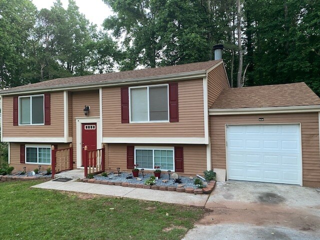
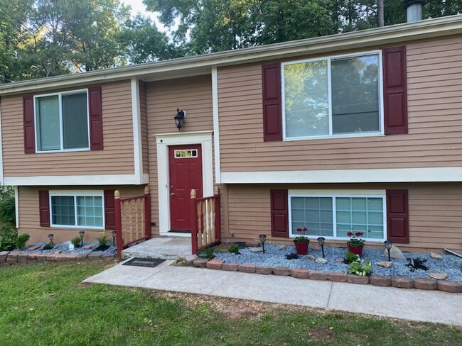
1993 Singer Way
Lithonia, GA 30058
1 Week Ago
Favorites
478-779-1517
-
Bedrooms
4
-
Bathrooms
2
-
Square Feet
2,300 sq ft
-
Available
Available Now
1993 Singer Way

Favorites
About This Home
12 Month Lease,
$2,300 deposit,
Available Now
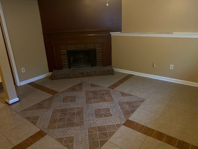
Newly renovated house. Access to public transportation and near by grocery stores.
1993 Singer Way is a house located in DeKalb County and the 30058 ZIP Code. This area is served by the DeKalb County attendance zone.
* Price shown is base rent and may not include non-optional fees and utilities.
Price, availability, fees, and any applicable rent special are subject to change without notice.
* Square footage definitions vary. Displayed square footage is approximate.
House Features
- Washer/Dryer Hookup
- Heating
- Ceiling Fans
Fees and Policies
The fees below are based on community-supplied data and may exclude additional fees and utilities.
- Parking
-
Garage--
Details
Property Information
-
Built in 2000
Contact
- Phone Number
- Contact
Location
Get Directions
Southeast DeKalb refers to a sprawling region in the southeastern portion of DeKalb County. Among the many communities in this area are the communities of Clarkston, Stone Mountain, Lithonia, Panthersville, Gresham Park, and Sheffield Woods.
Each community in this region has its own distinct character. Southeast DeKalb offers ample opportunities for outdoor recreation at destinations such as Stone Mountain Park, Panola Mountain State Park, and Arabia Mountain National Heritage Area. Southeast DeKalb sits within easy driving distance of all that Greater Atlanta has to offer, with close proximity to major thoroughfares like I-285, I-20, and U.S. 278.
Learn more about living in Southeast DeKalb
Education
| Colleges & Universities | Distance | ||
|---|---|---|---|
| Colleges & Universities | Distance | ||
| Drive: | 20 min | 9.3 mi | |
| Drive: | 20 min | 10.7 mi | |
| Drive: | 20 min | 11.3 mi | |
| Drive: | 24 min | 12.6 mi |
1993 Singer Way is within 20 minutes or 9.3 miles from Georgia Perim., Clarkston. It is also near Agnes Scott College and Georgia Perim. Coll., Decatur.
Schools


Public Elementary School
Grades PK-5
653 Students
Attendance Zone
Public Middle School
Grades 6-8
668 Students
Attendance Zone
Public High School
Grades 9-12
951 Students
Attendance Zone
Private Elementary School
Grades PK-1
Nearby
Private Elementary, Middle & High School
Grades 2-12
132 Students
Nearby
Private Elementary & Middle School
Grades K-8
82 Students
Nearby
School data provided by
 The GreatSchools Rating helps parents compare schools within a state based on a variety of school quality indicators and provides a helpful picture of how effectively each school serves all of its students. Ratings are on a scale of 1 (below average) to 10 (above average) and can include test scores, college readiness, academic progress, advanced courses, equity, discipline and attendance data. We also advise parents to visit schools, consider other information on school performance and programs, and consider family needs as part of the school selection process.
View GreatSchools Rating Methodology
Data provided by GreatSchools.org © 2025. All rights reserved.
View GreatSchools Rating Methodology
Data provided by GreatSchools.org © 2025. All rights reserved.
Transportation options available in Lithonia include Indian Creek, located 7.1 miles from 1993 Singer Way. 1993 Singer Way is near Hartsfield - Jackson Atlanta International, located 21.2 miles or 34 minutes away.
| Transit / Subway | Distance | ||
|---|---|---|---|
| Transit / Subway | Distance | ||
|
|
Drive: | 15 min | 7.1 mi |
|
|
Drive: | 16 min | 8.1 mi |
|
|
Drive: | 19 min | 9.7 mi |
|
|
Drive: | 20 min | 10.5 mi |
|
|
Drive: | 21 min | 11.5 mi |
| Commuter Rail | Distance | ||
|---|---|---|---|
| Commuter Rail | Distance | ||
|
|
Drive: | 32 min | 21.5 mi |
| Airports | Distance | ||
|---|---|---|---|
| Airports | Distance | ||
|
Hartsfield - Jackson Atlanta International
|
Drive: | 34 min | 21.2 mi |
Time and distance from 1993 Singer Way.
| Shopping Centers | Distance | ||
|---|---|---|---|
| Shopping Centers | Distance | ||
| Drive: | 5 min | 1.8 mi | |
| Drive: | 5 min | 1.8 mi | |
| Drive: | 5 min | 1.9 mi |
1993 Singer Way has 3 shopping centers within 1.9 miles, which is about a 5-minute drive. The miles and minutes will be for the farthest away property.
| Parks and Recreation | Distance | ||
|---|---|---|---|
| Parks and Recreation | Distance | ||
|
Arabia Mountain Heritage Area and Nature Center
|
Drive: | 14 min | 6.4 mi |
|
DeShong Park
|
Drive: | 19 min | 7.8 mi |
|
Stone Mountain State Memorial Park
|
Drive: | 21 min | 8.7 mi |
|
Yellow River Park
|
Drive: | 22 min | 9.5 mi |
|
Forty Oaks Nature Preserve
|
Drive: | 20 min | 10.7 mi |
1993 Singer Way has 5 parks within 10.7 miles, including Arabia Mountain Heritage Area and Nature Center, Stone Mountain State Memorial Park, and DeShong Park.
| Hospitals | Distance | ||
|---|---|---|---|
| Hospitals | Distance | ||
| Drive: | 7 min | 2.6 mi | |
| Drive: | 18 min | 10.7 mi | |
| Drive: | 21 min | 11.2 mi |
1993 Singer Way has 3 hospitals within 11.2 miles, the nearest is Emory Hillandale Hospital which is 2.6 miles away and a 7 minute drive.
| Military Bases | Distance | ||
|---|---|---|---|
| Military Bases | Distance | ||
| Drive: | 31 min | 18.9 mi | |
| Drive: | 33 min | 21.9 mi |
1993 Singer Way is 18.9 miles from Fort Gillem, and is convenient to other military bases, including Fort McPherson.
Amenities
- Washer/Dryer Hookup
- Heating
- Ceiling Fans
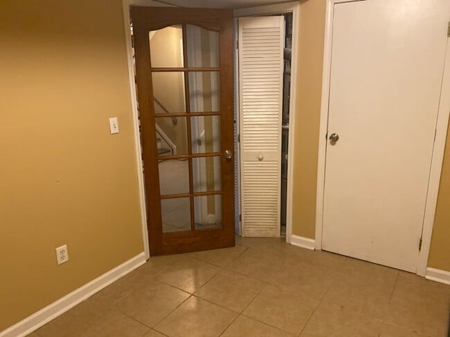
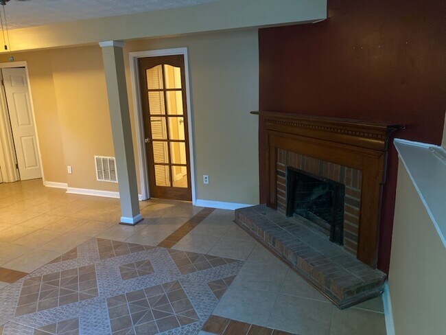
1993 Singer Way Photos
What Are Walk Score®, Transit Score®, and Bike Score® Ratings?
Walk Score® measures the walkability of any address. Transit Score® measures access to public transit. Bike Score® measures the bikeability of any address.
What is a Sound Score Rating?
A Sound Score Rating aggregates noise caused by vehicle traffic, airplane traffic and local sources

1993 Singer Way
Lithonia, GA 30058