
$2,550
/ Month
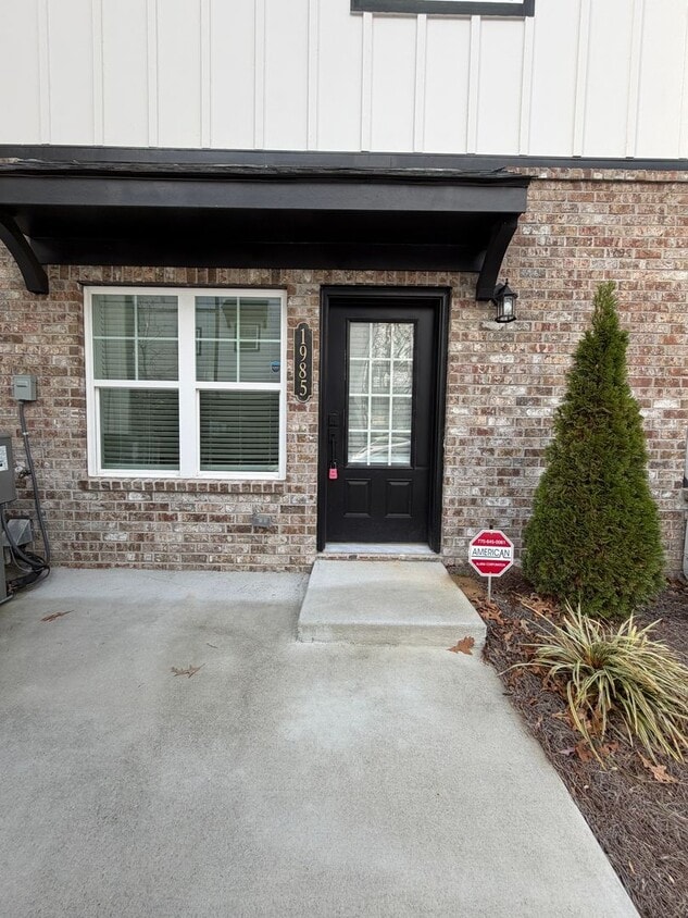
1985 North St NW
Atlanta, GA 30318
Today
|
Edit
Favorites
470-899-1389
-
Bedrooms
3
-
Bathrooms
3.5
-
Square Feet
2,000 sq ft
-
Available
Available Now
1985 North St NW

Favorites
About This Home
$2,550 deposit,
Available Now
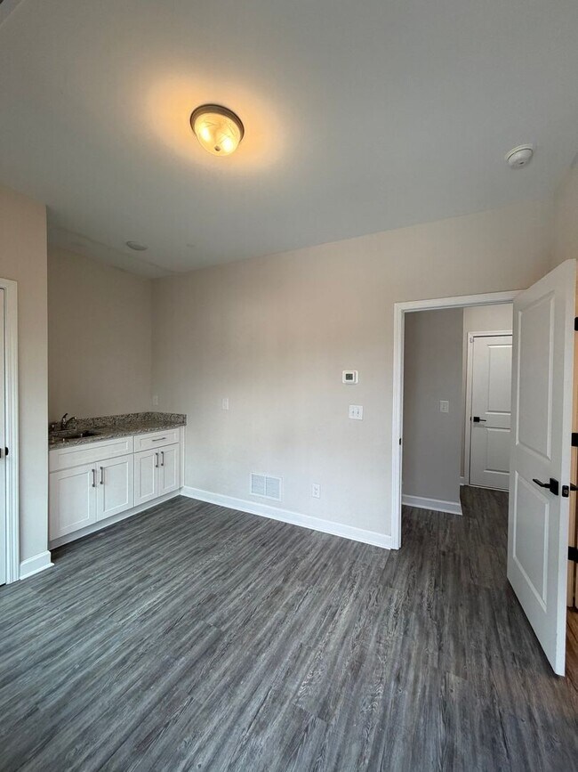
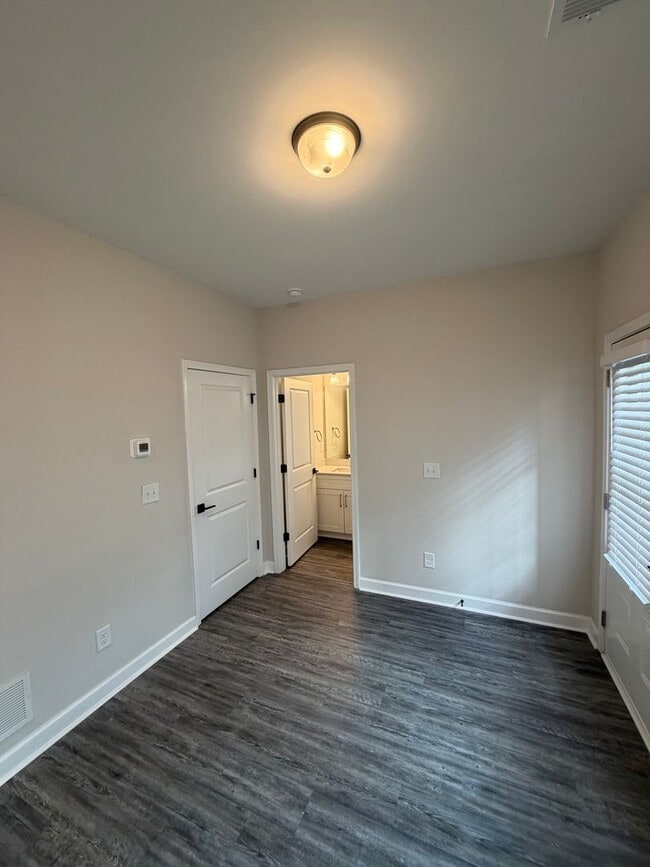
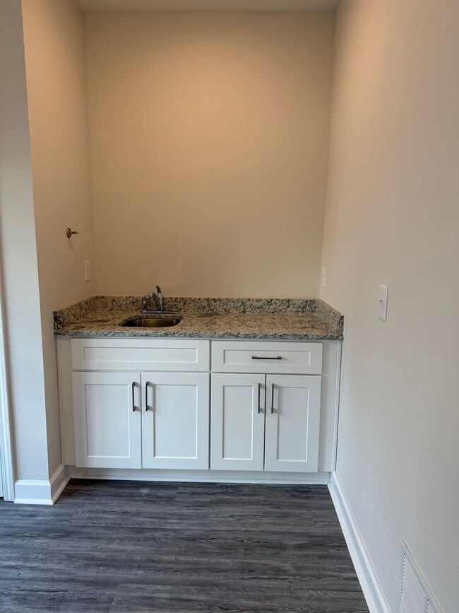
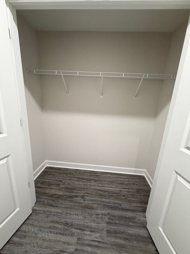
Modern and move-in ready, this spacious three-story townhome offers 3 bedrooms and 3.5 baths in one of Atlanta’s most desirable neighborhoods. The open main level features bright natural light, high ceilings, and a stylish kitchen with quartz countertops, stainless steel appliances, a large island, and plenty of storage. The living and dining areas flow easily, creating an ideal space for relaxing or entertaining. Each bedroom includes its own private en-suite bathroom. The primary suite offers a walk-in closet and a modern bathroom with double vanities and a beautifully tiled shower. A half bath on the main level adds extra convenience. Enjoy a private balcony and an unbeatable location just minutes from The Works ATL, Westside Reservoir Park, top restaurants, breweries, and quick access to I-75 and downtown. A perfect blend of style, comfort, and Upper Westside convenience.
Unique Features
- Washer/Dryer/Stove/Microwave/ Dishwasher
1985 North St NW is a house located in Fulton County and the 30318 ZIP Code. This area is served by the Atlanta Public Schools attendance zone.
* Price shown is base rent. Excludes user-selected optional fees and variable or usage-based fees and required charges due at or prior to move-in or at move-out. Price, availability, fees, and any applicable rent special are subject to change without notice.
* Square footage definitions vary. Displayed square footage is approximate.
Fees and Policies
The fees below are based on community-supplied data and may exclude additional fees and utilities.
-
One-Time Basics
-
Due at Move-In
-
Security Deposit - RefundableCharged per unit.$2,550
-
-
Due at Move-In
Property Fee Disclaimer: Based on community-supplied data and independent market research. Subject to change without notice. May exclude fees for mandatory or optional services and usage-based utilities.
Contact
- Listed by OakTree Stone Properties LLC | OakTree Stone Properties LLC
- Phone Number
- Contact
Location
Get Directions
Amenities
- Washer/Dryer/Stove/Microwave/ Dishwasher
With easy access to Highway 78 and Interstate 285, commuting to and from Atlanta’s Westside Park is a breeze. Locals appreciate the proximity this industrial neighborhood offers to Downtown, located just five miles away. Westside Park is a part of West Midtown, and is also near popular metropolitan neighborhoods like Midtown, Old Fourth Ward, and Atlantic Station.
Though Westside Park is a blend of wooded residential streets and industrial lands, including Westside Reservoir Park, this neighborhood is surrounded by all things urban Atlanta. The shopping at Atlantic Station, the restaurants in West Midtown, the tourist attractions in Downtown, and the prestigious Universities like Georgia Tech are all within reach of Westside Park. A variety of apartments, houses, condos, and townhomes, ranging from affordable to upscale, await you in this West Midtown neighborhood.
Learn more about living in Westside Park
Education
| Colleges & Universities | Distance | ||
|---|---|---|---|
| Colleges & Universities | Distance | ||
| Drive: | 10 min | 4.8 mi | |
| Drive: | 10 min | 4.8 mi | |
| Drive: | 11 min | 4.9 mi | |
| Drive: | 12 min | 5.5 mi |
1985 North St NW is within 11 minutes or 4.9 miles from Georgia Tech. It is also near Clark Atlanta University and Morehouse College.
Schools


Charter Elementary & Middle School
Grades K-8
346 Students
Nearby
Public Elementary School
Grades PK-5
503 Students
Attendance Zone
Public Middle & High School
Grades 6-12
237 Students
Nearby
Public High School
Grades 9-12
1,112 Students
Attendance Zone
Private Elementary School
Grades PK-5
48 Students
Nearby
Private Elementary & Middle School
Grades K-8
64 Students
Nearby
Private High School
Grades 9-12
75 Students
Nearby
School data provided by
 The GreatSchools Rating helps parents compare schools within a state based on a variety of school quality indicators and provides a helpful picture of how effectively each school serves all of its students. Ratings are on a scale of 1 (below average) to 10 (above average) and can include test scores, college readiness, academic progress, advanced courses, equity, discipline and attendance data. We also advise parents to visit schools, consider other information on school performance and programs, and consider family needs as part of the school selection process.
View GreatSchools Rating Methodology
Data provided by GreatSchools.org © 2025. All rights reserved.
View GreatSchools Rating Methodology
Data provided by GreatSchools.org © 2025. All rights reserved.
Transportation options available in Atlanta include Bankhead, located 2.3 miles from 1985 North St NW. 1985 North St NW is near Hartsfield - Jackson Atlanta International, located 14.9 miles or 26 minutes away.
| Transit / Subway | Distance | ||
|---|---|---|---|
| Transit / Subway | Distance | ||
|
|
Drive: | 4 min | 2.3 mi |
|
|
Drive: | 8 min | 3.4 mi |
|
|
Drive: | 9 min | 4.0 mi |
|
|
Drive: | 8 min | 4.1 mi |
|
|
Drive: | 10 min | 4.8 mi |
| Commuter Rail | Distance | ||
|---|---|---|---|
| Commuter Rail | Distance | ||
|
|
Drive: | 14 min | 7.3 mi |
| Airports | Distance | ||
|---|---|---|---|
| Airports | Distance | ||
|
Hartsfield - Jackson Atlanta International
|
Drive: | 26 min | 14.9 mi |
Time and distance from 1985 North St NW.
| Shopping Centers | Distance | ||
|---|---|---|---|
| Shopping Centers | Distance | ||
| Walk: | 14 min | 0.8 mi | |
| Drive: | 6 min | 2.9 mi | |
| Drive: | 9 min | 3.7 mi |
1985 North St NW has 3 shopping centers within 3.7 miles, which is about a 9-minute drive. The miles and minutes will be for the farthest away property.
| Parks and Recreation | Distance | ||
|---|---|---|---|
| Parks and Recreation | Distance | ||
|
West Atlanta Watershed Alliance (WAWA)
|
Drive: | 11 min | 4.9 mi |
|
Georgia Aquarium
|
Drive: | 10 min | 4.9 mi |
|
Georgia Conservancy
|
Drive: | 10 min | 5.2 mi |
|
Imagine It! The Children's Museum of Atlanta
|
Drive: | 10 min | 5.5 mi |
|
Atlanta BeltLine Southwest Connector Spur Trail
|
Drive: | 14 min | 6.1 mi |
1985 North St NW has 5 parks within 6.1 miles, including Georgia Aquarium, Georgia Conservancy, and West Atlanta Watershed Alliance (WAWA).
| Hospitals | Distance | ||
|---|---|---|---|
| Hospitals | Distance | ||
| Drive: | 9 min | 5.0 mi | |
| Drive: | 12 min | 6.4 mi | |
| Drive: | 14 min | 7.8 mi |
1985 North St NW has 3 hospitals within 7.8 miles, the nearest is Emory University Hospital Midtown which is 5.0 miles away and a 9 minute drive.
| Military Bases | Distance | ||
|---|---|---|---|
| Military Bases | Distance | ||
| Drive: | 16 min | 7.7 mi | |
| Drive: | 26 min | 14.2 mi |
1985 North St NW is 7.7 miles from Fort McPherson, and is convenient to other military bases, including Dobbins Air Force Base.
You May Also Like
Similar Rentals Nearby


What Are Walk Score®, Transit Score®, and Bike Score® Ratings?
Walk Score® measures the walkability of any address. Transit Score® measures access to public transit. Bike Score® measures the bikeability of any address.
What is a Sound Score Rating?
A Sound Score Rating aggregates noise caused by vehicle traffic, airplane traffic and local sources

1985 North St NW
Atlanta, GA 30318