
$1,925
Total Monthly Price
1970 Powell St Unit D
San Pablo, CA 94806
Today
|
Edit
Favorites
510-990-9439
-
Bedrooms
2
-
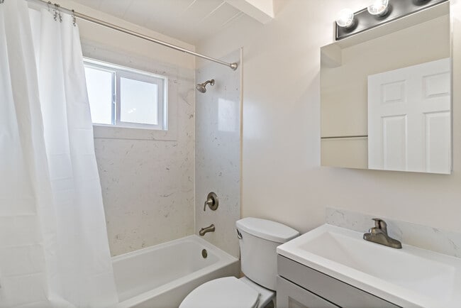
Bathrooms
1
-
Square Feet
740 sq ft
-
Available
Available Mar 15
1970 Powell St Unit D

Favorites
About This Home
12 Month Lease,
$1,925 deposit,
Available Mar 15
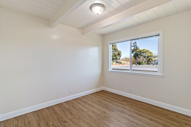
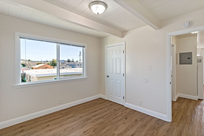
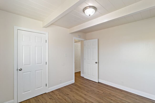
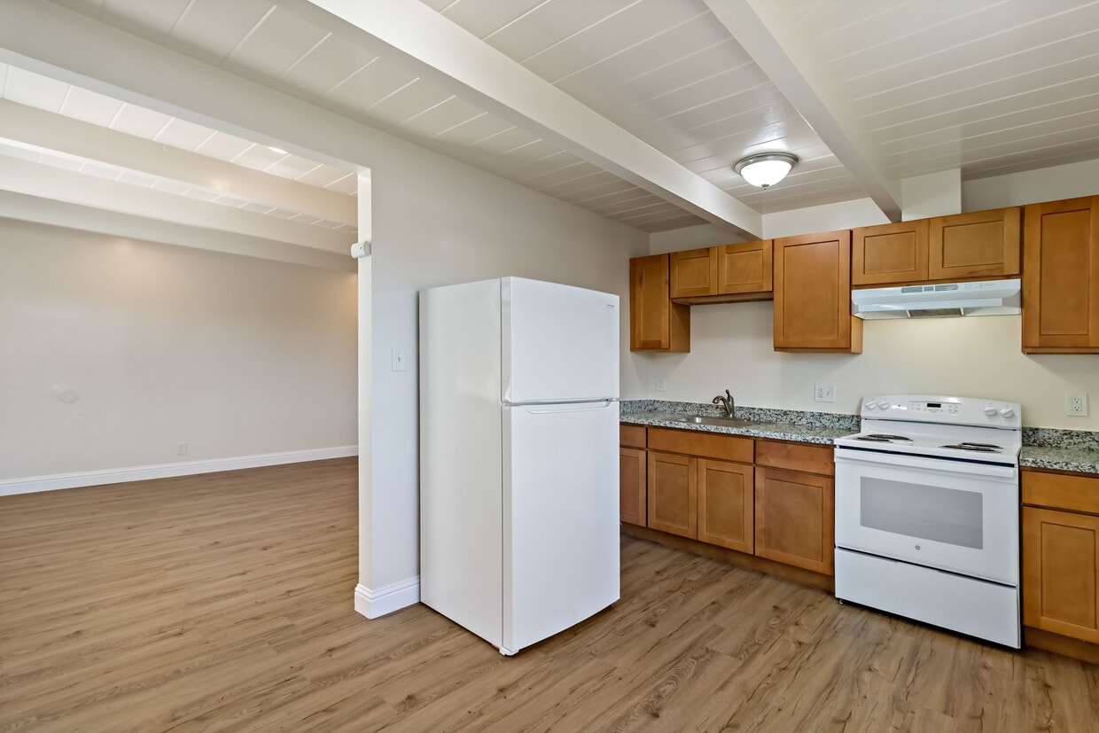
Beautiful freshly painted 2 bedroom and 1 bathroom. and 1 car space. This lovely newly remodeled home offers great updates such as new renovated kitchen, new appliances, new flooring, new doors and trims and more! laundry on site 2.5 times the rent income, good rental history, ok credit ablamos espanol pets ok Weight and breed restrictions apply
1970 Powell St is an apartment community located in Contra Costa County and the 94806 ZIP Code. This area is served by the West Contra Costa Unified School District attendance zone.
* Price shown is total price based on community-supplied monthly required fees. Excludes user-selected optional fees and variable or usage-based fees and required charges due at or prior to move-in or at move-out. Price, availability, fees, and any applicable rent special are subject to change without notice.
* Square footage definitions vary. Displayed square footage is approximate.
Apartment Features
- Kitchen
- Laundry Facilities
Fees and Policies
The fees listed below are community-provided and may exclude utilities or add-ons. All payments are made directly to the property and are non-refundable unless otherwise specified.
- Parking
-
Surface Lot--
Details
Utilities Included
-
Water
-
Trash Removal
Property Information
-
Built in 1950
-
4 units
Contact
- Listed by irma galvez
- Phone Number
- Contact
Location
Get Directions
Completely encompassed by the city of Richmond, San Pablo is a unique city nearing the coast of both the San Francisco Bay and San Pablo Bay. Beautiful bay views along the west coast are always a plus in our book! And on the other end of town, San Pablo borders Wildcat Canyon Regional Park. Though wildcat sightings are unlikely, these picturesque rolling hills are more known for their multi-use trails, playgrounds, and scenic picnic spots.
San Pablo boasts a diverse community with relatively affordable housing in comparison to neighboring cities. The city’s tight-knit community supports education and community growth, and Contra Costa College is a pristine example of that with its welcoming atmosphere and numerous athletic programs.
Along with a family-friendly vibe, San Pablo is a great place to find everyday conveniences such as casual dining, grocery stores, banks, and more.
Learn more about living in San Pablo
Education
| Colleges & Universities | Distance | ||
|---|---|---|---|
| Colleges & Universities | Distance | ||
| Drive: | 3 min | 1.3 mi | |
| Drive: | 17 min | 9.9 mi | |
| Drive: | 21 min | 10.9 mi | |
| Drive: | 23 min | 14.0 mi |
1970 Powell St Unit D is within 3 minutes or 1.3 miles from Contra Costa College. It is also near Berkeley City College and UC Berkeley.
Schools


Public Elementary School
Grades K-5
Nearby
Public Middle School
Grades 6-8
Nearby
Public High School
Grades 9-12
Nearby
Private High School
Grades 9-12
Nearby
School data provided by
 The GreatSchools Rating helps parents compare schools within a state based on a variety of school quality indicators and provides a helpful picture of how effectively each school serves all of its students. Ratings are on a scale of 1 (below average) to 10 (above average) and can include test scores, college readiness, academic progress, advanced courses, equity, discipline and attendance data. We also advise parents to visit schools, consider other information on school performance and programs, and consider family needs as part of the school selection process.
View GreatSchools Rating Methodology
Data provided by GreatSchools.org © 2026. All rights reserved.
View GreatSchools Rating Methodology
Data provided by GreatSchools.org © 2026. All rights reserved.
Transportation options available in San Pablo include Richmond Station, located 1.9 miles from 1970 Powell St Unit D. 1970 Powell St Unit D is near Metro Oakland International, located 22.9 miles or 32 minutes away, and San Francisco International, located 30.5 miles or 44 minutes away.
| Transit / Subway | Distance | ||
|---|---|---|---|
| Transit / Subway | Distance | ||
|
|
Drive: | 4 min | 1.9 mi |
|
|
Drive: | 7 min | 3.6 mi |
|
|
Drive: | 10 min | 5.6 mi |
|
|
Drive: | 15 min | 9.3 mi |
|
|
Drive: | 18 min | 10.0 mi |
| Commuter Rail | Distance | ||
|---|---|---|---|
| Commuter Rail | Distance | ||
| Drive: | 4 min | 2.1 mi | |
|
|
Drive: | 11 min | 8.0 mi |
| Drive: | 15 min | 10.3 mi | |
| Drive: | 21 min | 12.2 mi | |
| Drive: | 21 min | 13.1 mi |
| Airports | Distance | ||
|---|---|---|---|
| Airports | Distance | ||
|
Metro Oakland International
|
Drive: | 32 min | 22.9 mi |
|
San Francisco International
|
Drive: | 44 min | 30.5 mi |
Time and distance from 1970 Powell St Unit D.
| Shopping Centers | Distance | ||
|---|---|---|---|
| Shopping Centers | Distance | ||
| Walk: | 7 min | 0.4 mi | |
| Walk: | 8 min | 0.5 mi | |
| Walk: | 9 min | 0.5 mi |
1970 Powell St Unit D has 3 shopping centers within 0.5 mile, which is about a 9-minute walk. The miles and minutes will be for the farthest away property.
| Parks and Recreation | Distance | ||
|---|---|---|---|
| Parks and Recreation | Distance | ||
|
Marina Park & Green
|
Drive: | 7 min | 3.4 mi |
|
Rosie the Riveter WWII Home Front National Historical Park
|
Drive: | 8 min | 3.8 mi |
|
Shimada Friendship Park
|
Drive: | 8 min | 3.8 mi |
|
Point Pinole Regional Shoreline
|
Drive: | 8 min | 3.9 mi |
|
Miller/Knox Regional Shoreline
|
Drive: | 10 min | 4.8 mi |
1970 Powell St Unit D has 5 parks within 4.8 miles, including Marina Park & Green, Point Pinole Regional Shoreline, and Rosie the Riveter WWII Home Front National Historical Park.
| Hospitals | Distance | ||
|---|---|---|---|
| Hospitals | Distance | ||
| Drive: | 20 min | 11.5 mi | |
| Drive: | 18 min | 12.4 mi |
1970 Powell St Unit D is 11.5 miles from Alta Bates Summit Medical Center - Alta Bates Campus, and is convenient to other hospitals, including Children's Hospital & Research Center Oakland.
| Military Bases | Distance | ||
|---|---|---|---|
| Military Bases | Distance | ||
| Drive: | 3 min | 1.3 mi | |
| Drive: | 13 min | 6.3 mi | |
| Drive: | 26 min | 16.5 mi |
1970 Powell St Unit D has 3 military bases within 16.5 miles, the nearest is Armory West Contra Costa which is 1.3 miles away and a 3 minute drive.
Amenities
- Kitchen
- Laundry Facilities
1970 Powell St Unit D Photos
What Are Walk Score®, Transit Score®, and Bike Score® Ratings?
Walk Score® measures the walkability of any address. Transit Score® measures access to public transit. Bike Score® measures the bikeability of any address.
What is a Sound Score Rating?
A Sound Score Rating aggregates noise caused by vehicle traffic, airplane traffic and local sources.
1970 Powell St
San Pablo, CA 94806