$2,990
/ Month
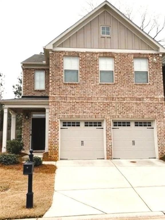
1962 Brightleaf Way
Marietta, GA 30060
Today
|
Edit
Favorites
678-521-3030
-
Bedrooms
3
-
Bathrooms
2.5
-
Square Feet
2,208 sq ft
-
Available
Available Dec 1
Highlights
- Media Room
- ENERGY STAR Certified Homes
- Home Energy Rating Service (HERS) Rated Property
- Dining Room Seats More Than Twelve
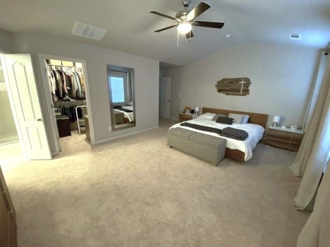
- Oversized primary bedroom
- Traditional Architecture
1962 Brightleaf Way

Favorites
About This Home
Available Dec 1
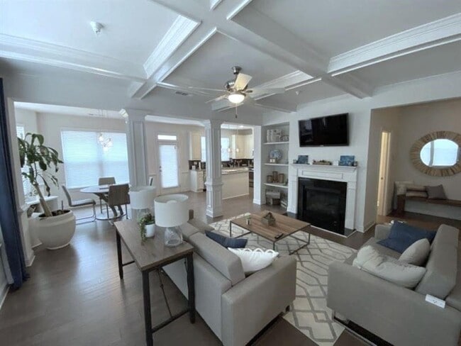
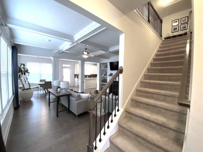
MINT CONDITION END UNIT Townhome- Available Dec 1. -Elegant decor-Grey tones- Plenty of space- 2nd family/flex room/play room on 2nd level. Hardwood floors and wall to wall carpet upstairs. Tile floors- walk in closets- Dimmer light system throughout as well as sensor lighting- Nest,alarm and Ring system. Pets welcomed. HOA neighborhood- swim,playground and clubhouse. Close to Braves Truist Park and Amenities- Easy access to 75,Windy Hill,Cobb Parkway. OCCUPIED- DO NOT DISTURB TENANTS.
1962 Brightleaf Way is a townhome located in Cobb County and the 30060 ZIP Code. This area is served by the Marietta City attendance zone.
* Price shown is base rent. Excludes user-selected optional fees and variable or usage-based fees and required charges due at or prior to move-in or at move-out. Price, availability, fees, and any applicable rent special are subject to change without notice.
* Square footage definitions vary. Displayed square footage is approximate.
Home Details
Home Type
Townhome
Year Built
Built in 2015
Bedrooms and Bathrooms
Oversized primary bedroom
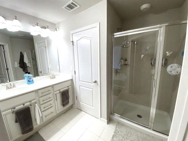
Vaulted Bathroom Ceilings
Separate Shower in Primary Bathroom
Dual Vanity Sinks in Primary Bathroom
Walk-In Closet
2.5 Bathrooms
3 Bedrooms
Eco-Friendly Details
ENERGY STAR Certified Homes
Home Energy Rating Service (HERS) Rated Property
Flooring
Wood
Ceramic Tile
Carpet
Home Design
Traditional Architecture
Three Sided Brick Exterior Elevation
Composition Roof
Home Security
Storm Windows
Security System Owned
Fire and Smoke Detector
Open Access
Interior Spaces
Media Room
Dining Room Seats More Than Twelve
Family Room with Fireplace
Loft
Bonus Room
Furnished
Game Room
Computer Room
Den
Keeping Room
Formal Dining Room
Shutters
Ceiling height of 9 feet on the main level
Entrance Foyer
Ceiling Fan
2,208 Sq Ft Home
Factory Built Fireplace
2-Story Property
Insulated Windows
Fireplace With Gas Starter
Kitchen
Stone Countertops
Walk-In Pantry
White Kitchen Cabinets
Open to Family Room
Kitchen Island
Gas Cooktop
Gas Oven
Microwave
Dishwasher
Disposal
Laundry
Laundry Room
Laundry in Hall
Laundry on upper level
Listing and Financial Details
Security Deposit $3,000
12 Month Lease Term
$50 Application Fee
Assessor Parcel Number 17066000700
Lot Details
1,742 Sq Ft Lot
No Common Walls
Corner Lot
Back Yard
Outdoor Features
Rear Porch
Patio
Parking
2 Car Attached Garage
Secured Garage or Parking
Front Facing Garage
Garage Door Opener
Schools
Dunleith Elementary School
Marietta Middle School
Marietta High School
Utilities
Forced Air Heating and Cooling System
Gas Water Heater
Cable TV Available
Underground Utilities
Community Details
Overview
Property has a Home Owners Association
Application Fee Required
Caswell Overlook Subdivision
Pet Policy
Pets Allowed
Pet Deposit $750
Recreation
Community Pool
Community Playground
Fees and Policies
The fees below are based on community-supplied data and may exclude additional fees and utilities.
- Dogs
- Allowed
- Cats
- Allowed
Property Fee Disclaimer: Based on community-supplied data and independent market research. Subject to change without notice. May exclude fees for mandatory or optional services and usage-based utilities.
Contact
- Listed by MAGDA I GOMEZ | RE/MAX Center
- Phone Number
- Contact
-
Source
 First Multiple Listing Service, Inc.
Copyright © 2025 First Multiple Listing Service, Inc. All rights reserved. All information provided by the listing agent/broker is deemed reliable but is not guaranteed and should be independently verified.
Location
Get Directions
Amenities
- Dishwasher
- Disposal
- Microwave
- Oven
- Range
- Refrigerator
Home to Kennesaw State University and the Dobbins Air Reserve Base, Southeast Marietta is split between a college town and a military base. Located just outside of Downtown Marietta, residents of the Southeast district have easy access to everything that makes Downtown so charming. From local breweries, restaurants, and bars to theaters, parks, and museums, Marietta has it all.
Southeast Marietta has directly access to Interstate 75, which will take you all the way into Downtown Atlanta, located about 15 miles southeast of town. Along the way, you’ll pass lively areas like Cumberland, Vinings, Buckhead, and Atlantic Station. The Fox Creek Golf Course & Driving Range sits at the edge of Southeast Marietta, and there’s a variety of supermarkets, retailers, and services within this neighborhood.
Learn more about living in Southeast Marietta
Education
| Colleges & Universities | Distance | ||
|---|---|---|---|
| Colleges & Universities | Distance | ||
| Drive: | 7 min | 2.9 mi | |
| Drive: | 12 min | 5.6 mi | |
| Drive: | 20 min | 10.6 mi | |
| Drive: | 24 min | 13.5 mi |
1962 Brightleaf Way is within 7 minutes or 2.9 miles from Life University. It is also near Chatt. Tech, Marietta and Argosy University, Atlanta.
Schools


Public Elementary & Middle School
Grades 6
663 Students
Attendance Zone
Public Elementary School
Grades K-5
562 Students
Attendance Zone
Public Middle School
Grades 6-8
1,222 Students
Nearby
Public Middle School
Grades 7-8
1,316 Students
Attendance Zone
Public High School
Grades 9-12
2,626 Students
Attendance Zone
Private Elementary, Middle & High School
Grades 5-12
23 Students
Nearby
Private Elementary & Middle School
Grades PK-8
134 Students
Nearby
Private Elementary School
Grades PK-K
18 Students
Nearby
School data provided by
 The GreatSchools Rating helps parents compare schools within a state based on a variety of school quality indicators and provides a helpful picture of how effectively each school serves all of its students. Ratings are on a scale of 1 (below average) to 10 (above average) and can include test scores, college readiness, academic progress, advanced courses, equity, discipline and attendance data. We also advise parents to visit schools, consider other information on school performance and programs, and consider family needs as part of the school selection process.
View GreatSchools Rating Methodology
Data provided by GreatSchools.org © 2025. All rights reserved.
View GreatSchools Rating Methodology
Data provided by GreatSchools.org © 2025. All rights reserved.
Transportation options available in Marietta include Medical Center, located 10.7 miles from 1962 Brightleaf Way. 1962 Brightleaf Way is near Hartsfield - Jackson Atlanta International, located 23.6 miles or 35 minutes away.
| Transit / Subway | Distance | ||
|---|---|---|---|
| Transit / Subway | Distance | ||
|
|
Drive: | 19 min | 10.7 mi |
|
|
Drive: | 19 min | 11.5 mi |
|
|
Drive: | 20 min | 11.7 mi |
|
|
Drive: | 23 min | 12.7 mi |
|
|
Drive: | 23 min | 16.0 mi |
| Commuter Rail | Distance | ||
|---|---|---|---|
| Commuter Rail | Distance | ||
|
|
Drive: | 19 min | 11.6 mi |
| Airports | Distance | ||
|---|---|---|---|
| Airports | Distance | ||
|
Hartsfield - Jackson Atlanta International
|
Drive: | 35 min | 23.6 mi |
Time and distance from 1962 Brightleaf Way.
| Shopping Centers | Distance | ||
|---|---|---|---|
| Shopping Centers | Distance | ||
| Walk: | 12 min | 0.7 mi | |
| Walk: | 14 min | 0.7 mi | |
| Walk: | 16 min | 0.8 mi |
1962 Brightleaf Way has 3 shopping centers within 0.8 mile, which is about a 16-minute walk. The miles and minutes will be for the farthest away property.
| Parks and Recreation | Distance | ||
|---|---|---|---|
| Parks and Recreation | Distance | ||
|
Chattahoochee River NRA - Cochran Shoals / Sope Creek
|
Drive: | 10 min | 5.0 mi |
|
Marietta Tree Keepers
|
Drive: | 12 min | 5.7 mi |
|
Silver Comet Trail
|
Drive: | 15 min | 7.8 mi |
|
Sandy Springs Historic Site
|
Drive: | 16 min | 8.9 mi |
|
Chastain Park
|
Drive: | 22 min | 9.6 mi |
1962 Brightleaf Way has 5 parks within 9.6 miles, including Chattahoochee River NRA - Cochran Shoals / Sope Creek, Marietta Tree Keepers, and Silver Comet Trail.
| Hospitals | Distance | ||
|---|---|---|---|
| Hospitals | Distance | ||
| Drive: | 12 min | 5.7 mi | |
| Drive: | 14 min | 6.6 mi | |
| Drive: | 18 min | 9.3 mi |
1962 Brightleaf Way has 3 hospitals within 9.3 miles, the nearest is Ridgeview Institute which is 5.7 miles away and a 12 minute drive.
| Military Bases | Distance | ||
|---|---|---|---|
| Military Bases | Distance | ||
| Drive: | 12 min | 5.0 mi | |
| Drive: | 29 min | 19.2 mi |
1962 Brightleaf Way is 5.0 miles from Dobbins Air Force Base, and is convenient to other military bases, including Fort McPherson.
You May Also Like
Similar Rentals Nearby


What Are Walk Score®, Transit Score®, and Bike Score® Ratings?
Walk Score® measures the walkability of any address. Transit Score® measures access to public transit. Bike Score® measures the bikeability of any address.
What is a Sound Score Rating?
A Sound Score Rating aggregates noise caused by vehicle traffic, airplane traffic and local sources

1962 Brightleaf Way
Marietta, GA 30060