
$800
Total Monthly Price
1961 S 23rd St Unit Lower Flat
Milwaukee, WI 53204
Favorites
1961 S 23rd St Unit Lower Flat

Favorites
Check Back Soon for Upcoming Availability
| Beds | Baths | Average SF |
|---|---|---|
| 2 Bedrooms 2 Bedrooms 2 Br | 1 Bath 1 Bath 1 Ba | 1,590 SF |
Fees and Policies
The fees listed below are community-provided and may exclude utilities or add-ons. All payments are made directly to the property and are non-refundable unless otherwise specified.
- Parking
-
Street--
Details
Utilities Included
-
Water
-
Trash Removal
-
Sewer
Property Information
-
2 units
About This Property
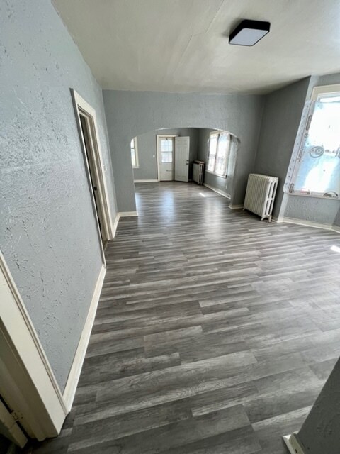
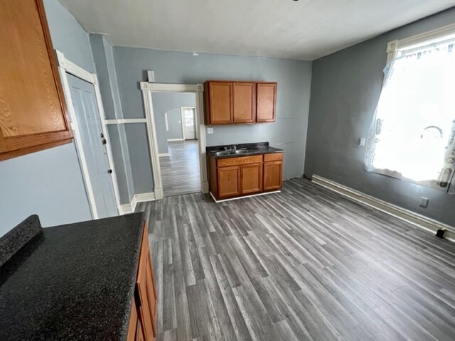
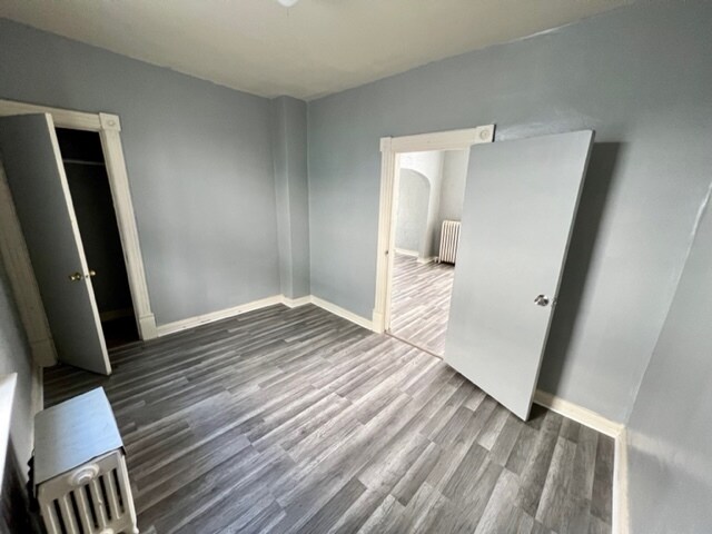
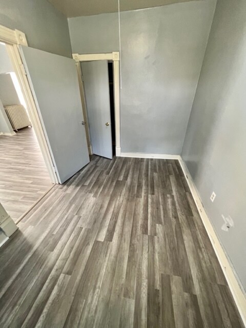
Large two bedroom lower flat. 23rd and Rogers. New flooring. Freshly painted.
1961 S 23rd St is an apartment community located in Milwaukee County and the 53204 ZIP Code.
Apartment Features
- Washer/Dryer Hookup
1961 S 23rd St,
Milwaukee,
WI
53204
Muskegg Way lies on Milwaukee's southwest side, four miles from the city's downtown restaurants and nightlife as well as the marvels of Milwaukee Harbor. Burnham Park is to the west and the Historic Mitchell Street area is to the east.
Muskegg Way provides residents affordable homes for rent, and its restaurants serve a wide range of cuisines. Locals love to visit La Caribena, which specializes in Latin American dishes such as aranitas and alcapurrias. For traditional Mexican cuisine, El Rey Sol serves up authentic regional dishes, including cochinita pibil and mole amarillo. Residents also visit the European Homemade Sausage Shop, which carries a rich variety of Euro-style sausages and deli offerings.
Learn more about living in Muskegg WayBelow are rent ranges for similar nearby apartments
Amenities
- Washer/Dryer Hookup
Expenses
Utilities Included
Water, Trash Removal, Sewer
Included
Education
| Colleges & Universities | Distance | ||
|---|---|---|---|
| Colleges & Universities | Distance | ||
| Drive: | 7 min | 2.6 mi | |
| Drive: | 7 min | 2.6 mi | |
| Drive: | 9 min | 3.3 mi | |
| Drive: | 10 min | 3.8 mi |
1961 S 23rd St Unit Lower Flat is within 7 minutes or 2.6 miles from Alverno College. It is also near Marquette University and Milwaukee Tech., Downtown.
Walkability Near 1961 S 23rd St Milwaukee, WI 53204
Getting Around
 What do Walkability, Transit, Drivability, and Bikeability mean?
Walkability measures the walking distance to day-to-day needs.
Transit measures access to public transportation.
Drivability measures congestion, parking availability, and access to major roads.
Bikeability measures the suitability for cycling.
How It Works
What do Walkability, Transit, Drivability, and Bikeability mean?
Walkability measures the walking distance to day-to-day needs.
Transit measures access to public transportation.
Drivability measures congestion, parking availability, and access to major roads.
Bikeability measures the suitability for cycling.
How It Works
Very Walkable
Walkability
80
/ 100
Some Public Transit
Transit
50
/ 100
Fairly Drivable
Drivability
50
/ 100
Moderately Bikeable
Bikeability
60
/ 100
Scores provided by
-
Soundscore™
-
/ 100
Traffic
-Airport
-Businesses
-Scores provided by
HowLoud What is a Sound Score Rating? A Sound Score Rating aggregates noise caused by vehicle traffic, airplane traffic and local sources. How It WorksYou May Also Like
Similar Rentals Nearby


What Are Walk Score®, Transit Score®, and Bike Score® Ratings?
Walk Score® measures the walkability of any address. Transit Score® measures access to public transit. Bike Score® measures the bikeability of any address.
What is a Sound Score Rating?
A Sound Score Rating aggregates noise caused by vehicle traffic, airplane traffic and local sources.

1961 S 23rd St
Milwaukee, WI 53204