

$4,150
/ Month
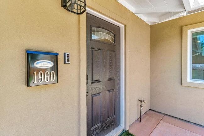
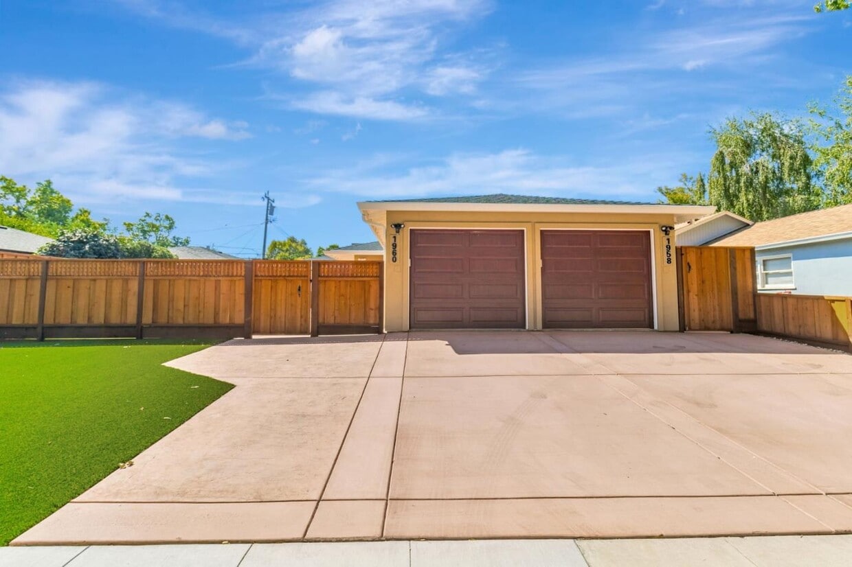
1958 Woodside Rd
Redwood City, CA 94061
Today
|
Edit
Favorites
-
Bedrooms
2
-
Bathrooms
1
-
Square Feet
1,000 sq ft
-
Available
Available Now
1958 Woodside Rd

Favorites
About This Home
Available Now
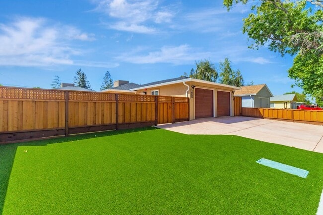
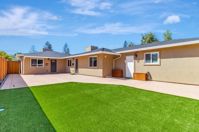
Newly renovated back unit of duplex (unit 1960 in the back of the property is currently available, unit 1958 in front has been leased) on a tree-lined frontage road adjacent to Woodside Road offering modern conveniences throughout. Each unit features 2 bedrooms, 1 bath. Inside, you'll discover a thoughtfully designed smart home featuring sleek stainless steel appliances, in-unit washer and dryer, and stylish finishes. Bright, open living spaces create an inviting atmosphere, perfect for both everyday comfort and entertaining. Large, low maintenance backyard. Prime west side Redwood City location close to amenities, public transportation, major freeways and neighborhood parks. Rent includes water. Worth a visit!
1958 Woodside Rd is a house located in San Mateo County and the 94061 ZIP Code. This area is served by the Redwood City Elementary attendance zone.
* Price shown is base rent. Excludes user-selected optional fees and variable or usage-based fees and required charges due at or prior to move-in or at move-out. Price, availability, fees, and any applicable rent special are subject to change without notice.
* Square footage definitions vary. Displayed square footage is approximate.
Home Details
Bedrooms and Bathrooms
1 Full Bathroom
2 Bedrooms
Interior Spaces
Dining Area
Vinyl Flooring
1,000 Sq Ft Home
1-Story Property
Kitchen
Electric Oven
Freezer
Dishwasher
Laundry
Washer and Dryer
Listing and Financial Details
Security Deposit $4,150
Property Available on 11/10/25
Rent includes sewer, water
Lot Details
6,752 Sq Ft Lot
Back Yard
Parking
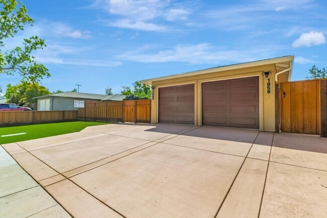
1 Car Attached Garage
Utilities
Tankless Water Heater
Forced Air Heating and Cooling System
Community Details
Overview
1,000 Sq Ft Building
Contact
- Listed by Denise Cronan | Cronan Real Estate Services, Inc.
- Contact
-
Source
 MLSListings Inc.
Copyright © 2025 MLSListings Inc.
Location
Get Directions
Redwood City, located in the heart of Silicon Valley, combines coastal living with a thriving tech economy. The downtown centers around the historic glass-domed courthouse and Courthouse Square, where residents enjoy entertainment at the Fox Theatre and community events throughout the year. The city offers diverse housing options, from established neighborhoods like Mount Carmel and Farm Hills to waterfront living in Redwood Shores. Current rental data shows one-bedroom apartments averaging $2,890 per month and two-bedroom units at $3,748 monthly.
Outdoor recreation abounds at Bair Island Ecological Preserve and Edgewood County Park, home to seasonal wildflower displays. The mild Mediterranean climate makes outdoor activities possible year-round. Major employers include Oracle, Electronic Arts, and Box, while Stanford Hospital provides healthcare services and Cañada College offers higher education opportunities.
Learn more about living in Redwood City
Education
| Colleges & Universities | Distance | ||
|---|---|---|---|
| Colleges & Universities | Distance | ||
| Drive: | 7 min | 3.1 mi | |
| Drive: | 9 min | 3.2 mi | |
| Drive: | 14 min | 5.0 mi | |
| Drive: | 20 min | 11.9 mi |
1958 Woodside Rd is within 7 minutes or 3.1 miles from Canada College. It is also near Menlo College and Stanford University.
Schools


Public Elementary School
Grades K-5
448 Students
Attendance Zone
Public Elementary School
Grades K-5
367 Students
Nearby
Public Middle School
Grades 6-8
706 Students
Attendance Zone
Public High School
Grades 9-12
1,694 Students
Attendance Zone
Private Elementary & Middle School
Grades PK-8
319 Students
Nearby
Private Elementary, Middle & High School
Grades PK-12
Nearby
School data provided by
 The GreatSchools Rating helps parents compare schools within a state based on a variety of school quality indicators and provides a helpful picture of how effectively each school serves all of its students. Ratings are on a scale of 1 (below average) to 10 (above average) and can include test scores, college readiness, academic progress, advanced courses, equity, discipline and attendance data. We also advise parents to visit schools, consider other information on school performance and programs, and consider family needs as part of the school selection process.
View GreatSchools Rating Methodology
Data provided by GreatSchools.org © 2025. All rights reserved.
View GreatSchools Rating Methodology
Data provided by GreatSchools.org © 2025. All rights reserved.
Transportation options available in Redwood City include Mountain View Station, located 14.6 miles from 1958 Woodside Rd. 1958 Woodside Rd is near San Francisco International, located 17.8 miles or 27 minutes away, and Norman Y Mineta San Jose International, located 21.8 miles or 31 minutes away.
| Transit / Subway | Distance | ||
|---|---|---|---|
| Transit / Subway | Distance | ||
| Drive: | 21 min | 14.6 mi | |
|
|
Drive: | 21 min | 14.7 mi |
| Commuter Rail | Distance | ||
|---|---|---|---|
| Commuter Rail | Distance | ||
| Drive: | 8 min | 3.3 mi | |
| Drive: | 10 min | 4.1 mi | |
| Drive: | 13 min | 5.2 mi | |
| Drive: | 13 min | 5.5 mi | |
| Drive: | 17 min | 7.0 mi |
| Airports | Distance | ||
|---|---|---|---|
| Airports | Distance | ||
|
San Francisco International
|
Drive: | 27 min | 17.8 mi |
|
Norman Y Mineta San Jose International
|
Drive: | 31 min | 21.8 mi |
Time and distance from 1958 Woodside Rd.
| Shopping Centers | Distance | ||
|---|---|---|---|
| Shopping Centers | Distance | ||
| Walk: | 7 min | 0.4 mi | |
| Drive: | 4 min | 1.5 mi | |
| Drive: | 5 min | 1.8 mi |
1958 Woodside Rd has 3 shopping centers within 1.8 miles, which is about a 5-minute walk. The miles and minutes will be for the farthest away property.
| Parks and Recreation | Distance | ||
|---|---|---|---|
| Parks and Recreation | Distance | ||
|
Stulsaft Park
|
Drive: | 5 min | 2.0 mi |
|
Sharon Hills Park
|
Drive: | 5 min | 2.1 mi |
|
Red Morton Park
|
Drive: | 6 min | 2.3 mi |
|
Sharon Park
|
Drive: | 8 min | 2.9 mi |
|
Holbrook-Palmer Park
|
Drive: | 10 min | 3.7 mi |
1958 Woodside Rd has 5 parks within 3.7 miles, including Stulsaft Park, Red Morton Park, and Sharon Hills Park.
| Hospitals | Distance | ||
|---|---|---|---|
| Hospitals | Distance | ||
| Drive: | 7 min | 2.8 mi | |
| Drive: | 8 min | 3.4 mi | |
| Drive: | 10 min | 4.0 mi |
1958 Woodside Rd has 3 hospitals within 4.0 miles, the nearest is Sequoia Hospital which is 2.8 miles away and a 7 minute drive.
| Military Bases | Distance | ||
|---|---|---|---|
| Military Bases | Distance | ||
| Drive: | 24 min | 14.7 mi |
1958 Woodside Rd is 14.7 miles and a 24 minute drive from Ames Research Center.
You May Also Like
Similar Rentals Nearby


What Are Walk Score®, Transit Score®, and Bike Score® Ratings?
Walk Score® measures the walkability of any address. Transit Score® measures access to public transit. Bike Score® measures the bikeability of any address.
What is a Sound Score Rating?
A Sound Score Rating aggregates noise caused by vehicle traffic, airplane traffic and local sources
1958 Woodside Rd
Redwood City, CA 94061