
$1,100
/ Month
19430 U.S. Rt. 66
Phillipsburg, MO 65722
2 Weeks Ago
|
Edit
Favorites
19430 U.S. Rt. 66

Favorites
Check Back Soon for Upcoming Availability
| Beds | Baths | Average SF |
|---|---|---|
| 3 Bedrooms 3 Bedrooms 3 Br | 2 Baths 2 Baths 2 Ba | 1,200 SF |
About This Property
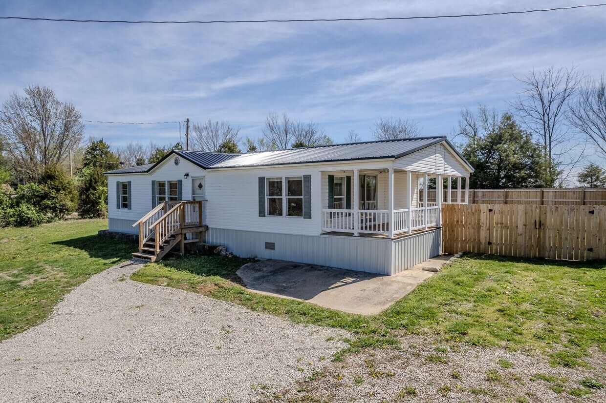
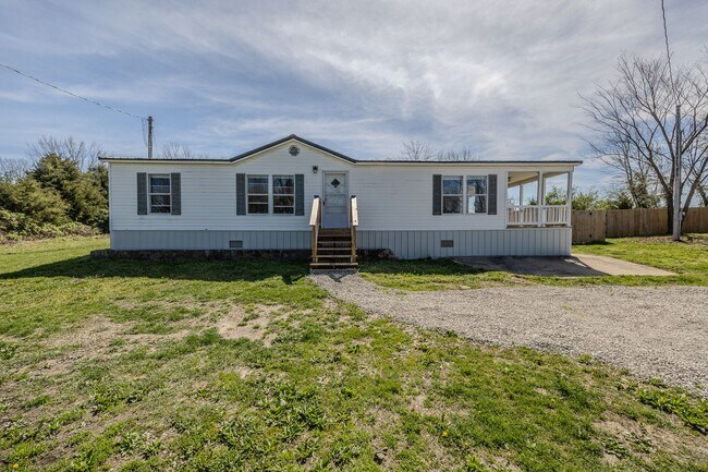
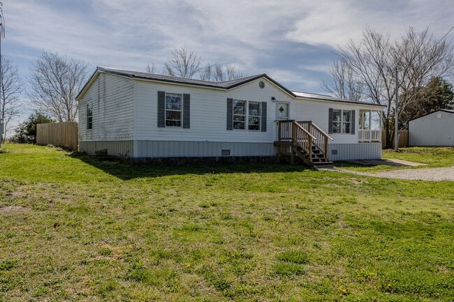
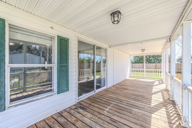
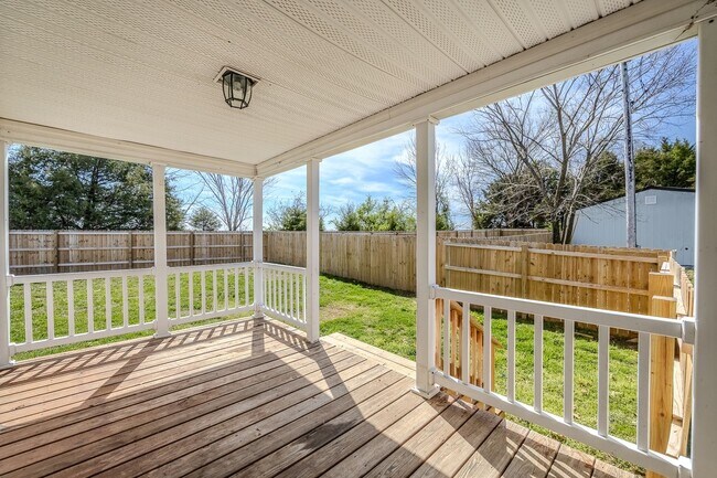
19430 Hwy W $1,100 Month/$1,100 Deposit 3 bedroom, 2 bath mobile home. Located off Highway W in Phillipsburg- in Joel E Barber school district. All electric, appliances included, washer/ dryer hook-ups. Beautiful updates including paint and vinyl flooring throughout. Large privacy-fenced back yard. Will allow pet with non-refundable pet fee. No Smoking. 1 Year Lease. Schedule your viewing today with Lebanon Property Management by calling . To apply, simply visit our website at or stop by our office at 205 East Commercial St in Lebanon and grab an application in-person.
19430 U.S. Rt. 66 is a house located in Laclede County and the 65722 ZIP Code. This area is served by the Lebanon R-Iii School District attendance zone.
19430 U.S. Rt. 66,
Phillipsburg,
MO
65722
Education
Schools


Public Elementary & Middle School
Grades PK-8
500 Students
Nearby
Public Elementary School
Grades K-5
558 Students
Attendance Zone
Public Elementary School
Grades K-5
578 Students
Attendance Zone
Public Middle School
Grades 6-8
921 Students
Attendance Zone
Public High School
Grades 9-12
1,474 Students
Attendance Zone
Private Elementary & Middle School
Grades K-8
35 Students
Nearby
Private Elementary, Middle & High School
Grades K-12
14 Students
Nearby
School data provided by
 The GreatSchools Rating helps parents compare schools within a state based on a variety of school quality indicators and provides a helpful picture of how effectively each school serves all of its students. Ratings are on a scale of 1 (below average) to 10 (above average) and can include test scores, college readiness, academic progress, advanced courses, equity, discipline and attendance data. We also advise parents to visit schools, consider other information on school performance and programs, and consider family needs as part of the school selection process.
View GreatSchools Rating Methodology
Data provided by GreatSchools.org © 2026. All rights reserved.
View GreatSchools Rating Methodology
Data provided by GreatSchools.org © 2026. All rights reserved.
Walkability Near 19430 U.S. Rt. 66 Phillipsburg, MO 65722
Getting Around
 What do Walkability, Transit, Drivability, and Bikeability mean?
Walkability measures the walking distance to day-to-day needs.
Transit measures access to public transportation.
Drivability measures congestion, parking availability, and access to major roads.
Bikeability measures the suitability for cycling.
How It Works
What do Walkability, Transit, Drivability, and Bikeability mean?
Walkability measures the walking distance to day-to-day needs.
Transit measures access to public transportation.
Drivability measures congestion, parking availability, and access to major roads.
Bikeability measures the suitability for cycling.
How It Works
Not Walkable
Walkability
0
/ 100
Exceptionally Drivable
Drivability
100
/ 100
Not Bikeable
Bikeability
10
/ 100
Scores provided by
-
Soundscore™
-
/ 100
Traffic
-Airport
-Businesses
-Scores provided by
HowLoud What is a Sound Score Rating? A Sound Score Rating aggregates noise caused by vehicle traffic, airplane traffic and local sources. How It WorksSimilar Rentals Nearby


What Are Walk Score®, Transit Score®, and Bike Score® Ratings?
Walk Score® measures the walkability of any address. Transit Score® measures access to public transit. Bike Score® measures the bikeability of any address.
What is a Sound Score Rating?
A Sound Score Rating aggregates noise caused by vehicle traffic, airplane traffic and local sources.

19430 U.S. Rt. 66
Phillipsburg, MO 65722