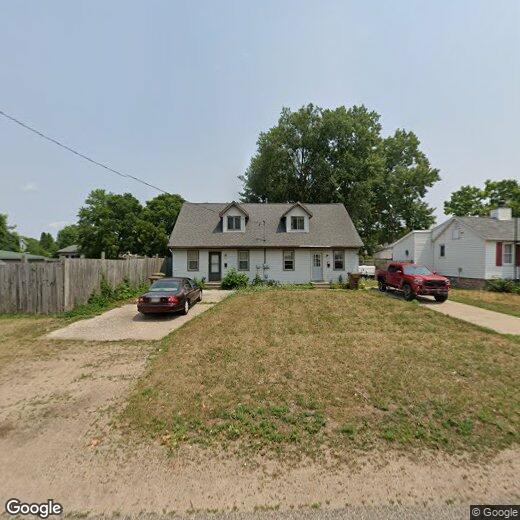
$1,100 / Month

1939-1941 Wood St

,

Stevens Point, WI 54481

Share Listing
Favorites
715-570-9717
  • Bedrooms

    2

  • Bathrooms

    1

  • Square Feet

    858 sq ft

  • Available

    Available Jul 6

1939-1941 Wood St
Share Listing
Favorites

Contact

  • Listed by H10 LLC | H10 LLC
  • Phone Number
  • Contact
| Edit

Under 30 minutes

Commute Time is calculated at rush hour.
City - Stevens Point

Sitting at the heart of the Wisconsin River Valley, Stevens Point moves at a pace that makes it easy to actually enjoy where you live. The 27-mile Green Circle Trail connects parks, wetlands, and riverbanks, making getting outside feel less like an event and more like a Tuesday. Downtown pulses with local breweries, farmers markets, and a growing arts scene that keeps weekends interesting without requiring a long drive.

The University of Wisconsin–Stevens Point anchors the city with energy and culture, offering performances, gallery shows, and lectures open to the community. Neighborhoods near campus blend older Craftsman-style homes with updated rentals, while other areas offer quieter streets. Renters will find apartments, townhomes, and garden-style buildings at some of the state's most accessible price points.

Learn more about living in Stevens Point 
Education
Colleges & Universities Distance
Drive: 3 min 1.3 mi
1939-1941 Wood St is within 3 minutes or 1.3 miles from Univ of Wisc., Stevens Point.
Schools
Public Elementary School
Grades K-5
271 Students
Attendance Zone
Public Elementary School
Grades K-5
356 Students
Attendance Zone
Grades PK-5
208 Students
Nearby
Public Middle School
Grades 6-8
661 Students
Attendance Zone
Grades 9-12
1,462 Students
Attendance Zone
Private Elementary & Middle School
Grades PK-8
149 Students
Nearby
Private Elementary, Middle & High School
Grades PK-12
596 Students
Nearby
Transportation

1939-1941 Wood St is near Central Wisconsin, located 19.7 miles or 26 minutes away.

Airports Distance
Airports Distance
Central Wisconsin
Drive: 26 min 19.7 mi
Getting Around
Fairly Walkable
Walkability
40 / 100
Very Drivable
Drivability
80 / 100
Moderately Bikeable
Bikeability
70 / 100

Scores provided by

What do Walkability, Transit, Drivability, and Bikeability mean? Walkability measures the walking distance to day-to-day needs. Transit measures access to public transportation. Drivability measures congestion, parking availability, and access to major roads. Bikeability measures the suitability for cycling. How It Works
-
Soundscore
- / 100

Traffic

-

Airport

-

Businesses

-

Scores provided by

HowLoud What is a Sound Score Rating? A Sound Score Rating aggregates noise caused by vehicle traffic, airplane traffic and local sources. How It Works
Points of Interest

Time and distance from 1939-1941 Wood St.

Shopping Centers Distance
Drive: 4 min 1.2 mi
Drive: 3 min 1.3 mi
Drive: 3 min 1.5 mi
1939-1941 Wood St has 3 shopping centers within 1.5 miles, which is about a 3-minute drive. The miles and minutes will be for the farthest away property.
Parks and Recreation Distance
Central Wisconsin Children's Museum
Walk: 15 min 0.8 mi
Allen F. Blocher Planetarium and UWSP Observatory
Drive: 3 min 1.2 mi
The Museum of Natural History, Stevens Point
Drive: 3 min 1.3 mi
Schmeeckle Reserve
Drive: 6 min 2.7 mi
Jordan Park
Drive: 13 min 6.4 mi
1939-1941 Wood St has 5 parks within 6.4 miles, including Central Wisconsin Children's Museum, Allen F. Blocher Planetarium and UWSP Observatory, and The Museum of Natural History, Stevens Point.
Hospitals Distance
Hospitals Distance
Drive: 4 min 1.5 mi
1939-1941 Wood St is 1.5 miles and a 4 minute drive from St. Michael's Hospital.
Military Bases Distance
Drive: 121 min 77.7 mi
1939-1941 Wood St is 77.7 miles and a 121 minute drive from Fort McCoy.

Similar Rentals Nearby