

$1,795 / Month
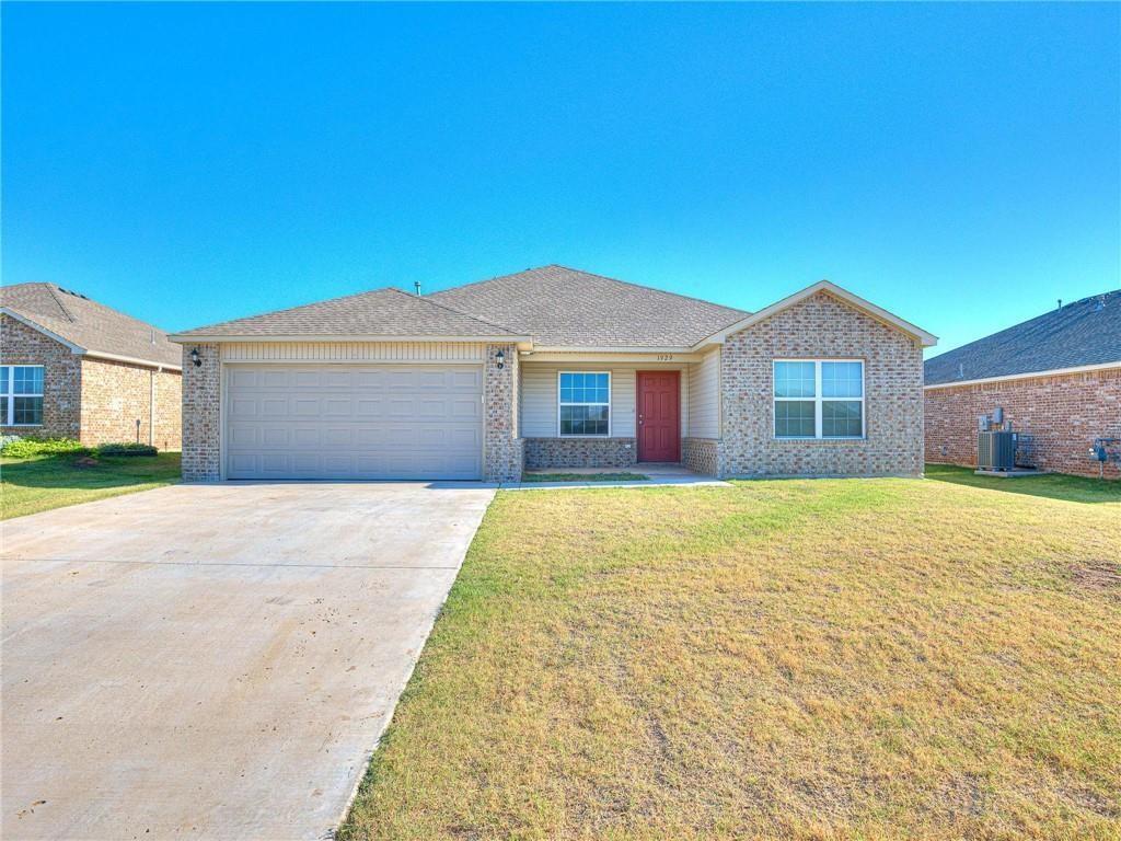
1929 West Antler Way
Mustang, OK 73064
Today
Favorites
405-406-1419
-
Bedrooms
4
-
Bathrooms
2
-
Square Feet
1,691 sq ft
-
Available
Available Now
Highlight
- Interior Lot
1929 West Antler Way

Favorites
About This Home
Available Now
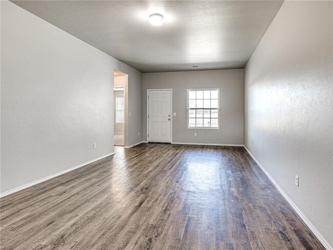
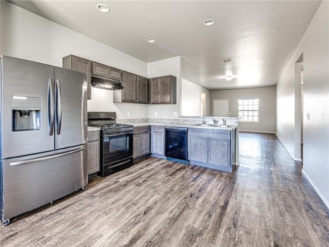
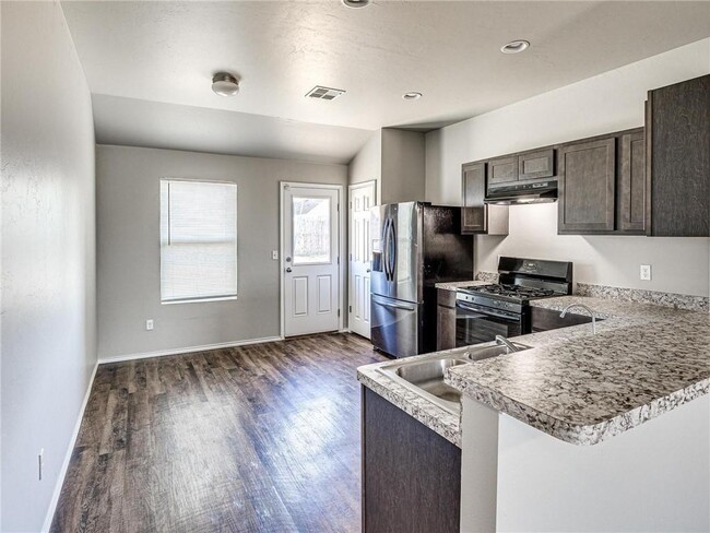
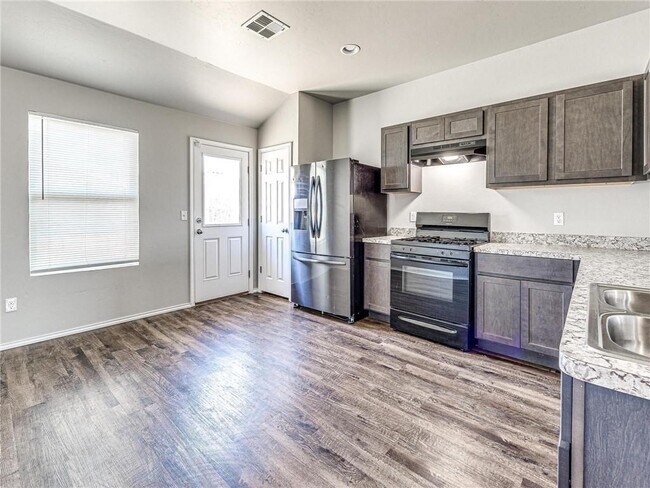
Beautifully maintained and in a sought after neighborhood with excellent school systems. This home boasts Laminate flooring in the open floor plan with dining and kitchen and eat-in bar. Storage galore with pantry and walking closet in master. Carpet in all bedrooms and a rare find for four bedrooms. Call Today!
1929 West Antler Way is a house located in Canadian County and the 73064 ZIP Code. This area is served by the Mustang attendance zone.
* Price shown is base rent and may not include non-optional fees and utilities.
Price, availability, fees, and any applicable rent special are subject to change without notice.
* Square footage definitions vary. Displayed square footage is approximate.
Home Details
Home Type
Single Family Detached Home
Year Built
Built in 2020
Bedrooms and Bathrooms
2 Full Bathrooms
4 Bedrooms
Home Design
Brick Exterior Construction
Composition Roof
Interior Spaces
1,691 Sq Ft Home
Lot Details
7,213 Sq Ft Lot
Interior Lot
Schools
Mustang Centennial Elementary School
Canyon Ridge IES Middle School
Mustang High School
Community Details
Contact
- Listed by Susan Carroll | MELROSE REALTY LLC
- Phone Number
- Contact
-
Source
 Oklahoma City Metropolitan Association of REALTORS®/MLSOK
Listing Content: Copyright© 2025 MLSOK, Inc. listing content is believed to be accurate but is not guaranteed. Subject to verification by all parties. The listing information being provided is for consumers’ personal, non-commercial use and may not be used for any purpose other than to identify prospective properties consumers may be interested in purchasing. This listing data is copyrighted and may not be transmitted, retransmitted, copied, framed, repurposed, or altered in any way for any other site, individual and/or purpose without the express written permission of MLSOK, Inc. Information last updated on 12/31/2024.
Location
Get Directions
As its name suggests, Southwest Oklahoma City is a neighborhood west of Oklahoma City that stretches from the Canadian River to Highway 66. Most of this community includes open spaces and farmland, but the closer to the city you travel, the more populated the area becomes. Residential neighborhoods and modern shops and restaurants can be found in the eastern sections of town. Renters can find several options for affordable apartments, single-family homes, and townhomes here too. Major roads like Interstate 40 allow for easy travel in and out of the neighborhood, and the Will Rogers World Airport, located just outside of the southeastern corner of the neighborhood, makes farther travel accessible.
Learn more about living in Southwest Oklahoma City
Education
| Colleges & Universities | Distance | ||
|---|---|---|---|
| Colleges & Universities | Distance | ||
| Drive: | 22 min | 14.5 mi | |
| Drive: | 22 min | 15.1 mi | |
| Drive: | 22 min | 15.2 mi | |
| Drive: | 29 min | 18.9 mi |
1929 West Antler Way is within 22 minutes or 14.5 miles from Okla. City Comm. Coll.. It is also near OSU-Oklahoma City and Southern Nazarene University.
Schools


Public Elementary School
Grades PK-4
643 Students
Nearby
Public Elementary School
Grades 5-6
702 Students
Attendance Zone
Public Elementary School
Grades PK-4
673 Students
Attendance Zone
Public Middle School
Grades 7-8
723 Students
Attendance Zone
Public High School
Grades 9-12
3,756 Students
Attendance Zone
Private Elementary, Middle & High School
Grades PK-12
Nearby
Private Elementary School
Grades PK-6
Nearby
School data provided by
 The GreatSchools Rating helps parents compare schools within a state based on a variety of school quality indicators and provides a helpful picture of how effectively each school serves all of its students. Ratings are on a scale of 1 (below average) to 10 (above average) and can include test scores, college readiness, academic progress, advanced courses, equity, discipline and attendance data. We also advise parents to visit schools, consider other information on school performance and programs, and consider family needs as part of the school selection process.
View GreatSchools Rating Methodology
Data provided by GreatSchools.org © 2025. All rights reserved.
View GreatSchools Rating Methodology
Data provided by GreatSchools.org © 2025. All rights reserved.
You May Also Like
Similar Rentals Nearby


What Are Walk Score®, Transit Score®, and Bike Score® Ratings?
Walk Score® measures the walkability of any address. Transit Score® measures access to public transit. Bike Score® measures the bikeability of any address.
What is a Sound Score Rating?
A Sound Score Rating aggregates noise caused by vehicle traffic, airplane traffic and local sources
1929 West Antler Way
Mustang, OK 73064