

$6,250
/ Month
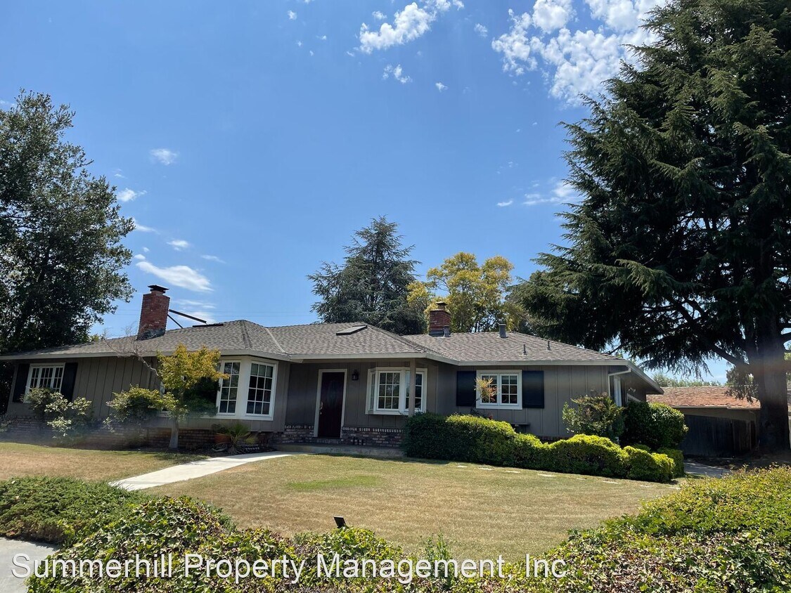
1927 Newcastle Dr
Los Altos, CA 94024
2 Weeks Ago
Favorites
1927 Newcastle Dr

Favorites
Check Back Soon for Upcoming Availability
| Beds | Baths | Average SF |
|---|---|---|
| 3 Bedrooms 3 Bedrooms 3 Br | 2 Baths 2 Baths 2 Ba | 1,699 SF |
About This Property
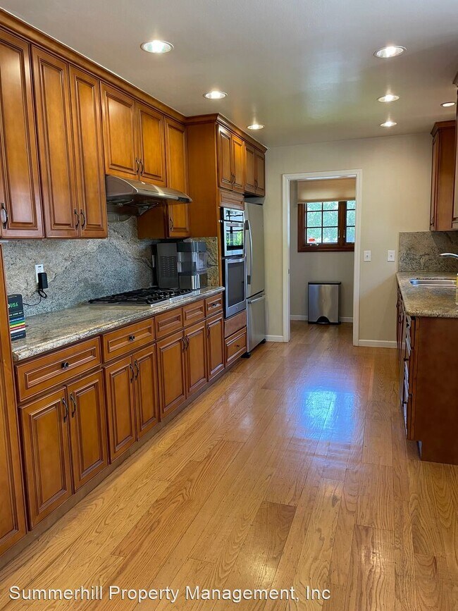
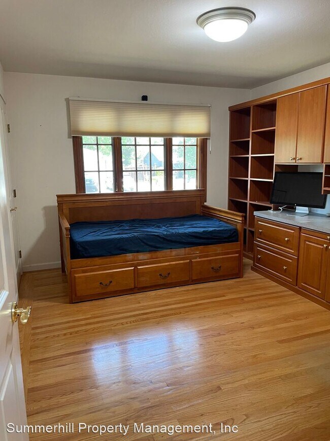
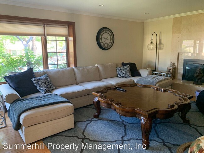
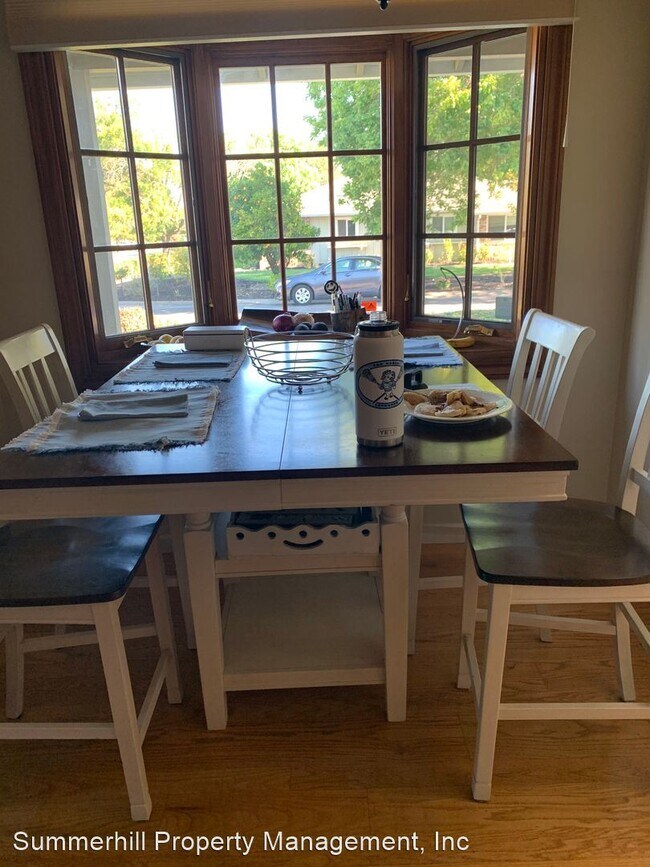
(650) 815-8588 - Fabulous South Los Altos home, convenient location, easy commute, walk to park and library!! - Spacious and comfortable! Beautiful formal living room and full formal dining room. Chef's kitchen with stainless appliances, loads of counter space, dine-in area. This kitchen will call out the chef in your soul! Gleaming hardwood floors throughout the home. Master suite with en-suite bathroom, plenty of closet space, sliding doors open to the patio. Two nice size guest rooms, hall bath with a tub. Dedicated laundry room. Two car garage, with plenty of room to actually PARK a car in the garage and have storage space! Fully fenced backyard. Public Schools: Montclaire Elementary Grades: K-5 Distance: 0.8 mi Rated 9/10 Cupertino Middle Grades: 6-8 Distance: 0.8 mi Rated 8/10 Homestead High Grades: 9-12 Distance: 1.4 mi Rated 8/10 (Tenant to verify availability and school schedules) Several private and parochial schools close by also. Please: No pets, (service animals of course exempt) no smoking. Call Teri Berwick (BRE 01705674) at 650 815 8588 for an appointment to view. Professionally managed by Summerhill Property Management, Inc. (BRE 01523660) (RLNE6824584)
1927 Newcastle Dr is a house located in Santa Clara County and the 94024 ZIP Code. This area is served by the Cupertino Union attendance zone.
Location
Get Directions
Los Altos likes to strike a balance between the urbanized atmosphere of the Bay Area and the more rural environment of the wide-open spaces bordering the city’s southwest side. While it is mainly a residential community, the downtown area surrounding Main Street is a walkable shopping and dining district with tree-lined streets and several public parks nearby. The crime rate is quite low and the local schools are among the highest-performing in the state. Palo Alto is right next door and San Jose just a few minutes down the road, giving Los Altos residents convenient access to Silicon Valley’s greatest amenities.
Learn more about living in Los AltosBelow are rent ranges for similar nearby apartments
Education
| Colleges & Universities | Distance | ||
|---|---|---|---|
| Colleges & Universities | Distance | ||
| Drive: | 8 min | 3.2 mi | |
| Drive: | 9 min | 5.3 mi | |
| Drive: | 13 min | 7.5 mi | |
| Drive: | 14 min | 8.1 mi |
1927 Newcastle Dr is within 8 minutes or 3.2 miles from De Anza College. It is also near Foothill Coll., Los Altos and Foothill College, Middlefield.
Schools


Public Elementary School
Grades K-5
367 Students
Nearby
Public Elementary School
Grades K-5
382 Students
Attendance Zone
Public Middle School
Grades 6-8
1,099 Students
Attendance Zone
Public High School
Grades 9-12
2,311 Students
Attendance Zone
Private Elementary & Middle School
Grades PK-8
247 Students
Nearby
Private Elementary, Middle & High School
Grades K-12
Nearby
Private Elementary & Middle School
Grades PK-8
500 Students
Nearby
School data provided by
 The GreatSchools Rating helps parents compare schools within a state based on a variety of school quality indicators and provides a helpful picture of how effectively each school serves all of its students. Ratings are on a scale of 1 (below average) to 10 (above average) and can include test scores, college readiness, academic progress, advanced courses, equity, discipline and attendance data. We also advise parents to visit schools, consider other information on school performance and programs, and consider family needs as part of the school selection process.
View GreatSchools Rating Methodology
Data provided by GreatSchools.org © 2025. All rights reserved.
View GreatSchools Rating Methodology
Data provided by GreatSchools.org © 2025. All rights reserved.
Transportation options available in Los Altos include Whisman Station, located 4.6 miles from 1927 Newcastle Dr. 1927 Newcastle Dr is near Norman Y Mineta San Jose International, located 12.8 miles or 19 minutes away, and San Francisco International, located 29.4 miles or 38 minutes away.
| Transit / Subway | Distance | ||
|---|---|---|---|
| Transit / Subway | Distance | ||
|
|
Drive: | 9 min | 4.6 mi |
| Drive: | 9 min | 4.6 mi | |
|
|
Drive: | 9 min | 4.6 mi |
|
|
Drive: | 9 min | 4.9 mi |
|
|
Drive: | 11 min | 6.2 mi |
| Commuter Rail | Distance | ||
|---|---|---|---|
| Commuter Rail | Distance | ||
| Drive: | 9 min | 4.4 mi | |
| Drive: | 8 min | 4.4 mi | |
| Drive: | 11 min | 4.6 mi | |
| Drive: | 11 min | 6.1 mi | |
| Drive: | 14 min | 6.4 mi |
| Airports | Distance | ||
|---|---|---|---|
| Airports | Distance | ||
|
Norman Y Mineta San Jose International
|
Drive: | 19 min | 12.8 mi |
|
San Francisco International
|
Drive: | 38 min | 29.4 mi |
Time and distance from 1927 Newcastle Dr.
| Shopping Centers | Distance | ||
|---|---|---|---|
| Shopping Centers | Distance | ||
| Walk: | 14 min | 0.8 mi | |
| Drive: | 4 min | 1.7 mi | |
| Drive: | 4 min | 1.8 mi |
1927 Newcastle Dr has 3 shopping centers within 1.8 miles, which is about a 4-minute walk. The miles and minutes will be for the farthest away property.
| Parks and Recreation | Distance | ||
|---|---|---|---|
| Parks and Recreation | Distance | ||
|
Deer Hollow Farm
|
Drive: | 6 min | 2.4 mi |
|
Rancho San Antonio County Park
|
Drive: | 7 min | 2.5 mi |
|
McClellan Ranch Park
|
Drive: | 7 min | 2.8 mi |
|
Fujitsu Planetarium
|
Drive: | 8 min | 3.2 mi |
|
Fremont Older Open Space Preserve
|
Drive: | 13 min | 5.1 mi |
1927 Newcastle Dr has 5 parks within 5.1 miles, including Deer Hollow Farm, Rancho San Antonio County Park, and McClellan Ranch Park.
| Hospitals | Distance | ||
|---|---|---|---|
| Hospitals | Distance | ||
| Drive: | 6 min | 2.3 mi | |
| Drive: | 10 min | 5.6 mi | |
| Drive: | 10 min | 6.0 mi |
1927 Newcastle Dr has 3 hospitals within 6.0 miles, the nearest is El Camino Hospital which is 2.3 miles away and a 6 minute drive.
| Military Bases | Distance | ||
|---|---|---|---|
| Military Bases | Distance | ||
| Drive: | 13 min | 6.3 mi |
1927 Newcastle Dr is 6.3 miles and a 13 minute drive from Ames Research Center.
You May Also Like
Similar Rentals Nearby


What Are Walk Score®, Transit Score®, and Bike Score® Ratings?
Walk Score® measures the walkability of any address. Transit Score® measures access to public transit. Bike Score® measures the bikeability of any address.
What is a Sound Score Rating?
A Sound Score Rating aggregates noise caused by vehicle traffic, airplane traffic and local sources
1927 Newcastle Dr
Los Altos, CA 94024