
$1,595
/ Month
1920 Janet Ln
Decatur, GA 30035
Today
|
Edit
Favorites
404-591-5135
-
Bedrooms
3
-
Bathrooms
2
-
Square Feet
1,069 sq ft
-
Available
Available Now
1920 Janet Ln

Favorites
About This Home
$1,500 deposit,
Available Now
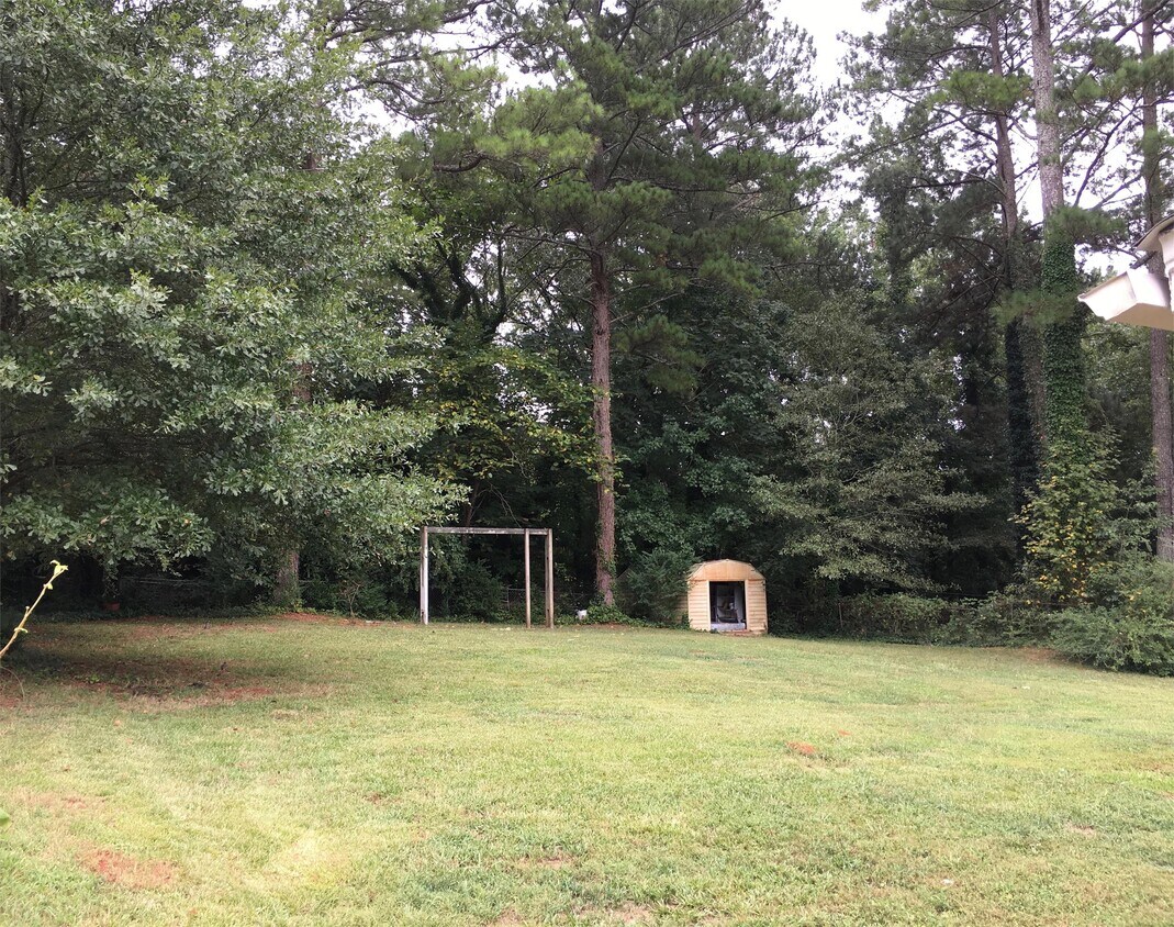
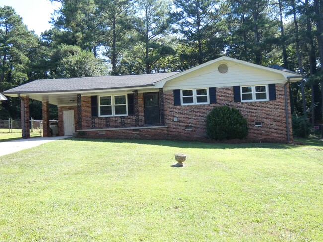
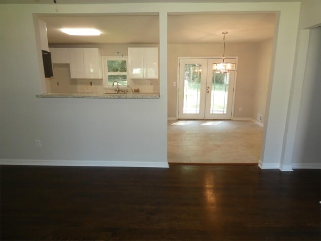
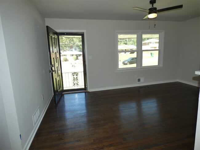
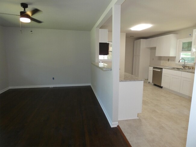
All brick, 3 bedroom, 2 full bath home conveniently located near I-285 and I-20. Features hardwood floors, modern kitchen and bathrooms, and large private back yard. Rental Qualifications: -Income 3x rent -No eviction in previous 2 years -No landlord collections -No utility collections -No felonies in previous 7 years -No active bankruptcy To apply: All brick. Private Yard
1920 Janet Ln is a house located in DeKalb County and the 30035 ZIP Code. This area is served by the DeKalb County attendance zone.
* Price shown is base rent. Excludes user-selected optional fees and variable or usage-based fees and required charges due at or prior to move-in or at move-out. Price, availability, fees, and any applicable rent special are subject to change without notice.
* Square footage definitions vary. Displayed square footage is approximate.
House Features
Air Conditioning
Dishwasher
Hardwood Floors
Microwave
- Air Conditioning
- Dishwasher
- Microwave
- Range
- Hardwood Floors
- Balcony
Fees and Policies
The fees below are based on community-supplied data and may exclude additional fees and utilities.
- One-Time Move-In Fees
-
Security Deposit Refundable - Refundable$1,500
- Parking
-
Covered--
Contact
- Listed by Leasing Manager
- Phone Number
- Contact
Location
Get Directions
Amenities
- Air Conditioning
- Dishwasher
- Microwave
- Range
- Hardwood Floors
- Balcony
Southeast DeKalb refers to a sprawling region in the southeastern portion of DeKalb County. Among the many communities in this area are the communities of Clarkston, Stone Mountain, Lithonia, Panthersville, Gresham Park, and Sheffield Woods.
Each community in this region has its own distinct character. Southeast DeKalb offers ample opportunities for outdoor recreation at destinations such as Stone Mountain Park, Panola Mountain State Park, and Arabia Mountain National Heritage Area. Southeast DeKalb sits within easy driving distance of all that Greater Atlanta has to offer, with close proximity to major thoroughfares like I-285, I-20, and U.S. 278.
Learn more about living in Southeast DeKalb
Education
| Colleges & Universities | Distance | ||
|---|---|---|---|
| Colleges & Universities | Distance | ||
| Drive: | 10 min | 5.4 mi | |
| Drive: | 11 min | 5.9 mi | |
| Drive: | 11 min | 6.6 mi | |
| Drive: | 15 min | 8.5 mi |
1920 Janet Ln is within 10 minutes or 5.4 miles from Georgia Perim., Clarkston. It is also near Agnes Scott College and Georgia Perim. Coll., Decatur.
Schools


Public Elementary School
Grades PK-5
461 Students
Attendance Zone
Public Middle School
Grades 6-8
718 Students
Attendance Zone
Public High School
Grades 9-12
764 Students
Attendance Zone
Private Elementary School
Grades K-1
Nearby
Private Elementary, Middle & High School
Grades K-1, 5-7 & 9-11
Nearby
Private Elementary School
Grades PK-1
Nearby
Private Elementary School
Grades PK-2
Nearby
Private Elementary, Middle & High School
Grades 3-12
Nearby
School data provided by
 The GreatSchools Rating helps parents compare schools within a state based on a variety of school quality indicators and provides a helpful picture of how effectively each school serves all of its students. Ratings are on a scale of 1 (below average) to 10 (above average) and can include test scores, college readiness, academic progress, advanced courses, equity, discipline and attendance data. We also advise parents to visit schools, consider other information on school performance and programs, and consider family needs as part of the school selection process.
View GreatSchools Rating Methodology
Data provided by GreatSchools.org © 2026. All rights reserved.
View GreatSchools Rating Methodology
Data provided by GreatSchools.org © 2026. All rights reserved.
Transportation options available in Decatur include Indian Creek, located 3.0 miles from 1920 Janet Ln. 1920 Janet Ln is near Hartsfield - Jackson Atlanta International, located 16.0 miles or 25 minutes away.
| Transit / Subway | Distance | ||
|---|---|---|---|
| Transit / Subway | Distance | ||
|
|
Drive: | 5 min | 3.0 mi |
|
|
Drive: | 8 min | 4.0 mi |
|
|
Drive: | 10 min | 5.6 mi |
|
|
Drive: | 11 min | 6.4 mi |
|
|
Drive: | 12 min | 7.3 mi |
| Commuter Rail | Distance | ||
|---|---|---|---|
| Commuter Rail | Distance | ||
|
|
Drive: | 25 min | 16.5 mi |
| Airports | Distance | ||
|---|---|---|---|
| Airports | Distance | ||
|
Hartsfield - Jackson Atlanta International
|
Drive: | 25 min | 16.0 mi |
Time and distance from 1920 Janet Ln.
| Shopping Centers | Distance | ||
|---|---|---|---|
| Shopping Centers | Distance | ||
| Walk: | 15 min | 0.8 mi | |
| Walk: | 17 min | 0.9 mi | |
| Walk: | 20 min | 1.1 mi |
1920 Janet Ln has 3 shopping centers within 1.1 miles, which is about a 20-minute walk. The miles and minutes will be for the farthest away property.
| Parks and Recreation | Distance | ||
|---|---|---|---|
| Parks and Recreation | Distance | ||
|
Ferns of the World Garden
|
Drive: | 9 min | 5.6 mi |
|
Glenn Creek Nature Preserve
|
Drive: | 11 min | 6.0 mi |
|
Bradley Observatory
|
Drive: | 10 min | 6.3 mi |
|
Forty Oaks Nature Preserve
|
Drive: | 10 min | 6.6 mi |
|
Wylde Center and Oakhurst Community Garden
|
Drive: | 12 min | 6.9 mi |
1920 Janet Ln has 5 parks within 6.9 miles, including Wylde Center and Oakhurst Community Garden, Bradley Observatory, and Ferns of the World Garden.
| Hospitals | Distance | ||
|---|---|---|---|
| Hospitals | Distance | ||
| Drive: | 9 min | 5.3 mi | |
| Drive: | 10 min | 5.7 mi | |
| Drive: | 12 min | 7.1 mi |
1920 Janet Ln has 3 hospitals within 7.1 miles, the nearest is Georgia Regional Hospital Atlanta which is 5.3 miles away and a 9 minute drive.
| Military Bases | Distance | ||
|---|---|---|---|
| Military Bases | Distance | ||
| Drive: | 21 min | 13.7 mi | |
| Drive: | 25 min | 16.9 mi |
1920 Janet Ln is 13.7 miles from Fort Gillem, and is convenient to other military bases, including Fort McPherson.
You May Also Like
Similar Rentals Nearby
-
-
-
-
1 / 58

-
-
-
-
-
-


What Are Walk Score®, Transit Score®, and Bike Score® Ratings?
Walk Score® measures the walkability of any address. Transit Score® measures access to public transit. Bike Score® measures the bikeability of any address.
What is a Sound Score Rating?
A Sound Score Rating aggregates noise caused by vehicle traffic, airplane traffic and local sources

1920 Janet Ln
Decatur, GA 30035