
$1,925
/ Month
19 W Maiden Ln
Somerdale, NJ 08083
Today
|
Edit
Favorites
856-625-7193
-
Bedrooms
2
-
Bathrooms
1
-
Square Feet
792 sq ft
-
Available
Available Dec 6
Highlight
- Basement
19 W Maiden Ln

Favorites
About This Home
Available Dec 6
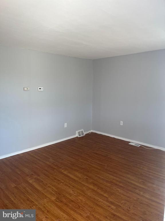
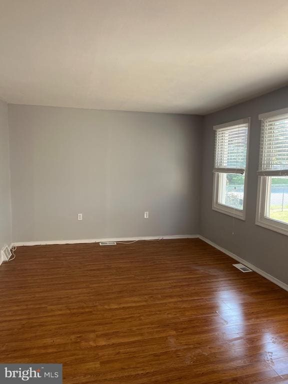
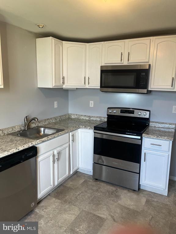
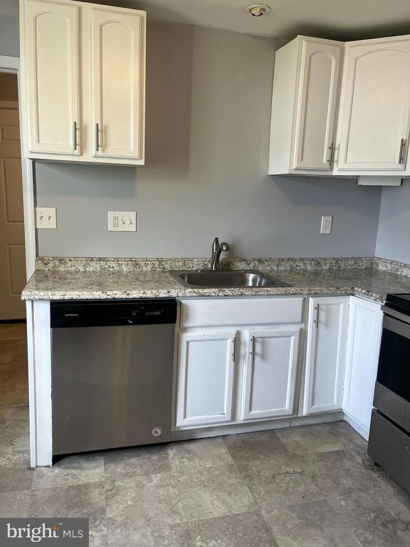
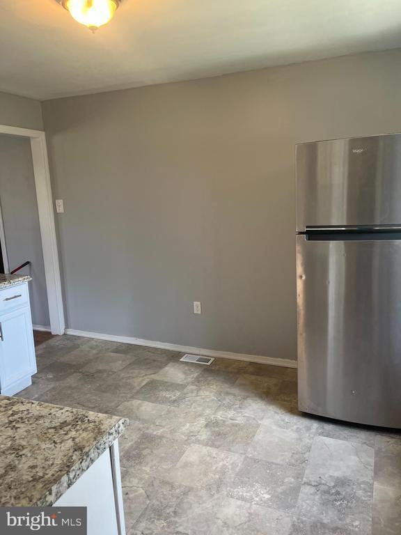
Welcome home to this charming 2 bedroom, 1 bath bungalow on a corner lot in Somerdale. This home features laminate flooring throughout, an updated bathroom with a tile tub surround, and an updated kitchen. This home offers a full appliance package, including a washer & dryer. Fenced-in yard. Pet-friendly up to 40 pounds. Don't miss this great property. *Email inquiries are preferred.
19 W Maiden Ln is a house located in Camden County and the 08083 ZIP Code.
* Price shown is base rent. Excludes user-selected optional fees and variable or usage-based fees and required charges due at or prior to move-in or at move-out. Price, availability, fees, and any applicable rent special are subject to change without notice.
* Square footage definitions vary. Displayed square footage is approximate.
House Features
- Basement
Contact
- Listed by Thomas J. Copsetta Jr. | Real Broker, LLC
- Phone Number
- Contact
-
Source
 Bright MLS, Inc.
Copyright © 2025 Bright MLS, Inc.
Location
Get Directions
Amenities
- Basement
Roughly 34 miles southwest of Trenton and 12 miles southeast of Philadelphia, Somerdale provides fast access to a wide variety of history, attractions, theaters, and museums. Minutes from the Philadelphia International Airport, Clementon Park and Splash World, Adventure Aquarium, and several golf courses, Somerdale is considered the "Crossroads of South Jersey."
Consisting of tree-filled neighborhoods lined with single-family homes on large lots, Somerdale offers a much more rural feel than many of its neighboring suburbs. White Horse Pike, which runs the length of the neighborhood and beyond, offers a variety of shops, restaurants, and specialty stores. Mores shops and restaurants are available just outside the borough at Voorhees Town Center and Eagle Plaza.
Learn more about living in Somerdale
Education
| Colleges & Universities | Distance | ||
|---|---|---|---|
| Colleges & Universities | Distance | ||
| Drive: | 11 min | 5.8 mi | |
| Drive: | 17 min | 10.2 mi | |
| Drive: | 15 min | 11.2 mi | |
| Drive: | 16 min | 11.6 mi |
19 W Maiden Ln is within 11 minutes or 5.8 miles from Camden Co. Coll., Blackwood. It is also near Gloucester County College and Camden Co. Coll., Camden City.
Transportation options available in Somerdale include Lindenwold (Patco), located 1.9 miles from 19 W Maiden Ln. 19 W Maiden Ln is near Philadelphia International, located 17.5 miles or 29 minutes away, and Trenton Mercer, located 41.3 miles or 56 minutes away.
| Transit / Subway | Distance | ||
|---|---|---|---|
| Transit / Subway | Distance | ||
|
|
Drive: | 3 min | 1.9 mi |
|
|
Drive: | 4 min | 2.0 mi |
|
|
Drive: | 7 min | 3.2 mi |
|
|
Drive: | 7 min | 4.3 mi |
|
|
Drive: | 9 min | 5.6 mi |
| Commuter Rail | Distance | ||
|---|---|---|---|
| Commuter Rail | Distance | ||
|
|
Drive: | 3 min | 1.9 mi |
|
|
Drive: | 12 min | 7.4 mi |
|
|
Drive: | 12 min | 8.9 mi |
| Drive: | 19 min | 11.1 mi | |
|
|
Drive: | 20 min | 13.6 mi |
| Airports | Distance | ||
|---|---|---|---|
| Airports | Distance | ||
|
Philadelphia International
|
Drive: | 29 min | 17.5 mi |
|
Trenton Mercer
|
Drive: | 56 min | 41.3 mi |
Time and distance from 19 W Maiden Ln.
| Shopping Centers | Distance | ||
|---|---|---|---|
| Shopping Centers | Distance | ||
| Walk: | 7 min | 0.4 mi | |
| Walk: | 8 min | 0.4 mi | |
| Walk: | 10 min | 0.6 mi |
19 W Maiden Ln has 3 shopping centers within 0.6 mile, which is about a 10-minute walk. The miles and minutes will be for the farthest away property.
| Parks and Recreation | Distance | ||
|---|---|---|---|
| Parks and Recreation | Distance | ||
|
Downs Farms Trails
|
Drive: | 4 min | 2.6 mi |
|
Kresson Nature Trails
|
Drive: | 9 min | 4.8 mi |
|
Croft Farm Nature Trail
|
Drive: | 9 min | 5.3 mi |
|
Erlton North Trails
|
Drive: | 11 min | 6.9 mi |
|
Barclay Farmstead Nature Trail
|
Drive: | 12 min | 7.3 mi |
19 W Maiden Ln has 5 parks within 7.3 miles, including Downs Farms Trails, Croft Farm Nature Trail, and Kresson Nature Trails.
| Hospitals | Distance | ||
|---|---|---|---|
| Hospitals | Distance | ||
| Drive: | 2 min | 1.7 mi | |
| Drive: | 12 min | 6.5 mi | |
| Drive: | 15 min | 7.4 mi |
19 W Maiden Ln has 3 hospitals within 7.4 miles, the nearest is Jefferson Stratford Hospital which is 1.7 miles away and a 2 minute drive.
| Military Bases | Distance | ||
|---|---|---|---|
| Military Bases | Distance | ||
| Drive: | 19 min | 12.6 mi |
19 W Maiden Ln is 12.6 miles and a 19 minute drive from Philadelphia Naval Busi Center.
You May Also Like
How do I access Social Services in New Jersey?
Statewide service is free, confidential, multilingual and always open. Three easy ways to reach Social Services in NJ: Dial 2-1-1; text your zip code to 898-211; or chat at https://www.nj211.org
Similar Rentals Nearby


What Are Walk Score®, Transit Score®, and Bike Score® Ratings?
Walk Score® measures the walkability of any address. Transit Score® measures access to public transit. Bike Score® measures the bikeability of any address.
What is a Sound Score Rating?
A Sound Score Rating aggregates noise caused by vehicle traffic, airplane traffic and local sources

19 W Maiden Ln
Somerdale, NJ 08083