
$2,775
/ Month
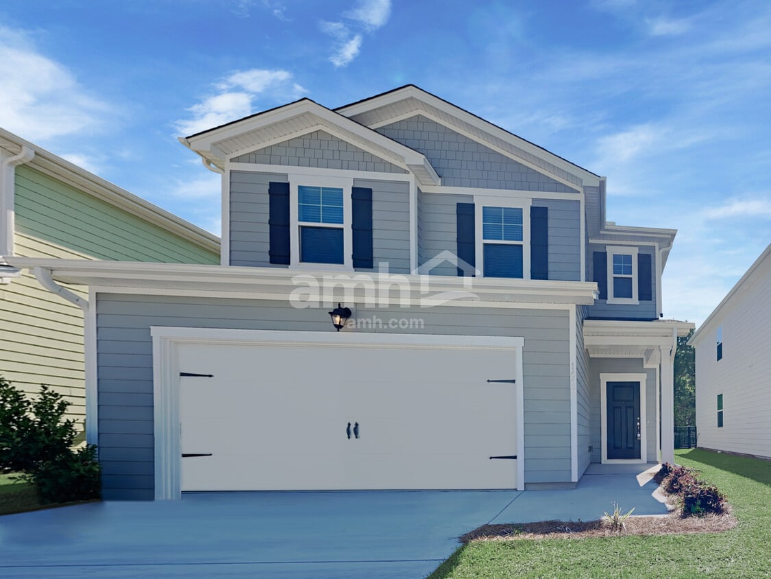
1836 Produce Ln
Johns Island, SC 29455
2 Weeks Ago
|
Edit
Favorites
1836 Produce Ln

Favorites
Check Back Soon for Upcoming Availability
| Beds | Baths | Average SF |
|---|---|---|
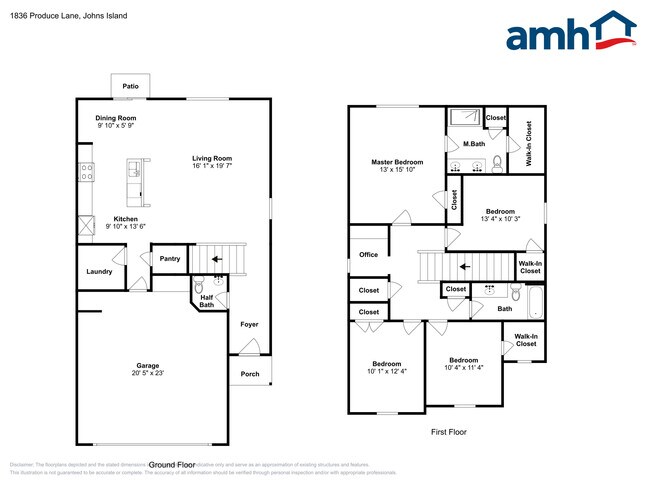
| 4 Bedrooms 4 Bedrooms 4 Br | 2.5 Baths 2.5 Baths 2.5 Ba | 1,888 SF |
Fees and Policies
The fees listed below are community-provided and may exclude utilities or add-ons. All payments are made directly to the property and are non-refundable unless otherwise specified.
- Parking
-
Garage--
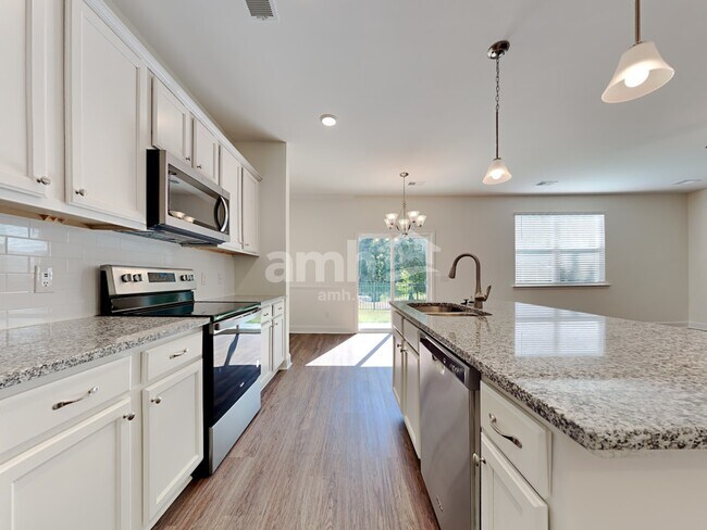
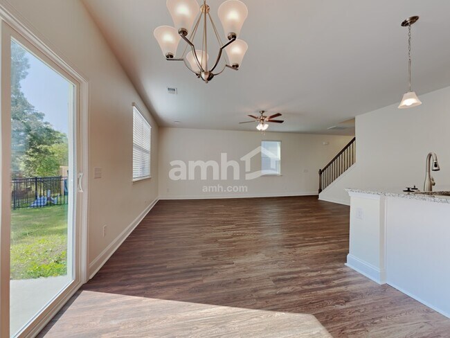
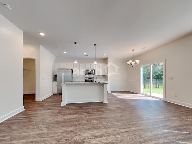
About This Property
Live in this recently built property located in the Produce Lane community. This property is professionally managed by AMH, a leading single-family rental company. We work to simplify your rental experience by offering self-guided tours and a streamlined leasing process you can complete all online, all on your own schedule. Once moved in, we provide maintenance support that you can rely on, so you can enjoy your weekends stress-free. We look forward to welcoming you home! Note: Monthly utility fees and local taxes may apply to leases in this state. Please know that details supplied on our website listings are for illustrative purposes only, and may vary from the actual property. You should verify all information before signing your lease for your own protection. If you have any doubts, don’t hesitate to contact one of our representatives for guidance. All applications, documentation, and initial payments for this property must be submitted directly through or by calling the number above. We do not advertise properties on Craigslist, Facebook Marketplace, or other classified advertising websites. If you believe one of our residences is being listed there by a scammer, please notify us at . For further description of applicable fees, please go to our website.
1836 Produce Ln is a house located in Charleston County and the 29455 ZIP Code. This area is served by the Charleston 01 School District attendance zone.
1836 Produce Ln,
Johns Island,
SC
29455
Johns Island sits on the South Carolina state line just south of the Charleston peninsula and is bordered to the north by the Stono and Wadmalaw Rivers. As the largest island in South Carolina, Johns Island encompasses an array of island living options and popular Lowcountry destinations. Upscale, modern apartment complexes and historic single-family homes can be found closer to the north of the island near Charleston.
The southern reaches of the island don’t lend themselves very well to large-scale residential development because of the surrounding marshland. However, the marshland is what makes Johns Island a hotspot for seafood and Lowcountry cuisine in general. Boating and fishing are wildly popular on the island, and many residents enjoy waterway access from their very own homes. The Angel Oak Tree is a popular tourist hotspot. The 60-foot-tall oak has a massive canopy that evokes the classic look of Lowcountry living.
Learn more about living in Johns IslandBelow are rent ranges for similar nearby apartments
| Beds | Average Size | Lowest | Typical | Premium |
|---|---|---|---|---|
| Studio Studio Studio | 553 Sq Ft | $1,521 | $1,624 | $1,902 |
| 1 Bed 1 Bed 1 Bed | 762-770 Sq Ft | $1,639 | $2,039 | $2,681 |
| 2 Beds 2 Beds 2 Beds | 1176-1183 Sq Ft | $1,600 | $2,455 | $3,047 |
| 3 Beds 3 Beds 3 Beds | 1543-1547 Sq Ft | $2,428 | $3,033 | $5,793 |
| 4 Beds 4 Beds 4 Beds | 2194 Sq Ft | $2,795 | $3,738 | $5,000 |
Education
| Colleges & Universities | Distance | ||
|---|---|---|---|
| Colleges & Universities | Distance | ||
| Drive: | 13 min | 6.9 mi | |
| Drive: | 15 min | 8.0 mi | |
| Drive: | 15 min | 8.1 mi | |
| Drive: | 16 min | 8.1 mi |
1836 Produce Ln is within 13 minutes or 6.9 miles from Medical Univ. of S.C.. It is also near The Citadel and Charleston School Of Law.
Schools


Public Elementary School
Grades PK-5
258 Students
Attendance Zone
Public Middle School
Grades 6-8
444 Students
Attendance Zone
Public High School
Grades 9-12
387 Students
Attendance Zone
Private Elementary, Middle & High School
Grades PK-12
283 Students
Nearby
School data provided by
 The GreatSchools Rating helps parents compare schools within a state based on a variety of school quality indicators and provides a helpful picture of how effectively each school serves all of its students. Ratings are on a scale of 1 (below average) to 10 (above average) and can include test scores, college readiness, academic progress, advanced courses, equity, discipline and attendance data. We also advise parents to visit schools, consider other information on school performance and programs, and consider family needs as part of the school selection process.
View GreatSchools Rating Methodology
Data provided by GreatSchools.org © 2026. All rights reserved.
View GreatSchools Rating Methodology
Data provided by GreatSchools.org © 2026. All rights reserved.
Walkability Near 1836 Produce Ln Johns Island, SC 29455
Getting Around
 What do Walkability, Transit, Drivability, and Bikeability mean?
Walkability measures the walking distance to day-to-day needs.
Transit measures access to public transportation.
Drivability measures congestion, parking availability, and access to major roads.
Bikeability measures the suitability for cycling.
How It Works
What do Walkability, Transit, Drivability, and Bikeability mean?
Walkability measures the walking distance to day-to-day needs.
Transit measures access to public transportation.
Drivability measures congestion, parking availability, and access to major roads.
Bikeability measures the suitability for cycling.
How It Works
Fairly Walkable
Walkability
40
/ 100
Very Drivable
Drivability
80
/ 100
Somewhat Bikeable
Bikeability
20
/ 100
Scores provided by
Active
Soundscore™
79
/ 100
Traffic
ActiveAirport
CalmBusinesses
ActiveScores provided by
HowLoud What is a Sound Score Rating? A Sound Score Rating aggregates noise caused by vehicle traffic, airplane traffic and local sources. How It WorksYou May Also Like
Similar Rentals Nearby
-
-
 Total Monthly Price New4 Beds$2,399+Total Monthly PricePrices include required monthly fees of $79.Base Rent:4 Beds$2,320+
 -
 4 Beds$2,795Total Monthly PriceTotal Monthly Price NewPrices include all required monthly fees.House for Rent
 -

-
 4 Beds$2,735Total Monthly PriceTotal Monthly Price NewPrices include all required monthly fees.House for Rent
 -
 5 Beds$2,690Total Monthly PriceTotal Monthly Price NewPrices include all required monthly fees.House for Rent
 -
 4 Beds$2,360Total Monthly PriceTotal Monthly Price NewPrices include all required monthly fees.House for Rent
 -
 5 Beds$2,645Total Monthly PriceTotal Monthly Price NewPrices include all required monthly fees.House for Rent
 -
 4 Beds$3,640Total Monthly PriceTotal Monthly Price NewPrices include all required monthly fees.House for Rent
 -
 4 Beds$2,720Total Monthly PriceTotal Monthly Price NewPrices include all required monthly fees.House for Rent
What Are Walk Score®, Transit Score®, and Bike Score® Ratings?
Walk Score® measures the walkability of any address. Transit Score® measures access to public transit. Bike Score® measures the bikeability of any address.
What is a Sound Score Rating?
A Sound Score Rating aggregates noise caused by vehicle traffic, airplane traffic and local sources.
1836 Produce Ln
Johns Island, SC 29455