$2,600
/ Month
1835 Amsterdam Ave Unit 4C
New York, NY 10031
Favorites
1835 Amsterdam Ave Unit 4C

Favorites
Check Back Soon for Upcoming Availability
| Beds | Baths | Average SF |
|---|---|---|
| 3 Bedrooms 3 Bedrooms 3 Br | 2 Baths 2 Baths 2 Ba | — |
About This Property
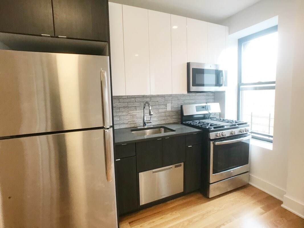
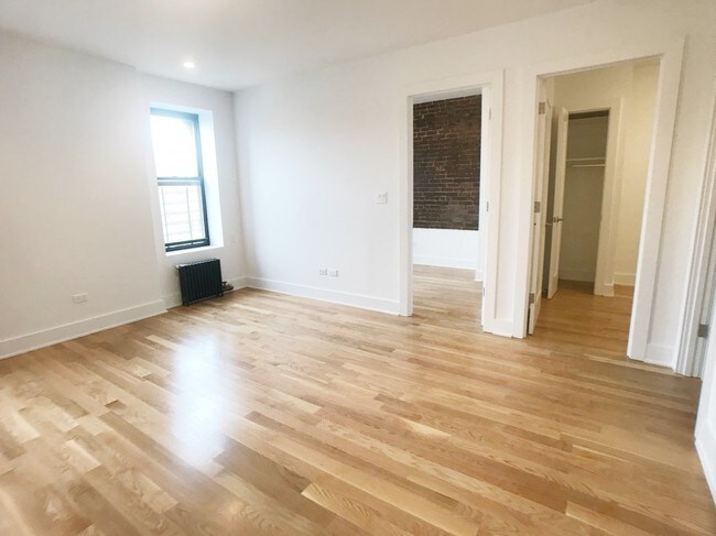
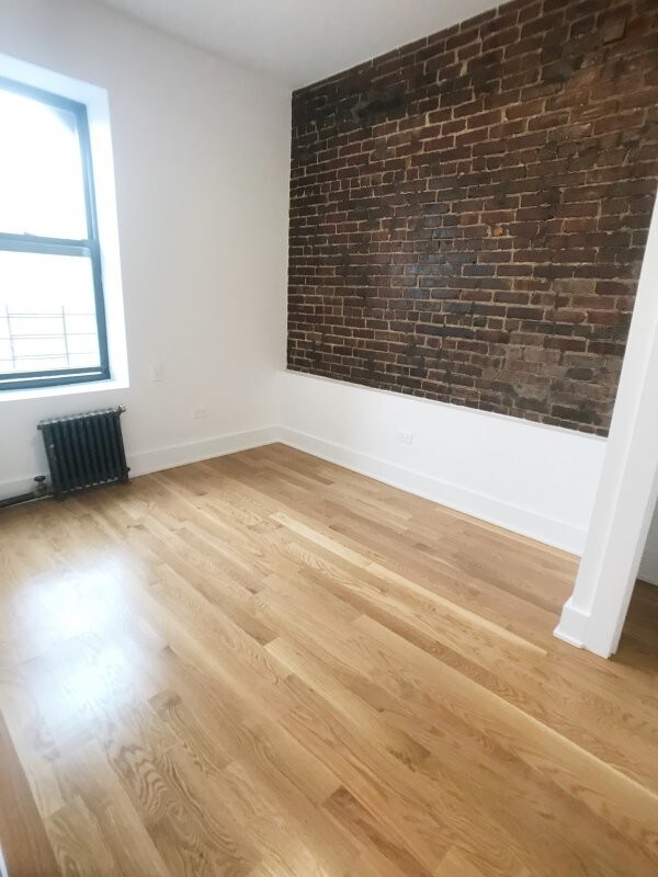
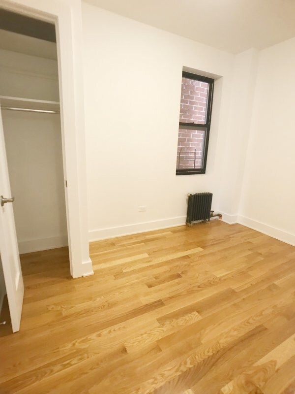
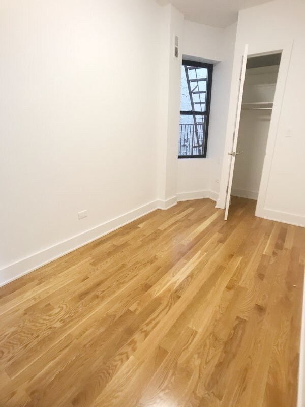
Call today to view this or any other NYC apartment on Bohemia's Website!!!CONTACT: Behzad PanahCELL: 917-769-1918EMAIL: Benz@bohemiarealtygroup.comAPARTMENT INFO:*** Gut renovated *** S/S appliances*** W/D*** Huge size bedrooms & closets*** Dish washer*** Super sunnyTHESE ARE ACTUAL PHOTO'S OF THE APARTMENT!!! BUILDING:*** Lowrise *** Live in super *** Close to shops-banks and more*** Close to 1/A/B/C/D trains*** Pets okThis is not what you're looking for?I have hundreds of listings and I can make sure to find you what you're looking for!!!CONTACT: Behzad PanahCELL: 917-769-1918EMAIL: Benz@bohemiarealtygroup.com
1835 Amsterdam Ave is a condo located in New York County and the 10031 ZIP Code. This area is served by the New York City Geographic District # 6 attendance zone.
1835 Amsterdam Ave,
New York,
NY
10031
As a historic part of Harlem in Upper Manhattan, Sugar Hill is tied to the Harlem Renaissance, harboring the sense of community that came from the era. Almost entirely residential, in an urban sense, Sugar Hill houses a variety of prewar walk-up apartment buildings, rowhouses, and townhomes that give this neighborhood an architectural appeal. And if cost is an issue for you, Sugar Hill is known as one of the more affordable neighborhoods in the area.
Though the neighborhood offers a few pizza shops, cafes, and delis, there are many more restaurants and shops outside of Sugar Hill.
Learn more about living in Sugar HillBelow are rent ranges for similar nearby apartments
Education
| Colleges & Universities | Distance | ||
|---|---|---|---|
| Colleges & Universities | Distance | ||
| Walk: | 18 min | 0.9 mi | |
| Drive: | 5 min | 1.5 mi | |
| Drive: | 4 min | 1.7 mi | |
| Drive: | 4 min | 1.8 mi |
1835 Amsterdam Ave Unit 4C is within 18 minutes or 0.9 mile from The City College of New York. It is also near Hostos Community College and Manhattan School Of Music.
Schools


Public Elementary, Middle & High School
Grades K-12
672 Students
Nearby
Public Elementary School
Grades PK-5
386 Students
Attendance Zone
Public Middle School
Grades 6-8
227 Students
Attendance Zone
Public Middle School
Grades 6-8
171 Students
Attendance Zone
Private Elementary & Middle School
Grades PK-8
Nearby
Private High School
Grades 9-12
Nearby
School data provided by
 The GreatSchools Rating helps parents compare schools within a state based on a variety of school quality indicators and provides a helpful picture of how effectively each school serves all of its students. Ratings are on a scale of 1 (below average) to 10 (above average) and can include test scores, college readiness, academic progress, advanced courses, equity, discipline and attendance data. We also advise parents to visit schools, consider other information on school performance and programs, and consider family needs as part of the school selection process.
View GreatSchools Rating Methodology
Data provided by GreatSchools.org © 2026. All rights reserved.
View GreatSchools Rating Methodology
Data provided by GreatSchools.org © 2026. All rights reserved.
Transportation options available in New York include 155 Street (A,C Line), located 0.3 mile from 1835 Amsterdam Ave Unit 4C. 1835 Amsterdam Ave Unit 4C is near LaGuardia, located 8.4 miles or 17 minutes away, and Newark Liberty International, located 21.8 miles or 26 minutes away.
| Transit / Subway | Distance | ||
|---|---|---|---|
| Transit / Subway | Distance | ||
|
|
Walk: | 5 min | 0.3 mi |
|
|
Walk: | 8 min | 0.4 mi |
|
|
Walk: | 9 min | 0.5 mi |
|
|
Walk: | 9 min | 0.5 mi |
|
|
Walk: | 15 min | 0.8 mi |
| Commuter Rail | Distance | ||
|---|---|---|---|
| Commuter Rail | Distance | ||
|
|
Drive: | 8 min | 2.3 mi |
|
|
Drive: | 6 min | 2.5 mi |
|
|
Drive: | 6 min | 2.8 mi |
|
|
Drive: | 9 min | 3.4 mi |
| Drive: | 7 min | 3.4 mi |
| Airports | Distance | ||
|---|---|---|---|
| Airports | Distance | ||
|
LaGuardia
|
Drive: | 17 min | 8.4 mi |
|
Newark Liberty International
|
Drive: | 26 min | 21.8 mi |
Walkability Near 1835 Amsterdam Ave New York, NY 10031
Getting Around
 What do Walkability, Transit, Drivability, and Bikeability mean?
Walkability measures the walking distance to day-to-day needs.
Transit measures access to public transportation.
Drivability measures congestion, parking availability, and access to major roads.
Bikeability measures the suitability for cycling.
How It Works
What do Walkability, Transit, Drivability, and Bikeability mean?
Walkability measures the walking distance to day-to-day needs.
Transit measures access to public transportation.
Drivability measures congestion, parking availability, and access to major roads.
Bikeability measures the suitability for cycling.
How It Works
Exceptionally Walkable
Walkability
100
/ 100
Exceptional Public Transit
Transit
100
/ 100
Fairly Drivable
Drivability
40
/ 100
Moderately Bikeable
Bikeability
70
/ 100
Scores provided by
-
Soundscore™
-
/ 100
Traffic
-Airport
-Businesses
-Scores provided by
HowLoud What is a Sound Score Rating? A Sound Score Rating aggregates noise caused by vehicle traffic, airplane traffic and local sources. How It WorksTime and distance from 1835 Amsterdam Ave Unit 4C.
| Shopping Centers | Distance | ||
|---|---|---|---|
| Shopping Centers | Distance | ||
| Drive: | 4 min | 1.2 mi | |
| Drive: | 6 min | 1.6 mi | |
| Drive: | 3 min | 1.6 mi |
1835 Amsterdam Ave Unit 4C has 3 shopping centers within 1.6 miles, which is about a 3-minute drive. The miles and minutes will be for the farthest away property.
| Parks and Recreation | Distance | ||
|---|---|---|---|
| Parks and Recreation | Distance | ||
|
Northern Manhattan Parks
|
Walk: | 5 min | 0.3 mi |
|
Jackie Robinson Park
|
Walk: | 7 min | 0.4 mi |
|
Roger Morris Park
|
Walk: | 12 min | 0.6 mi |
|
Mill Pond Park
|
Drive: | 4 min | 1.2 mi |
|
Riverbank State Park
|
Drive: | 4 min | 1.7 mi |
1835 Amsterdam Ave Unit 4C has 5 parks within 1.7 miles, including Northern Manhattan Parks, Jackie Robinson Park, and Roger Morris Park.
| Hospitals | Distance | ||
|---|---|---|---|
| Hospitals | Distance | ||
| Walk: | 21 min | 1.1 mi | |
| Drive: | 4 min | 1.5 mi | |
| Drive: | 5 min | 1.7 mi |
1835 Amsterdam Ave Unit 4C has 3 hospitals within 1.7 miles, the nearest is New York State Psychiatric Institute which is 1.1 miles away and a 21 minute walk.
| Military Bases | Distance | ||
|---|---|---|---|
| Military Bases | Distance | ||
| Drive: | 26 min | 11.0 mi | |
| Drive: | 23 min | 12.3 mi | |
| Drive: | 34 min | 22.2 mi |
1835 Amsterdam Ave Unit 4C has 3 military bases within 22.2 miles, the nearest is Governors Island Support Center which is 11.0 miles away and a 26 minute drive.
You May Also Like
Similar Rentals Nearby


What Are Walk Score®, Transit Score®, and Bike Score® Ratings?
Walk Score® measures the walkability of any address. Transit Score® measures access to public transit. Bike Score® measures the bikeability of any address.
What is a Sound Score Rating?
A Sound Score Rating aggregates noise caused by vehicle traffic, airplane traffic and local sources.

1835 Amsterdam Ave
New York, NY 10031