

$3,200 / Month
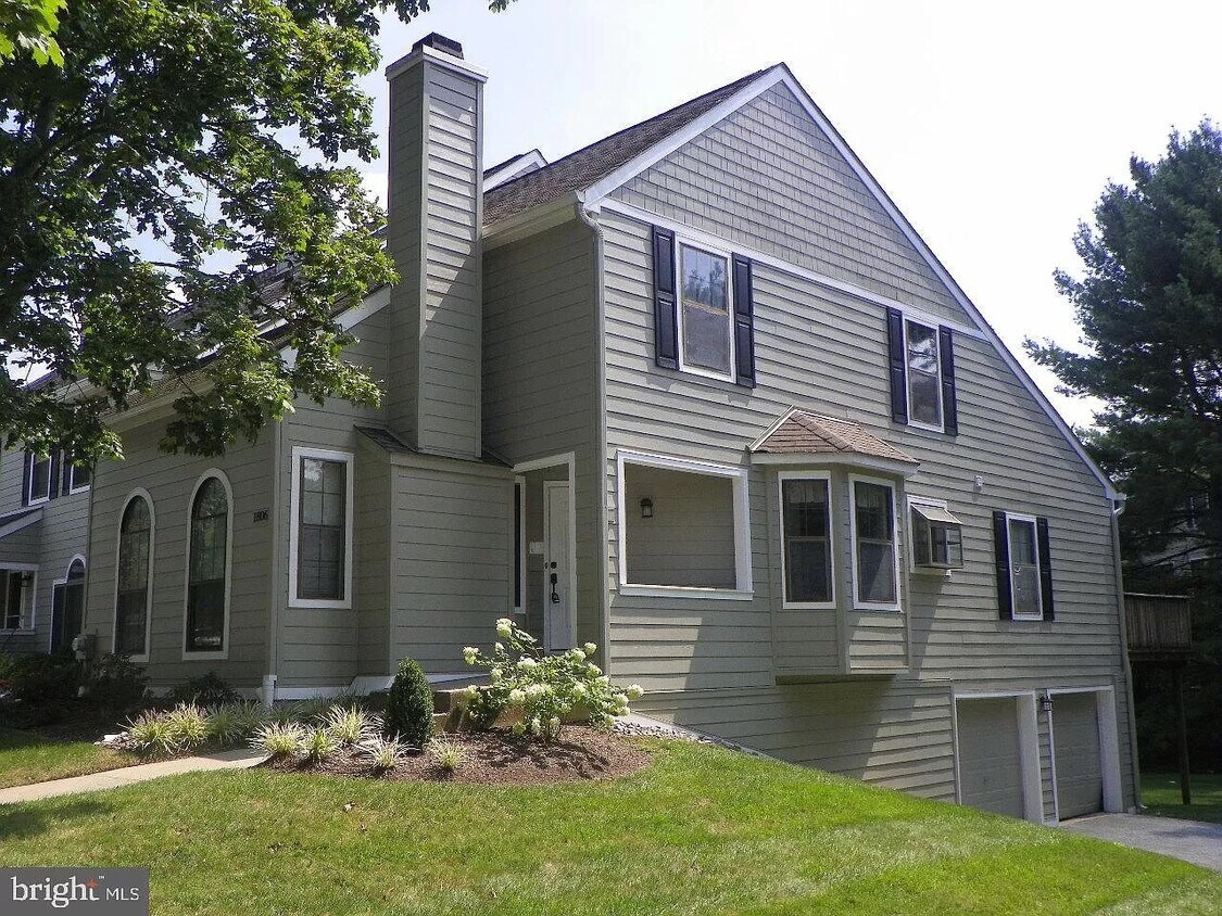
1806 Westfield Ct
Newtown Square, PA 19073
2 Weeks Ago
Favorites
1806 Westfield Ct

Favorites
Check Back Soon for Upcoming Availability
| Beds | Baths | Average SF |
|---|---|---|
| 3 Bedrooms 3 Bedrooms 3 Br | 2 Baths 2 Baths 2 Ba | 2,374 SF |
Location
Get Directions
Newtown Square is a small suburban community about thirty minutes west of Philadelphia on the West Chester Pike. The high-performing schools and low crime rate contribute to a family-friendly environment, and the proximity to Philadelphia makes it an appealing location for commuters.
The area contains an abundance of natural areas to explore, from Springton Reservoir to the sprawling Ridley Creek State Park. Residents of Newtown Square also enjoy convenient access to several institutes of higher learning: Delaware County Community College, Bryn Mawr College, Haverford College, and Swarthmore College are all within a few minutes’ drive.
Learn more about living in Newtown Square
Education
| Colleges & Universities | Distance | ||
|---|---|---|---|
| Colleges & Universities | Distance | ||
| Drive: | 14 min | 7.7 mi | |
| Drive: | 17 min | 8.5 mi | |
| Drive: | 17 min | 8.6 mi | |
| Drive: | 17 min | 8.7 mi |
1806 Westfield Ct is within 14 minutes or 7.7 miles from West Chester Univ.. It is also near Delaware County Comm. Coll. and Immaculata University.
Transportation options available in Newtown Square include Orange St/Media, located 8.1 miles from 1806 Westfield Ct. 1806 Westfield Ct is near Philadelphia International, located 18.4 miles or 34 minutes away.
| Transit / Subway | Distance | ||
|---|---|---|---|
| Transit / Subway | Distance | ||
| Drive: | 17 min | 8.1 mi | |
|
|
Drive: | 17 min | 8.2 mi |
|
|
Drive: | 17 min | 8.3 mi |
| Drive: | 17 min | 8.4 mi | |
|
|
Drive: | 18 min | 8.4 mi |
| Commuter Rail | Distance | ||
|---|---|---|---|
| Commuter Rail | Distance | ||
| Drive: | 16 min | 6.5 mi | |
|
|
Drive: | 14 min | 7.3 mi |
|
|
Drive: | 17 min | 8.2 mi |
|
|
Drive: | 19 min | 9.2 mi |
|
|
Drive: | 21 min | 10.3 mi |
| Airports | Distance | ||
|---|---|---|---|
| Airports | Distance | ||
|
Philadelphia International
|
Drive: | 34 min | 18.4 mi |
Time and distance from 1806 Westfield Ct.
| Shopping Centers | Distance | ||
|---|---|---|---|
| Shopping Centers | Distance | ||
| Drive: | 6 min | 3.3 mi | |
| Drive: | 8 min | 4.4 mi | |
| Drive: | 9 min | 4.8 mi |
1806 Westfield Ct has 3 shopping centers within 4.8 miles, which is about a 9-minute drive. The miles and minutes will be for the farthest away property.
| Parks and Recreation | Distance | ||
|---|---|---|---|
| Parks and Recreation | Distance | ||
|
Ridley Creek State Park
|
Drive: | 9 min | 4.1 mi |
|
Tyler Arboretum
|
Drive: | 11 min | 5.3 mi |
|
Colonial Pennsylvania Plantation
|
Drive: | 11 min | 6.0 mi |
|
Willisbrook Preserve
|
Drive: | 12 min | 6.7 mi |
|
West Chester Railroad
|
Drive: | 14 min | 7.8 mi |
1806 Westfield Ct has 5 parks within 7.8 miles, including Ridley Creek State Park, Tyler Arboretum, and Willisbrook Preserve.
| Hospitals | Distance | ||
|---|---|---|---|
| Hospitals | Distance | ||
| Drive: | 12 min | 6.2 mi | |
| Drive: | 14 min | 7.5 mi | |
| Drive: | 19 min | 9.2 mi |
1806 Westfield Ct has 3 hospitals within 9.2 miles, the nearest is Riddle Memorial Hospital which is 6.2 miles away and a 12 minute drive.
| Military Bases | Distance | ||
|---|---|---|---|
| Military Bases | Distance | ||
| Drive: | 42 min | 24.1 mi |
1806 Westfield Ct is 24.1 miles and a 42 minute drive from Philadelphia Naval Busi Center.
You May Also Like
Similar Rentals Nearby
-
-

-

-
-
-
-
-
-
-
1 / 55


What Are Walk Score®, Transit Score®, and Bike Score® Ratings?
Walk Score® measures the walkability of any address. Transit Score® measures access to public transit. Bike Score® measures the bikeability of any address.
What is a Sound Score Rating?
A Sound Score Rating aggregates noise caused by vehicle traffic, airplane traffic and local sources
1806 Westfield Ct
Newtown Square, PA 19073