
$2,000
Total Monthly Price
1785 Day Valley Rd
Aptos, CA 95003
Favorites
-
Bedrooms
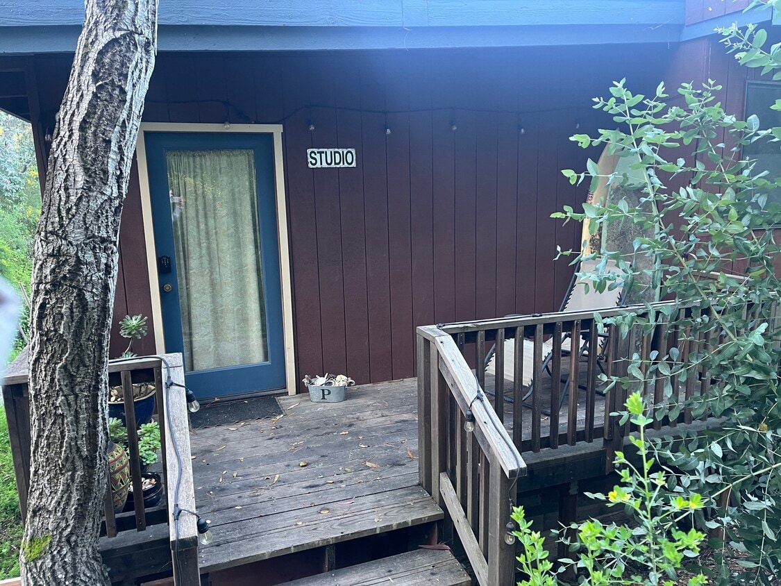
Studio
-
Bathrooms
1
-
Square Feet
400 sq ft
-
Available
Available May 21
Highlights
- Deck
- Double Vanities
1785 Day Valley Rd

Favorites
About This Home
12 Month Lease,
$1,000 deposit,
Available May 21
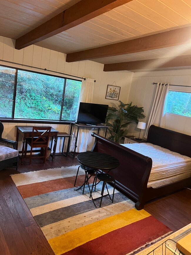
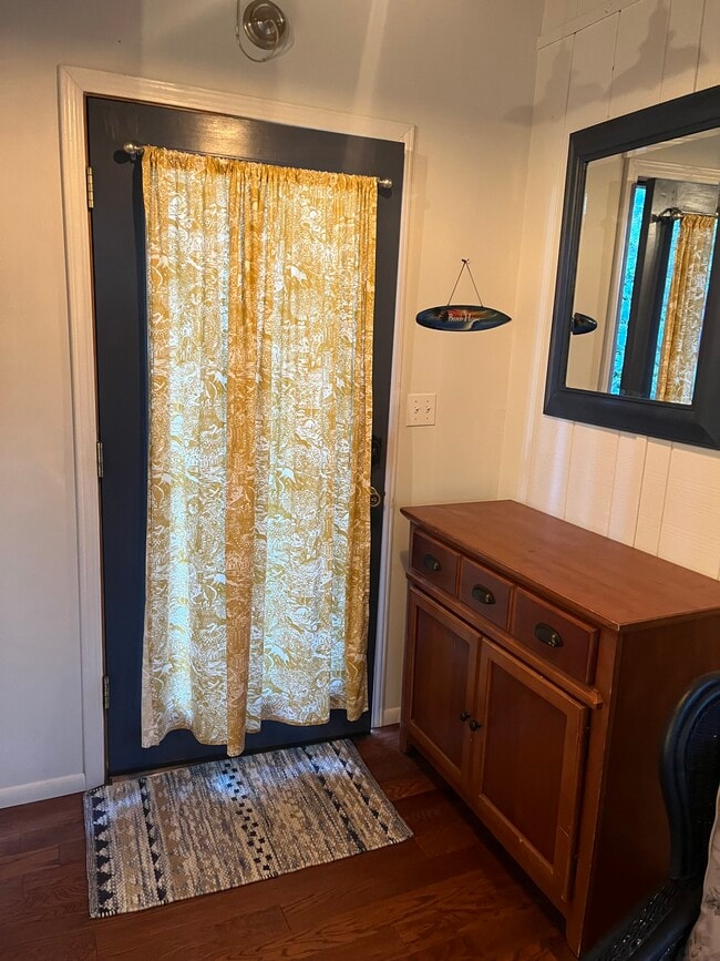
Spacious studio amidst trees. Front deck to private entrance of studio.
1785 Day Valley Rd is a house located in Santa Cruz County and the 95003 ZIP Code. This area is served by the Pajaro Valley Unified School District attendance zone.
* Price shown is total price based on community-supplied monthly required fees. Excludes user-selected optional fees and variable or usage-based fees and required charges due at or prior to move-in or at move-out. Price, availability, fees, and any applicable rent special are subject to change without notice.
* Square footage definitions vary. Displayed square footage is approximate.
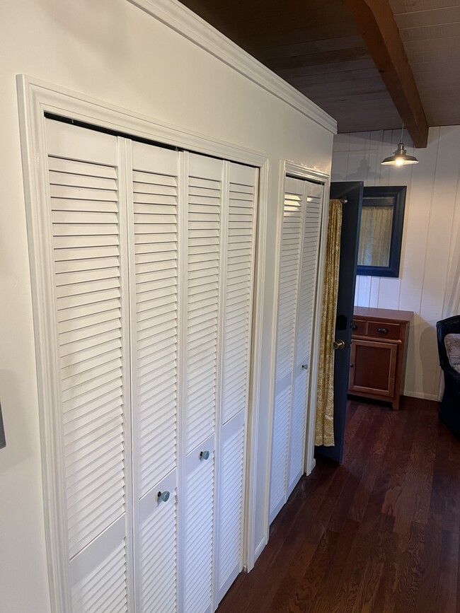
House Features
Washer/Dryer
High Speed Internet Access
Wi-Fi
Heating
- High Speed Internet Access
- Wi-Fi
- Washer/Dryer
- Heating
- Cable Ready
- Double Vanities
- Framed Mirrors
- Deck
Fees and Policies
The fees listed below are community-provided and may exclude utilities or add-ons. All payments are made directly to the property and are non-refundable unless otherwise specified.
- Parking
-
Surface Lot--
Details
Utilities Included
-
Water
-
Electricity
-
Heat
-
Trash Removal
-
Sewer
-
Cable
-
Air Conditioning
Property Information
-
Built in 1978
Contact
- Contact
Location
Get Directions
Overlooking Monterey Bay and home to the gorgeous Seacliff State Beach, Aptos provides amazing ocean views -- or the forest if you prefer, bordered on northeast side by the Forest of Nisene Marks State Park. This redwood forest begins at sea level and extends into the coastal mountains, providing 30 miles of hiking trails. The park is also terrific for camping, picnicking, and wildlife viewing.
At the other side of Aptos, Seacliff State Beach is perfect for surfing, beachcombing, swimming, and fishing. It also features a fishing pier with an unusual feature -- a concrete ship named the SS Palo Alto, a WWI ship that was built toward the end of the war -- too late for use. It was towed to its current location and allowed to sink where it now serves as an artificial reef. Aptos is located about seven miles east of Santa Cruz and roughly one hour south of San Jose.
Learn more about living in Aptos
Education
| Colleges & Universities | Distance | ||
|---|---|---|---|
| Colleges & Universities | Distance | ||
| Drive: | 10 min | 6.2 mi | |
| Drive: | 28 min | 16.6 mi | |
| Drive: | 45 min | 25.3 mi | |
| Drive: | 51 min | 35.1 mi |
1785 Day Valley Rd is within 10 minutes or 6.2 miles from Cabrillo College. It is also near UC Santa Cruz and Gavilan College, Gilroy.
Schools


Public Elementary School
Grades K-5
487 Students
Attendance Zone
Public Middle School
Grades 6-8
587 Students
Attendance Zone
Public High School
Grades 9-12
1,274 Students
Attendance Zone
Private Elementary School
Grades K-5
45 Students
Nearby
Private Elementary & Middle School
Grades PK-8
Nearby
Private Elementary, Middle & High School
Grades K-12
166 Students
Nearby
School data provided by
 The GreatSchools Rating helps parents compare schools within a state based on a variety of school quality indicators and provides a helpful picture of how effectively each school serves all of its students. Ratings are on a scale of 1 (below average) to 10 (above average) and can include test scores, college readiness, academic progress, advanced courses, equity, discipline and attendance data. We also advise parents to visit schools, consider other information on school performance and programs, and consider family needs as part of the school selection process.
View GreatSchools Rating Methodology
Data provided by GreatSchools.org © 2026. All rights reserved.
View GreatSchools Rating Methodology
Data provided by GreatSchools.org © 2026. All rights reserved.
Getting Around
 What do Walkability, Transit, Drivability, and Bikeability mean?
Walkability measures the walking distance to day-to-day needs.
Transit measures access to public transportation.
Drivability measures congestion, parking availability, and access to major roads.
Bikeability measures the suitability for cycling.
How It Works
What do Walkability, Transit, Drivability, and Bikeability mean?
Walkability measures the walking distance to day-to-day needs.
Transit measures access to public transportation.
Drivability measures congestion, parking availability, and access to major roads.
Bikeability measures the suitability for cycling.
How It Works
Not Walkable
Walkability
10
/ 100
Limited Public Transit
Transit
20
/ 100
Exceptionally Drivable
Drivability
100
/ 100
Somewhat Bikeable
Bikeability
30
/ 100
Scores provided by
-
Soundscore™
-
/ 100
Traffic
-Airport
-Businesses
-Scores provided by
HowLoud What is a Sound Score Rating? A Sound Score Rating aggregates noise caused by vehicle traffic, airplane traffic and local sources. How It Works
Amenities
- High Speed Internet Access
- Wi-Fi
- Washer/Dryer
- Heating
- Cable Ready
- Double Vanities
- Framed Mirrors
- Deck
1785 Day Valley Rd Photos
What Are Walk Score®, Transit Score®, and Bike Score® Ratings?
Walk Score® measures the walkability of any address. Transit Score® measures access to public transit. Bike Score® measures the bikeability of any address.
What is a Sound Score Rating?
A Sound Score Rating aggregates noise caused by vehicle traffic, airplane traffic and local sources.
1785 Day Valley Rd
Aptos, CA 95003