

$2,995
/ Month
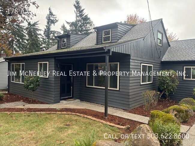
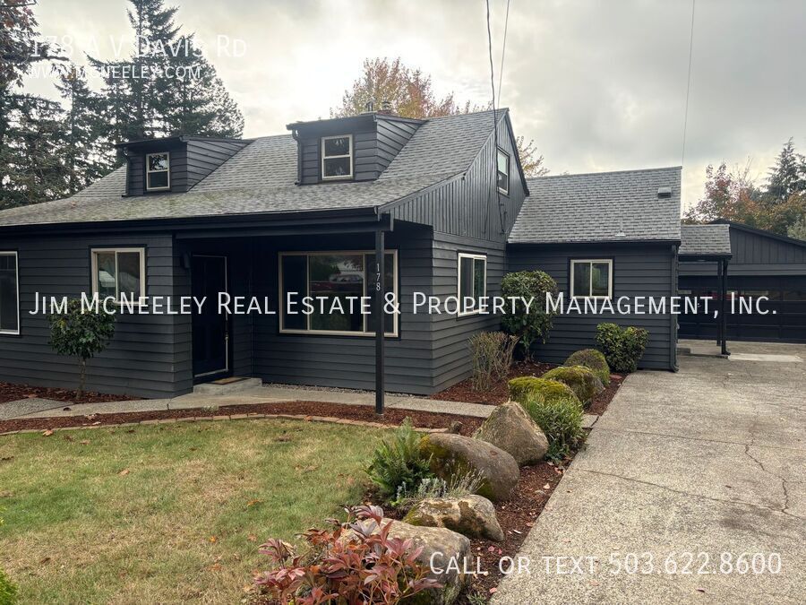
178 A V Davis Rd
Oregon City, OR 97045
Today
|
Edit
Favorites
503-622-8600
-
Bedrooms
4
-
Bathrooms
2
-
Square Feet
2,000 sq ft
-
Available
Available Now
178 A V Davis Rd

Favorites
About This Home
Available Now
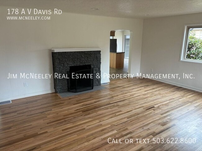
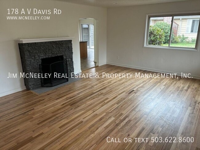
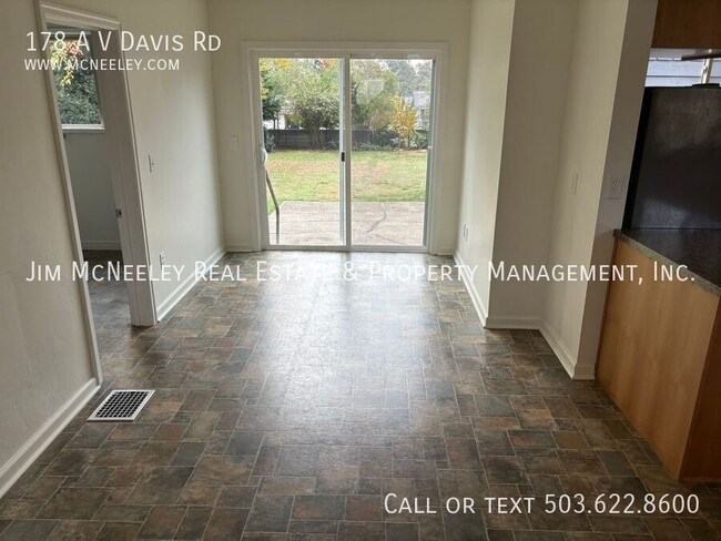
Sorry, no pets are allowed at this property. Recently renovated home with large private yard, oversized garage, workshop, and fireplace. Tenants will be responsible for yard maintenance and will need to bring their own washer & dryer. NOTE: the fireplace is decommissioned. *****To Apply for This Property (Use links on listing on our company website - mcneeley . com. They may not appear on third-party sites) **** - Our Application Process and Criteria (Please review before applying):
178 A V Davis Rd is a house located in Clackamas County and the 97045 ZIP Code. This area is served by the Oregon City School District 62 attendance zone.
* Price shown is base rent. Excludes user-selected optional fees and variable or usage-based fees and required charges due at or prior to move-in or at move-out. Price, availability, fees, and any applicable rent special are subject to change without notice.
* Square footage definitions vary. Displayed square footage is approximate.
Contact
- Listed by Mark McNeeley w/JMRE
- Phone Number
- Contact
Location
Get Directions
Located in the hills along the Willamette River and featuring a frontier-style downtown, Oregon City provides a tree-filled community and inspiring river views just 13 miles south of Downtown Portland. It is the county seat for Clackamas County and is home to roughly 35,000 residents. The beautiful landscape includes the confluence of the Willamette and Clackamas Rivers and the awe-inspiring Willamette Falls -- the largest waterfall in the Pacific Northwest and one of the widest waterfalls in the world.
Founded in 1829 Oregon City was the capital of the Oregon Territory. Today, Oregon City serves as a hub of high-tech industries. The city is home to 22 parks, including Clackamette Park, which features river access and cove trails, an RV park, a boat launch, playgrounds, horseshoe pits, a skate park, and picnic areas. If you choose to rent an apartment in Oregon City, you'll have easy access to Clackamas Community College, Hilltop Mall, and the Museum of the Oregon Territory.
Learn more about living in Oregon City
Education
| Colleges & Universities | Distance | ||
|---|---|---|---|
| Colleges & Universities | Distance | ||
| Drive: | 7 min | 3.2 mi | |
| Drive: | 15 min | 7.8 mi | |
| Drive: | 23 min | 10.0 mi | |
| Drive: | 25 min | 16.0 mi |
178 A V Davis Rd is within 7 minutes or 3.2 miles from Clackamas C.C., Oregon City. It is also near Clackamas C.C., Harmony Campus and Lewis & Clark College.
Schools


Public Elementary School
Grades PK-5
217 Students
Nearby
Public Elementary School
Grades K-5
445 Students
Attendance Zone
Public Middle School
Grades 6-8
671 Students
Attendance Zone
Public High School
Grades 9-12
1,931 Students
Attendance Zone
Private Elementary & Middle School
Grades PK-8
138 Students
Nearby
Private Middle & High School
Grades 7-12
66 Students
Nearby
School data provided by
 The GreatSchools Rating helps parents compare schools within a state based on a variety of school quality indicators and provides a helpful picture of how effectively each school serves all of its students. Ratings are on a scale of 1 (below average) to 10 (above average) and can include test scores, college readiness, academic progress, advanced courses, equity, discipline and attendance data. We also advise parents to visit schools, consider other information on school performance and programs, and consider family needs as part of the school selection process.
View GreatSchools Rating Methodology
Data provided by GreatSchools.org © 2025. All rights reserved.
View GreatSchools Rating Methodology
Data provided by GreatSchools.org © 2025. All rights reserved.
Transportation options available in Oregon City include Se Park Ave Max Station, located 7.1 miles from 178 A V Davis Rd. 178 A V Davis Rd is near Portland International, located 20.2 miles or 33 minutes away.
| Transit / Subway | Distance | ||
|---|---|---|---|
| Transit / Subway | Distance | ||
| Drive: | 14 min | 7.1 mi | |
|
|
Drive: | 16 min | 8.2 mi |
| Drive: | 16 min | 8.2 mi | |
| Drive: | 20 min | 9.5 mi | |
|
|
Drive: | 16 min | 9.5 mi |
| Commuter Rail | Distance | ||
|---|---|---|---|
| Commuter Rail | Distance | ||
|
|
Drive: | 6 min | 2.4 mi |
|
|
Drive: | 19 min | 11.9 mi |
|
|
Drive: | 25 min | 16.2 mi |
|
|
Drive: | 26 min | 16.3 mi |
|
|
Drive: | 26 min | 17.4 mi |
| Airports | Distance | ||
|---|---|---|---|
| Airports | Distance | ||
|
Portland International
|
Drive: | 33 min | 20.2 mi |
Time and distance from 178 A V Davis Rd.
| Shopping Centers | Distance | ||
|---|---|---|---|
| Shopping Centers | Distance | ||
| Drive: | 3 min | 1.1 mi | |
| Drive: | 4 min | 1.7 mi | |
| Drive: | 4 min | 1.8 mi |
178 A V Davis Rd has 3 shopping centers within 1.8 miles, which is about a 4-minute drive. The miles and minutes will be for the farthest away property.
| Parks and Recreation | Distance | ||
|---|---|---|---|
| Parks and Recreation | Distance | ||
|
McLoughlin House
|
Drive: | 3 min | 1.5 mi |
|
John Inskeep Environmental Learning Center
|
Drive: | 6 min | 2.9 mi |
|
Haggart Observatory
|
Drive: | 6 min | 2.9 mi |
|
Mary S. Young State Recreation Area
|
Drive: | 9 min | 4.0 mi |
|
Luscher Farm
|
Drive: | 17 min | 6.9 mi |
178 A V Davis Rd has 5 parks within 6.9 miles, including McLoughlin House, John Inskeep Environmental Learning Center, and Haggart Observatory.
| Hospitals | Distance | ||
|---|---|---|---|
| Hospitals | Distance | ||
| Drive: | 5 min | 2.0 mi | |
| Drive: | 14 min | 7.8 mi | |
| Drive: | 18 min | 8.8 mi |
178 A V Davis Rd has 3 hospitals within 8.8 miles, the nearest is Providence Willamette Falls Medical Center which is 2.0 miles away and a 5 minute drive.
| Military Bases | Distance | ||
|---|---|---|---|
| Military Bases | Distance | ||
| Drive: | 32 min | 19.4 mi | |
| Drive: | 56 min | 34.1 mi |
178 A V Davis Rd is 19.4 miles from Portland Airport Air Guard Station, and is convenient to other military bases, including Camp Bonneville Military Reservation.
You May Also Like
Similar Rentals Nearby


What Are Walk Score®, Transit Score®, and Bike Score® Ratings?
Walk Score® measures the walkability of any address. Transit Score® measures access to public transit. Bike Score® measures the bikeability of any address.
What is a Sound Score Rating?
A Sound Score Rating aggregates noise caused by vehicle traffic, airplane traffic and local sources
178 A V Davis Rd
Oregon City, OR 97045