
The Equestrian At Pelham Parkway
1680 Pelham Pkwy S,
Bronx, NY 10461
$1,850 - $2,900
Studio - 2 Beds

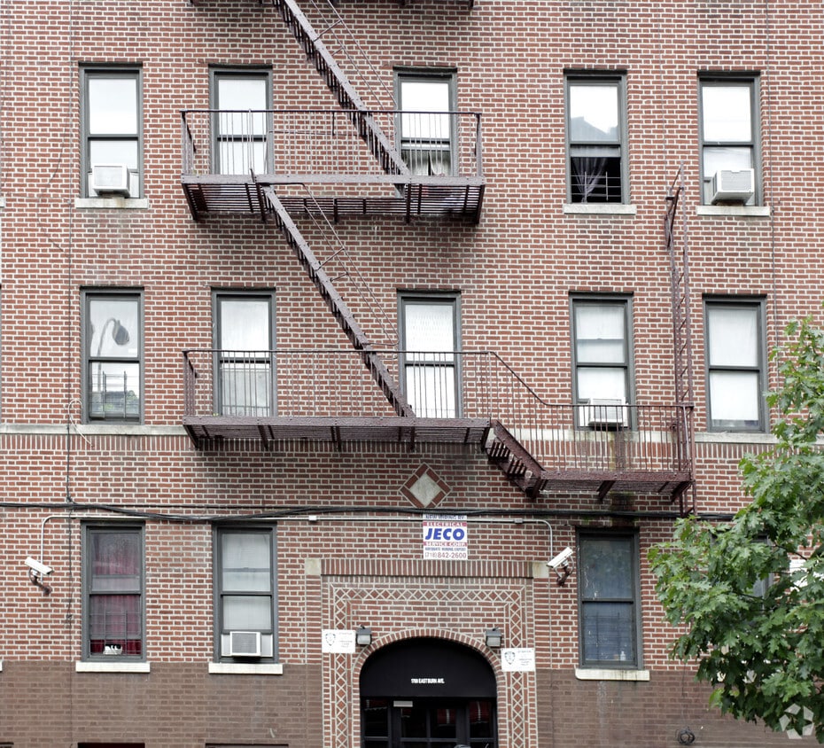
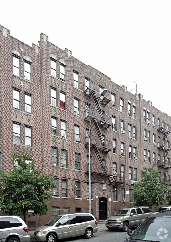

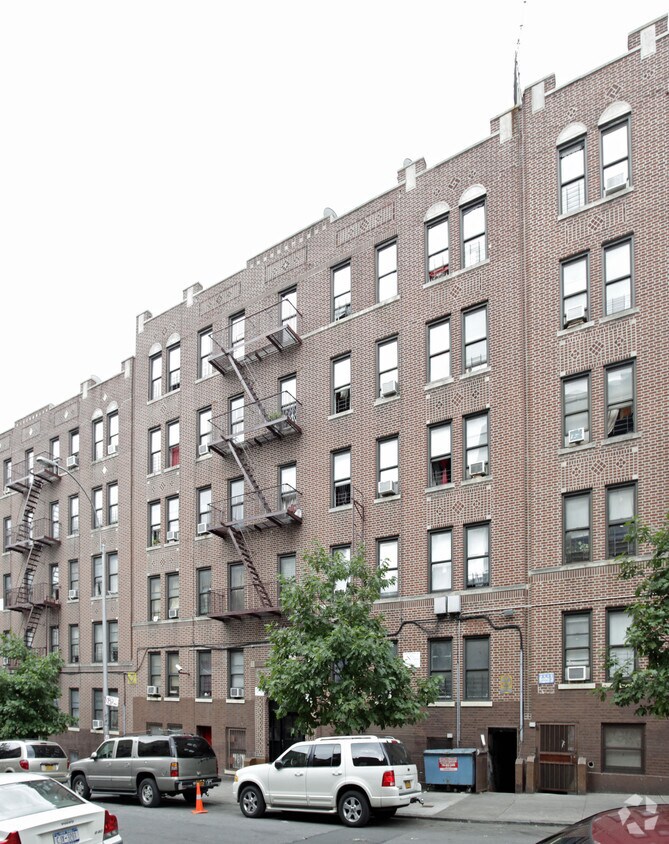
1769 Eastburn Ave is ready for you to visit. The location of this community is in the 10457 area of Bronx. From amenities to availability, the professional leasing staff is ready to help you find your perfect home. Be sure to check out the apartment floorplan options. It's time to find your next place. Contact or stop by 1769 Eastburn Ave to talk about leasing your next apartment!
1769 Eastburn Ave is an apartment community located in Bronx County and the 10457 ZIP Code. This area is served by the New York City Geographic District # 9 attendance zone.
Located in the Bronx, Mount Hope is known for its longstanding, mid-rise apartment buildings and wood-frame houses, along with some Queen Anne architecture scattered throughout. Mount Hope is bordered by Interstate 95 to the south, Webster Avenue to the east, and Jerome Avenue to the west. Grand Concourse runs through the heart of town and is the location of several subway stations and bus stops. This densely populated neighborhood features several parks and green spaces, including Echo Park. Residents of Mount Hope appreciate the neighborhood’s proximity to Manhattan, located just nine miles away, as well as proximity to major attractions like the Bronx Zoo and Yankee Stadium. Apartments for rent in the area are priced below the borough’s average.
Learn more about living in Mount HopeCompare neighborhood and city base rent averages by bedroom.
| Mount Hope | Bronx, NY | |
|---|---|---|
| Studio | $1,722 | $1,630 |
| 1 Bedroom | $1,480 | $1,636 |
| 2 Bedrooms | $1,721 | $2,102 |
| 3 Bedrooms | $1,949 | $2,370 |
| Colleges & Universities | Distance | ||
|---|---|---|---|
| Colleges & Universities | Distance | ||
| Drive: | 5 min | 1.5 mi | |
| Drive: | 4 min | 1.7 mi | |
| Drive: | 5 min | 1.8 mi | |
| Drive: | 7 min | 2.4 mi |


Transportation options available in Bronx include 174-175 Streets, located 0.2 mile from 1769 Eastburn Ave. 1769 Eastburn Ave is near LaGuardia, located 9.4 miles or 19 minutes away, and John F Kennedy International, located 19.8 miles or 29 minutes away.
| Transit / Subway | Distance | ||
|---|---|---|---|
| Transit / Subway | Distance | ||
|
|
Walk: | 3 min | 0.2 mi |
|
|
Walk: | 6 min | 0.3 mi |
|
|
Walk: | 7 min | 0.4 mi |
|
|
Walk: | 9 min | 0.5 mi |
|
|
Walk: | 11 min | 0.6 mi |
| Commuter Rail | Distance | ||
|---|---|---|---|
| Commuter Rail | Distance | ||
|
|
Walk: | 11 min | 0.6 mi |
| Drive: | 5 min | 2.0 mi | |
|
|
Drive: | 6 min | 2.0 mi |
|
|
Drive: | 6 min | 2.0 mi |
|
|
Drive: | 7 min | 2.6 mi |
| Airports | Distance | ||
|---|---|---|---|
| Airports | Distance | ||
|
LaGuardia
|
Drive: | 19 min | 9.4 mi |
|
John F Kennedy International
|
Drive: | 29 min | 19.8 mi |
Scores provided by
Traffic
-Airport
-Businesses
-Scores provided by
HowLoud What is a Sound Score Rating? A Sound Score Rating aggregates noise caused by vehicle traffic, airplane traffic and local sources. How It WorksTime and distance from 1769 Eastburn Ave.
| Shopping Centers | Distance | ||
|---|---|---|---|
| Shopping Centers | Distance | ||
| Walk: | 11 min | 0.6 mi | |
| Drive: | 6 min | 1.7 mi | |
| Drive: | 6 min | 2.0 mi |
| Parks and Recreation | Distance | ||
|---|---|---|---|
| Parks and Recreation | Distance | ||
|
Claremont Park
|
Walk: | 10 min | 0.5 mi |
|
Crotona Park
|
Drive: | 5 min | 1.4 mi |
|
Roberto Clemente State Park
|
Drive: | 7 min | 2.1 mi |
|
Highbridge Park
|
Drive: | 10 min | 4.4 mi |
|
Sherman Creek and Swindler Cove
|
Drive: | 11 min | 4.5 mi |
| Hospitals | Distance | ||
|---|---|---|---|
| Hospitals | Distance | ||
| Drive: | 5 min | 1.7 mi | |
| Drive: | 6 min | 1.9 mi | |
| Drive: | 8 min | 2.7 mi |
| Military Bases | Distance | ||
|---|---|---|---|
| Military Bases | Distance | ||
| Drive: | 19 min | 10.2 mi | |
| Drive: | 31 min | 14.2 mi |
What Are Walk Score®, Transit Score®, and Bike Score® Ratings?
Walk Score® measures the walkability of any address. Transit Score® measures access to public transit. Bike Score® measures the bikeability of any address.
What is a Sound Score Rating?
A Sound Score Rating aggregates noise caused by vehicle traffic, airplane traffic and local sources.
1769 Eastburn Ave
Bronx, NY 10457


