$5,500 / Month
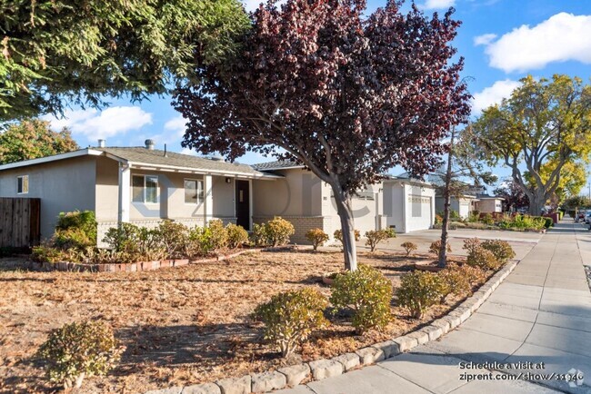
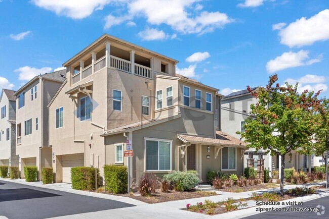
1750 Eastbrook Ave
Los Altos, CA 94024
2 Weeks Ago
Favorites
1750 Eastbrook Ave

Favorites
Check Back Soon for Upcoming Availability
| Beds | Baths | Average SF |
|---|---|---|
| 3 Bedrooms 3 Bedrooms 3 Br | 2 Baths 2 Baths 2 Ba | 1,880 SF |
Fees and Policies
The fees below are based on community-supplied data and may exclude additional fees and utilities.
- Dogs Allowed
-
Fees not specified
- Cats Allowed
-
Fees not specified
- Parking
-
Garage--
Details
Utilities Included
-
Sewer
About This Property
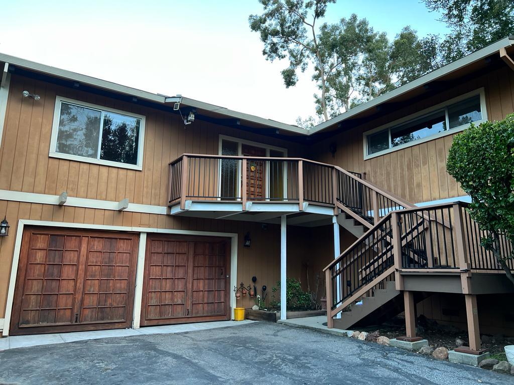
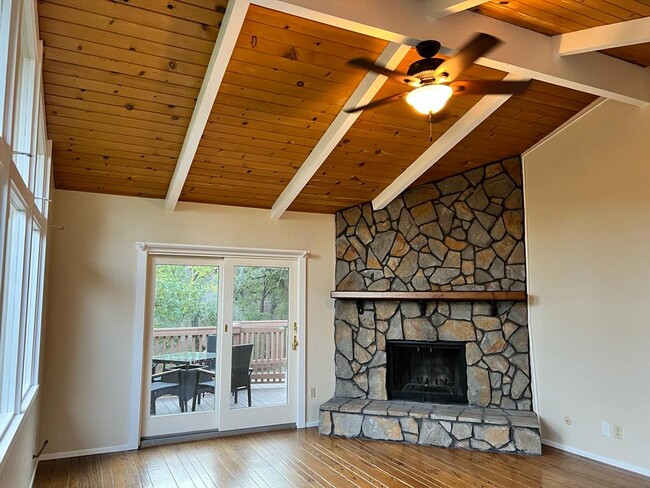
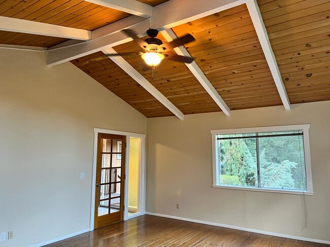
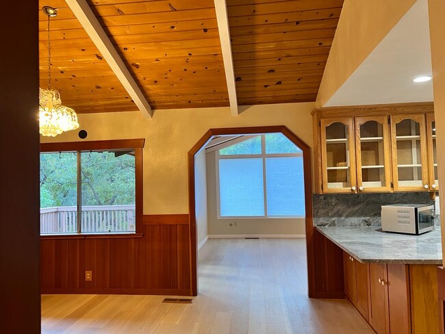
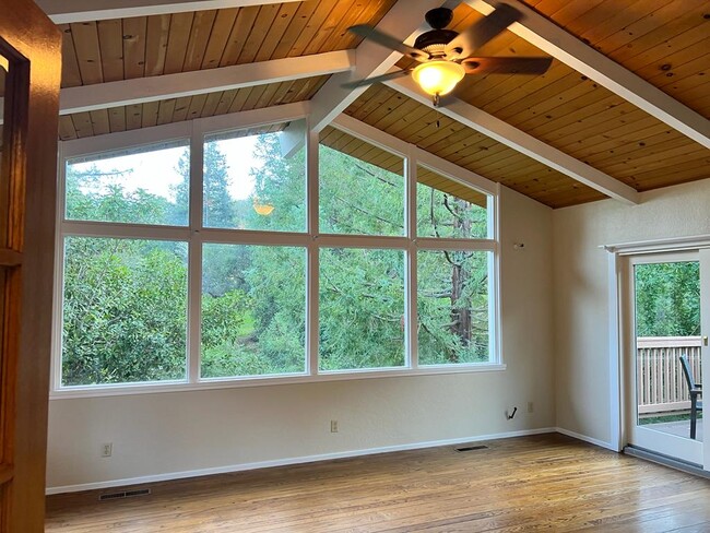
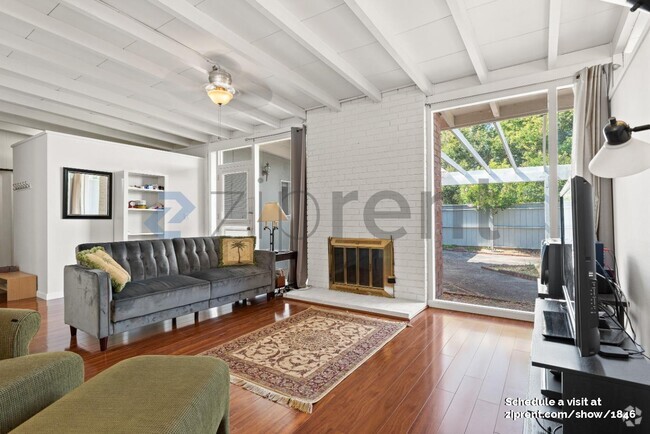
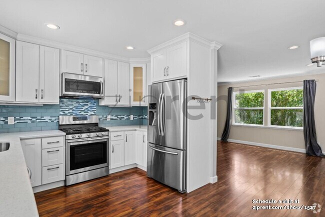
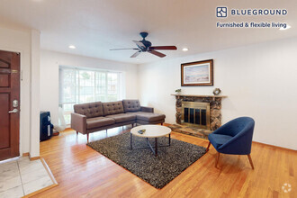
Custom built contemporary ranch-style 3 bedrooms, 2 bathrooms spacious executive home set back on a beautiful 1.27 acres lot with a seasonal stream in a very desirable Los Altos neighborhood. Very Bright and Sunny house with private surroundings, with plenty of outdoor space, and two large decks. Wood-beamed cathedral ceilings in formal Living Room and Study, separate Dining Room, and a large Family Room to enjoy with your family. The house has large picture windows, French doors, Hardwood floors throughout the house, and custom moldings. House was recently updated with brand new Air-Conditioner and Heating system, Nest Control, New Paint, New Kitchen counters, new vanity in master bathroom and new entry and European Oak hardwood floors. Corral and 2-stall horse barn (optional). Enjoy a serene home within minutes of all major Silicon Valley employers, and Stanford University. Minutes away to Highway 280 and 4 minutes to shopping center with major grocery stores, restaurants, gyms and many other businesses. Within walking distance is 4,000 acres of public open space preserve with miles of hiking trails. Top Los Altos Schools: Loyola Elementary; Blach Middle; Mountain View High; and at a half mile from Waldorf School. No smoking. Pet are permitted.
1750 Eastbrook Ave is a house located in Santa Clara County and the 94024 ZIP Code.
House Features
Washer/Dryer
Air Conditioning
Dishwasher
Hardwood Floors
- Washer/Dryer
- Air Conditioning
- Heating
- Smoke Free
- Fireplace
- Dishwasher
- Kitchen
- Hardwood Floors
- Dining Room
- Family Room
Location
Get Directions
Los Altos likes to strike a balance between the urbanized atmosphere of the Bay Area and the more rural environment of the wide-open spaces bordering the city’s southwest side. While it is mainly a residential community, the downtown area surrounding Main Street is a walkable shopping and dining district with tree-lined streets and several public parks nearby. The crime rate is quite low and the local schools are among the highest-performing in the state. Palo Alto is right next door and San Jose just a few minutes down the road, giving Los Altos residents convenient access to Silicon Valley’s greatest amenities.
Learn more about living in Los Altos
Amenities
- Washer/Dryer
- Air Conditioning
- Heating
- Smoke Free
- Fireplace
- Dishwasher
- Kitchen
- Hardwood Floors
- Dining Room
- Family Room
Expenses
Utilities Included
Sewer
Included
Education
| Colleges & Universities | Distance | ||
|---|---|---|---|
| Colleges & Universities | Distance | ||
| Drive: | 5 min | 2.3 mi | |
| Drive: | 9 min | 5.5 mi | |
| Drive: | 13 min | 6.1 mi | |
| Drive: | 14 min | 8.2 mi |
1750 Eastbrook Ave is within 5 minutes or 2.3 miles from Foothill Coll., Los Altos. It is also near De Anza College and Foothill College, Middlefield.
Transportation options available in Los Altos include Mountain View Station, located 4.6 miles from 1750 Eastbrook Ave. 1750 Eastbrook Ave is near Norman Y Mineta San Jose International, located 15.2 miles or 21 minutes away, and San Francisco International, located 29.3 miles or 40 minutes away.
| Transit / Subway | Distance | ||
|---|---|---|---|
| Transit / Subway | Distance | ||
|
|
Drive: | 11 min | 4.6 mi |
|
|
Drive: | 12 min | 5.4 mi |
|
|
Drive: | 12 min | 5.7 mi |
|
Bayshore/Nasa Station
|
Drive: | 14 min | 6.6 mi |
|
|
Drive: | 15 min | 7.4 mi |
| Commuter Rail | Distance | ||
|---|---|---|---|
| Commuter Rail | Distance | ||
| Drive: | 12 min | 4.7 mi | |
| Drive: | 10 min | 5.2 mi | |
| Drive: | 14 min | 8.5 mi | |
| Drive: | 15 min | 8.8 mi | |
| Drive: | 17 min | 11.5 mi |
| Airports | Distance | ||
|---|---|---|---|
| Airports | Distance | ||
|
Norman Y Mineta San Jose International
|
Drive: | 21 min | 15.2 mi |
|
San Francisco International
|
Drive: | 40 min | 29.3 mi |
Time and distance from 1750 Eastbrook Ave.
| Shopping Centers | Distance | ||
|---|---|---|---|
| Shopping Centers | Distance | ||
| Drive: | 3 min | 1.5 mi | |
| Drive: | 6 min | 2.7 mi | |
| Drive: | 6 min | 3.9 mi |
1750 Eastbrook Ave has 3 shopping centers within 3.9 miles, which is about a 6-minute drive. The miles and minutes will be for the farthest away property.
| Parks and Recreation | Distance | ||
|---|---|---|---|
| Parks and Recreation | Distance | ||
|
Rancho San Antonio Open Space Preserve
|
Drive: | 7 min | 2.5 mi |
|
Foothill College Observatory
|
Drive: | 6 min | 2.5 mi |
|
Redwood Grove
|
Drive: | 7 min | 2.8 mi |
|
Deer Hollow Farm
|
Drive: | 9 min | 4.8 mi |
|
Rancho San Antonio County Park
|
Drive: | 9 min | 4.9 mi |
1750 Eastbrook Ave has 5 parks within 4.9 miles, including Foothill College Observatory, Rancho San Antonio Open Space Preserve, and Redwood Grove.
| Hospitals | Distance | ||
|---|---|---|---|
| Hospitals | Distance | ||
| Drive: | 8 min | 3.1 mi | |
| Drive: | 11 min | 7.9 mi | |
| Drive: | 12 min | 8.3 mi |
1750 Eastbrook Ave has 3 hospitals within 8.3 miles, the nearest is El Camino Hospital which is 3.1 miles away and a 8 minute drive.
| Military Bases | Distance | ||
|---|---|---|---|
| Military Bases | Distance | ||
| Drive: | 17 min | 7.3 mi |
1750 Eastbrook Ave is 7.3 miles and a 17 minute drive from Ames Research Center.
You May Also Like
Similar Rentals Nearby
What Are Walk Score®, Transit Score®, and Bike Score® Ratings?
Walk Score® measures the walkability of any address. Transit Score® measures access to public transit. Bike Score® measures the bikeability of any address.
What is a Sound Score Rating?
A Sound Score Rating aggregates noise caused by vehicle traffic, airplane traffic and local sources

1750 Eastbrook Ave
Los Altos, CA 94024