
$895
/ Month
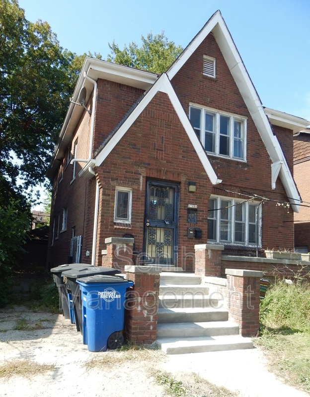
17331 Quincy St
Detroit, MI 48221
2 Weeks Ago
|
Edit
Favorites
17331 Quincy St

Favorites
Check Back Soon for Upcoming Availability
| Beds | Baths | Average SF |
|---|---|---|
| 2 Bedrooms 2 Bedrooms 2 Br | 1 Bath 1 Bath 1 Ba | 1,000 SF |
Fees and Policies
The fees below are based on community-supplied data and may exclude additional fees and utilities.
- Dogs Allowed
-
Fees not specified
- Cats Allowed
-
Fees not specified
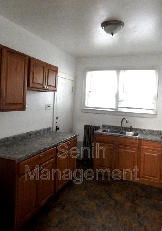
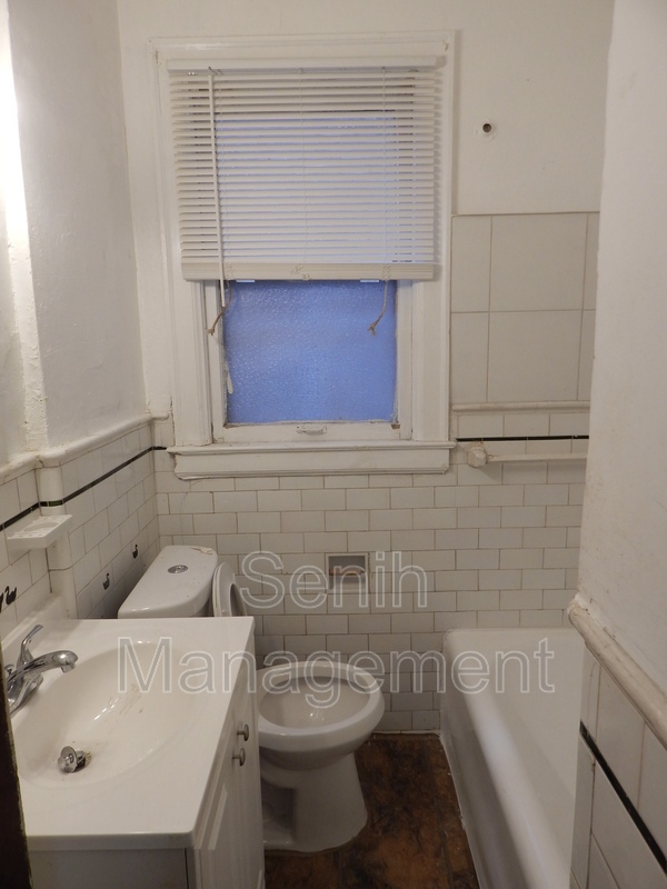
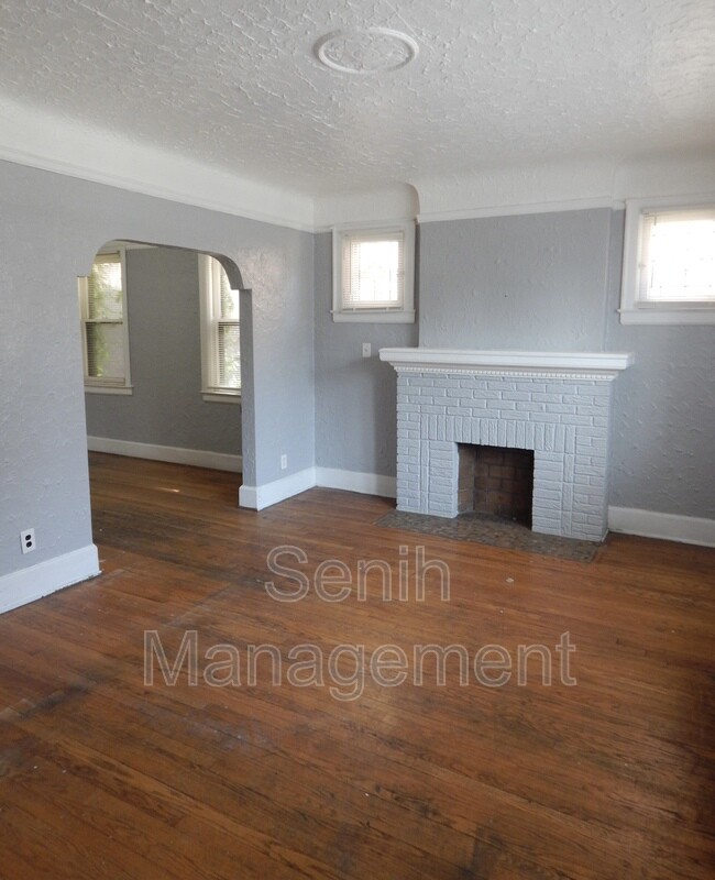
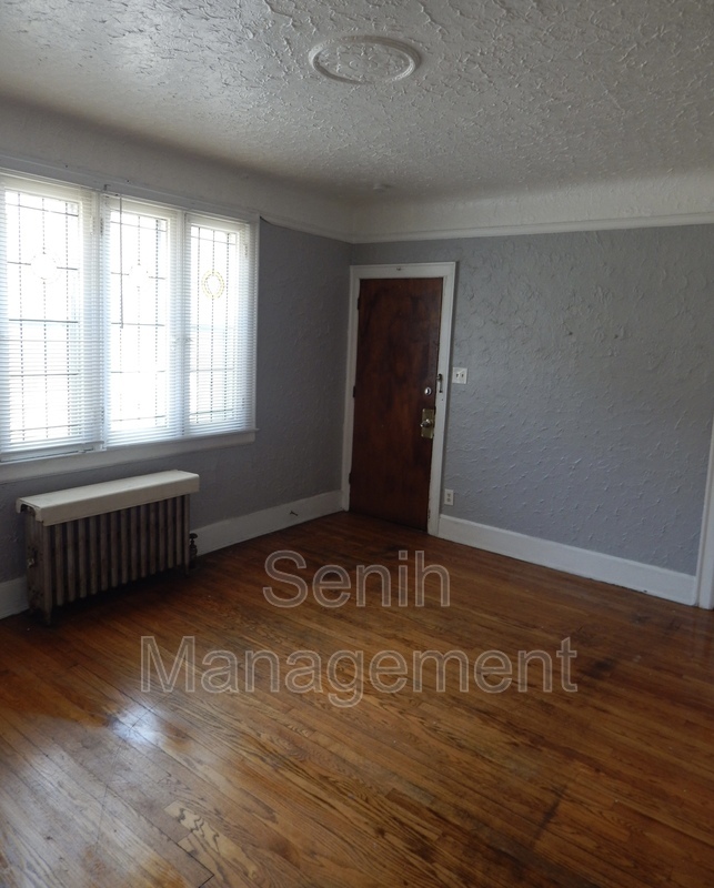
About This Property
This well-lit lower unit, in the gorgeous LIV6 neighborhood, is perfect for a couple a single person. Located right next to the University Of Detroit Mercy, it has everything you need. Parks, grocery stores, bike paths, restaurants, and more, all within walking distance.
17331 Quincy St is a house located in Wayne County and the 48221 ZIP Code. This area is served by the Detroit Public Schools Community District attendance zone.
Location
Get Directions
Situated about eight miles north of Downtown Detroit, Palmer Park blends natural beauty and historic architecture in a community-oriented environment. Dense rows of lush trees line the streets in Palmer Park, separating the elegant houses and vintage apartments from the community’s main commercial thoroughfares.
Palmer Park’s namesake park is a neighborhood landmark, offering the community hiking and biking trails, tennis courts, an ornate fountain, and an 18-hole golf course to explore. In addition to a peaceful, park-like locale, Palmer Park provides residents with convenience to a slew of everyday amenities strewn along Woodward Avenue and McNichols Road.
Proximity to the University of Detroit Mercy and Marygrove College make the neighborhood a top choice for many students, faculty, and staff looking for a rental close to campus. Nearby Interstate 75 connects Palmer Park to the rest of Greater Detroit with ease.
Learn more about living in Palmer ParkBelow are rent ranges for similar nearby apartments
Education
| Colleges & Universities | Distance | ||
|---|---|---|---|
| Colleges & Universities | Distance | ||
| Walk: | 8 min | 0.4 mi | |
| Walk: | 20 min | 1.0 mi | |
| Drive: | 13 min | 4.9 mi | |
| Drive: | 14 min | 5.8 mi |
17331 Quincy St is within 8 minutes or 0.4 mile from Detroit Mercy, McNichols. It is also near Marygrove College and Wayne County C.C., Northwest.
Schools


Public Elementary School
Grades PK-6
312 Students
Attendance Zone
Charter Elementary & Middle School
Grades PK-7
202 Students
Nearby
Public Elementary & Middle School
Grades PK-8
425 Students
Attendance Zone
Public High School
Grades 9-12
889 Students
Nearby
Private Elementary & Middle School
Grades PK-8
278 Students
Nearby
Private Middle & High School
Grades 7-12
877 Students
Nearby
School data provided by
 The GreatSchools Rating helps parents compare schools within a state based on a variety of school quality indicators and provides a helpful picture of how effectively each school serves all of its students. Ratings are on a scale of 1 (below average) to 10 (above average) and can include test scores, college readiness, academic progress, advanced courses, equity, discipline and attendance data. We also advise parents to visit schools, consider other information on school performance and programs, and consider family needs as part of the school selection process.
View GreatSchools Rating Methodology
Data provided by GreatSchools.org © 2026. All rights reserved.
View GreatSchools Rating Methodology
Data provided by GreatSchools.org © 2026. All rights reserved.
Transportation options available in Detroit include Baltimore St - Southbound, located 6.2 miles from 17331 Quincy St. 17331 Quincy St is near Detroit Metro Wayne County, located 27.0 miles or 41 minutes away.
| Transit / Subway | Distance | ||
|---|---|---|---|
| Transit / Subway | Distance | ||
| Drive: | 12 min | 6.2 mi | |
| Drive: | 12 min | 6.2 mi | |
| Drive: | 12 min | 6.3 mi | |
| Drive: | 13 min | 6.5 mi | |
| Drive: | 13 min | 7.1 mi |
| Commuter Rail | Distance | ||
|---|---|---|---|
| Commuter Rail | Distance | ||
|
|
Drive: | 15 min | 6.1 mi |
|
|
Drive: | 12 min | 6.2 mi |
|
|
Drive: | 24 min | 11.0 mi |
|
|
Drive: | 23 min | 12.2 mi |
| Airports | Distance | ||
|---|---|---|---|
| Airports | Distance | ||
|
Detroit Metro Wayne County
|
Drive: | 41 min | 27.0 mi |
Time and distance from 17331 Quincy St.
| Shopping Centers | Distance | ||
|---|---|---|---|
| Shopping Centers | Distance | ||
| Walk: | 3 min | 0.2 mi | |
| Walk: | 13 min | 0.7 mi | |
| Drive: | 3 min | 1.2 mi |
17331 Quincy St has 3 shopping centers within 1.2 miles, which is about a 3-minute drive. The miles and minutes will be for the farthest away property.
| Parks and Recreation | Distance | ||
|---|---|---|---|
| Parks and Recreation | Distance | ||
|
Palmer Park
|
Drive: | 6 min | 2.2 mi |
|
Belle Isle Nature Zoo
|
Drive: | 13 min | 5.5 mi |
|
Detroit Zoo
|
Drive: | 14 min | 5.9 mi |
|
Wayne State University Museum of Natural History
|
Drive: | 16 min | 7.0 mi |
|
Detroit Historical Museum
|
Drive: | 13 min | 7.2 mi |
17331 Quincy St has 5 parks within 7.2 miles, including Palmer Park, Belle Isle Nature Zoo, and Detroit Zoo.
| Hospitals | Distance | ||
|---|---|---|---|
| Hospitals | Distance | ||
| Drive: | 7 min | 2.6 mi | |
| Drive: | 8 min | 3.2 mi | |
| Drive: | 12 min | 5.4 mi |
17331 Quincy St has 3 hospitals within 5.4 miles, the nearest is DMC Sinai - Grace Hospital which is 2.6 miles away and a 7 minute drive.
You May Also Like
Similar Rentals Nearby


What Are Walk Score®, Transit Score®, and Bike Score® Ratings?
Walk Score® measures the walkability of any address. Transit Score® measures access to public transit. Bike Score® measures the bikeability of any address.
What is a Sound Score Rating?
A Sound Score Rating aggregates noise caused by vehicle traffic, airplane traffic and local sources

17331 Quincy St
Detroit, MI 48221