
$8,750 / Month
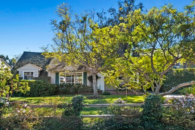
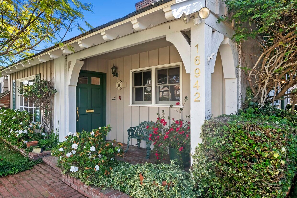
16942 Livorno Dr
Pacific Palisades, CA 90272
2 Weeks Ago
Favorites
16942 Livorno Dr

Favorites
Check Back Soon for Upcoming Availability
| Beds | Baths | Average SF |
|---|---|---|
| 3 Bedrooms 3 Bedrooms 3 Br | 1.5 Baths 1.5 Baths 1.5 Ba | 1,991 SF |
Fees and Policies
The fees below are based on community-supplied data and may exclude additional fees and utilities.
- Parking
-
Garage--
About This Property
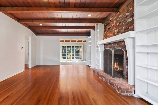
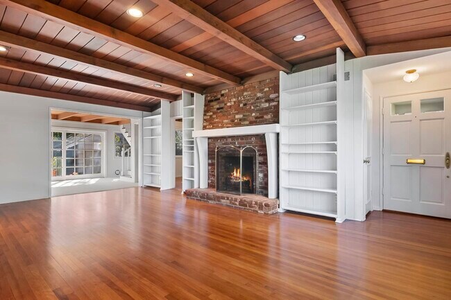
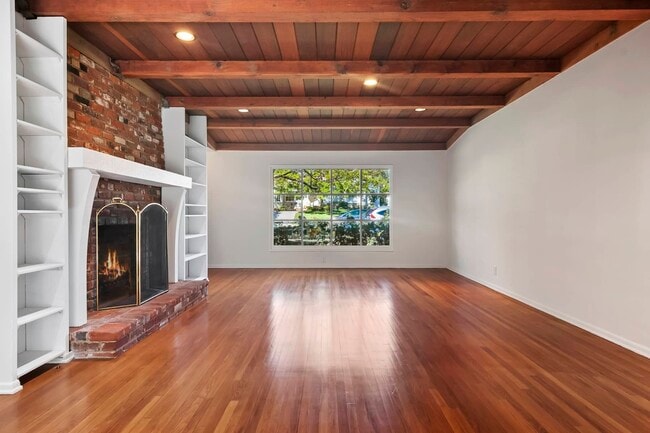
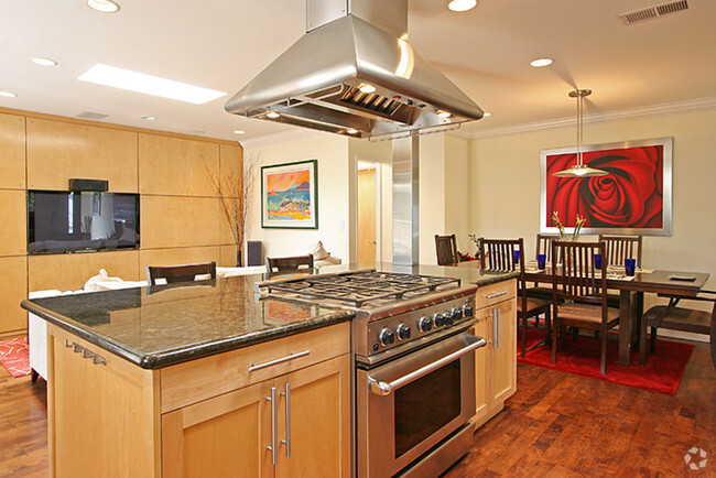
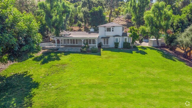
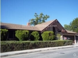
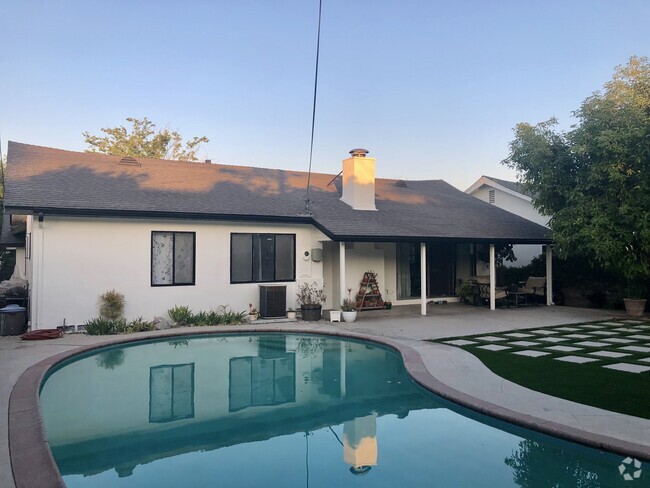
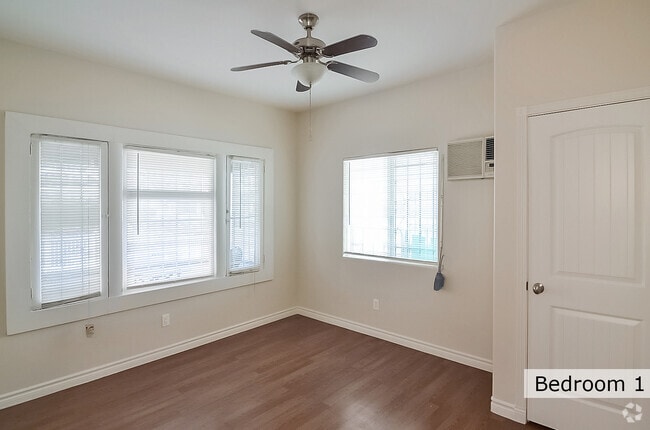
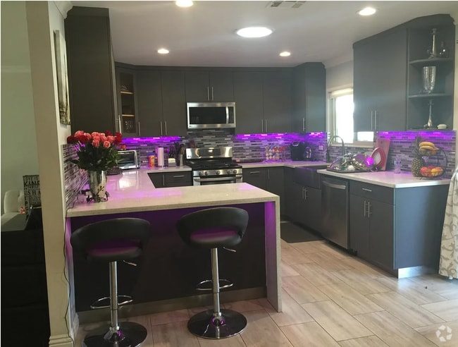
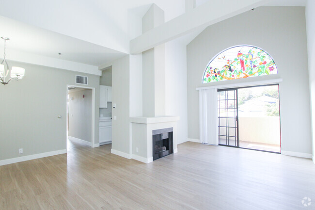
Farm Style home on wide and quiet residential street in The Lower Marquez Flats area of The Palisades. Wood flooring and newer carpet throughout. Beamed ceilings and 2 working fireplaces (1 in the kitchen). Brick clad Country Kitchen, quaint dining area, open living room and a cozy den that leads out into a lushly landscaped and grass backyard, including a small, brick patio. Newer washer & dryer and 1/2 Bath are adjacent the kitchen. Primary and 2nd bedrooms downstairs, 1 additional bedroom upstairs. Ample built-ins and closet space. Close to Marquez Elementary School and The Marquez business district with shops and restaurants. Also near Downtown Palisades including the Caruso development, multiple shops and restaurants and other schools (public and private). An ideal home for families of all kinds.
16942 Livorno Dr is a house located in Los Angeles County and the 90272 ZIP Code.
House Features
Washer/Dryer
Tub/Shower
Heating
Carpet
- Washer/Dryer
- Heating
- Cable Ready
- Storage Space
- Tub/Shower
- Kitchen
- Carpet
- Dining Room
- Den
- Patio
Location
Get Directions
From mountain hikes to beach volleyball, everything you've heard about Pacific Palisades is true -- it is gorgeous, filled with outdoor adventures, and is home to some of California's most beautiful stretches of beach. Situated directly north of Santa Monica and just 16 miles west of Downtown Los Angeles, it's easy to see why this is the playground for movie stars and celebrities. Cruise along the Pacific Coast Highway to Sunset Beach, play volleyball at Will Rogers State Beach, or go bicycling along the ocean at Marvin Braude Bike Trail.
On days you'd rather be hiking than surfing, Temescal Canyon State Park, Rivas Canyon Park, and Will Rogers State Historic Park are all on the east side of Pacific Palisades. Palisades Park features a rec center, a playground, ball fields, and picnic areas. Topanga State Park features 36 miles of hiking trails. While Pacific Palisades is primarily a residential area, Sunset Boulevard is home to several shops, restaurants, and other businesses.
Learn more about living in Pacific Palisades
Amenities
- Washer/Dryer
- Heating
- Cable Ready
- Storage Space
- Tub/Shower
- Kitchen
- Carpet
- Dining Room
- Den
- Patio
Education
| Colleges & Universities | Distance | ||
|---|---|---|---|
| Colleges & Universities | Distance | ||
| Drive: | 10 min | 5.0 mi | |
| Drive: | 12 min | 5.7 mi | |
| Drive: | 14 min | 6.8 mi | |
| Drive: | 14 min | 7.5 mi |
16942 Livorno Dr is within 10 minutes or 5.0 miles from Santa Monica Coll., Emeritus. It is also near Santa Monica College, Madison and Santa Monica Coll..
Transportation options available in Pacific Palisades include Downtown Santa Monica Station, located 5.5 miles from 16942 Livorno Dr. 16942 Livorno Dr is near Los Angeles International, located 14.0 miles or 26 minutes away, and Bob Hope, located 23.0 miles or 40 minutes away.
| Transit / Subway | Distance | ||
|---|---|---|---|
| Transit / Subway | Distance | ||
|
|
Drive: | 12 min | 5.5 mi |
| Drive: | 13 min | 6.8 mi | |
|
|
Drive: | 13 min | 7.3 mi |
|
|
Drive: | 14 min | 8.3 mi |
| Drive: | 16 min | 9.3 mi |
| Commuter Rail | Distance | ||
|---|---|---|---|
| Commuter Rail | Distance | ||
|
|
Drive: | 34 min | 19.3 mi |
|
|
Drive: | 42 min | 21.1 mi |
| Drive: | 40 min | 22.9 mi | |
| Drive: | 40 min | 23.0 mi | |
|
|
Drive: | 41 min | 23.0 mi |
| Airports | Distance | ||
|---|---|---|---|
| Airports | Distance | ||
|
Los Angeles International
|
Drive: | 26 min | 14.0 mi |
|
Bob Hope
|
Drive: | 40 min | 23.0 mi |
Time and distance from 16942 Livorno Dr.
| Shopping Centers | Distance | ||
|---|---|---|---|
| Shopping Centers | Distance | ||
| Walk: | 12 min | 0.6 mi | |
| Drive: | 10 min | 5.0 mi | |
| Drive: | 12 min | 5.8 mi |
16942 Livorno Dr has 3 shopping centers within 5.8 miles, which is about a 12-minute walk. The miles and minutes will be for the farthest away property.
| Parks and Recreation | Distance | ||
|---|---|---|---|
| Parks and Recreation | Distance | ||
|
Temescal Gateway Park
|
Drive: | 3 min | 1.4 mi |
|
Will Rogers State Beach
|
Drive: | 5 min | 2.6 mi |
|
Will Rogers State Historic Park
|
Drive: | 10 min | 3.6 mi |
|
Topanga State Park
|
Drive: | 12 min | 4.5 mi |
|
Santa Monica State Beach
|
Drive: | 9 min | 4.8 mi |
16942 Livorno Dr has 5 parks within 4.8 miles, including Temescal Gateway Park, Will Rogers State Beach, and Will Rogers State Historic Park.
| Hospitals | Distance | ||
|---|---|---|---|
| Hospitals | Distance | ||
| Drive: | 13 min | 5.9 mi | |
| Drive: | 14 min | 7.4 mi | |
| Drive: | 21 min | 11.9 mi |
16942 Livorno Dr has 3 hospitals within 11.9 miles, the nearest is Santa Monica - UCLA Medical Center & Orthopaedic Hospital which is 5.9 miles away and a 13 minute drive.
| Military Bases | Distance | ||
|---|---|---|---|
| Military Bases | Distance | ||
| Drive: | 27 min | 19.3 mi |
16942 Livorno Dr is 19.3 miles and a 27 minute drive from Los Angeles Air Force Base.
You May Also Like
Similar Rentals Nearby
What Are Walk Score®, Transit Score®, and Bike Score® Ratings?
Walk Score® measures the walkability of any address. Transit Score® measures access to public transit. Bike Score® measures the bikeability of any address.
What is a Sound Score Rating?
A Sound Score Rating aggregates noise caused by vehicle traffic, airplane traffic and local sources
16942 Livorno Dr
Pacific Palisades, CA 90272