
$4,200
Total Monthly Price
167 Massapoag Ave
Easton, MA 02356
Favorites
167 Massapoag Ave

Favorites
Check Back Soon for Upcoming Availability
| Beds | Baths | Average SF |
|---|---|---|
| 5 Bedrooms 5 Bedrooms 5 Br | 3 Baths 3 Baths 3 Ba | 2,792 SF |
About This Property
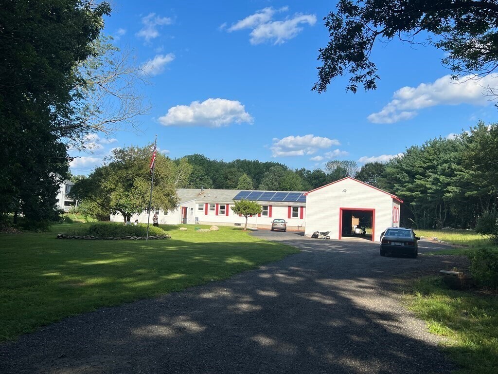
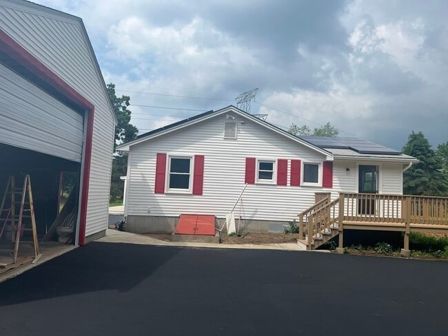
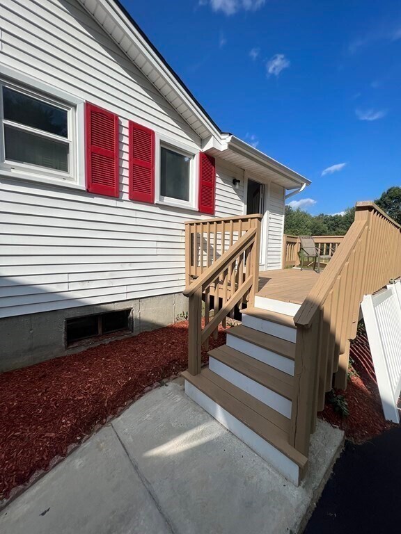
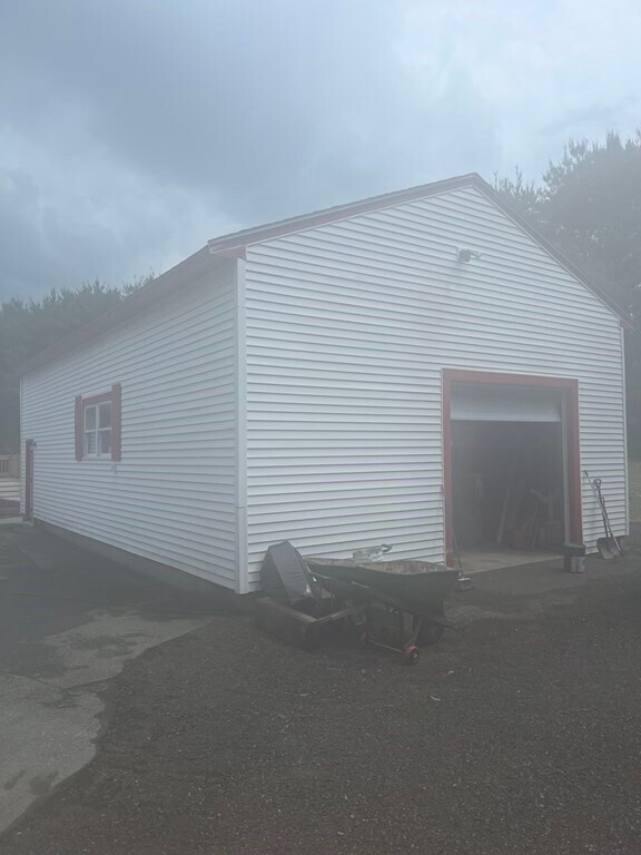
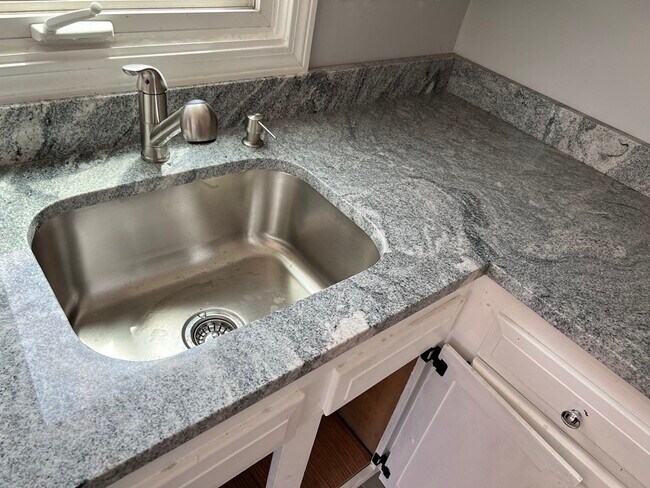
Great value for This custom ranch in North Easton (Approx 2,800sq ft finished single floor living space and full unfinished basement) and 960 sq ft multi car parking with oversized doors and high ceiling height detached barn/garage. The house is set on a 2.5 acre heavily wooded (private with no wetlands) lot adjoining Borderland State Park. Built in 1987 and in-law was added in 1995. House has undergone complete renovation with new heating and air conditioning,new tiled and hardwood floors,new granite counter tops in two separate kitchens,and all new kitchen appliances. The house features five bedrooms and three full baths. The new driveway is environmentally desirable granular asphalt (allowing water to soak underground). This home has solar electric co-generation panels to save the cost of electricity. 5th bedroom is used as a cut thru for in-law side.
167 Massapoag Ave is a house located in Bristol County and the 02356 ZIP Code. This area is served by the Easton School District attendance zone.
167 Massapoag Ave,
Easton,
MA
02356
In the landscape of historic Massachusetts towns, Easton is one of the oldest. Just 40 minutes south of Boston, Easton is a sleepy suburb with a few pockets of old Massachusetts still standing. Oakes Ames Memorial Hall is the posterchild of Easton. Built in the late 19th century, it was a gift intended to be used as the Town Hall, but today it’s used as a popular venue and meeting space.
Most of Easton is largely residential, with long, tree-lined roads connecting the more populous parts of the area with each other. A concise downtown area offers up chic new shops and restaurants like The Farmer’s Daughter. You’ll find some of Massachusetts most highly-rated schools in Easton, making the area popular with families.
The town comes together every year for a number of events, including the Lighting of the Rockery. The Fall River Expressway is the closest thoroughfare near Easton, making a commute up to Boston relatively simple.
Learn more about living in Easton
Education
| Colleges & Universities | Distance | ||
|---|---|---|---|
| Colleges & Universities | Distance | ||
| Drive: | 15 min | 6.2 mi | |
| Drive: | 17 min | 8.2 mi | |
| Drive: | 23 min | 10.4 mi | |
| Drive: | 27 min | 14.1 mi |
167 Massapoag Ave is within 15 minutes or 6.2 miles from Stonehill College. It is also near Wheaton College, Norton and Massasoit C.C., Brockton.
Schools


Public Elementary School
Grades K-5
736 Students
Nearby
Public Elementary School
Grades PK-5
348 Students
Nearby
Public Middle School
Grades 6-8
783 Students
Nearby
Public High School
Grades 9-12
988 Students
Attendance Zone
Private Elementary School
Grades K-5
138 Students
Nearby
Private Elementary, Middle & High School
Grades PK-12
209 Students
Nearby
Private Elementary & Middle School
Grades PK-8
250 Students
Nearby
School data provided by
 The GreatSchools Rating helps parents compare schools within a state based on a variety of school quality indicators and provides a helpful picture of how effectively each school serves all of its students. Ratings are on a scale of 1 (below average) to 10 (above average) and can include test scores, college readiness, academic progress, advanced courses, equity, discipline and attendance data. We also advise parents to visit schools, consider other information on school performance and programs, and consider family needs as part of the school selection process.
View GreatSchools Rating Methodology
Data provided by GreatSchools.org © 2026. All rights reserved.
View GreatSchools Rating Methodology
Data provided by GreatSchools.org © 2026. All rights reserved.
Walkability Near 167 Massapoag Ave Easton, MA 02356
Getting Around
 What do Walkability, Transit, Drivability, and Bikeability mean?
Walkability measures the walking distance to day-to-day needs.
Transit measures access to public transportation.
Drivability measures congestion, parking availability, and access to major roads.
Bikeability measures the suitability for cycling.
How It Works
What do Walkability, Transit, Drivability, and Bikeability mean?
Walkability measures the walking distance to day-to-day needs.
Transit measures access to public transportation.
Drivability measures congestion, parking availability, and access to major roads.
Bikeability measures the suitability for cycling.
How It Works
Not Walkable
Walkability
10
/ 100
Minimal Public Transit
Transit
0
/ 100
Exceptionally Drivable
Drivability
100
/ 100
Fairly Bikeable
Bikeability
50
/ 100
Scores provided by
-
Soundscore™
-
/ 100
Traffic
-Airport
-Businesses
-Scores provided by
HowLoud What is a Sound Score Rating? A Sound Score Rating aggregates noise caused by vehicle traffic, airplane traffic and local sources. How It WorksYou May Also Like
Similar Rentals Nearby
-
-

-

-

-

-

-

-

-

-
 4 Beds, 2 Baths, 1,432 sq ft$4,250Total Monthly Price12 Month LeaseTotal Monthly Price NewPrices include all required monthly fees.75 Tower Ave
What Are Walk Score®, Transit Score®, and Bike Score® Ratings?
Walk Score® measures the walkability of any address. Transit Score® measures access to public transit. Bike Score® measures the bikeability of any address.
What is a Sound Score Rating?
A Sound Score Rating aggregates noise caused by vehicle traffic, airplane traffic and local sources.

167 Massapoag Ave
Easton, MA 02356